
South Fork Snake River Idaho Fly Fishing Map | Public Access Guide
36" x 24" Double-Sided, GPS Accurate
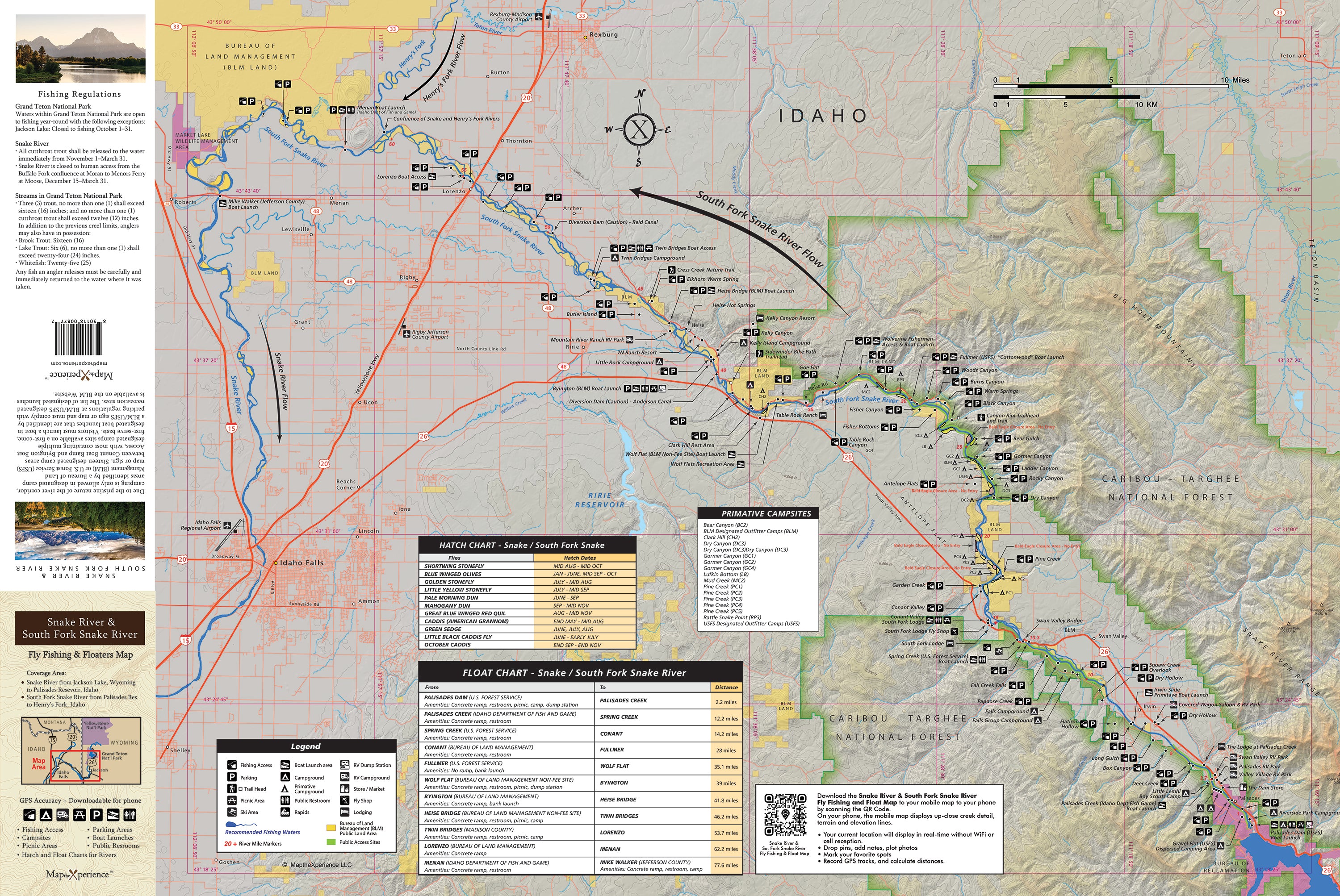
The ultimate resource for anglers and floaters, this all-new, highly detailed map covers both the Snake River and the South Fork of the Snake River. Designed specifically for fly fishing and river travel, it’s GPS-accurate and packed with critical information you won’t find anywhere else.
Features include:
-
All federal, state, county, and city public lands
-
Every fishing access point and area
-
All boat ramps, take-outs, and parking locations
-
Campsites, including primitive sites on the South Fork
-
Bald Eagle Closure Areas
-
Floaters chart with river mileages
-
Picnic areas and public restrooms
-
Insect hatch charts and fishing regulations
Includes a QR Code to scan and download the accompanying mobile map and the Avenza Map App. The map works without cell service or internet.
Whether you're chasing trout or planning a float, this map is a must-have tool to navigate and explore two of the West's most iconic rivers.