Snake River Wyoming Fly Fishing Map | Public Access Guide
Snake River, Wyoming Pocket-Sized Guide with a Powerful Mobile Map!
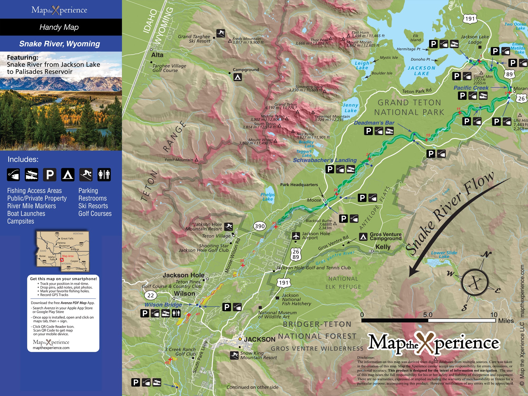
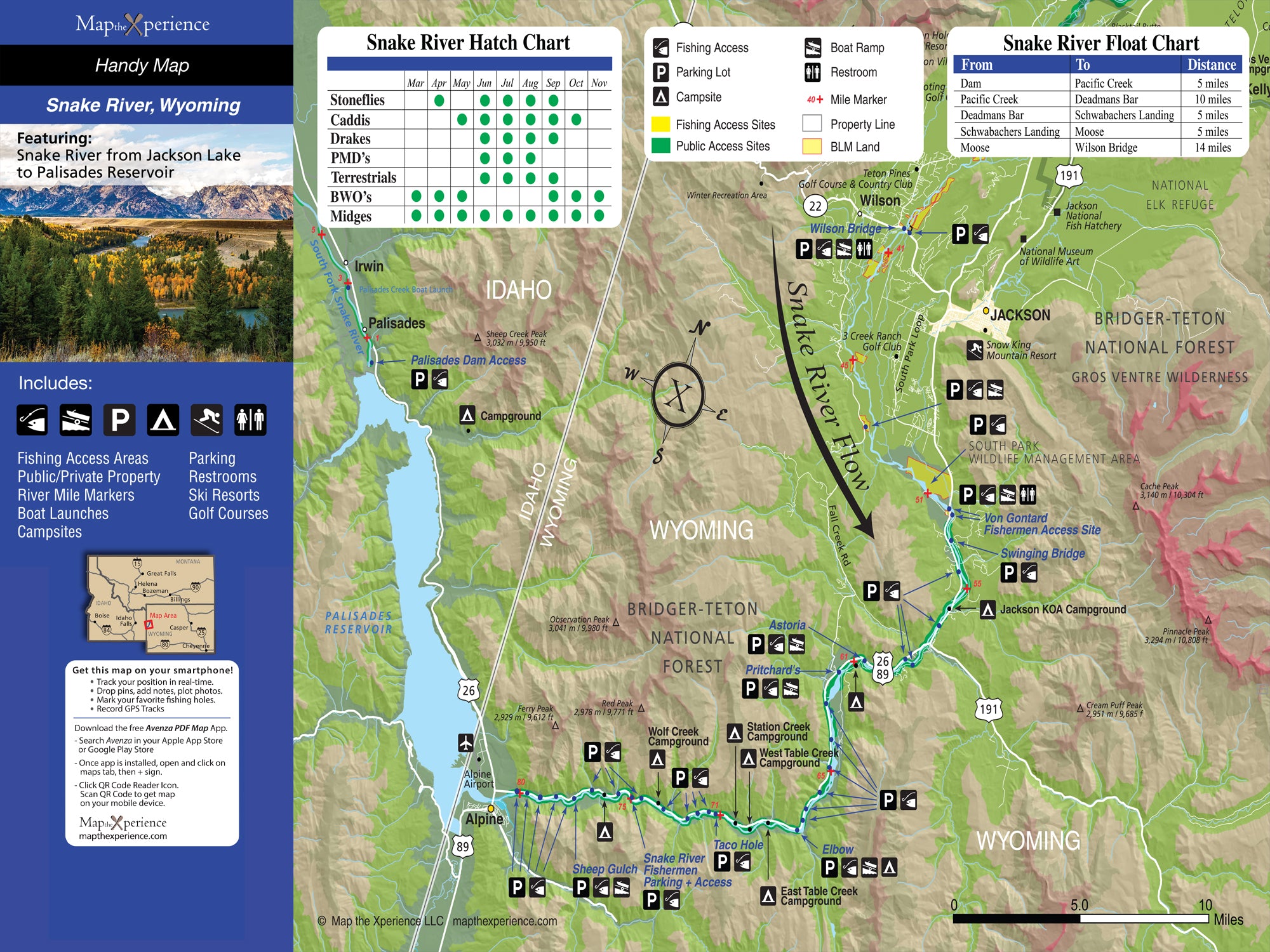
Explore the legendary Snake River in Wyoming with our detailed fly fishing map, built for adventurous anglers. Covering key stretches from Jackson Lake Dam through Grand Teton National Park and south toward Alpine, this detailed map highlights public fishing access points, river miles, boat ramps, wade access, and prime trout waters. Whether you’re chasing native Snake River cutthroat on the flats or floating through deep canyon runs, this rugged guide helps you fish smarter, explore farther, and experience one of the West’s most iconic rivers. Lightweight, tear-resistant, and adventure-tested — your essential map for the Snake.
Pocket-Sized & Adventure-Ready! – Compact & portable (15” x 12” unfolded, 3” x 6” folded), this lightweight, map fits right in your pocket or tackle box!
Includes a Mobile Map! (Avenza Map App)
- Works offline – no cell service needed!
- Zoom in for even more detail than the printed map
- GPS-enabled so you can see your exact location in real time
- Identical to the printed version for seamless navigation