Bitterroot River Montana Fly Fishing Map | Public Access Guide
Bitterroot River, Montana Pocket-Sized Guide with a Powerful Mobile Map!
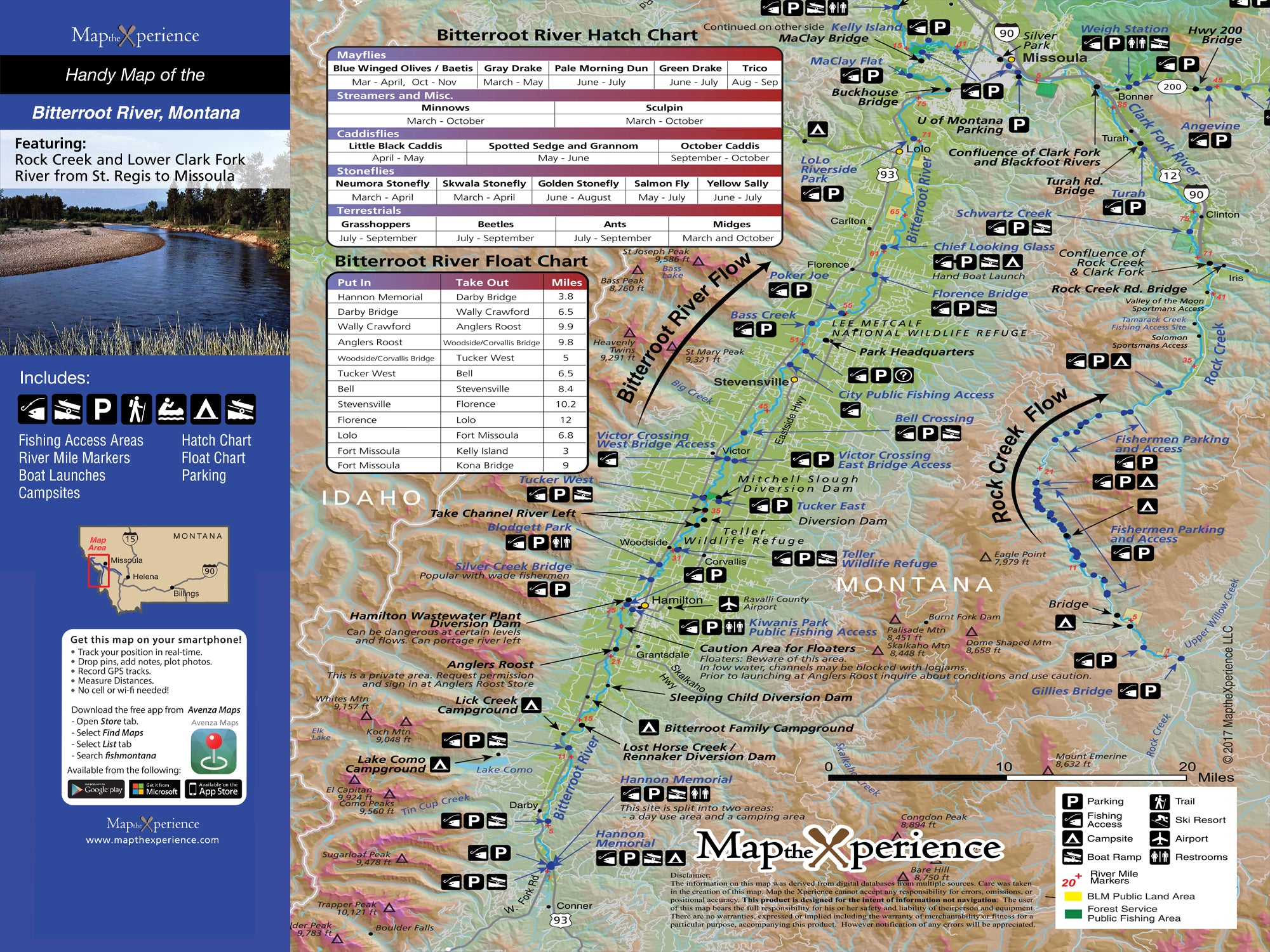
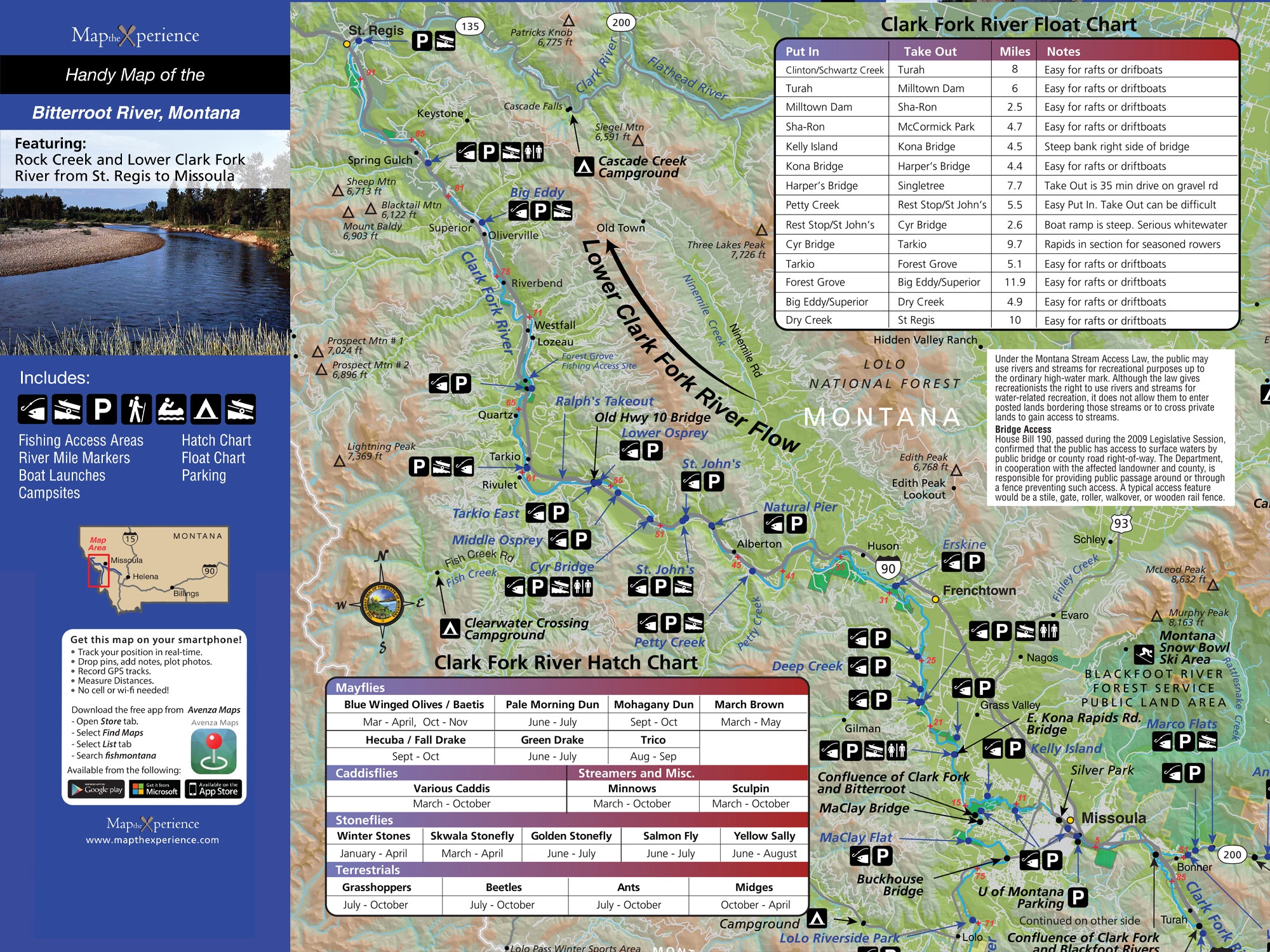
Discover Montana’s Bitterroot River with our detailed fly fishing map, crafted for serious anglers. Covering from Hamilton, Stevensville, and into Missoula, this durable map highlights public fishing access points, river miles, boat ramps, and top trout runs. Whether you're chasing cutthroat, rainbows, or browns, our detailed guide helps you fish smarter, find hidden spots, and plan unforgettable days on the water. Rugged, lightweight, and adventure-tested — essential gear for every Bitterroot angler. Includes Rock Creek and the lower Clark Fork River.
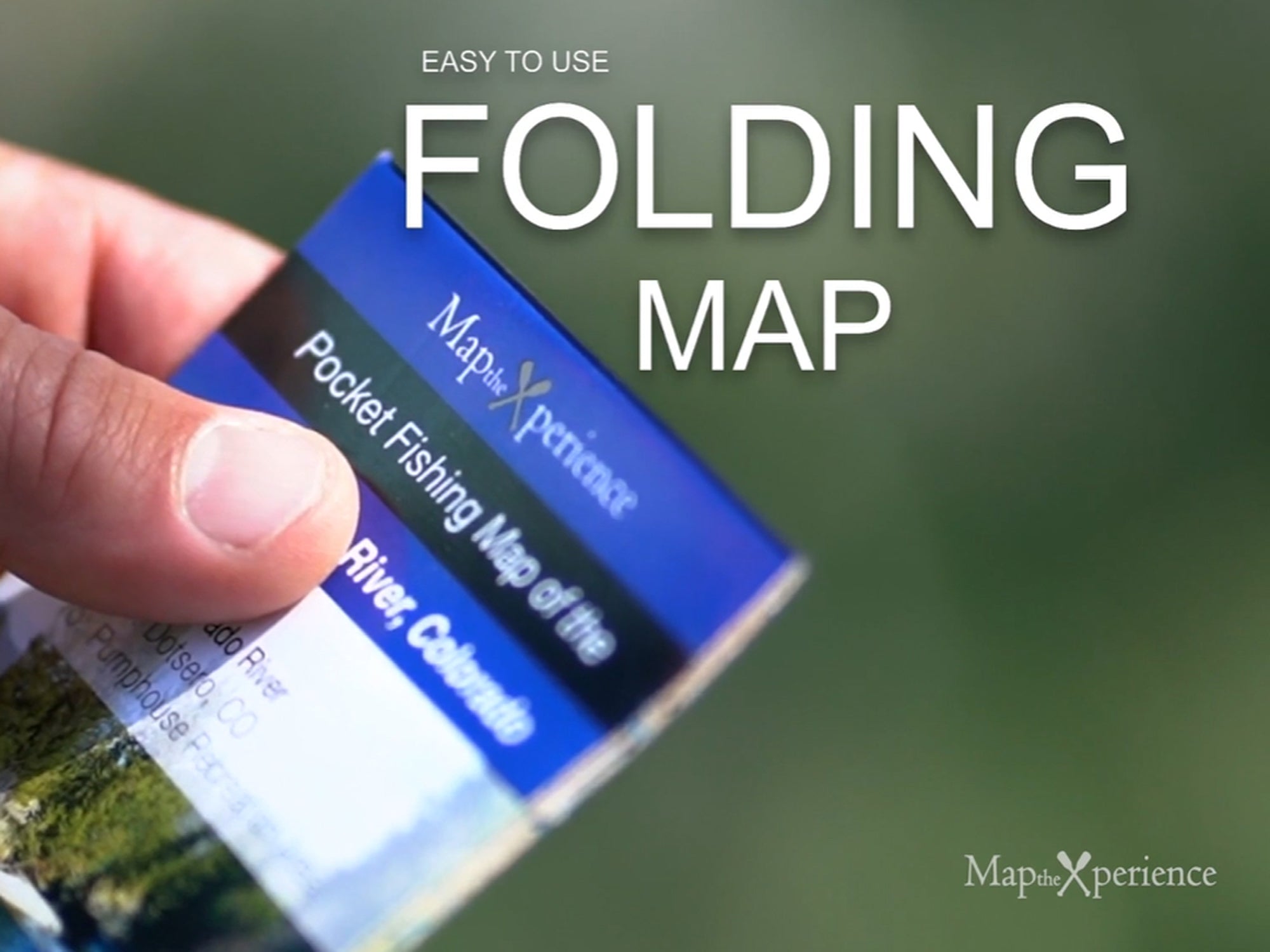
Pocket-Sized & Adventure-Ready! – Compact & portable (15” x 12” unfolded, 3” x 6” folded), this lightweight, map fits right in your pocket or tackle box!
Includes a Mobile Map! (Avenza Map App)
- Works offline – no cell service needed!
- Zoom in for even more detail than the printed map
- GPS-enabled so you can see your exact location in real time
- Identical to the printed version for seamless navigation