Glacier National Park Hiking Trail Map | Detailed GPS Adventure Guide
Quantity:
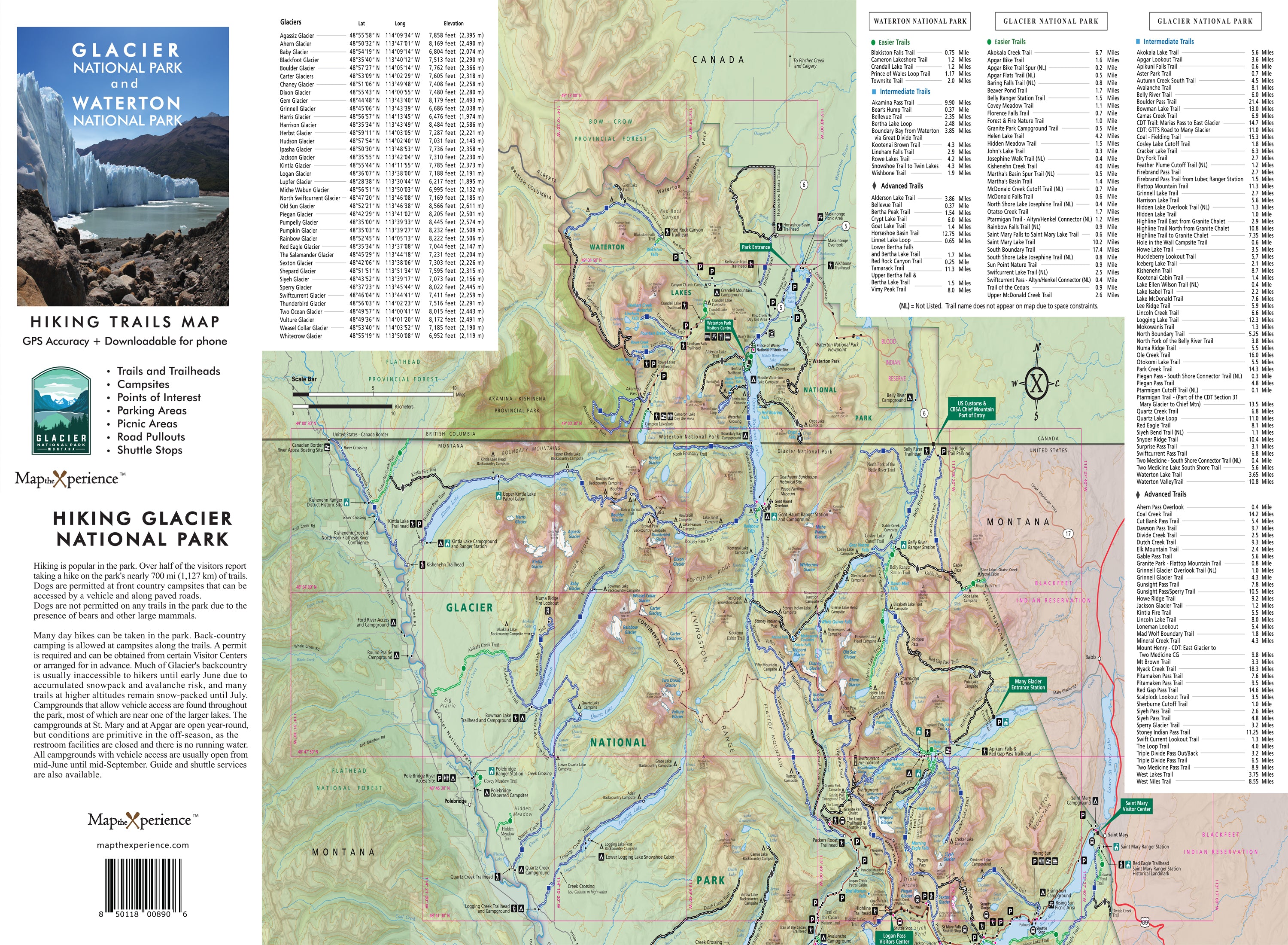
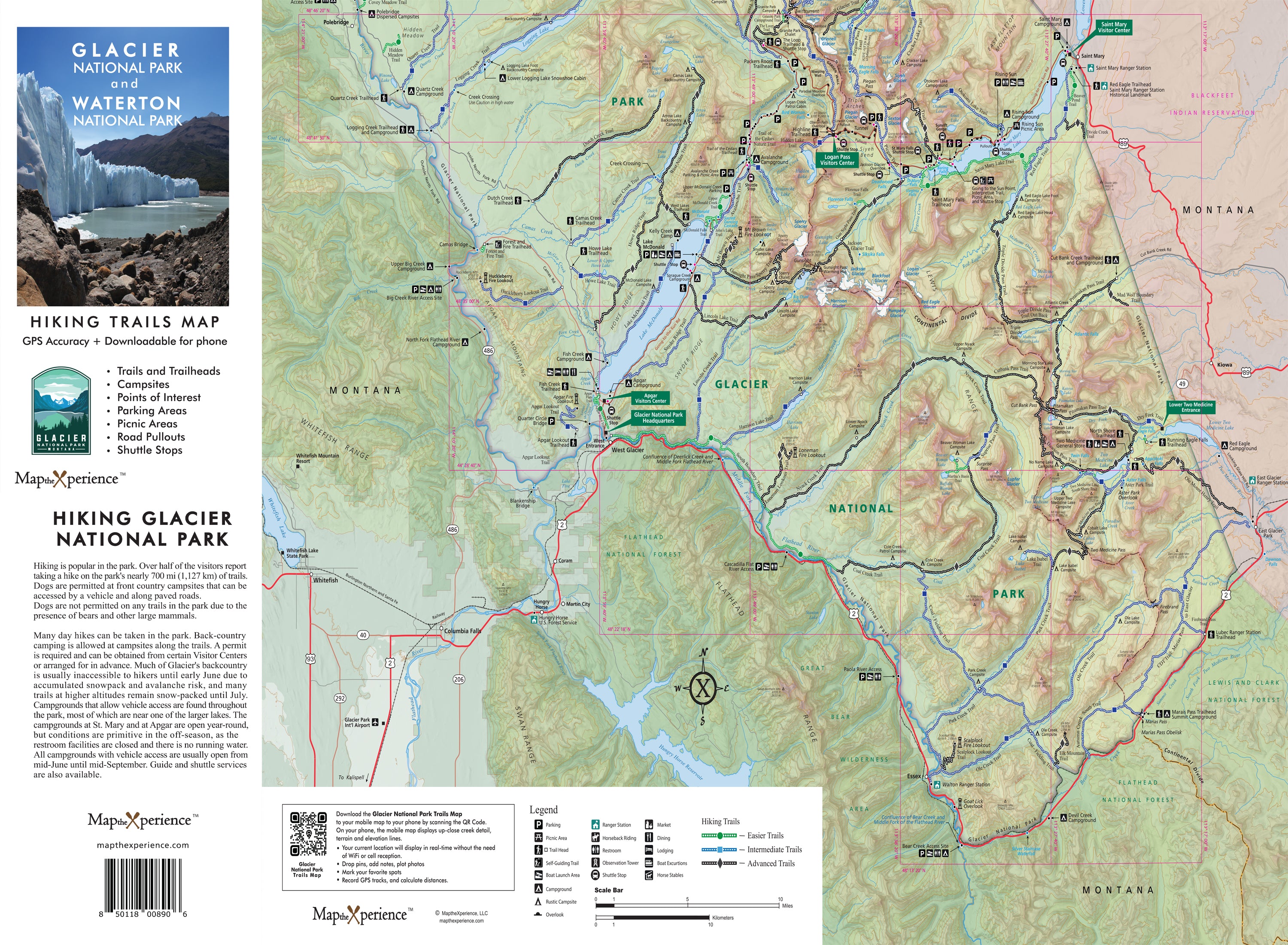
Glacier National Park Hiking Trail Map
Explore Glacier National Park’s rugged beauty with our detailed hiking trail map, built for serious adventurers. Covering the park’s most iconic trails — from Hidden Lake and Grinnell Glacier to Highline Trail and Avalanche Lake — this detailed map highlights trailheads, mileage, elevation changes, backcountry campsites, and points of interest. Designed for hikers, backpackers, and explorers, this durable guide helps you plan smarter treks, navigate safely, and experience the best of Montana’s crown jewel. Lightweight, tear-resistant, and adventure-tested — your must-have trail companion for Glacier.
✅ Trail Designations for Every Skill Level – Easily identify hikes based on difficulty:
- 🟢 Green (Easy) – Perfect for casual hikers & families
- 🔵 Blue (Moderate) – A bit more challenging with some elevation gain
- ⚫ Black (Difficult) – For experienced hikers ready to take on Glacier’s toughest terrain!
4x8" Folded, 36x24" unfolded
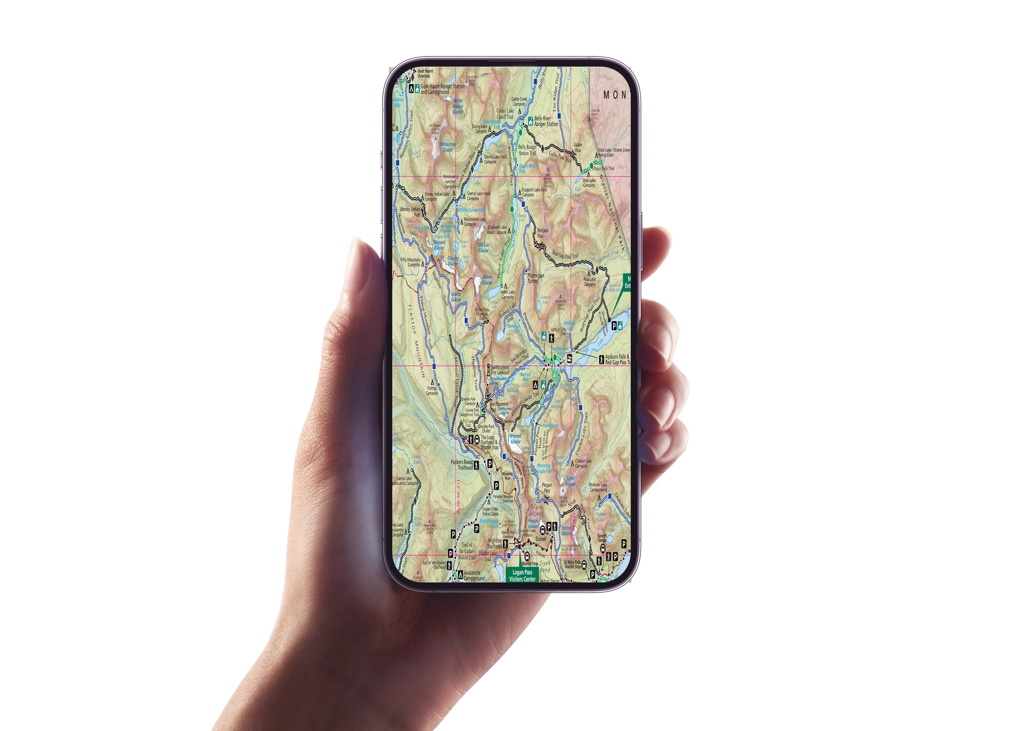
Includes a Mobile Map!
- Works offline – no cell service needed!
- GPS-enabled so you can see your exact location on the trail
- Even more detail than the printed version.