
Henry’s Fork River Idaho Pocket Fishing Guide Map
Pocket-sized on land. Powerfully detailed on water. Built for serious anglers—and smart retailers.
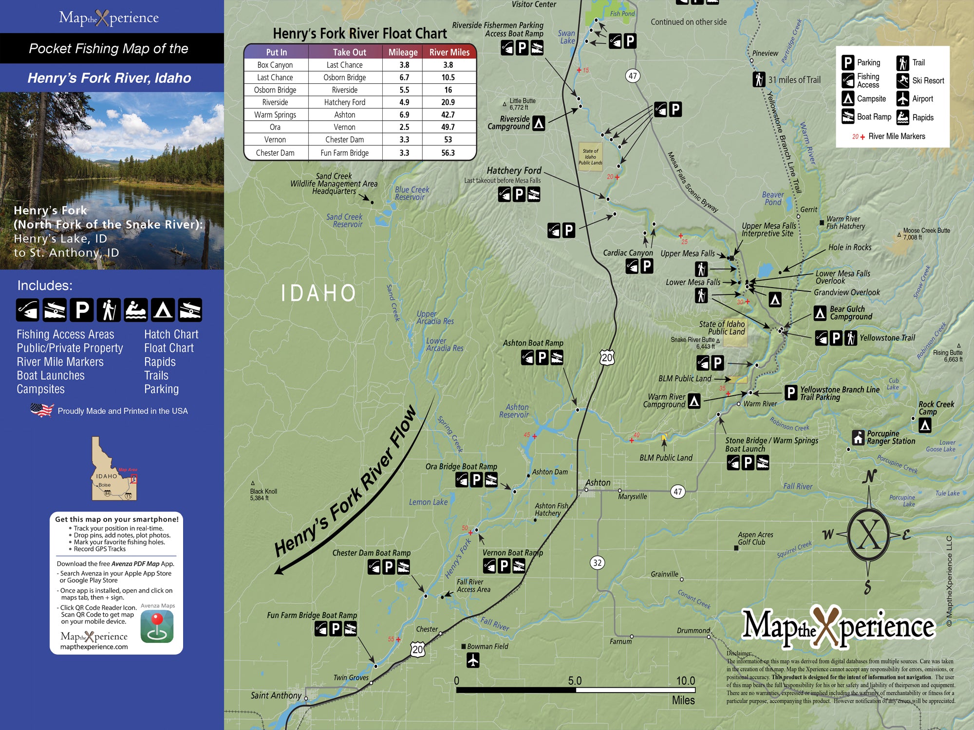
Ready to fish smarter, not harder? Our Henry’s Fork Fishing Map is your essential guide from the tailwaters of Island Park Dam through the legendary waters of Harriman Ranch, down to the fertile flats near Ashton. Designed by local experts, this map highlights public access points, boat launches, river miles, and world-famous trout water—so you spend less time searching and more time fishing.
It includes all public lands—federal, state, and local—as well as exclusive parking areas, access easements, and float information you won’t find on any other map. Whether you’re stalking picky risers on the Ranch, floating through canyon stretches, or swinging streamers down low, this map gives you the edge.
Why Anglers Love This Map:
-
Pinpoint iconic hatches and productive runs with detailed access info
-
Navigate confidently with public land and easement boundaries clearly marked
-
Discover lesser-known entry points and parking spots for better access
-
Maximize your day with insider knowledge and local-tested details
Pocket-Sized and Adventure-Ready
Folded to 3” x 6” and unfolding to 15” x 12”, this rugged, tear-resistant map is built for long days on the water—fitting perfectly in your pack, boat bag, or fly vest.
Track your location, zoom in for greater detail, and mirror your print map with GPS-enabled compatibility through a QR code. Perfect for planning your float or navigating off-grid—no signal needed.
Retailers: Want to Offer Something That Sells Itself?
This map is a must-have for fly shops, outfitters, and gear stores across eastern Idaho. Locally designed, field-tested, and packed with value, it’s an ideal grab-and-go product for both traveling anglers and hometown regulars.
Don’t just fish the Henry’s Fork—know it, master it, and make every cast count.