Missouri River Montana Fly Fishing Map | Public Access Guide
Missouri River, Montana Pocket-Sized Guide with a Powerful Mobile Map!
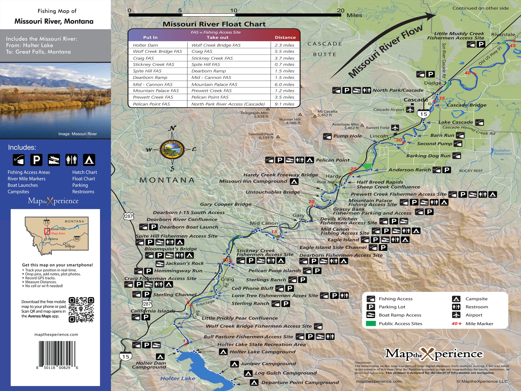
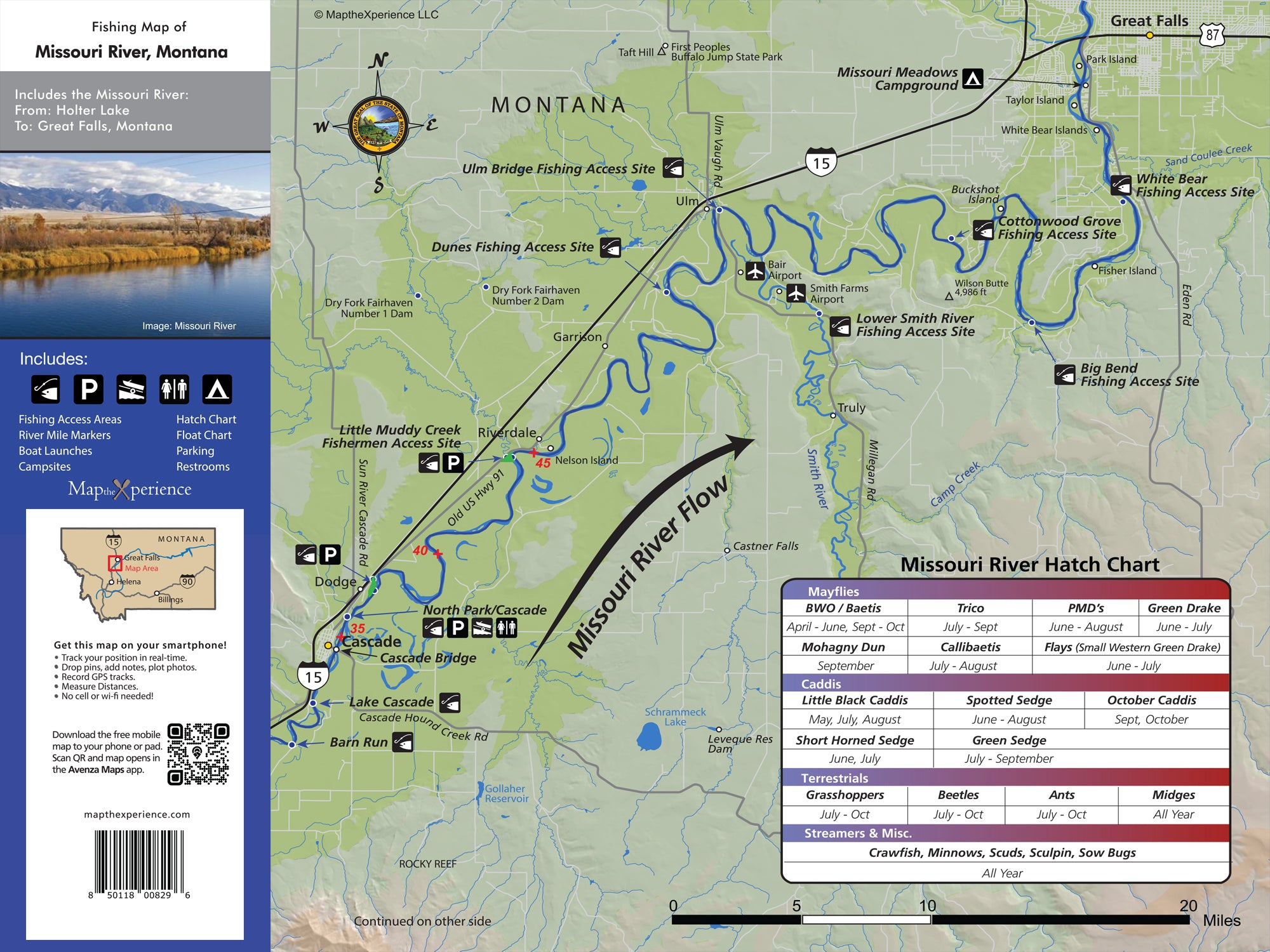
xplore the world-class trout waters of Montana’s Missouri River with our detailed fly fishing map, designed for serious anglers. Covering the famed stretch from Holter Dam through Craig and down to Cascade, this rugged map highlights public fishing access points, river miles, boat ramps, wade access, and prime trout waters. Whether you’re drifting dry flies through slow slicks or nymphing deep runs, this detailed guide helps you fish smarter, explore farther, and connect with the rich tradition of Big Mo fly fishing. Lightweight, tear-resistant, and adventure-tested — your essential companion for the Missouri.
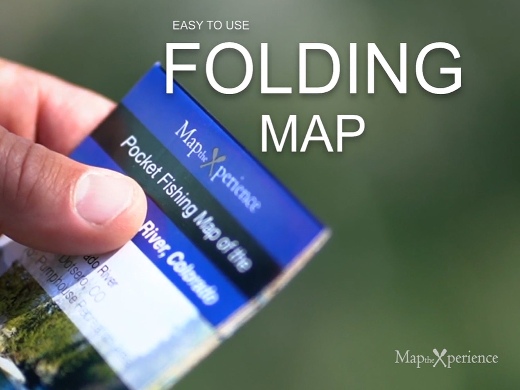
Pocket-Sized & Adventure-Ready! – Compact & portable (15” x 12” unfolded, 3” x 6” folded), this lightweight, map fits right in your pocket or tackle box!
Includes a Mobile Map! (Avenza Map App)
- Works offline – no cell service needed!
- Zoom in for even more detail than the printed map
- GPS-enabled so you can see your exact location in real time
- Identical to the printed version for seamless navigation