North Platte River Wyoming Fly Fishing Map | Public Access Guide
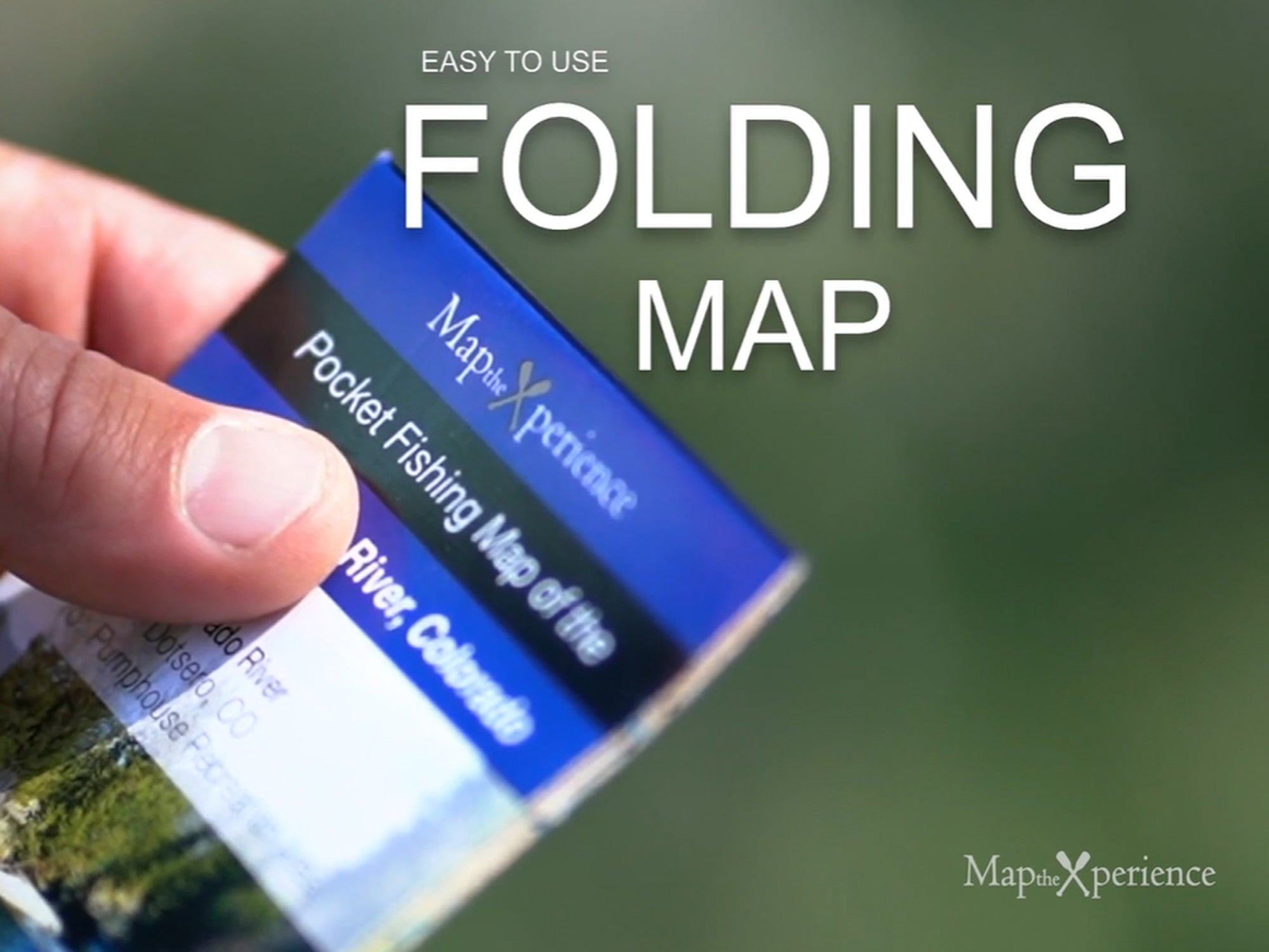
North Platte River, Wyoming Pocket-Sized Guide with a Powerful Mobile Map!
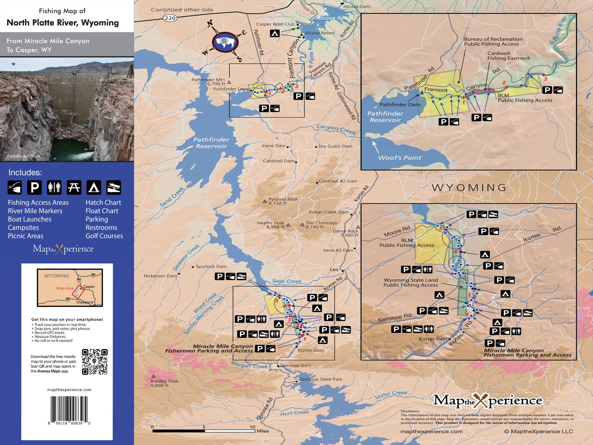
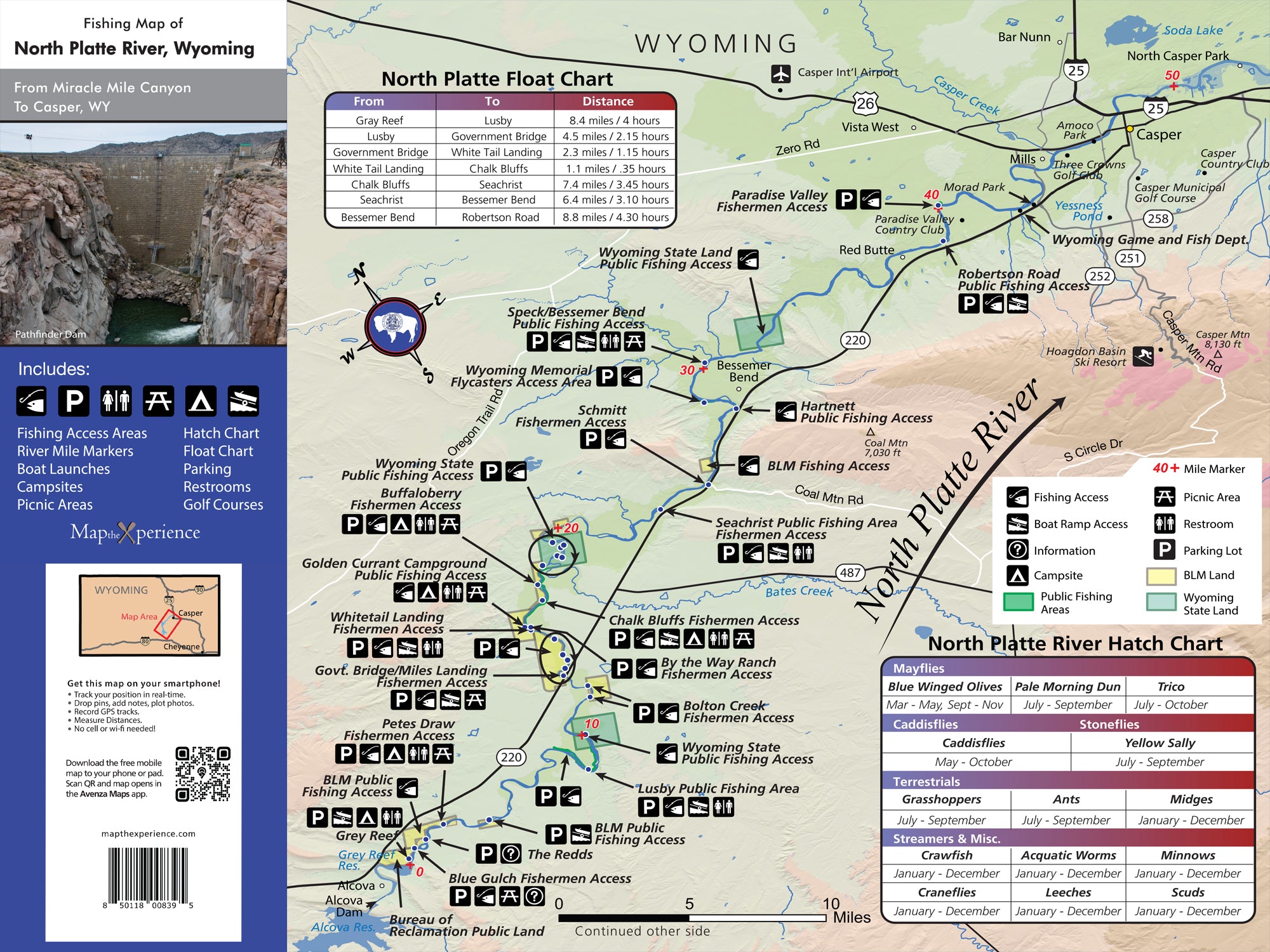
Discover the legendary trout waters of Wyoming’s North Platte River with our waterproof fly fishing map, designed for serious anglers. Covering iconic stretches from the Grey Reef through Miracle Mile and down to Saratoga, this detailed map highlights public fishing access points, river miles, boat ramps, campsites, and prime trout runs. Whether you're hunting trophy rainbows on a float trip or wading hidden side channels, this rugged guide helps you fish smarter, explore farther, and unlock the full potential of the North Platte. Lightweight, tear-resistant, and adventure-tested — your must-have map for Wyoming’s finest trout river.
Pocket-Sized & Adventure-Ready! – Compact & portable (15” x 12” unfolded, 3” x 6” folded), this lightweight, map fits right in your pocket or tackle box!
Includes a Mobile Map! (Avenza Map App)
- Works offline – no cell service needed!
- Zoom in for even more detail than the printed map
- GPS-enabled so you can see your exact location in real time
- Identical to the printed version for seamless navigation