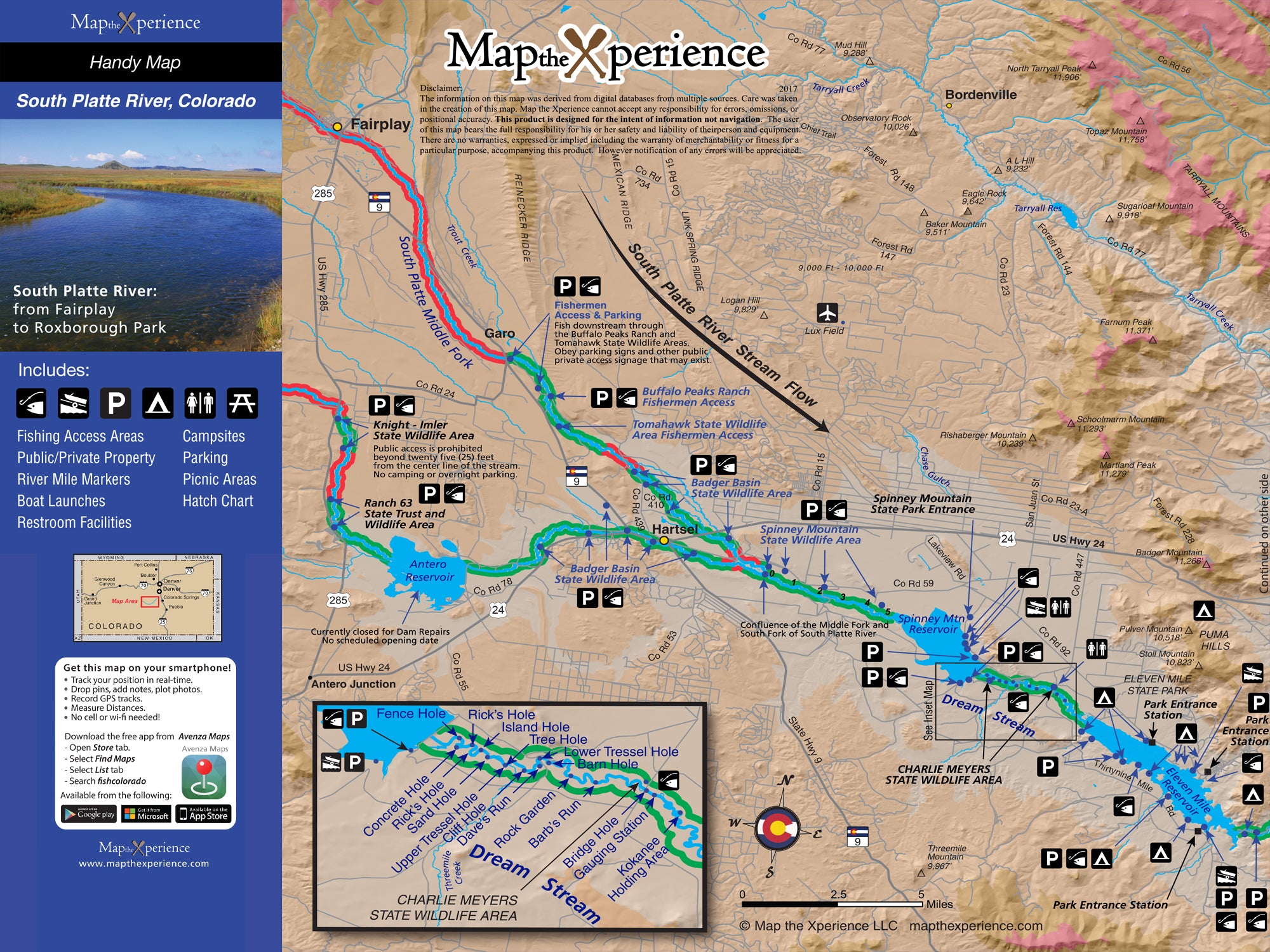
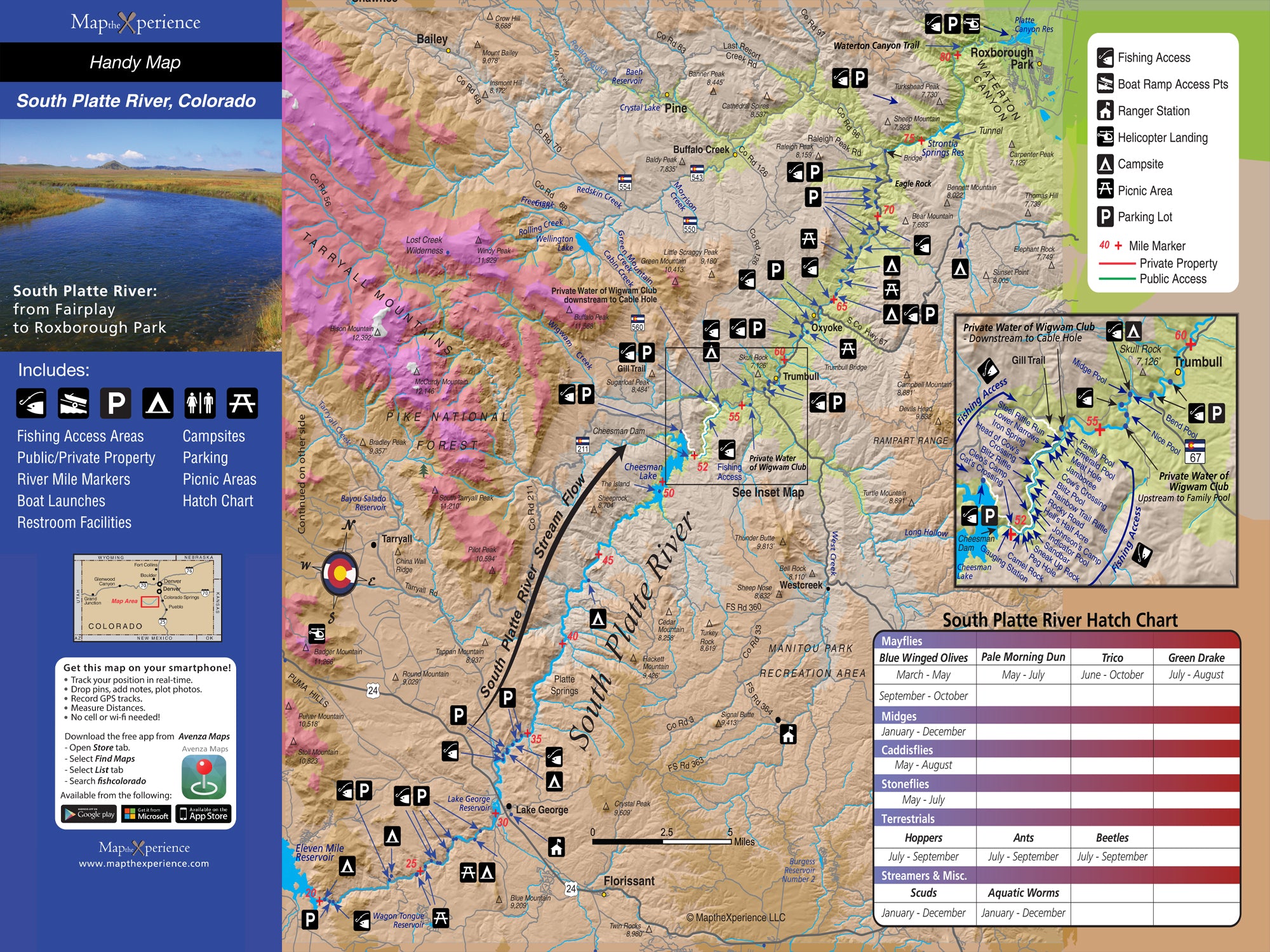

South Platte River Colorado Fly Fishing Map | Public Access Guide
South Platte River, Colorado Pocket-Sized Guide with a Powerful Mobile Map!
Fish Colorado’s iconic South Platte River with our detailed fly fishing map, built for serious anglers. Covering the legendary stretches through the Dream Stream, Eleven Mile Canyon, Deckers, and Cheesman Canyon, this detailed map highlights public fishing access points, river miles, boat ramps, trails, and prime trout waters. Whether you're stalking trophy rainbows in clear tailwaters or exploring technical canyon runs, this rugged guide helps you fish smarter, explore farther, and connect with some of Colorado’s most famous trout fisheries. Lightweight, tear-resistant, and adventure-tested — your essential guide for the South Platte.
Pocket-Sized & Adventure-Ready! – Compact & portable (15” x 12” unfolded, 3” x 6” folded), this lightweight, map fits right in your pocket or tackle box!
Includes a Mobile Map! (Avenza Map App)
- Works offline – no cell service needed!
- Zoom in for even more detail than the printed map
- GPS-enabled so you can see your exact location in real time
- Identical to the printed version for seamless navigation