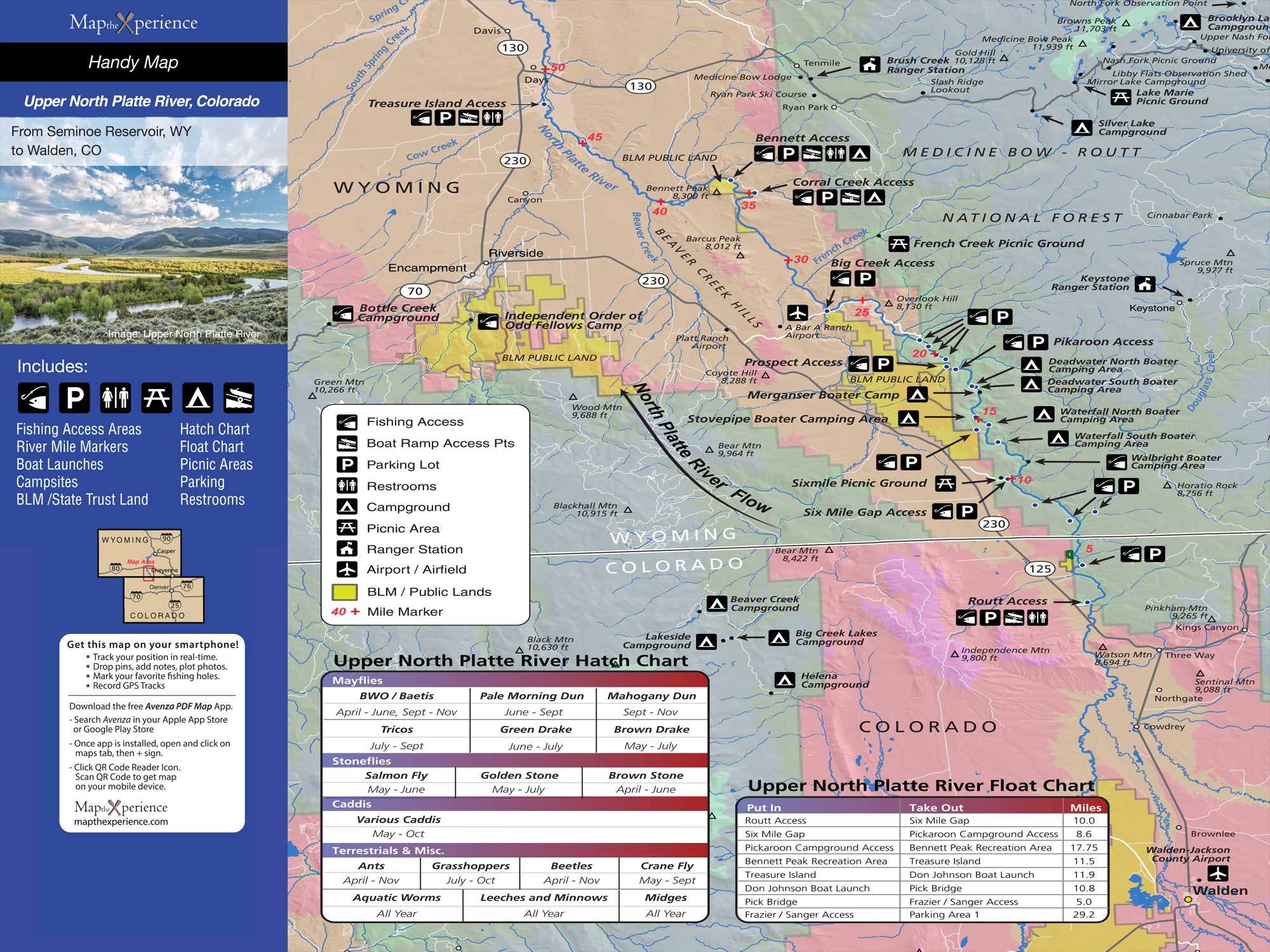
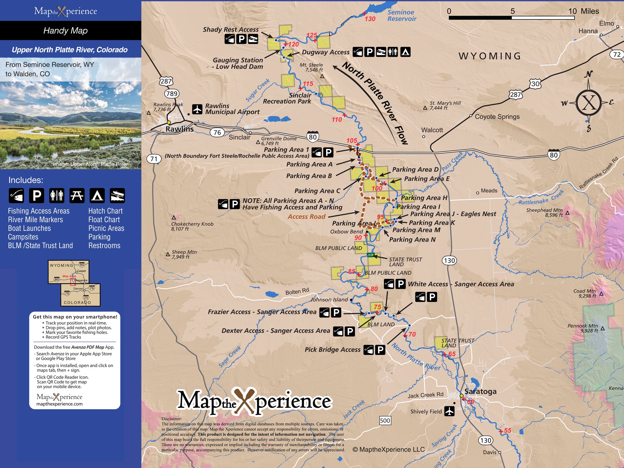
Upper North Platte River Wyoming Fly Fishing Map | Public Access Guide
Upper North Platte River, Colorado & Wyoming Pocket-Sized Guide with a Powerful Mobile Map!
Fish Wyoming’s wild Upper North Platte River with our detailed fly fishing map, crafted for serious anglers. Covering prime stretches from the Colorado-Wyoming border near Northgate Canyon through Saratoga and beyond, this detailed map highlights public fishing access points, river miles, boat ramps, trails, and prime trout waters. Whether you're floating broad canyon waters or wading hidden bends, this rugged guide helps you fish smarter, explore farther, and connect with one of the West’s best wild trout rivers. Lightweight, tear-resistant, and adventure-tested — your essential map for the Upper Platt
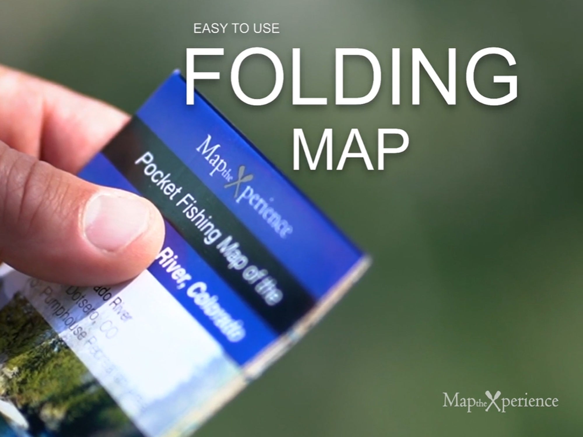
Pocket-Sized & Adventure-Ready! – Compact & portable (15” x 12” unfolded, 3” x 6” folded), this lightweight, map fits right in your pocket or tackle box!
Includes a Mobile Map! (Avenza Map App)
- Works offline – no cell service needed!
- Zoom in for even more detail than the printed map
- GPS-enabled so you can see your exact location in real time
- Identical to the printed version for seamless navigation