Arches National Park GPS Map Neck Gaiter
The Ultimate Arches National Park Neck Gaiter
Where red rock towers touch the sky and every trail leads to wonder—this is the adventure-ready essential you won’t want to explore without.
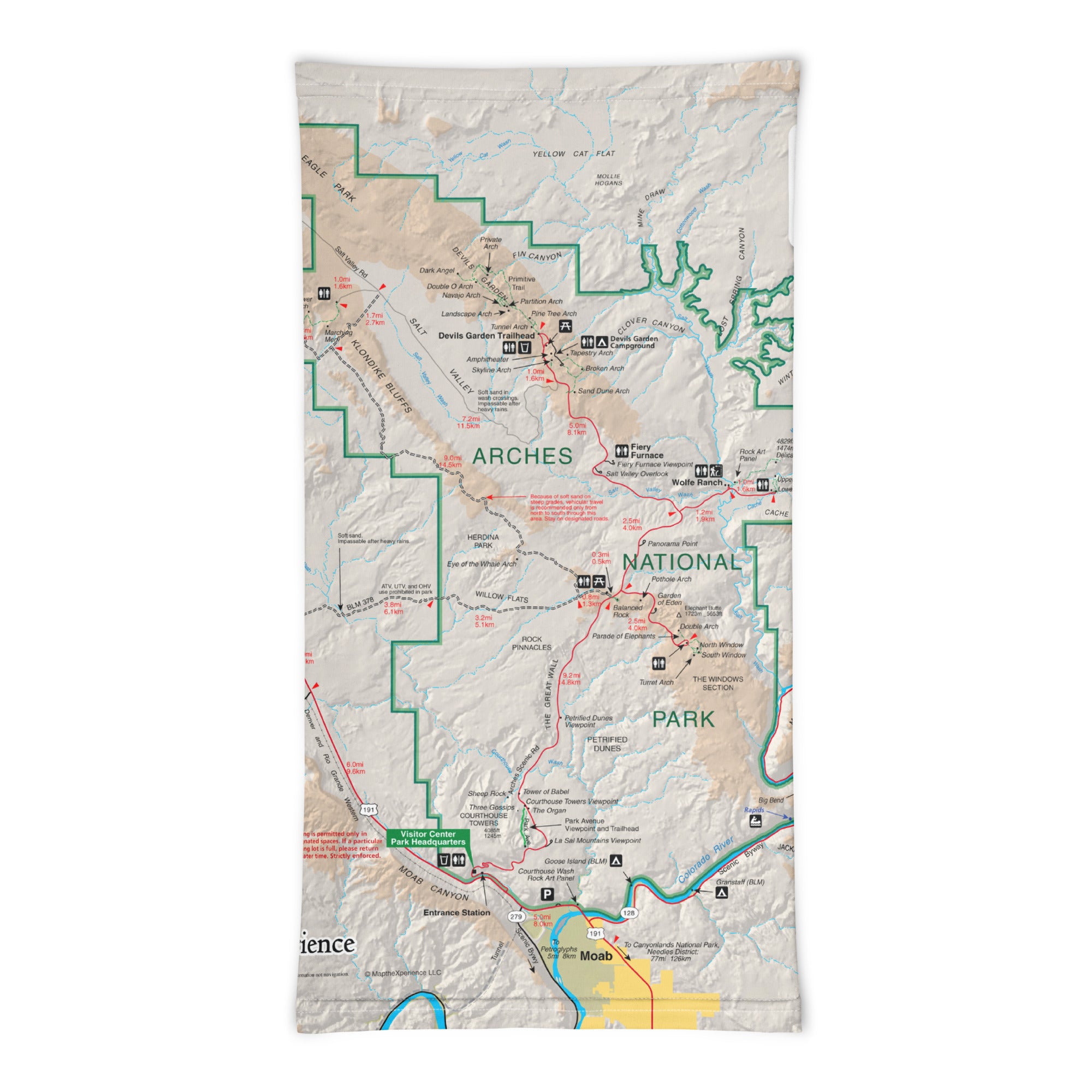
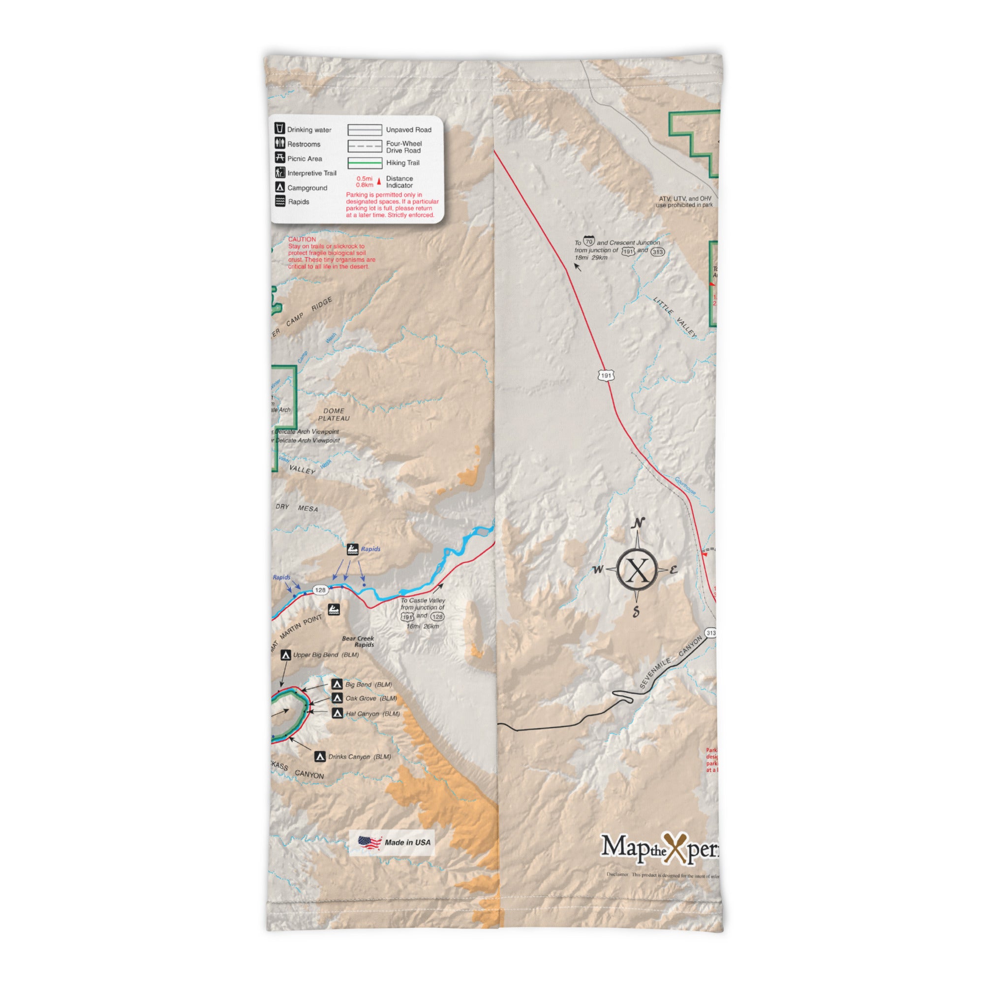
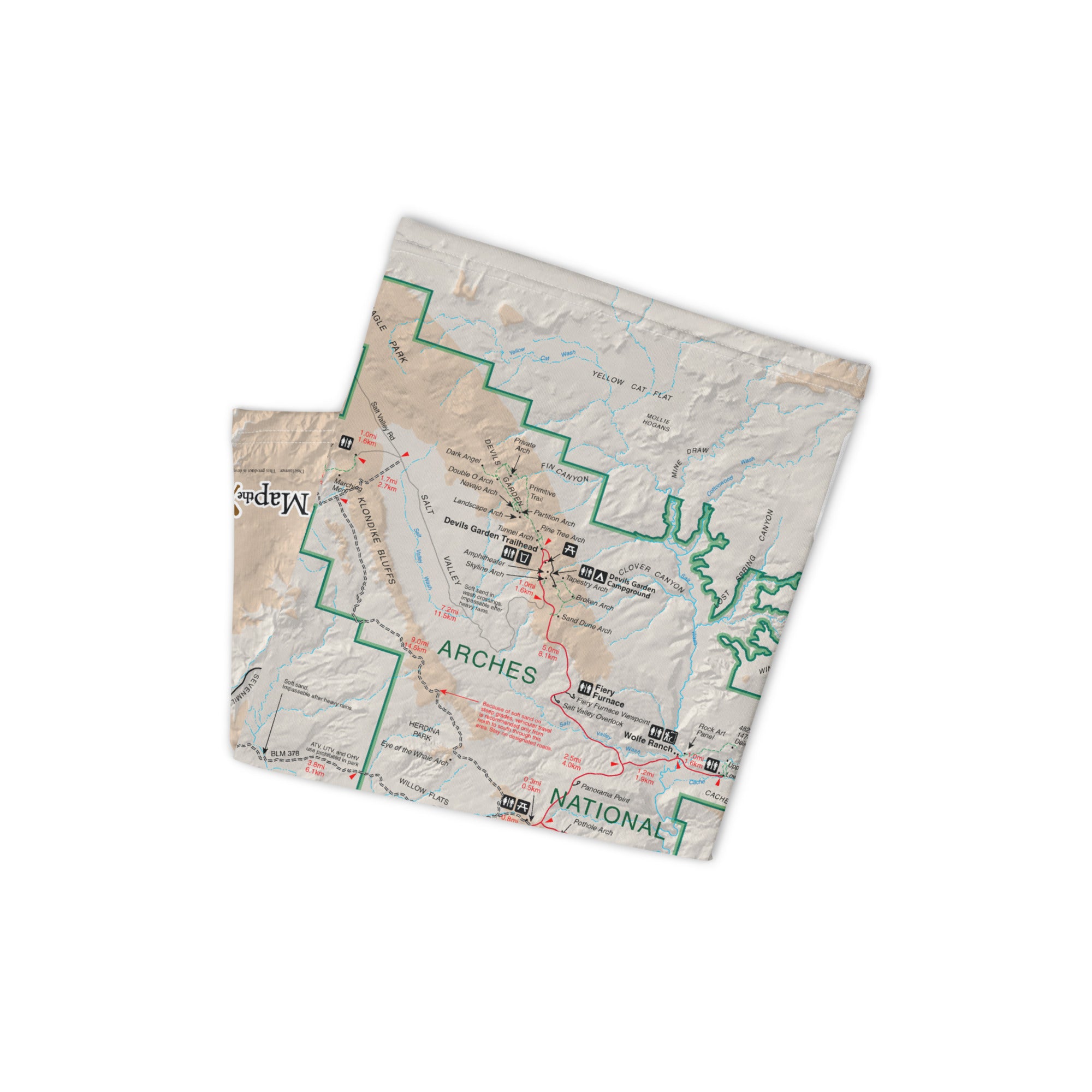
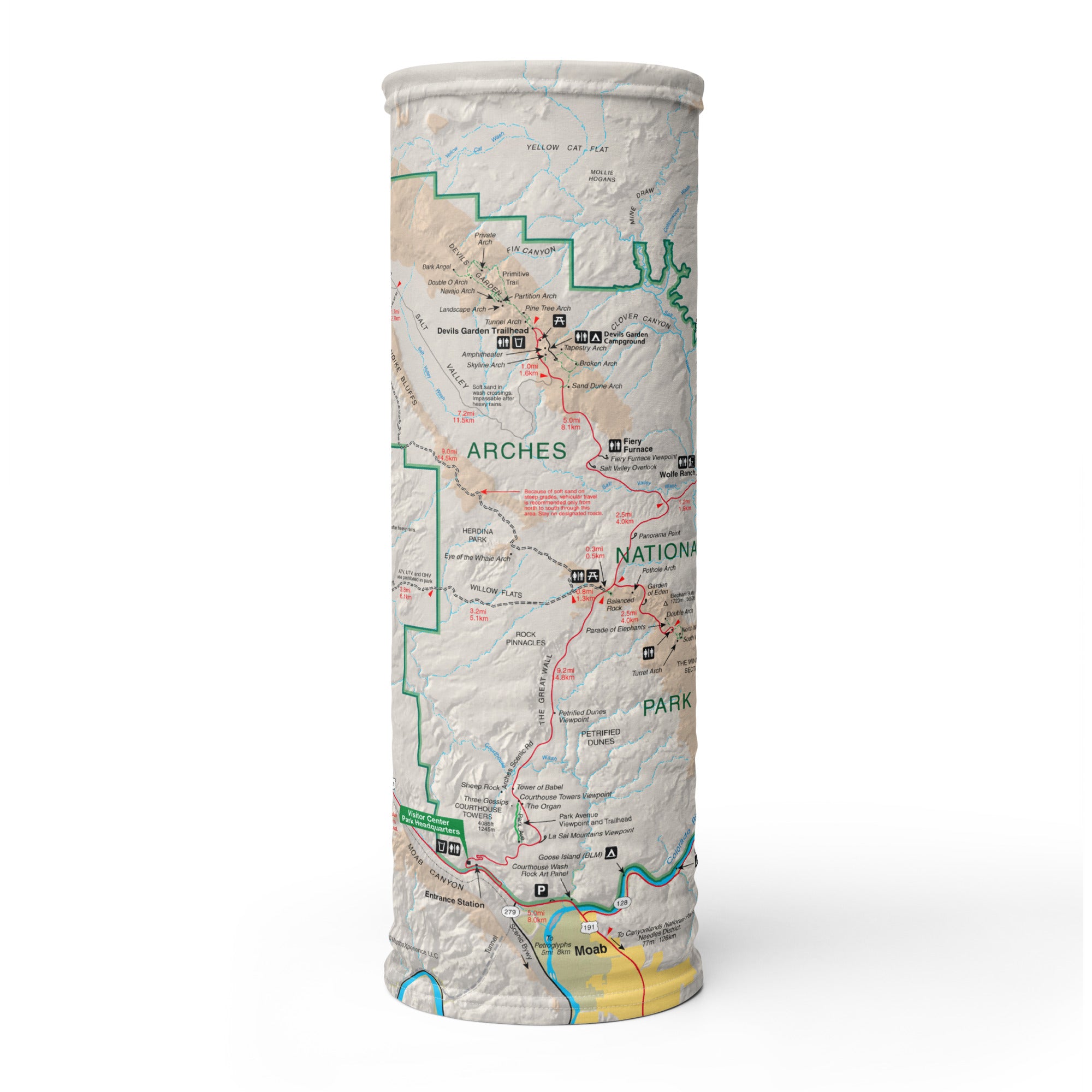
The Arches GPS Map Neck Gaiter is more than just gear—it’s your all-in-one trail companion, crafted for sun-soaked hikes, canyon winds, and long days beneath Utah’s iconic arches. Featuring a GPS-accurate map of Arches National Park, it blends function, protection, and style into one versatile piece you’ll reach for every time you hit the trail.
Explore Smart. Stay Protected.
Made from a soft, high-performance polyester-spandex blend, this gaiter offers 12+ ways to wear it—from face covering and neck guard to headband, wrist wrap, and balaclava. Whether you’re powering up to Delicate Arch, navigating Devil’s Garden, or snapping photos in the Fiery Furnace, it keeps you cool, covered, and confident.
Trail-Tested Features:
-
Full-color, GPS-accurate map of Arches National Park
-
Lightweight, breathable, moisture-wicking fabric
-
UPF 50+ sun protection—essential for desert days
-
2-way stretch for a snug yet comfortable fit
-
Machine washable and built for repeated use
-
One size fits all—form-fitting and flexible
A Must-Have for Park Visitors—and a Standout for Retailers
This gaiter isn’t just useful—it’s highly giftable and retail-ready, with strong appeal to hikers, road trippers, and national park fans. Eye-catching, functional, and unique, it’s a proven favorite for visitor centers, park stores, outfitters, and gift shops looking for products that blend adventure, purpose, and story.
Where Form Meets Function—and Adventure Never Ends
Whether you're navigating narrow canyons or standing in awe beneath sandstone arches, the Arches GPS Map Neck Gaiter helps you explore smarter, stay protected, and carry the map with you—literally.
X FIBER - A BREATHABLE FABRIC UNLIKE ANY OTHER
X GUARD MULTIFACETED FACE WEAR
