
Bighorn River Montana Fly Fishing Map | Public Access Guide
Map Features
Pocket-sized on land. Powerfully detailed on water. Built for serious anglers—and smart retailers.
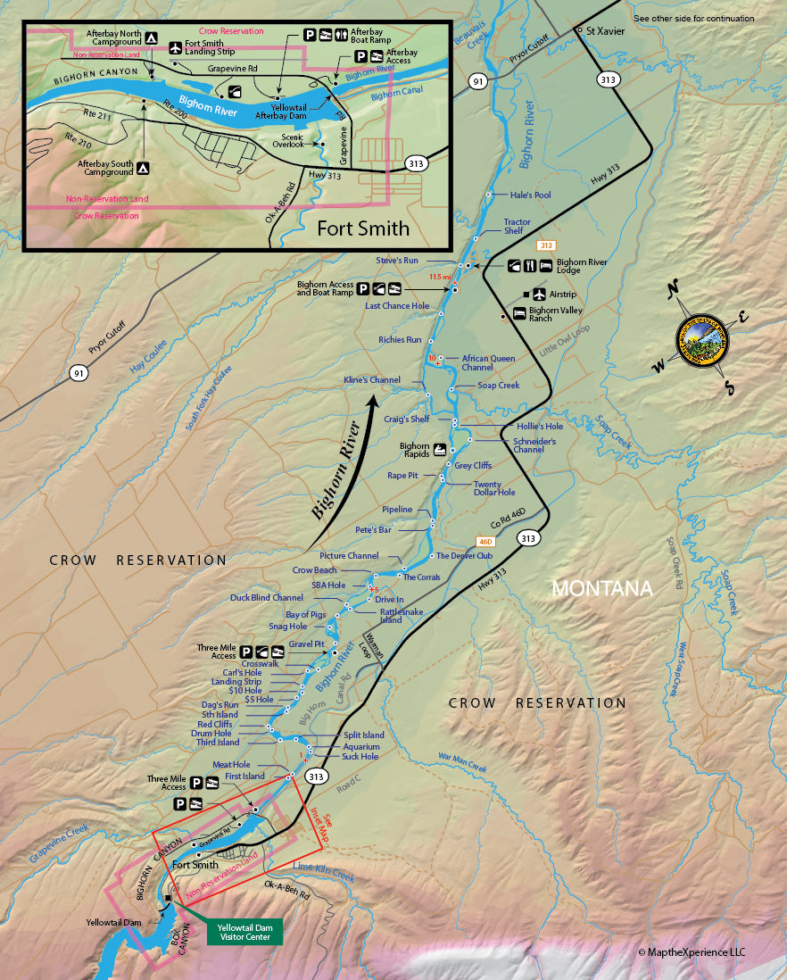
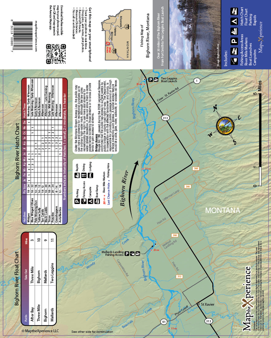
Ready to fish smarter, not harder? Our Bighorn River Fishing Map is your essential guide to one of Montana’s most famous tailwater fisheries. From the stretches below Yellowtail Dam through classic riffles, runs, and long glides, this map is designed by local experts to highlight public access points, boat launches, river miles, parking areas, and prime trout water—so you spend less time guessing and more time fishing.
The map clearly displays all public lands—federal, state, county, and city—and includes exclusive parking locations and access details not found on any other map. Whether you’re floating long productive sections, wading technical water, or guiding clients on a blue-ribbon tailwater, this map puts expert-level, river-specific knowledge right in your pocket.
Why Anglers Love This Map:
-
Pinpoint productive water fast with detailed access and float information
-
Navigate confidently with clearly marked public land boundaries
-
Discover lesser-known parking and entry points
-
Maximize your day with proven Bighorn-specific insights
Pocket-Sized and Adventure-Ready
Folded to 3” x 6” and unfolding to 15” x 12”, this durable paper map slips easily into any vest, pack, or glovebox—ready for long days on legendary Montana water like the Bighorn River.
Track your location, zoom in for greater detail, and mirror your print map with GPS-enabled compatibility via QR Code—perfect for planning ahead or navigating confidently on the river.