Skip to product information

Grand Teton National Park Hiking Trail & Fishing Map | Mobile Map | GPS
$11.95
Shipping calculated at checkout.
Explore the Tetons with the Ultimate Hiking Trail Map
(Grand Teton National Park – Rugged, Accurate, Adventure-Ready)
Pocket-sized in your pack. Powerfully detailed on the trail. Built for alpine hikers, backcountry trekkers—and smart retailers.
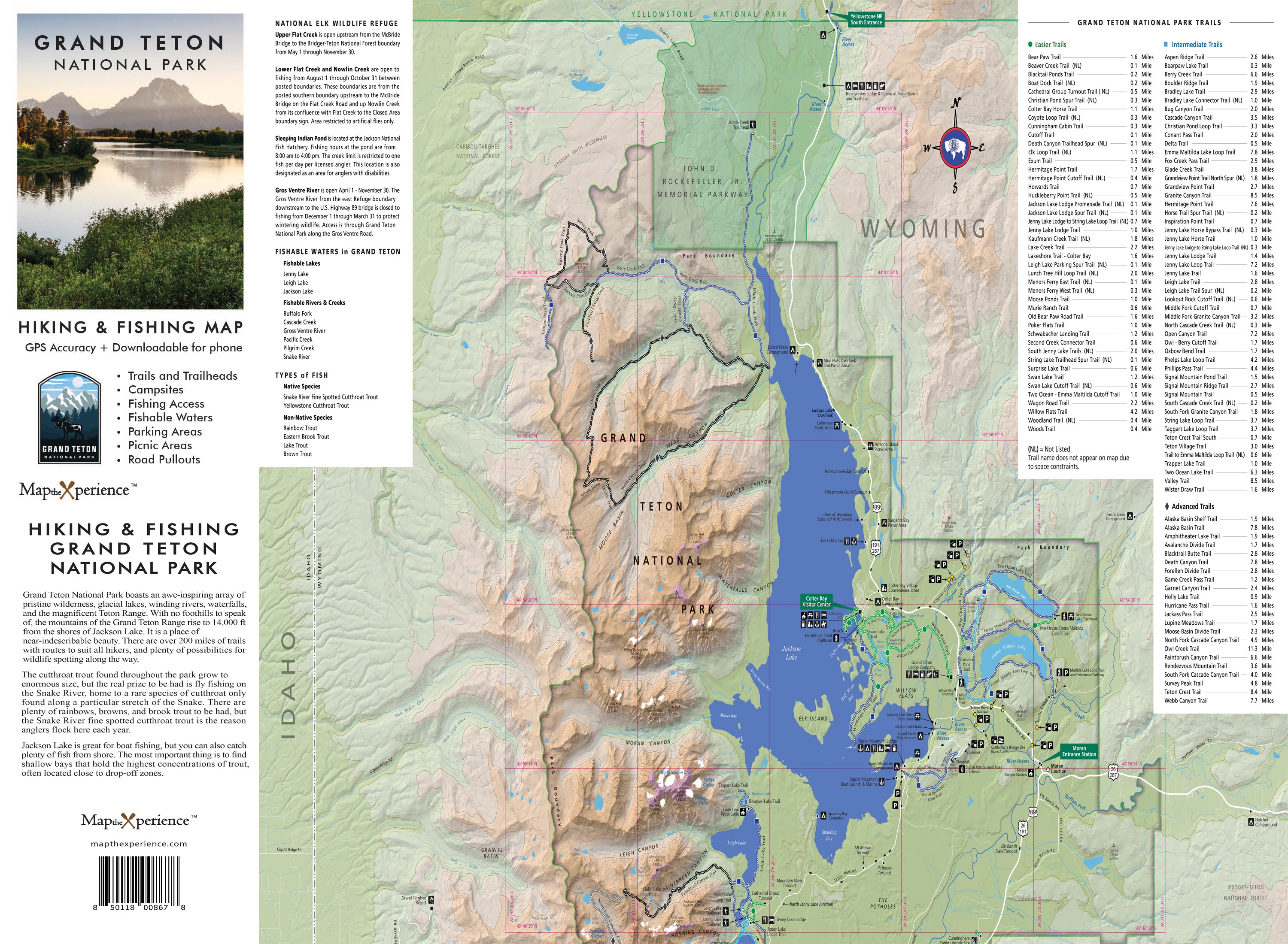
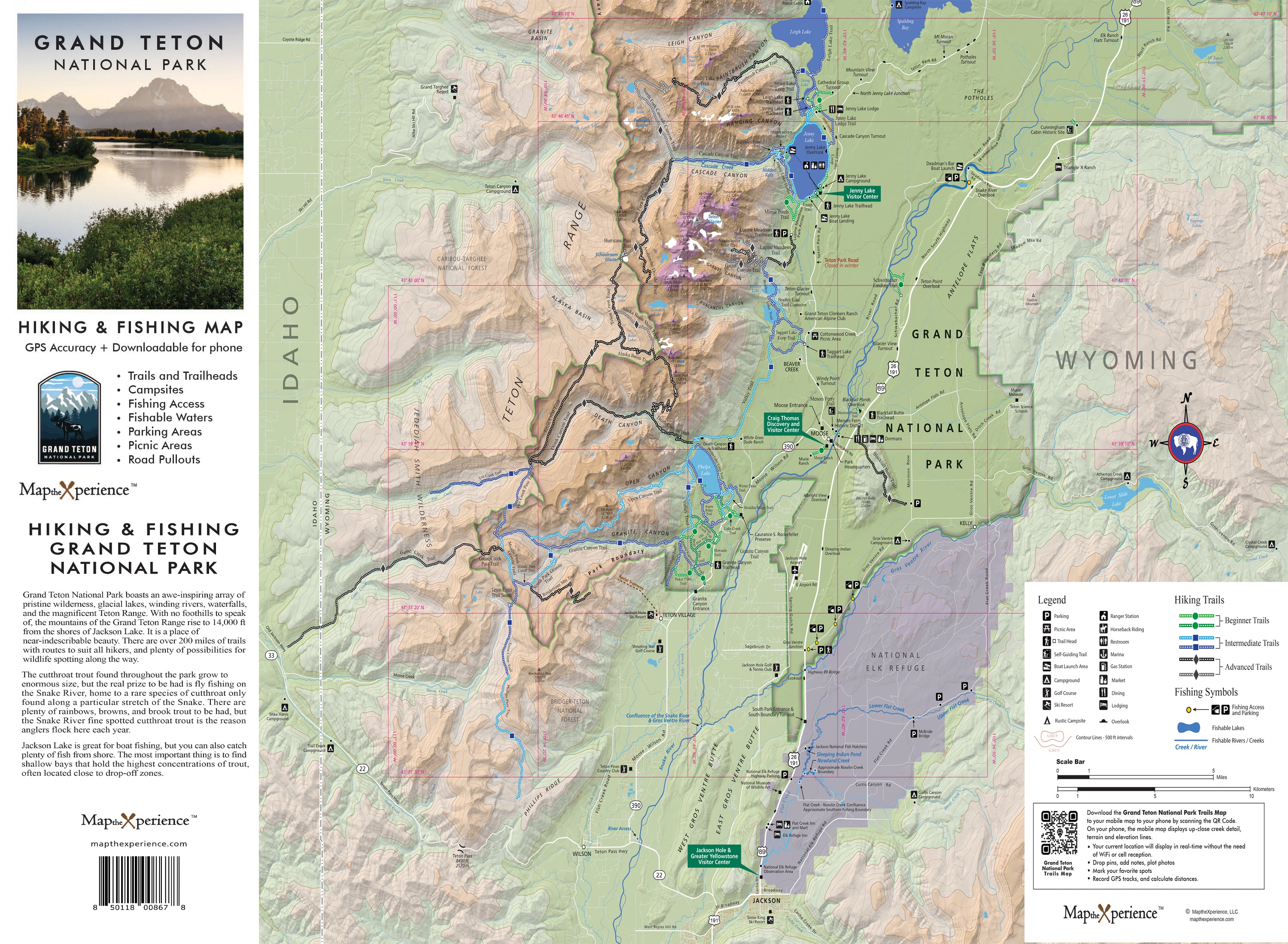
Ready to hike smarter, climb higher, and experience the Tetons like never before? Our Grand Teton National Park Hiking Trail Map is your essential guide to one of America’s most dramatic landscapes—from family-friendly loops near Jenny Lake to high-alpine epics in Cascade Canyon, Death Canyon, and beyond. Designed with real GPS data and local expertise, this map gives you unmatched accuracy and total confidence on the trail.
Whether you’re hiking to a glacial lake, crossing wildflower-covered passes, or pushing into rugged backcountry terrain, this map equips you for every step of your Teton adventure.
Why Hikers Love This Map:
-
Covers all official park trails, routes, and backcountry zones
-
Trailheads, mileage, elevation profiles, waterfalls, overlooks, and alpine lakes included
-
Clearly marked trail difficulty ratings:
🟢 Easy – Ideal for families and flatland wanderers
🔵 Moderate – Great for elevation gain and longer day hikes
⚫ Difficult – Built for seasoned hikers tackling steep, technical terrain -
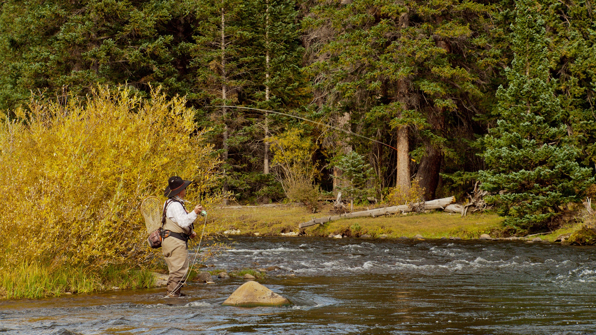
Fishing access points, species listings, and hike-in vs. drive-up designations
-
Campgrounds, picnic areas, and essential facilities marked throughout
3D Shaded Relief for Terrain Clarity
Visualize every climb, canyon, and summit with high-resolution shaded topography—giving you a true sense of the landscape before your boots hit the dirt.
Trail-Tested and Ready to Roam
Folded to 4” x 8” and unfolding to 36” x 24”, this waterproof, tear-resistant map is built for wind, sweat, and wild weather—perfect for your daypack, vest pocket, or campsite table.
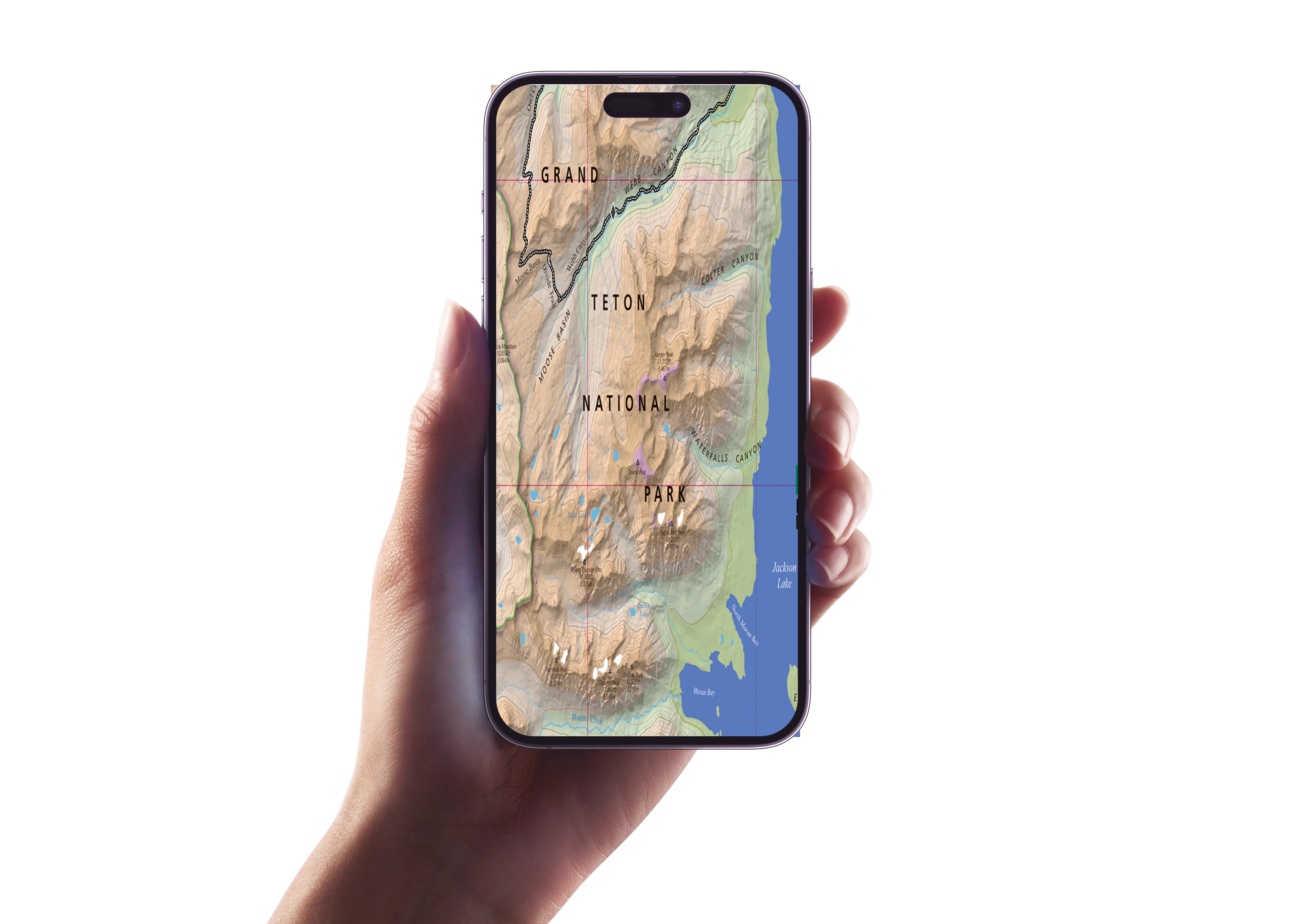
Scan the QR code to see your exact location in real time, zoom in for added trail detail, and seamlessly mirror your printed map—even when you’re miles from a signal.
Retailers: Want to Offer Something That Sells Itself?
This map is a must-have for gear shops, outdoor outfitters, park stores, and visitor centers across Jackson Hole and beyond. Locally made, expert-designed, and packed with value, it’s the ultimate grab-and-go tool for hikers of all levels.
Don’t just hike the Tetons—know them, climb them, and experience their wild beauty like never before.
Plan better. Hike smarter. Explore deeper.
Details
This product is crafted with quality materials to ensure durability and performance. Designed with your convenience in mind, it seamlessly fits into your everyday life.
Shipping & Returns
We strive to process and ship all orders in a timely manner, working diligently to ensure that your items are on their way to you as soon as possible.
We are committed to ensuring a positive shopping experience for all our customers. If for any reason you wish to return an item, we invite you to reach out to our team for assistance, and we will evaluate every return request with care and consideration.