Skip to product information

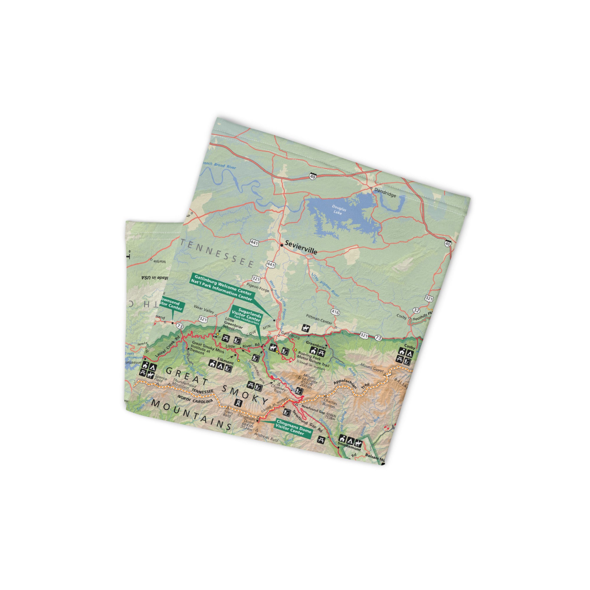
Great Smoky Mountains National Park GPS Map Neck Gaiter
Sale price
$14.97
Regular price
$24.95
Shipping calculated at checkout.
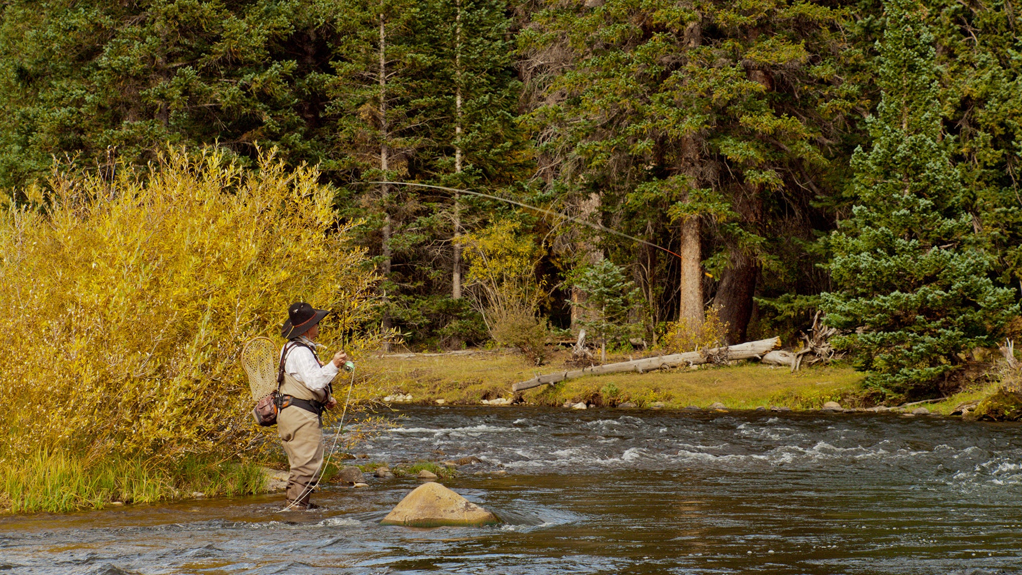
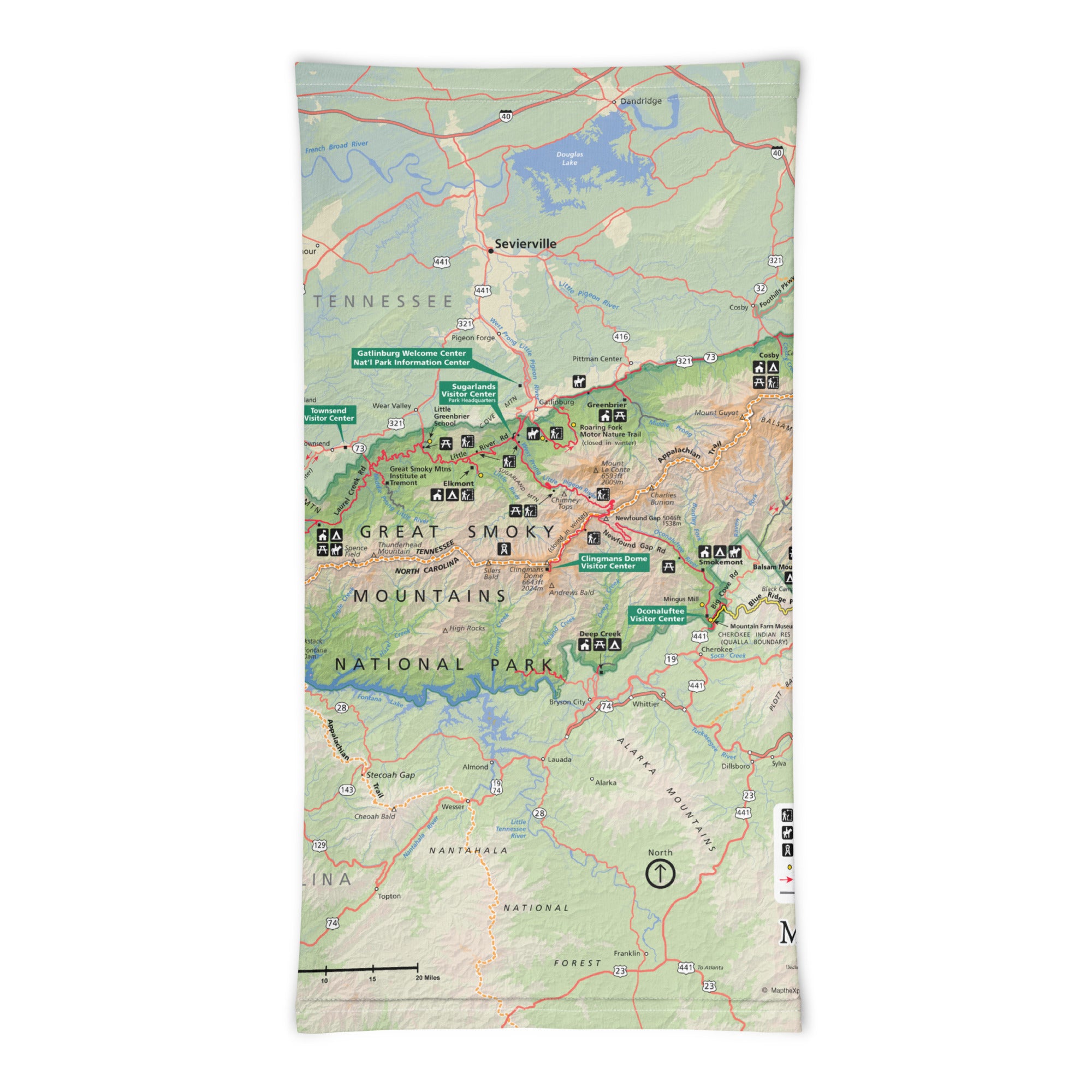
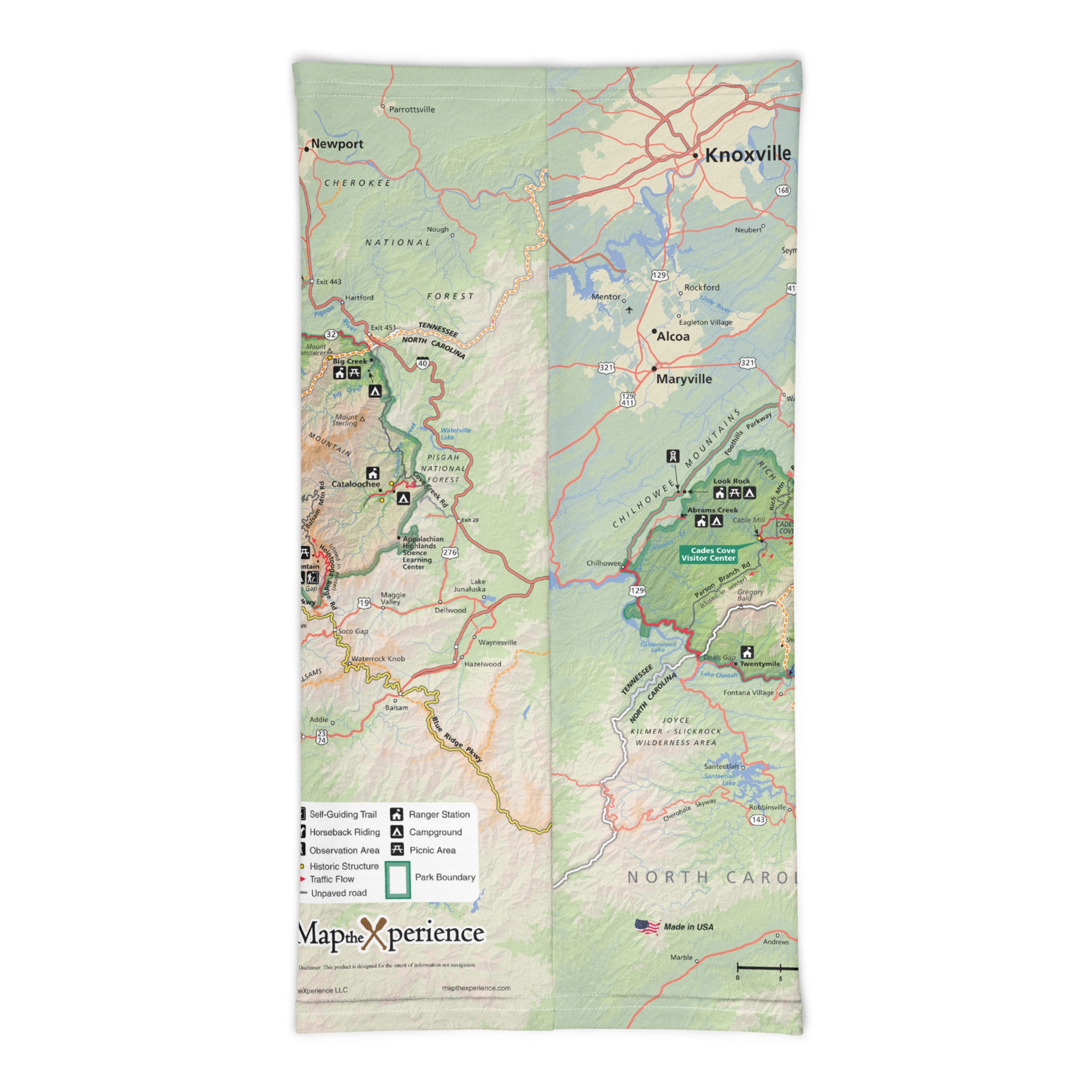
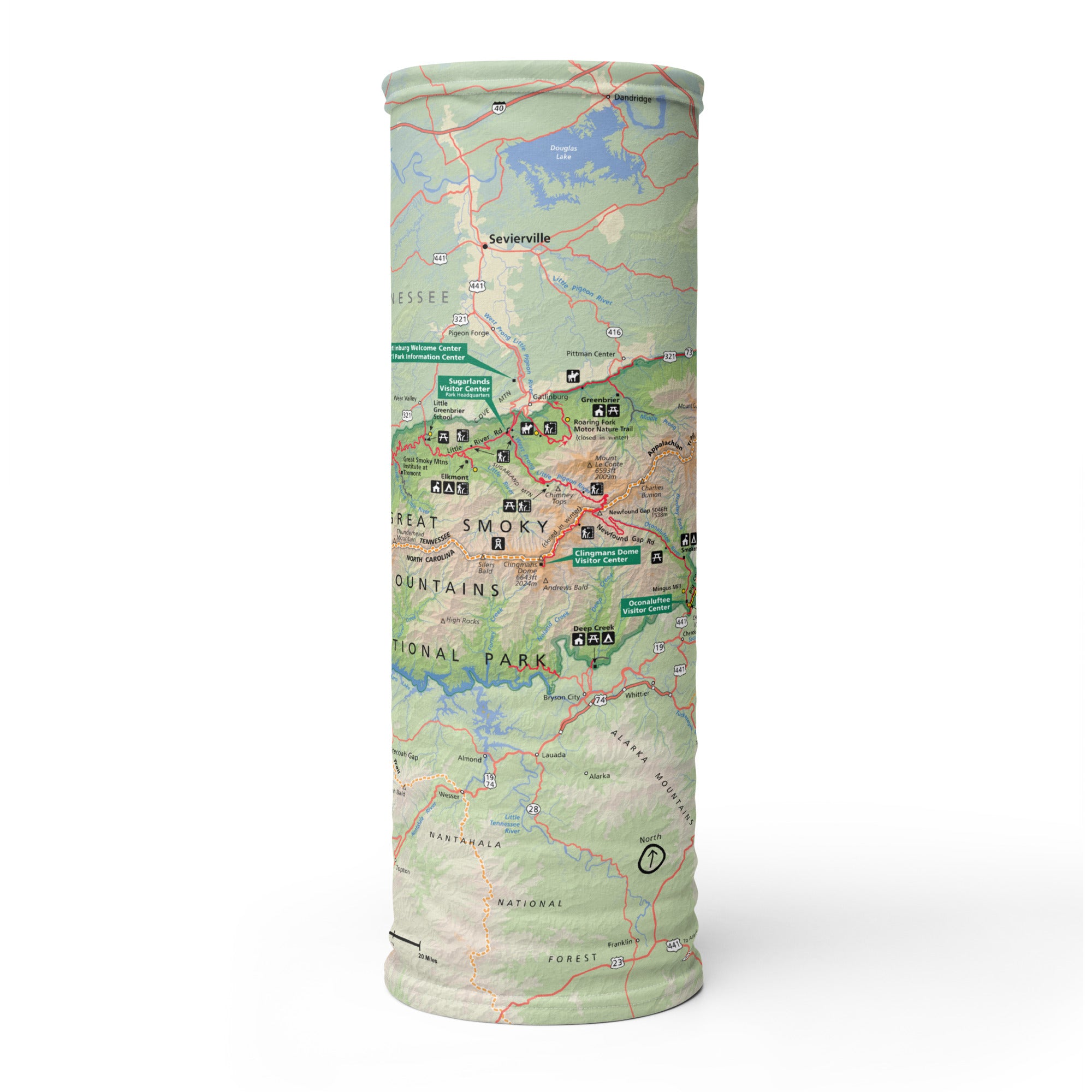
Misty ridgelines, cascading waterfalls, and ancient hardwood forests—Great Smoky Mountains National Park is a place where nature thrives and adventure awaits. The Great Smoky Mountains GPS Map Neck Gaiter features a detailed, GPS-accurate overview map of the park, helping hikers, backpackers, and scenic travelers explore the most visited national park in the U.S. with confidence and comfort.
Trail-Tested Performance:
-
Wear it 12+ ways — as a neck gaiter, face covering, headband, balaclava, beanie, and more
-
One size fits all — ultra-soft, stretchy material offers a snug and comfortable fit
-
Made from a durable polyester-spandex blend that’s breathable, moisture-wicking, and quick-drying
-
Lightweight, machine washable, and perfect for all-season use
-
UPF 50+ sun protection — ideal for exposed ridges, open trails, and sunny overlooks
Includes Free Mobile Map
Each gaiter includes a free downloadable GPS-enabled map of Great Smoky Mountains National Park
-
Works offline in the Avenza Maps App — no cell service or Wi-Fi required
-
Track your real-time location on trails like Alum Cave, Clingmans Dome, Appalachian Trail segments, and Cades Cove
Whether you're chasing sunrises on the ridges, spotting wildlife in the valleys, or trekking deep into the backcountry, this gaiter keeps you cool, covered, and always on course in the heart of the Southern Appalachians.
Details
This product is crafted with quality materials to ensure durability and performance. Designed with your convenience in mind, it seamlessly fits into your everyday life.
Shipping & Returns
We strive to process and ship all orders in a timely manner, working diligently to ensure that your items are on their way to you as soon as possible.
We are committed to ensuring a positive shopping experience for all our customers. If for any reason you wish to return an item, we invite you to reach out to our team for assistance, and we will evaluate every return request with care and consideration.