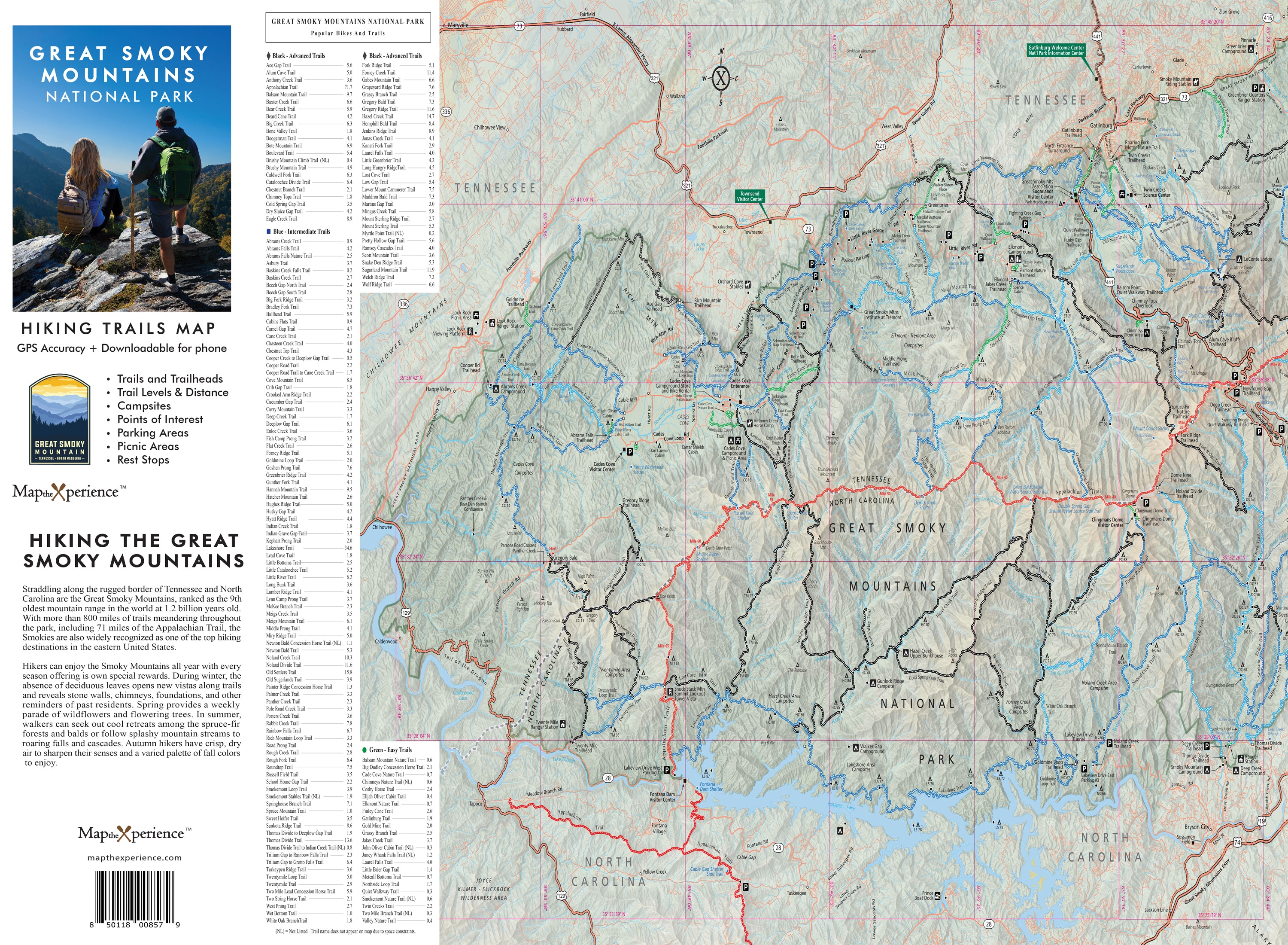
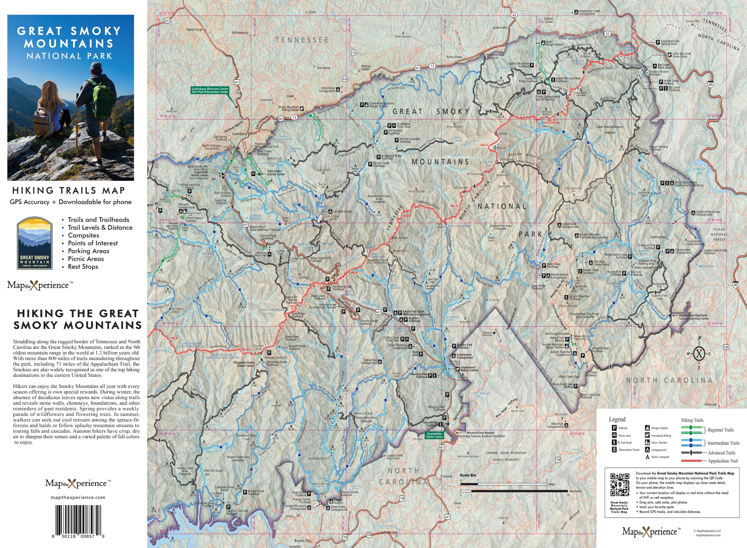
Great Smoky Mountains National Park Hiking Trail Map | Paper + Mobile GPS Guide
Great Smoky Mountains National Park Hiking Trail Map
Navigate America’s most visited national park with our detailed hiking trail map and free mobile GPS guide. Covering the Great Smoky Mountains' most popular and remote trails — from Clingmans Dome and Alum Cave to Abrams Falls and Deep Creek — this detailed map highlights trailheads, mileage, elevation profiles, waterfalls, campsites, and scenic viewpoints. Built for hikers, backpackers, and outdoor explorers, this rugged guide helps you plan better trips, stay on track, and experience the wild beauty of the Smokies. Lightweight, adventure-tested, and tear-resistant — essential gear for every Smoky Mountains adventurer
✅ Trail Designations for Every Skill Level – Easily identify hikes based on difficulty:
- 🟢 Green (Easy) – Perfect for casual hikers & families
- 🔵 Blue (Moderate) – A bit more challenging with some elevation gain
- ⚫ Black (Difficult) – For experienced hikers ready to take on Great Smoky Mountains toughest terrain!
4x8" Folded, 36x24" unfolded
Includes a Mobile Map!
- Works offline – no cell service needed!
- GPS-enabled so you can see your exact location on the trail
- Even more detail than the printed version.