Skip to product information


Lake Tahoe Summer Trails GPS Map Neck Gaiter
$24.95
Shipping calculated at checkout.
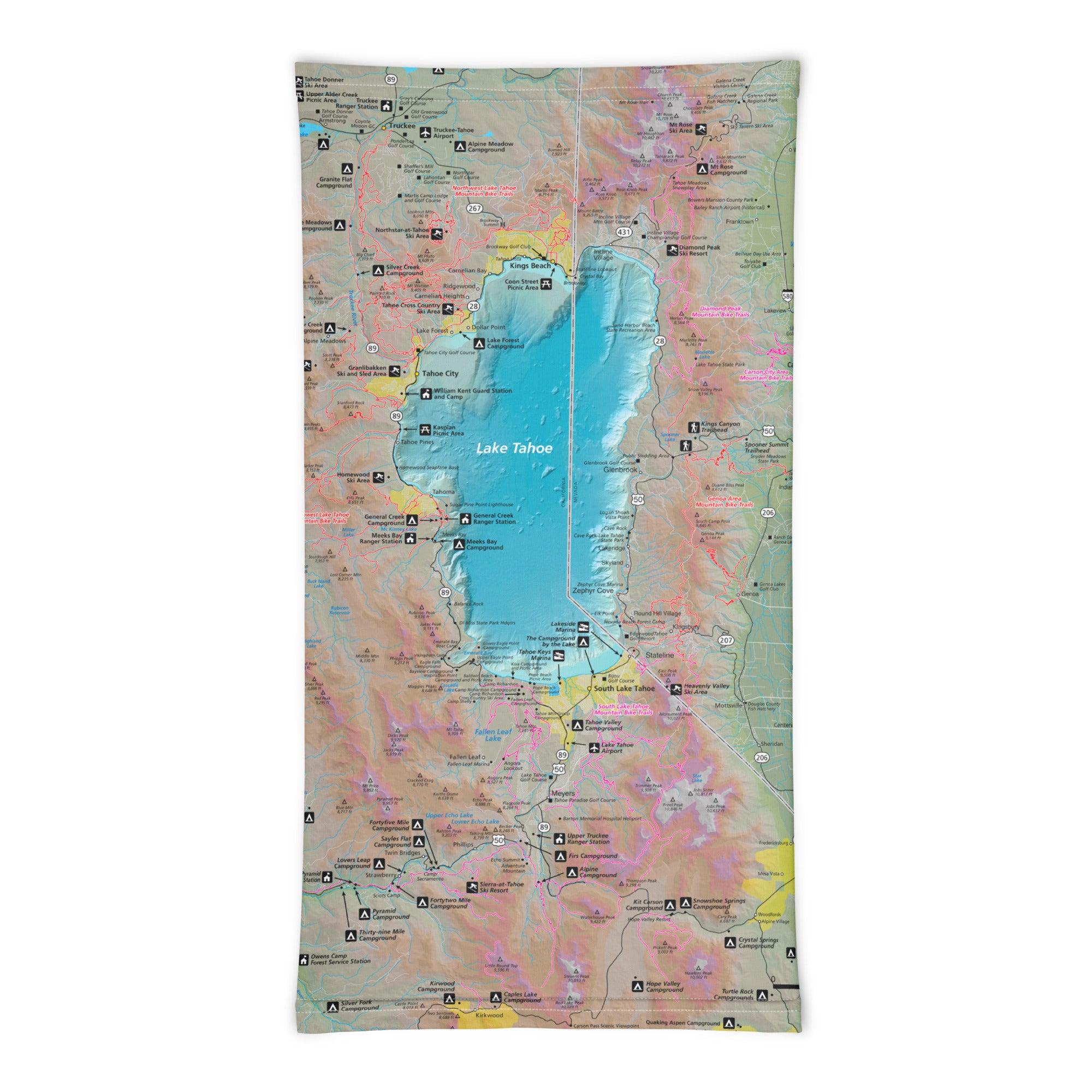
Crystal-clear waters, alpine air, and miles of scenic trails—Lake Tahoe is a summer paradise for hikers, bikers, and mountain adventurers. The Lake Tahoe Summer Trails GPS Map Neck Gaiter features a beautifully detailed, GPS-accurate overview of the region’s most popular and hidden summer trails, making it the perfect blend of comfort, protection, and navigation.
Made for Mountain Miles:
-
Wear it 12+ ways — as a neck gaiter, face covering, headband, balaclava, sun shield, and more
-
One size fits all — soft, stretchy fabric provides a secure and comfortable fit
-
Made from a lightweight polyester-spandex blend that’s breathable, moisture-wicking, and quick-drying
-
Machine washable, 2-way stretch, built for high-output summer adventures
-
UPF 50+ sun protection — perfect for exposed ridgelines, lakefront strolls, and sunny summit hikes
Includes Free Mobile Map
Each gaiter includes a free downloadable GPS-enabled map of Lake Tahoe’s summer trail network
-
Works offline with the Avenza Maps App — no cell service or Wi-Fi needed
-
Track your real-time location on trails like the Tahoe Rim Trail, Flume Trail, Cascade Falls, and more
Whether you’re hiking to panoramic overlooks, biking along forested singletrack, or exploring lakeside paths, this gaiter keeps you cool, protected, and confidently navigating one of the most stunning alpine regions in the world.
Details
This product is crafted with quality materials to ensure durability and performance. Designed with your convenience in mind, it seamlessly fits into your everyday life.
Shipping & Returns
We strive to process and ship all orders in a timely manner, working diligently to ensure that your items are on their way to you as soon as possible.
We are committed to ensuring a positive shopping experience for all our customers. If for any reason you wish to return an item, we invite you to reach out to our team for assistance, and we will evaluate every return request with care and consideration.