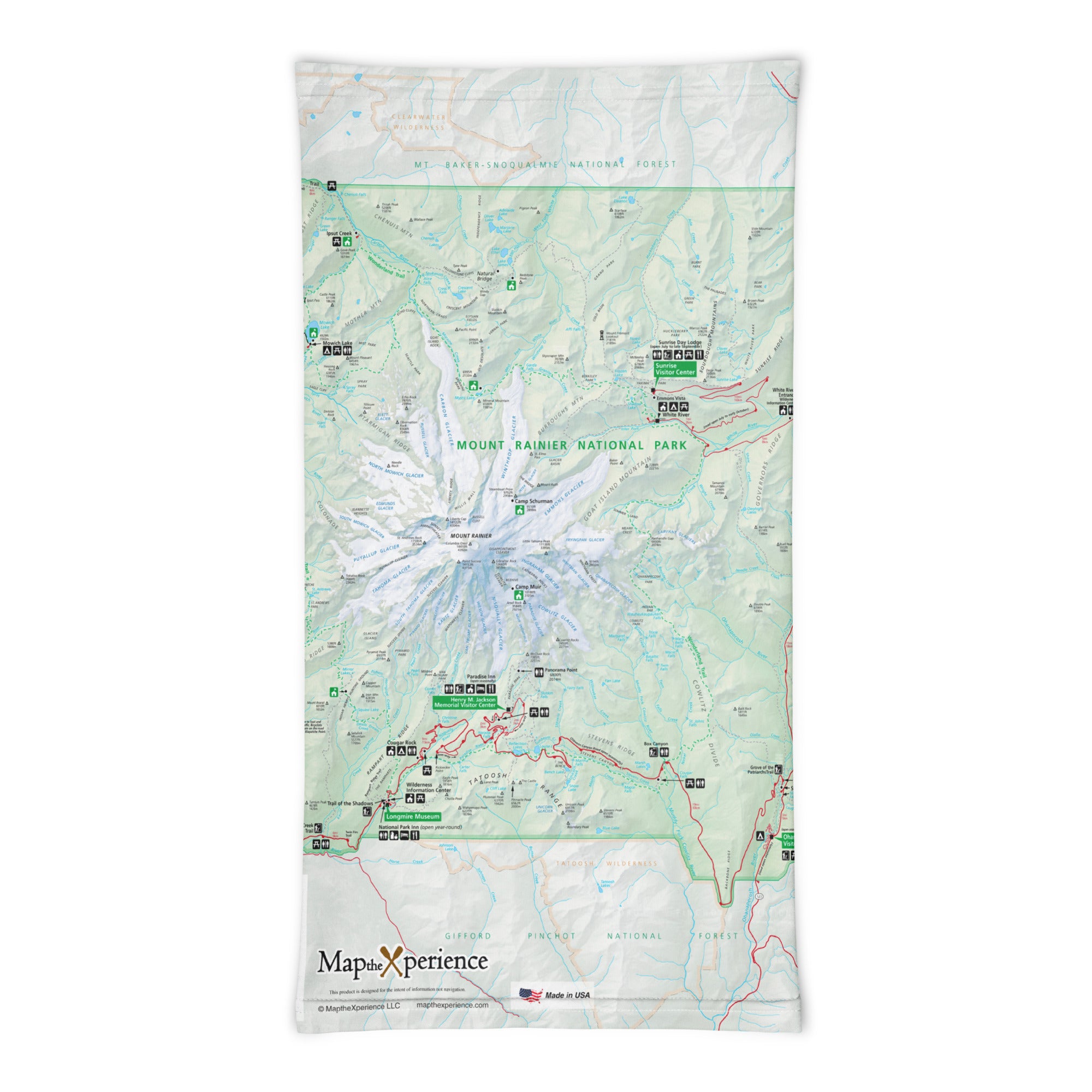
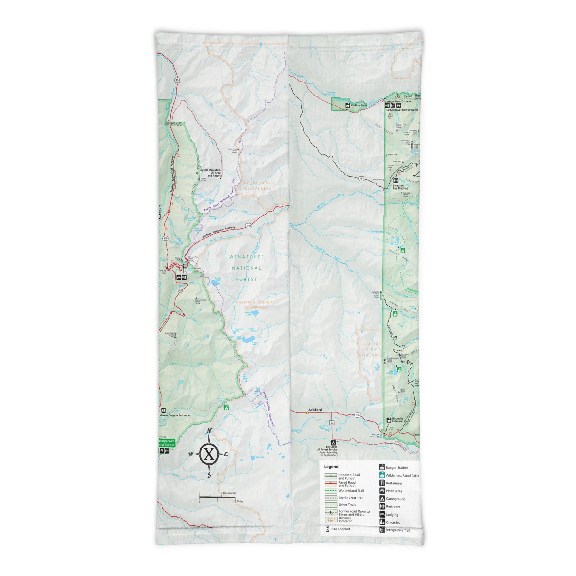
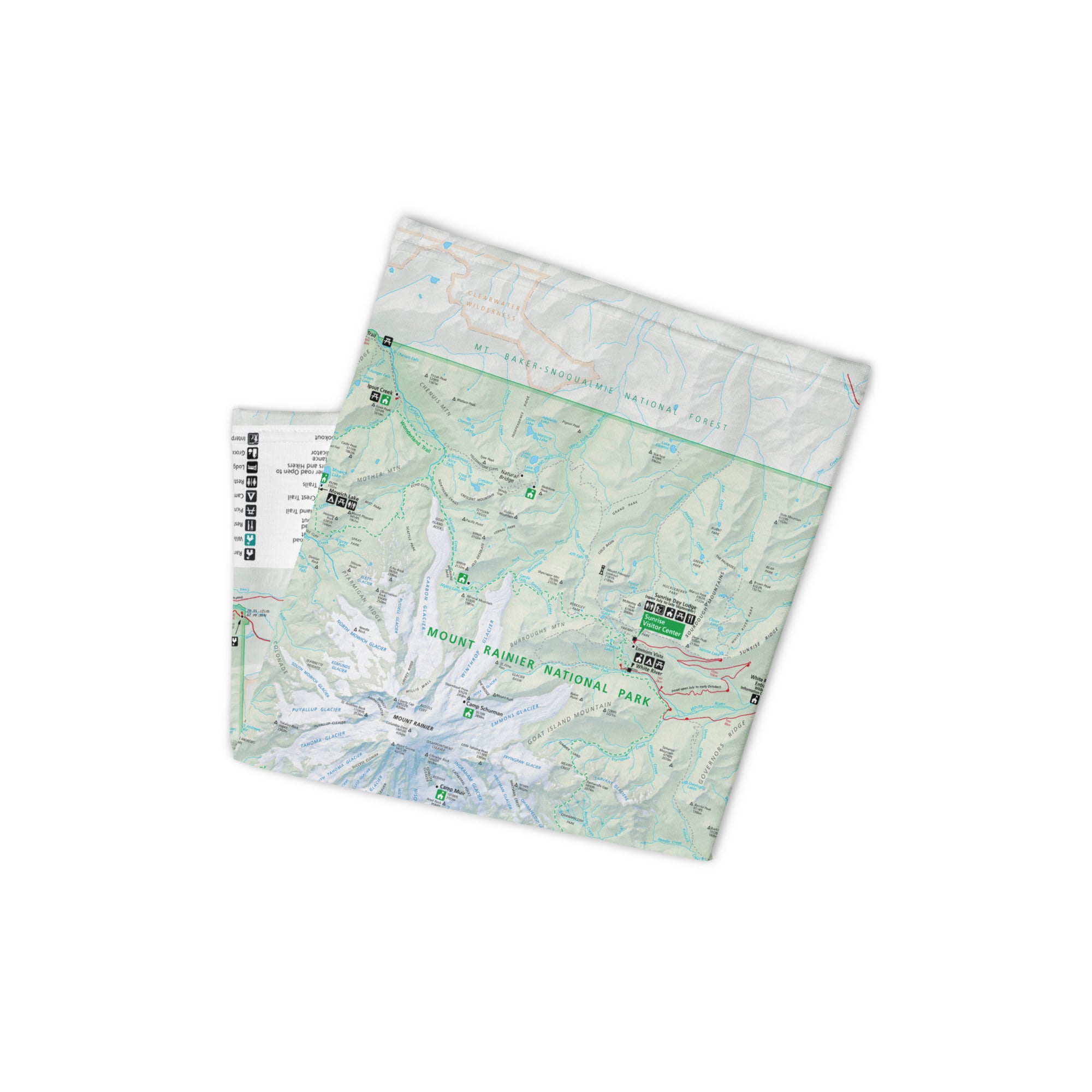
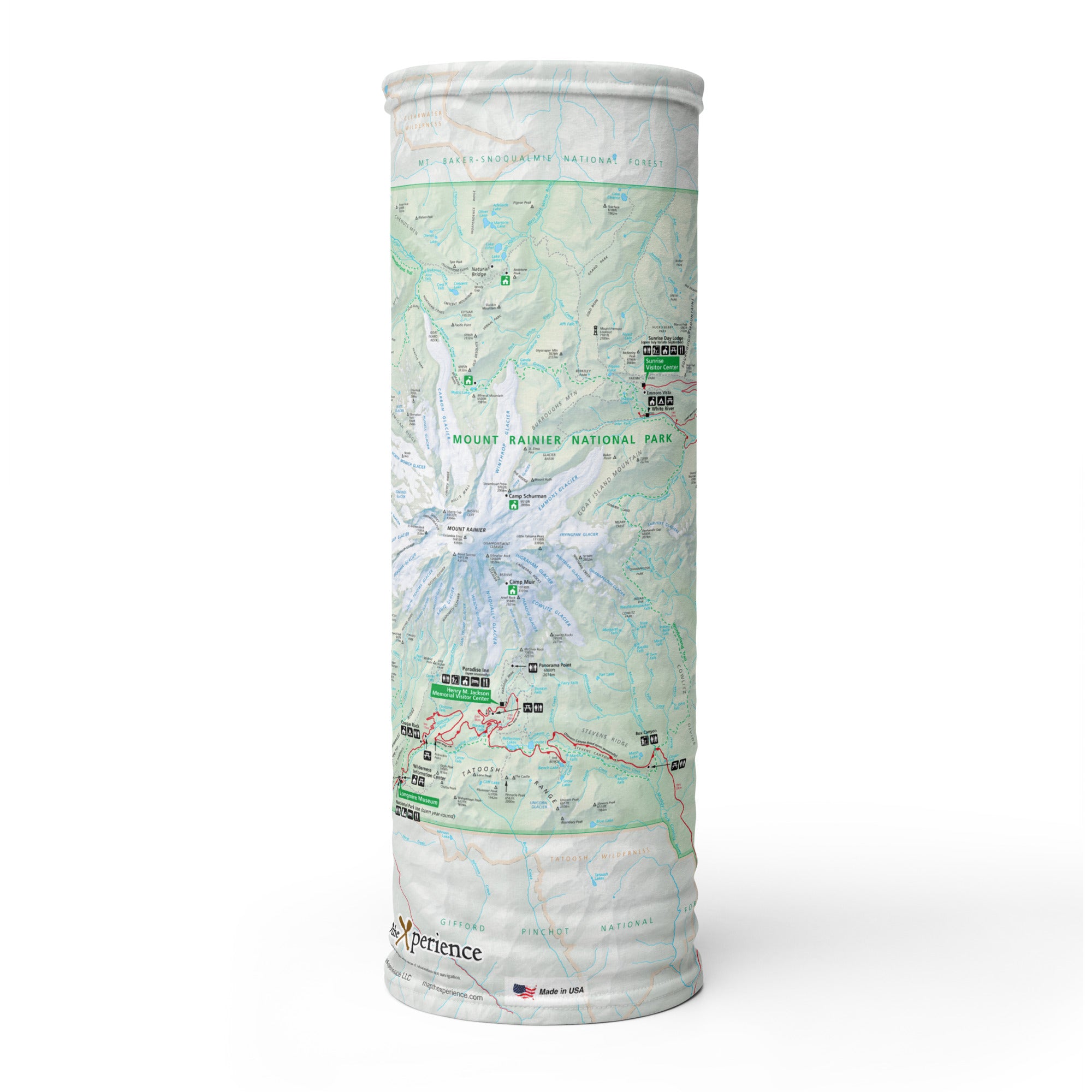
Mount Rainier National Park GPS Map Neck Gaiter
Rising over 14,000 feet, Mount Rainier dominates the horizon and inspires adventure—and now you can carry the mountain with you. The Mount Rainier National Park GPS Map Neck Gaiter features a detailed, GPS-accurate overview map of the park, making it the perfect companion for hikers, climbers, and explorers tackling Rainier’s rugged terrain.
Built for the Ascent:
-
Wear it 12+ ways — as a face covering, neck gaiter, headband, balaclava, helmet liner, and more
-
One size fits all — with ultra-soft, stretchable comfort for any outdoor pursuit
-
Constructed from a high-performance polyester-spandex blend for smooth, breathable wear
-
2-way stretch, moisture-wicking, lightweight, and machine washable
-
UPF 50+ sun protection — essential for high-altitude and glacial exposure
Includes Free Mobile Map
Each gaiter includes a free downloadable GPS smartphone map of Mount Rainier National Park
-
Use with the Avenza Maps App — works offline, no cell service required
-
See your real-time location on iconic trails like Wonderland, Skyline, or Emmons Glacier routes
Whether you’re trekking to Camp Muir, photographing wildflower meadows, or exploring ancient forests, this gaiter keeps you protected, comfortable, and on track.
X FIBER - A BREATHABLE FABRIC UNLIKE ANY OTHER
X GUARD MULTIFACETED FACE WEAR
