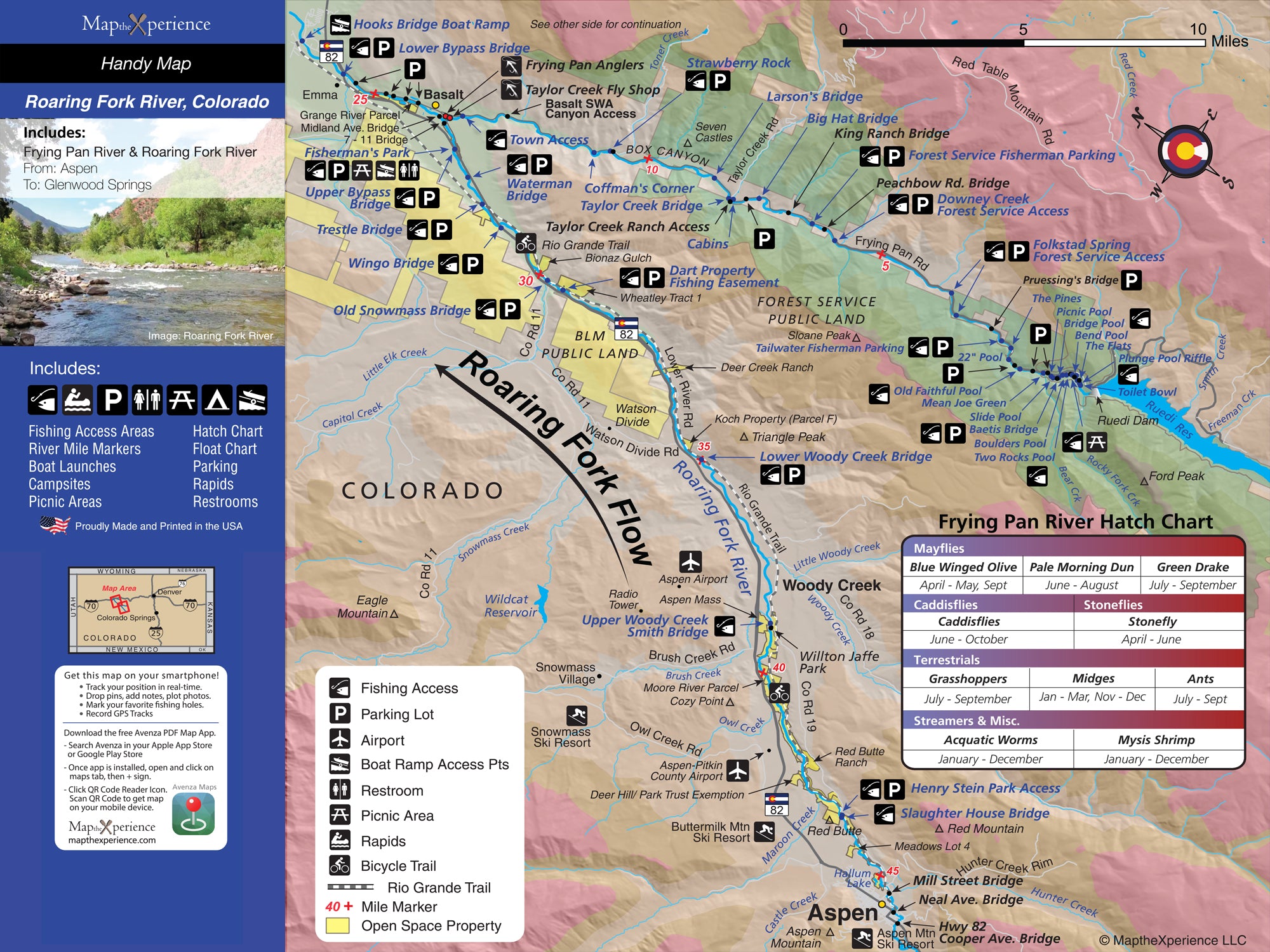
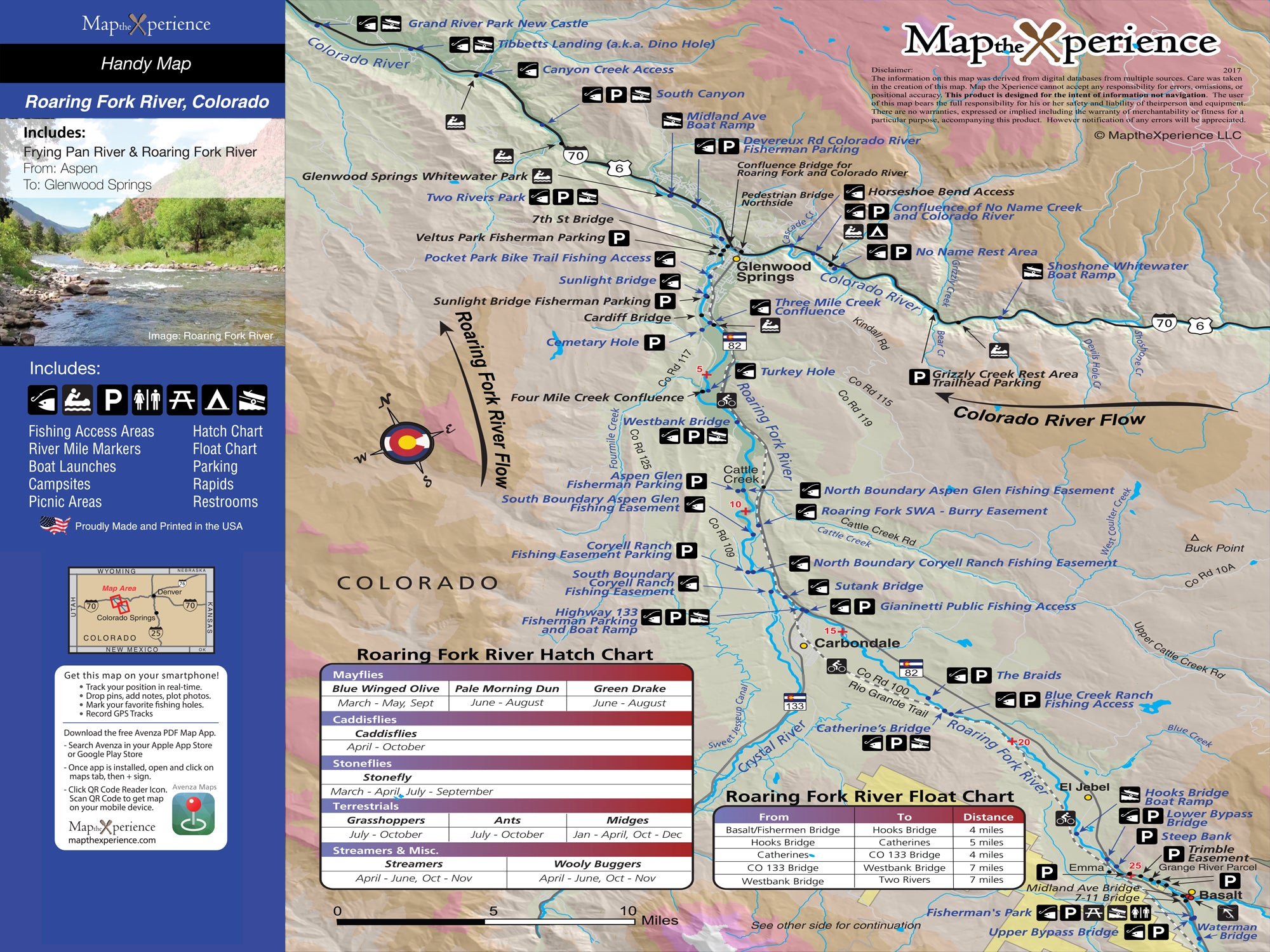
Roaring Fork River Colorado Fly Fishing Map | Public Access Guide
Roaring Fork River, Colorado Pocket-Sized Guide with a Powerful Mobile Map!
Fish Colorado’s fast and wild Roaring Fork River with our detailed fly fishing map, designed for serious anglers. Covering prime stretches from Aspen through Basalt and Carbondale down to Glenwood Springs, this detailed map highlights public fishing access points, river miles, boat ramps, trails, and prime trout waters. Whether you're drifting big runs or wading technical pocket water, this rugged guide helps you fish smarter, explore farther, and chase trophy browns and rainbows in one of Colorado’s premier freestone rivers. Lightweight, tear-resistant, and adventure-tested — your essential map for the Roaring Fork. Includes the Frying Pan River from Ruedi Reservoir to Basalt.
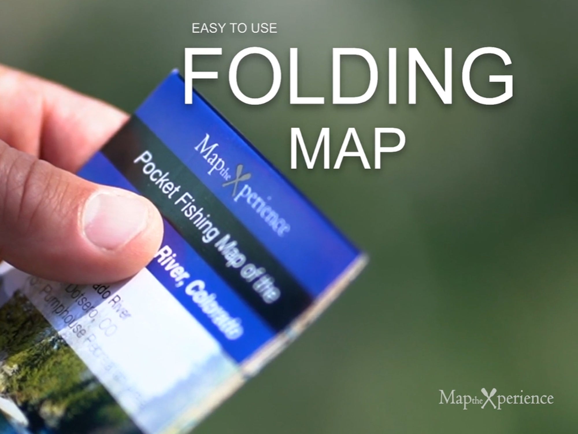
Pocket-Sized & Adventure-Ready! – Compact & portable (15” x 12” unfolded, 3” x 6” folded), this lightweight, map fits right in your pocket or tackle box!
Includes a Mobile Map! (Avenza Map App)
- Works offline – no cell service needed!
- Zoom in for even more detail than the printed map
- GPS-enabled so you can see your exact location in real time
- Identical to the printed version for seamless navigation