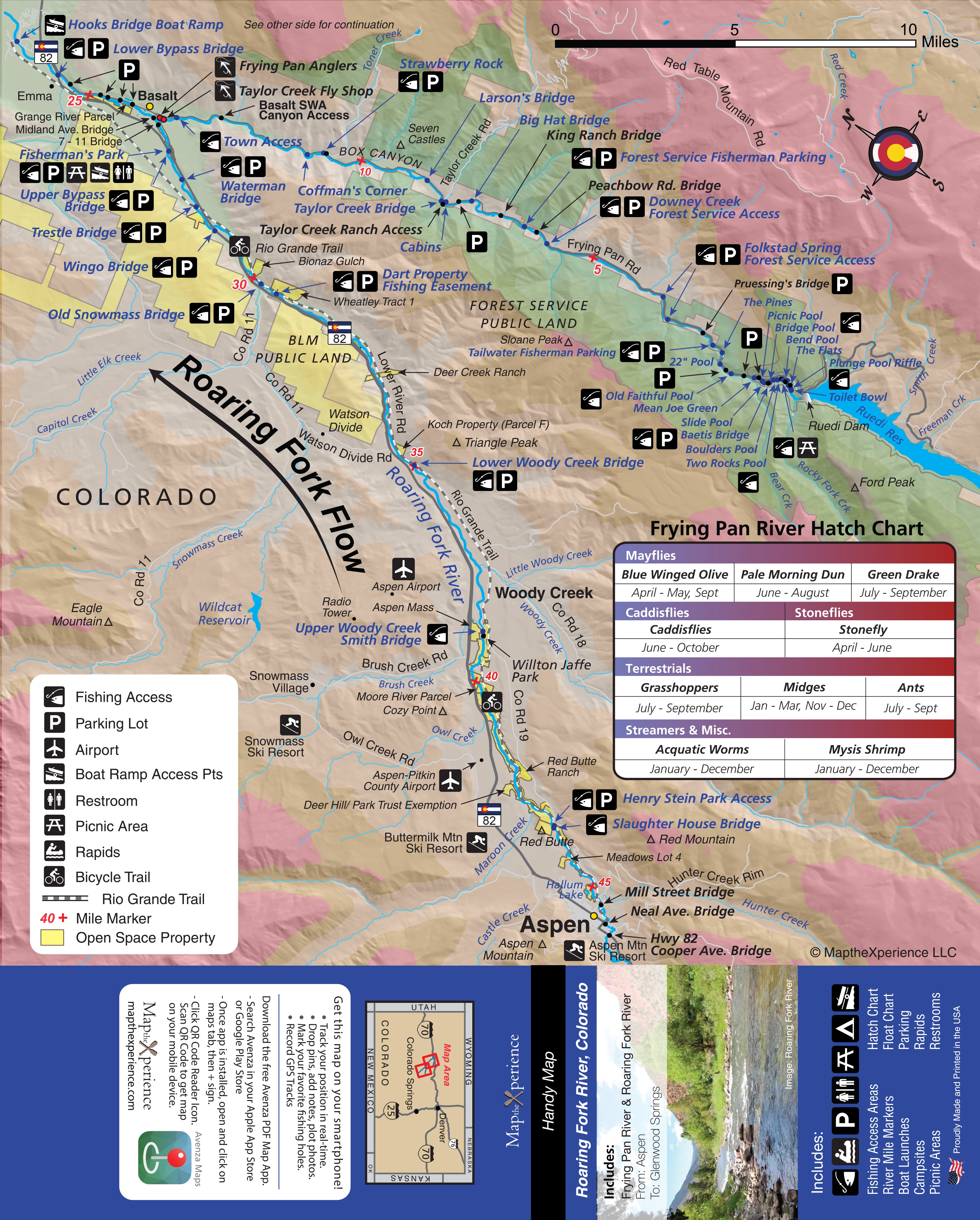
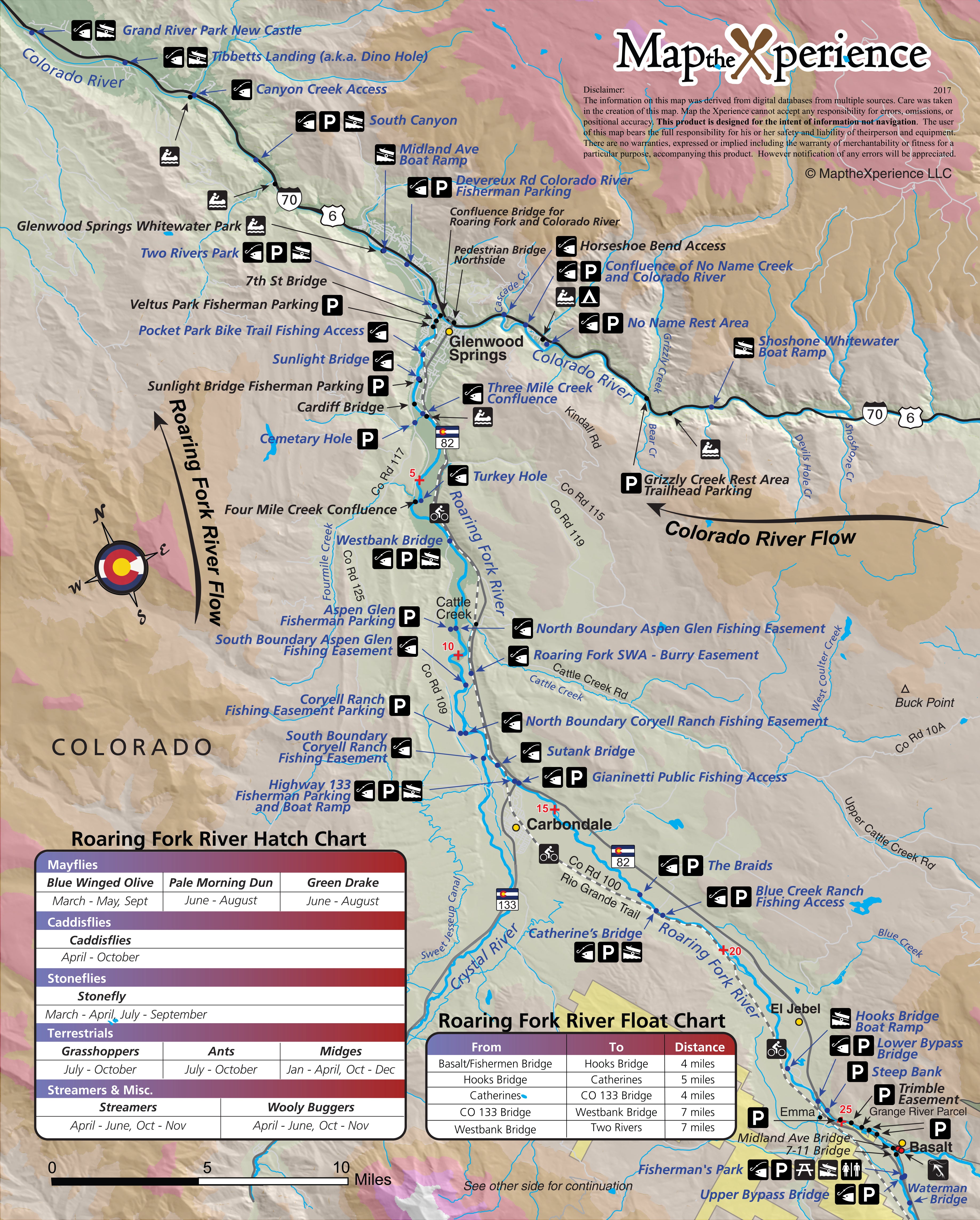
Roaring Fork River Colorado Fly Fishing Map | Public Access Guide
Quantity:
Roaring Fork River, Colorado Pocket-Sized Guide with a Powerful Mobile Map!
Fish Colorado’s famous Roaring Fork River with confidence using our detailed fly fishing map. Covering the best stretches from Aspen and down to Glenwood Springs, this rugged map highlights public fishing access points, river miles, trailheads, and prime trout runs. Designed for serious anglers targeting trophy rainbows and browns, it helps you plan smarter trips, find hidden gems, and fish some of the state's finest Gold Medal waters. Lightweight, durable, and built for adventure — your essential guide to the Blue. Includes the Frying Pan River.
Pocket-Sized & Adventure-Ready! – Compact & portable (15” x 12” unfolded, 3” x 6” folded), this lightweight, map fits right in your pocket or tackle box!
Includes a Mobile Map! (Avenza Map App)
- Works offline – no cell service needed!
- Zoom in for even more detail than the printed map
- GPS-enabled so you can see your exact location in real time
- Identical to the printed version for seamless navigation