
Snake River & South Fork Snake River Fly Fishing and Floaters Map | Public GPS Access Guide
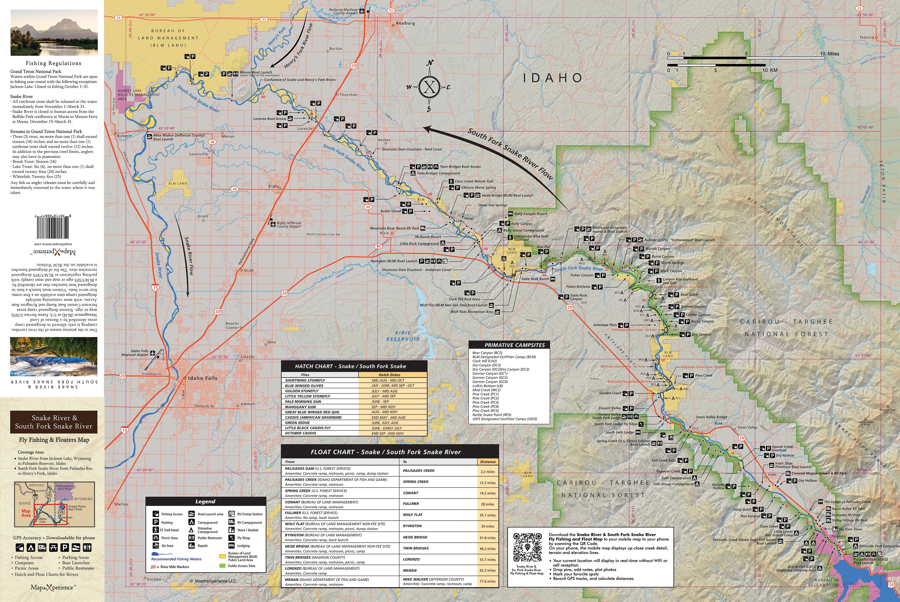
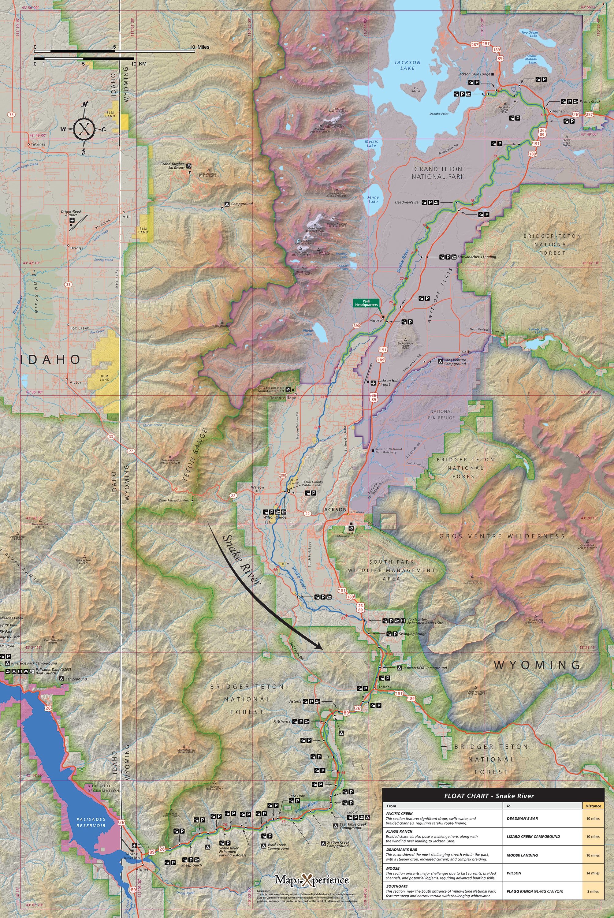
Snake River & South Fork Snake River Fishing & Floaters Map
(Idaho – Snake River & South Fork Snake River, Double-Sided and GPS-Accurate)
Pocket-sized in your boat bag. Powerfully detailed on the water. Built for serious anglers, seasoned floaters—and smart retailers.
Ready to fish smarter, float farther, and navigate with total confidence? Our Snake River & South Fork Snake River Fly Fishing and Floaters Map is your go-to guide for exploring two of the West’s most iconic trout rivers. Designed by anglers for anglers, this double-sided, GPS-accurate map delivers the detail you need to cast with purpose and float like a pro.
Whether you're drifting through deep canyon runs, stalking sipping trout on smooth glides, or planning a multi-day float with riverside camps, this map is built to get you there—efficiently, safely, and with expert precision.
Why River Rats and Fly Fishers Love This Map:
-
Full coverage of the Snake and South Fork Snake Rivers, from riffles to rapids
-
Every fishing access point, boat ramp, and take-out clearly marked
-
Public lands—federal, state, county, and city—mapped with precision
-
Detailed parking areas and river-side trail info you won’t find anywhere else
-
Primitive and developed campsites, picnic areas, and restrooms noted for float planning
-
Bald eagle nesting closures and habitat zones to protect sensitive wildlife
-
Insect hatch chart and up-to-date fishing regulations for ethical, informed angling
-
Floater mileage chart with segment distances for smart route planning
Double-Sided. Durable. Built for the River.
Printed on a rugged, waterproof, and tear-resistant sheet measuring 36” x 24”, this map folds down for on-the-water use, planning at camp, or stashing in your vest or dry bag.
Track Your Float with QR Code Access
Zoom in for exact river detail, track your location in real time, and mirror your print map seamlessly via a QR code with no signal required.
Retailers: Want to Offer Something That Sells Itself?
This map is a must-have for fly shops, outfitters, lodges, and outdoor stores throughout Idaho and the greater Yellowstone region. Locally made, angler-tested, and loaded with real-world value, it’s the ultimate grab-and-go tool for anyone fishing or floating these storied waters.
Don’t just float the Snake—know it, fish it, and own every mile.
Fish smarter. Float farther. Master the Snake.
