South Fork Snake River Idaho Fly Fishing Map | Public Access Guide

South Fork Snake River Idaho Fly Fishing Map | Public Access Guide

Sale price$9.95
Quantity:

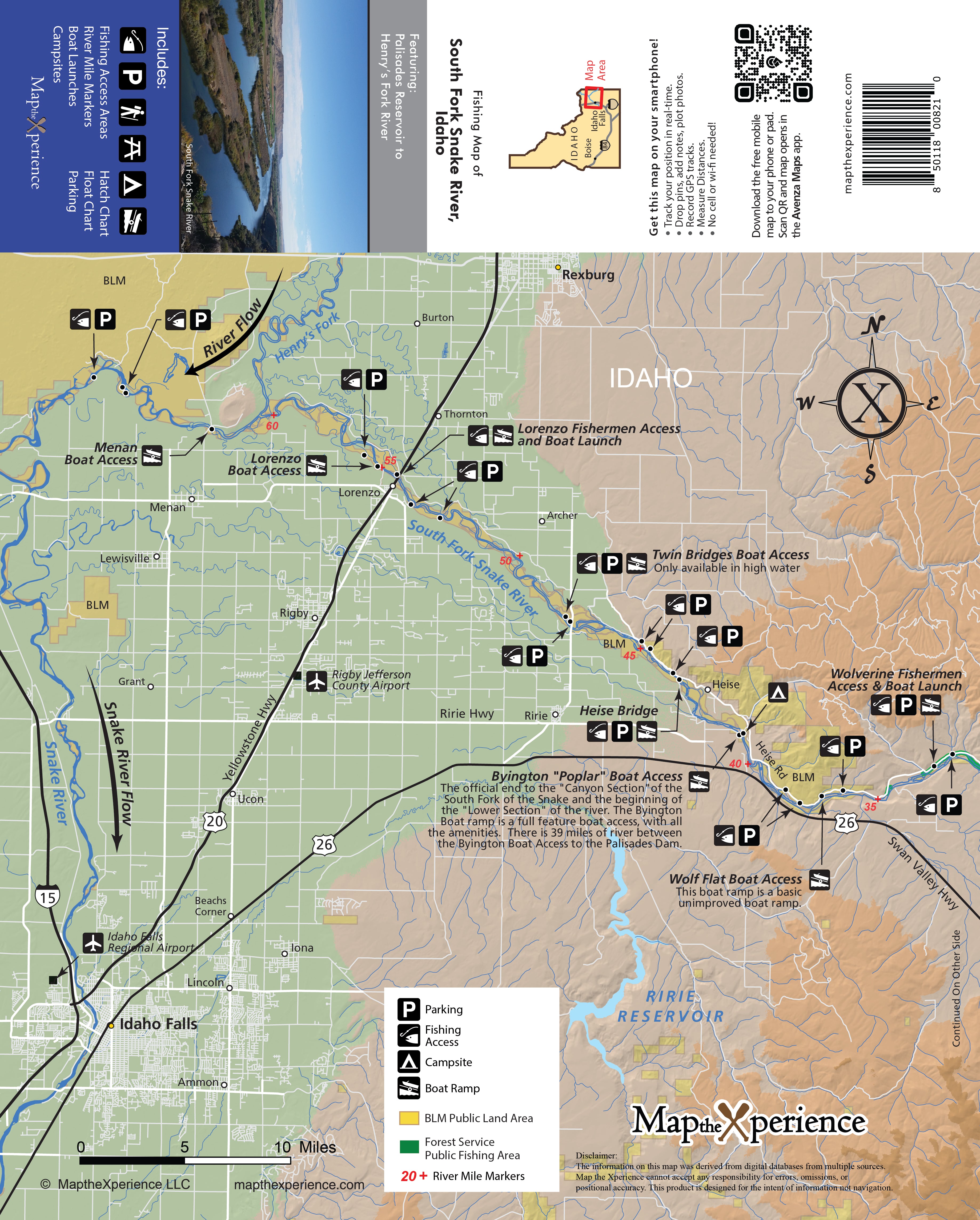
Snake River & South Fork Snake River Fly Fishing and Floaters Map

36" x 24" Double-Sided | GPS-Accurate | Public Access Guide

Navigate Like a Pro — From Rapids to Riffles

This all-new, highly detailed GPS-accurate map is the ultimate resource for anglers and floaters exploring Idaho’s legendary Snake River and South Fork Snake River. Whether you’re casting to sipping trout or charting a multi-day float, this guide delivers the precision and depth you need to fish smarter and travel with confidence.

Map Features Include:

  • All public lands, including federal, state, county, and city jurisdictions

  • Every fishing access point and area clearly marked

  • All boat ramps, take-outs, and detailed parking locations found on no other map

  • Campsites, including primitive campsites along the South Fork

  • Bald Eagle closure areas and regulations to help protect sensitive habitats

  • Floaters mileage chart with key distances and segment breakdowns

  • Picnic areas and public restrooms

  • Insect hatch charts and current fishing regulations

Built by anglers for anglers, this rugged, river-tested map is a must-have for anyone fishing or floating two of the West’s most iconic and trout-rich rivers.