Skip to product information


Tail of the Dragon, North Carolina GPS Map Neck Gaiter
$24.95
Shipping calculated at checkout.
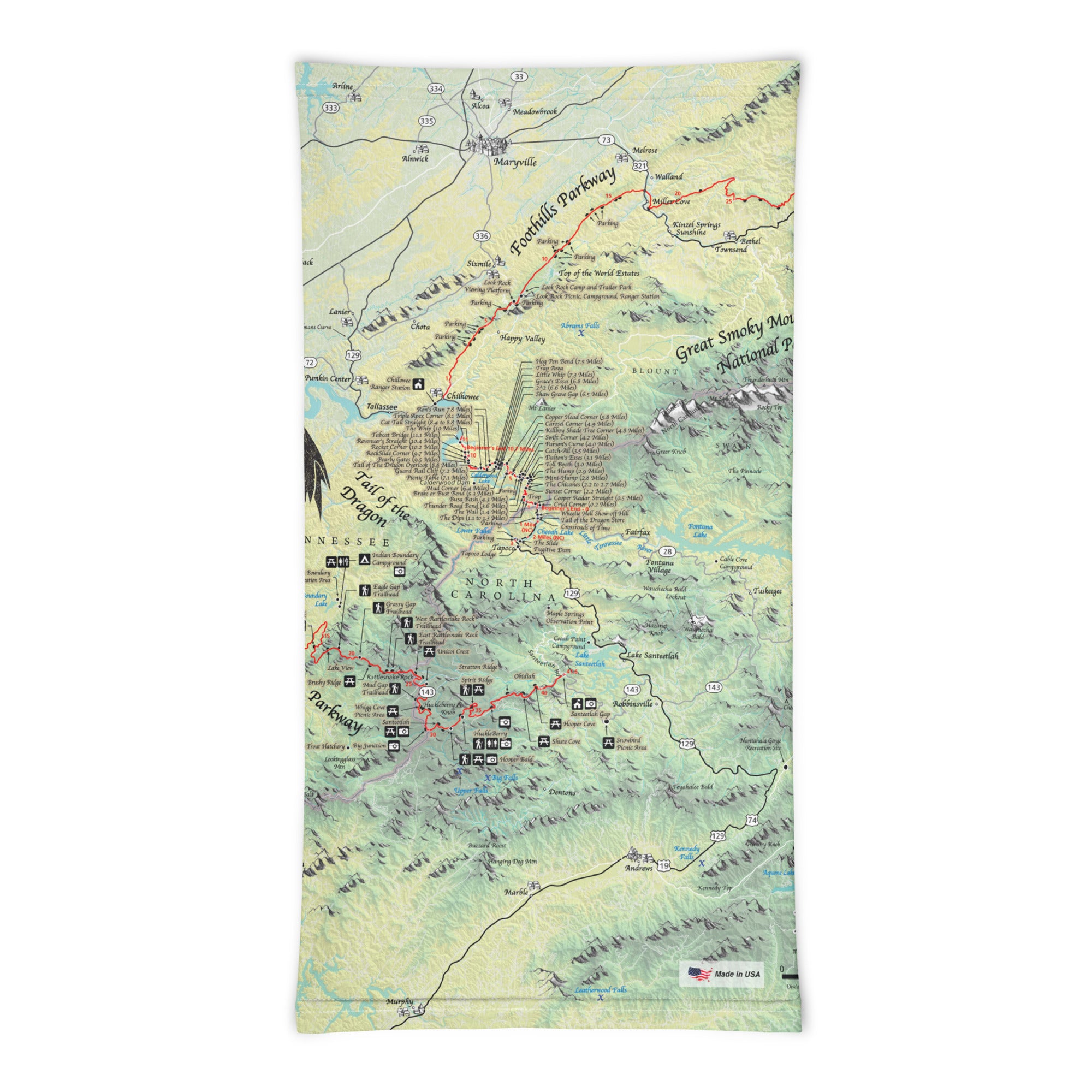
With 318 curves in just 11 miles, the legendary Tail of the Dragon is one of the most thrilling roads in America—an iconic destination for motorcyclists, sports car drivers, and scenic travelers alike. The Tail of the Dragon GPS Map Neck Gaiter features a detailed, GPS-accurate overview of the Tail, including curves, pull-offs, elevation changes, and surrounding routes like the Cherohala Skyway and Foothills Parkway. Whether you're riding or driving, this gaiter blends comfort, protection, and high-performance navigation.
Engineered for the Ride:
-
Wear it 12+ ways — as a neck gaiter, face covering, helmet liner, balaclava, headband, and more
-
One size fits all — soft, stretchy fabric for a secure, all-day fit under helmets or on the go
-
Made from a breathable polyester-spandex blend that’s moisture-wicking, quick-drying, and lightweight
-
Machine washable, 2-way stretch, perfect for changing mountain weather
-
UPF 50+ sun protection — essential for sunny rides and open-road exposure
Includes Free Mobile Map
Each gaiter includes a free downloadable GPS-enabled map of the Tail of the Dragon and surrounding scenic byways
-
Works offline with the Avenza Maps App — no signal or Wi-Fi needed
-
Track your real-time location along the Tail, as well as popular nearby routes like the Cherohala Skyway, Moonshiner 28, and the Hellbender
Whether you're leaning into every curve or stopping to admire the Smoky Mountain views, this gaiter keeps you cool, protected, and perfectly on track through one of America’s most iconic stretches of road.
Details
This product is crafted with quality materials to ensure durability and performance. Designed with your convenience in mind, it seamlessly fits into your everyday life.
Shipping & Returns
We strive to process and ship all orders in a timely manner, working diligently to ensure that your items are on their way to you as soon as possible.
We are committed to ensuring a positive shopping experience for all our customers. If for any reason you wish to return an item, we invite you to reach out to our team for assistance, and we will evaluate every return request with care and consideration.