
Western North Carolina Fly Fishing Map | Public Access Guide
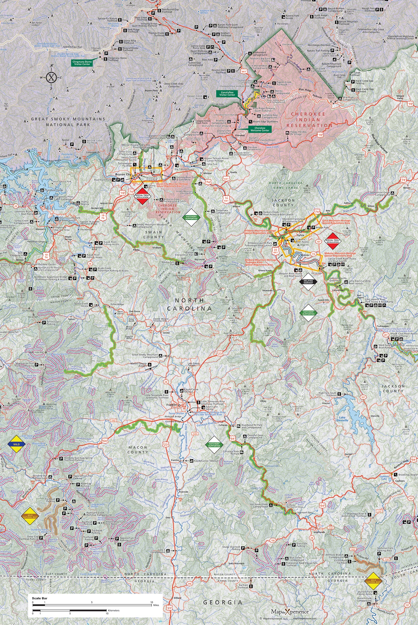
Western North Carolina’s Public Trout Waters Map
Explore the finest trout fishing from the Tennessee border to the headwaters of the Tuckasegee River with this comprehensive guide to Western North Carolina’s Public Mountain Trout Waters. Covering the counties of Haywood, Transylvania, Jackson, Swain, and parts of Macon and Buncombe, this meticulously crafted map ensures your fishing adventures are informed, seamless, and unforgettable.
Discover the legendary trout streams of Western North Carolina with our waterproof fly fishing map, designed for adventurous anglers. Covering top waters including the Davidson River, Nantahala River, Tuckasegee River, and the streams of Pisgah and Nantahala National Forests, this detailed map highlights public fishing access points, river miles, trailheads, and prime trout waters. Whether you're chasing wild brookies in remote headwaters or floating big rivers for rainbows and browns, this rugged guide helps you fish smarter, explore farther, and unlock the best fishing in the Blue Ridge Mountains. Lightweight, tear-resistant, and adventure-tested — your essential map for Western North Carolina.
Special Designations: Clearly marked waters include Special Regulations, Wild Trout/Natural Bait, Wild Trout, Hatchery Supported, Delayed Harvest, and Catch-and-Release zones. Know exactly what to expect before you cast.
Comprehensive Road Details: Includes all major highways, state highways, and secondary roads for easy navigation. (Supplementary map recommended for USFS roads.)