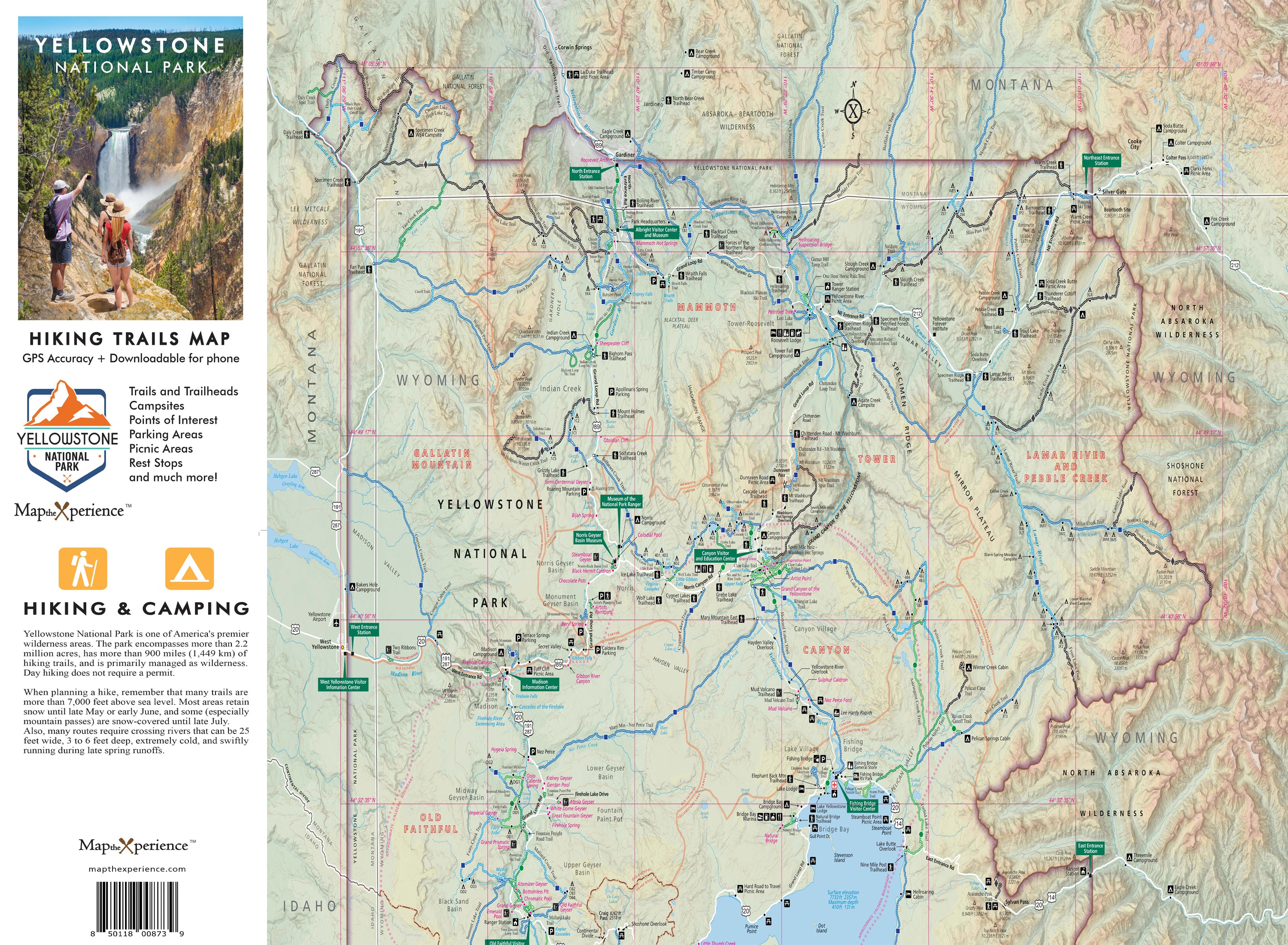
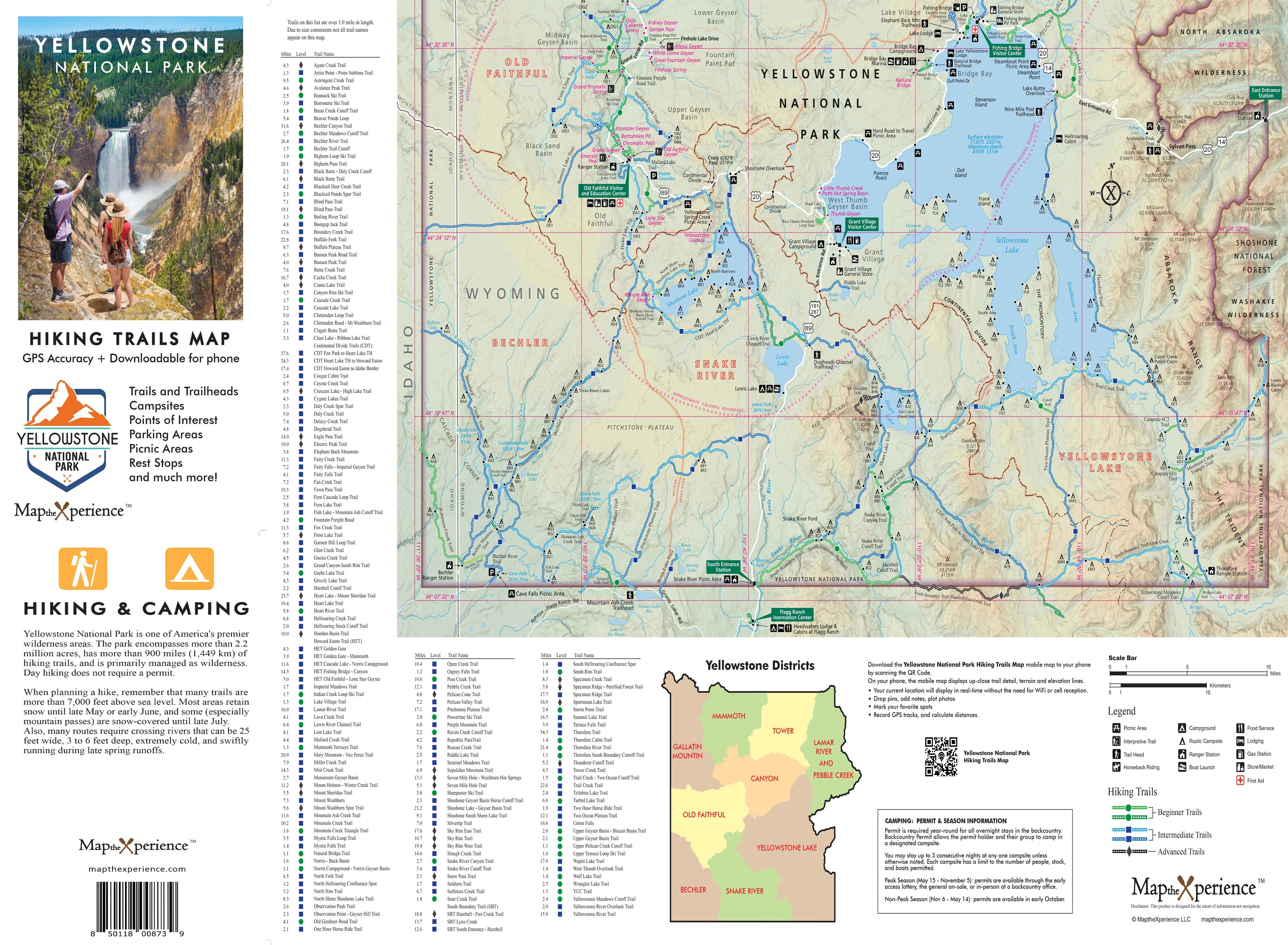

Yellowstone National Park Hiking Trails GPS Map | Paper & Mobile Adventure Guide
Yellowstone National Park Hiking Trail Map
Explore Yellowstone National Park’s stunning backcountry with our waterproof hiking trails GPS map, built for serious adventurers. Covering the park’s most iconic hikes — including Mount Washburn, Fairy Falls, Lamar Valley, and Yellowstone Lake — this detailed mobile guide highlights trailheads, mileage, elevation profiles, campsites, scenic viewpoints, and geothermal features. Whether you're trekking to remote wilderness camps or hiking past geysers and waterfalls, this rugged GPS map helps you navigate smarter, explore farther, and experience the untamed beauty of Yellowstone. Lightweight, adventure-tested, and instantly accessible — your essential hiking companion for America's first national park.
✅ Trail Designations for Every Skill Level – Easily identify hikes based on difficulty:
- 🟢 Green (Easy) – Perfect for casual hikers & families
- 🔵 Blue (Moderate) – A bit more challenging with some elevation gain
- ⚫ Black (Difficult) – For experienced hikers ready to take on Yellowstone’s toughest terrain!
4x8" Folded, 36x24" unfolded
Includes a Mobile Map!
- Works offline – no cell service needed!
- GPS-enabled so you can see your exact location on the trail
- Even more detail than the printed version.