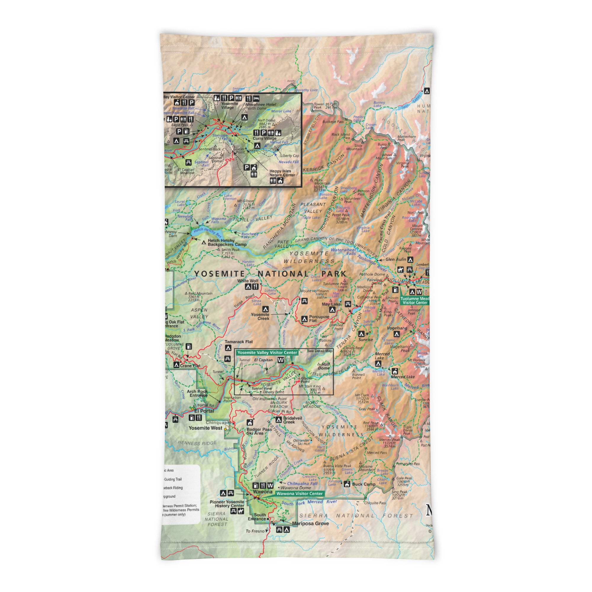
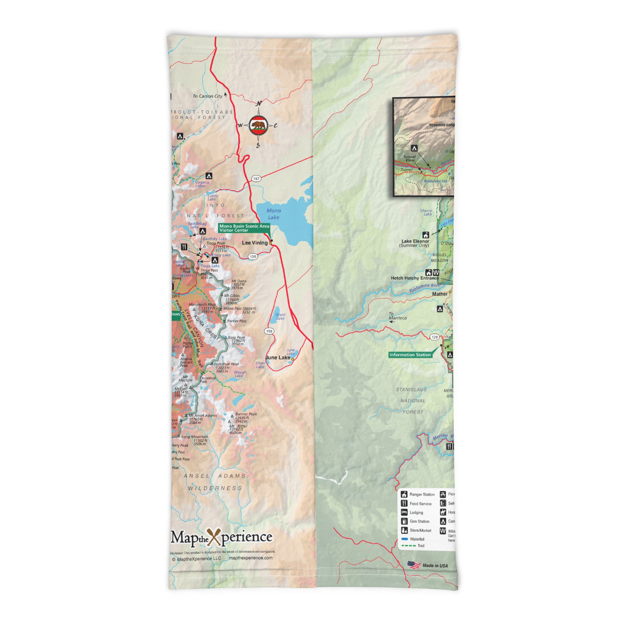
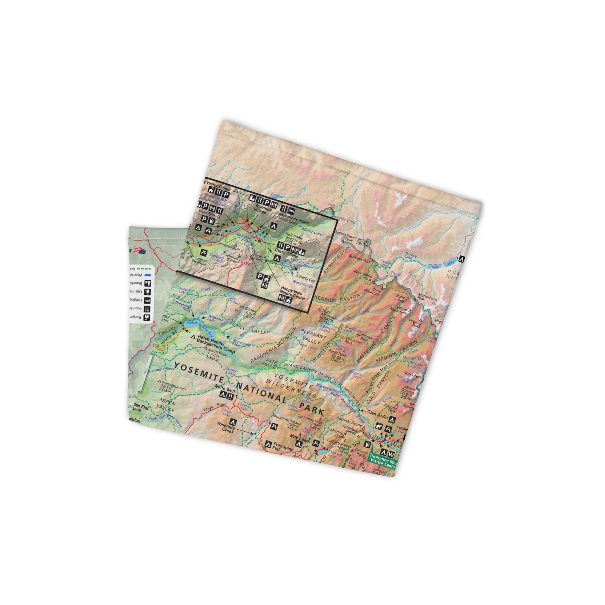
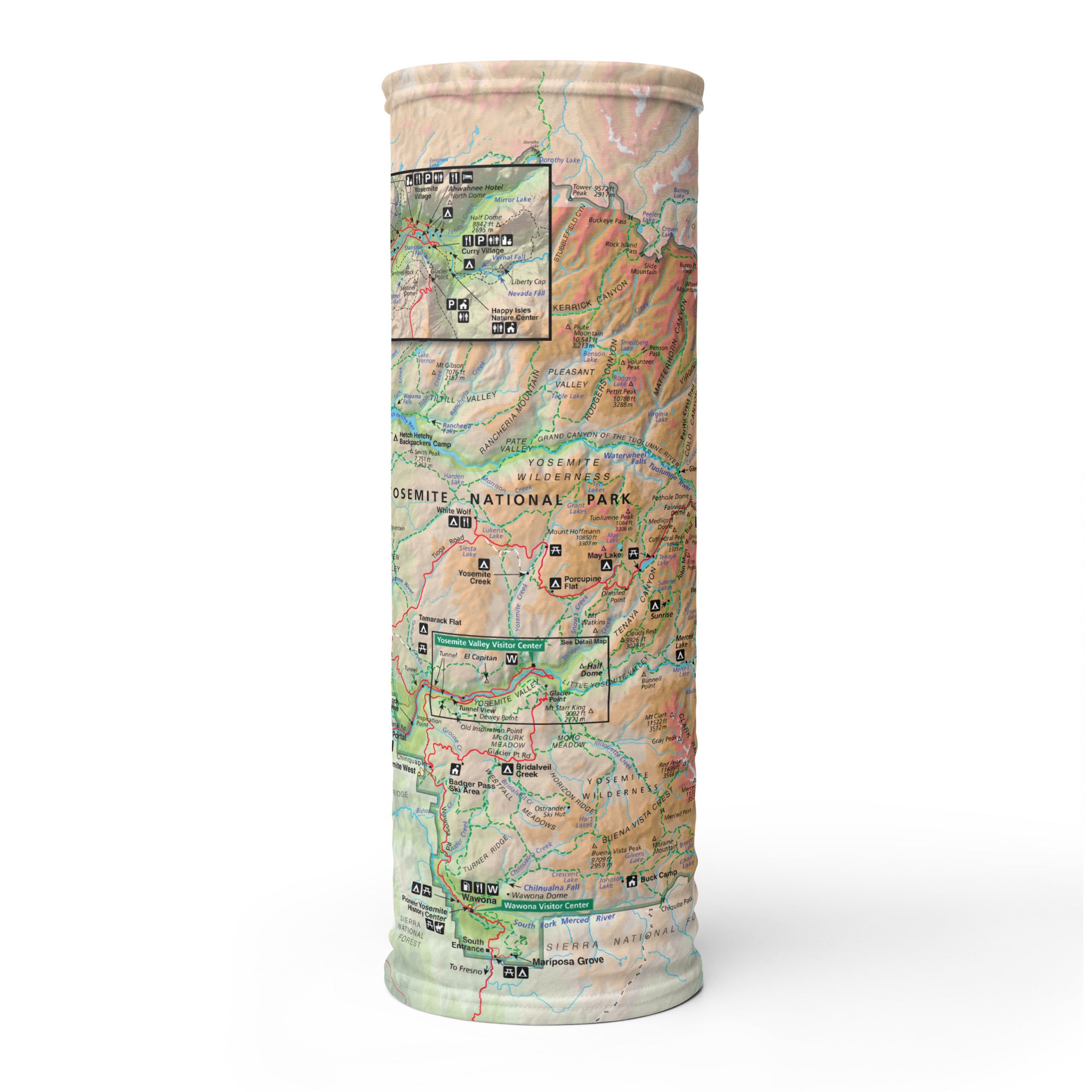
Yosemite National Park Map Neck Gaiter
Iconic granite walls, towering waterfalls, and breathtaking backcountry—all captured in our Yosemite National Park GPS Map Neck Gaiter. Featuring a detailed, GPS-accurate overview map of Yosemite, this versatile gaiter is designed for hikers, climbers, photographers, and outdoor lovers who want comfort, protection, and real navigation in one essential accessory.
Trail-Tested Versatility:
-
Wear it 12+ ways — as a face covering, neck gaiter, headband, helmet liner, bandana, and more
-
One size fits all — with soft, stretchy comfort that moves with you
-
Made from a premium polyester-spandex blend for smooth, 2-way stretch performance
-
Breathable, moisture-wicking, lightweight, and washable
-
UPF 50+ sun protection — critical for exposed summits and sunny valley hikes
Includes Free Mobile Map
Each gaiter includes a free downloadable GPS smartphone map of Yosemite National Park
-
Works offline with the Avenza Maps App — no cell service or Wi-Fi needed
-
Track your real-time location in Yosemite Valley, Tuolumne Meadows, Glacier Point, and more
Whether you’re hiking Half Dome, exploring Mariposa Grove, or camping in the high country, this gaiter keeps you cool, covered, and connected to the park you love.
X FIBER - A BREATHABLE FABRIC UNLIKE ANY OTHER
X GUARD MULTIFACETED FACE WEAR
