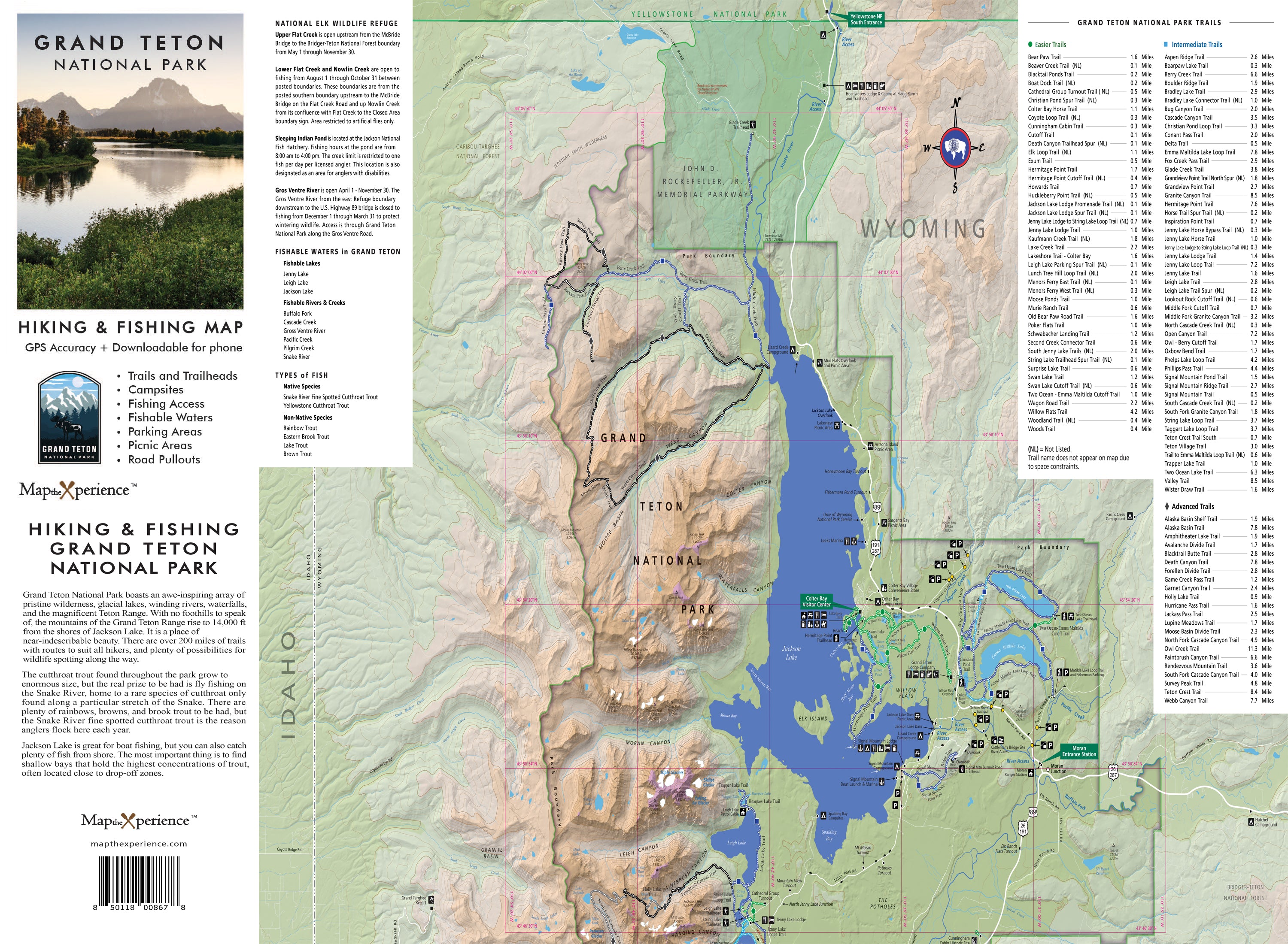
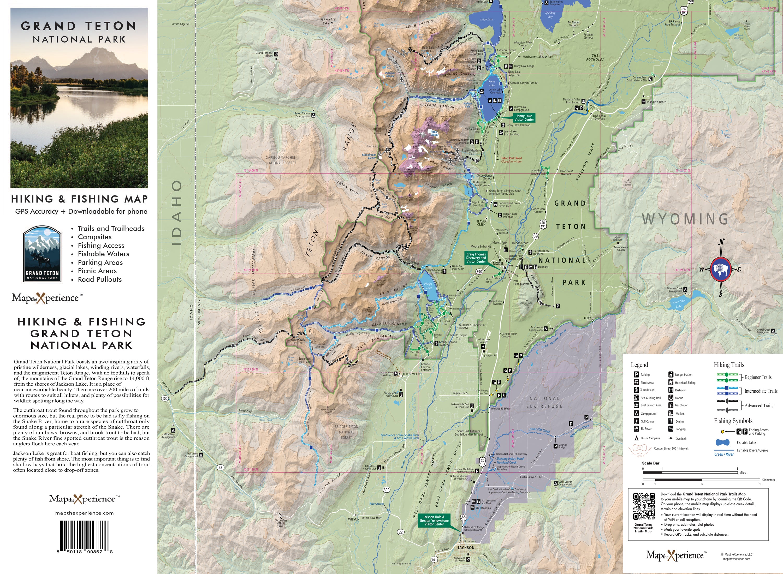

Grand Teton National Park Hiking Trail & Fishing Map | Mobile Map | GPS
Grand Teton National Park Hiking Trail Map
The most accurate, adventure-ready map for exploring Grand Teton’s rugged beauty.
Built with real GPS data, this highly detailed trail map offers unmatched accuracy and clarity, helping you navigate Grand Teton National Park with total confidence. Whether you're planning a family-friendly hike or tackling high alpine routes, this is your ultimate tool for discovering every mile of one of America’s most breathtaking parks.
Trail Difficulty Ratings Included
Quickly identify trails by difficulty level with clearly marked designations:
🟢 Green (Easy) – Great for casual hikers and families
🔵 Blue (Moderate) – For hikers looking to gain elevation and explore deeper
⚫ Black (Difficult) – For seasoned adventurers ready to take on the park’s toughest terrain
What This Map Covers
-
All official park trails and backcountry routes
-
Trailheads, mileage, elevation profiles, lakes, waterfalls, scenic overlooks, and must-see highlights
-
Fishing access points and remote fishable waters
-
Species listings and whether access is hike-in or drive-up
-
Campgrounds, picnic areas, and essential facilities
3D Shaded Relief for Terrain Clarity
Get a realistic sense of the landscape with high-resolution shaded topography, helping you visualize elevation changes and plan routes more effectively.
Sized for the Trail
-
Folds to 4” x 8”, opens to 36” x 24”
-
Lightweight and built for rugged use in the Tetons
Includes a GPS-Enabled Mobile Map (via Avenza Maps)
-
Works offline — perfect for deep canyons and remote trails
-
GPS-enabled so you always know your exact location
-
Zoom in for even more trail detail than the printed version
-
Seamless print-to-digital navigation
Locally Designed & Printed
Created by professional cartographers with a deep connection to Grand Teton National Park.
Plan better. Hike smarter. Explore deeper.
Order your Grand Teton Hiking Trail Map today and start your next unforgettable journey through the Tetons.