Trail Maps by Map the Xperience
Explore More. Get Lost Less.
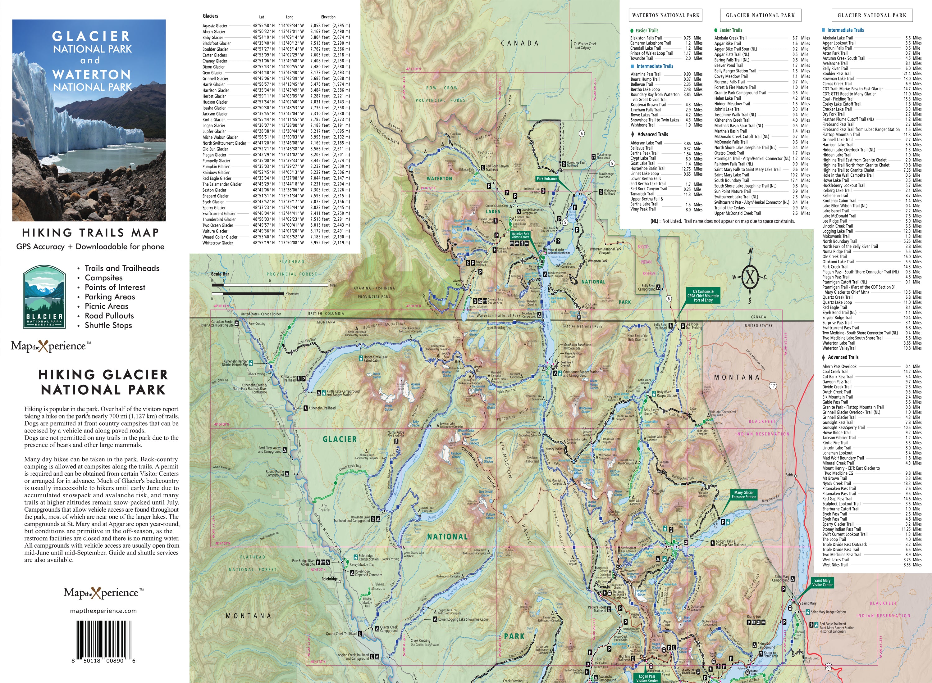
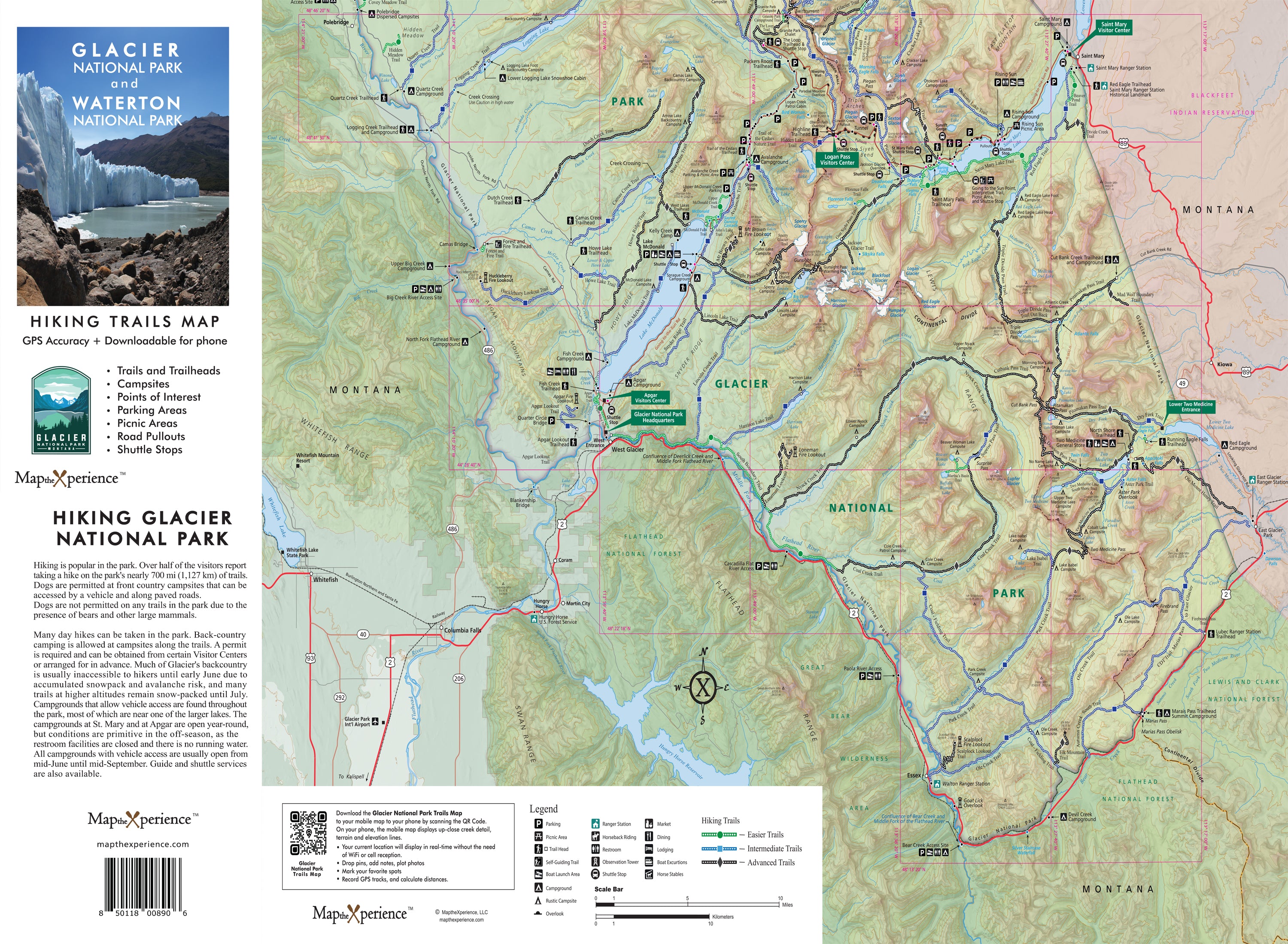
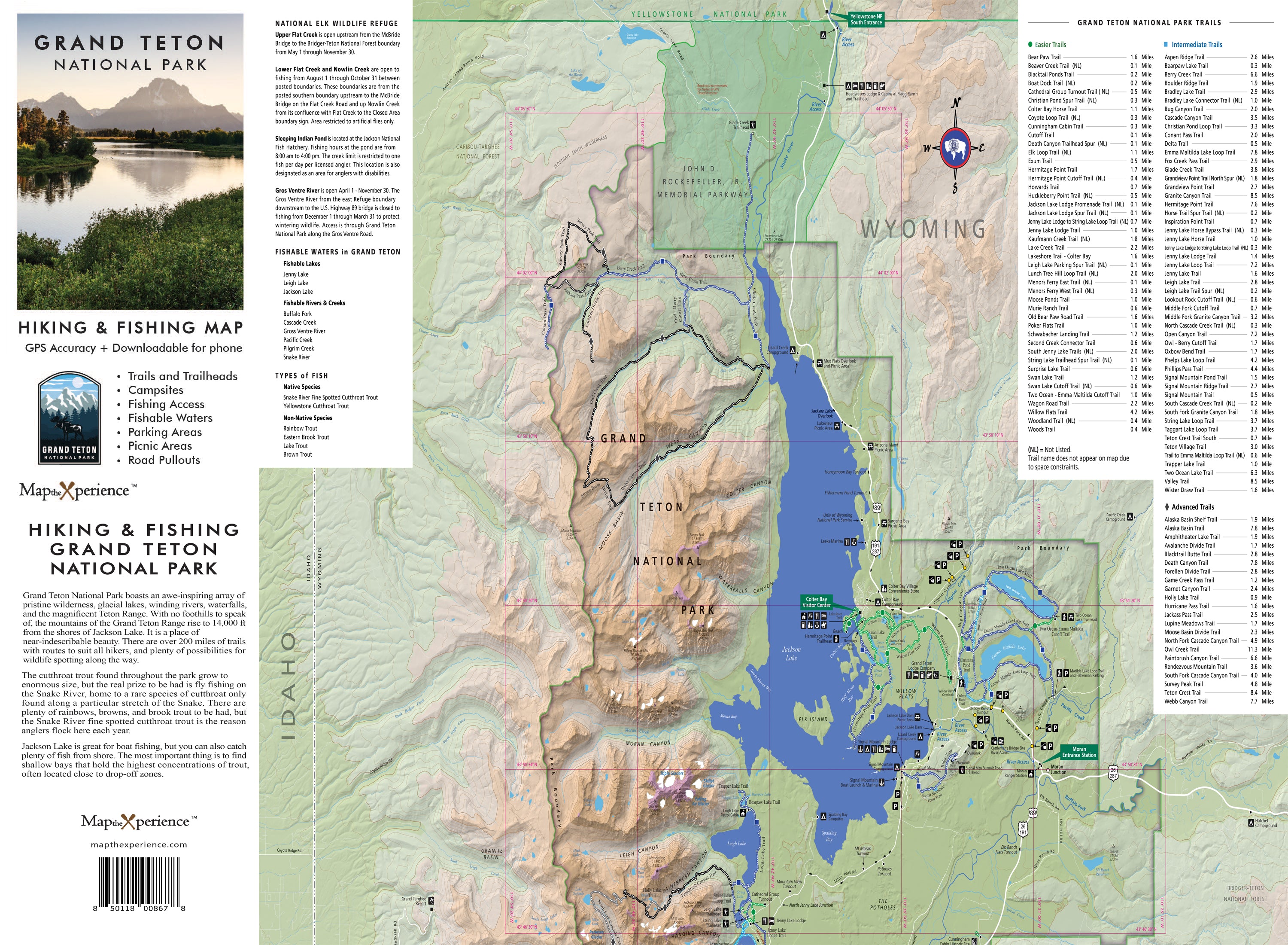
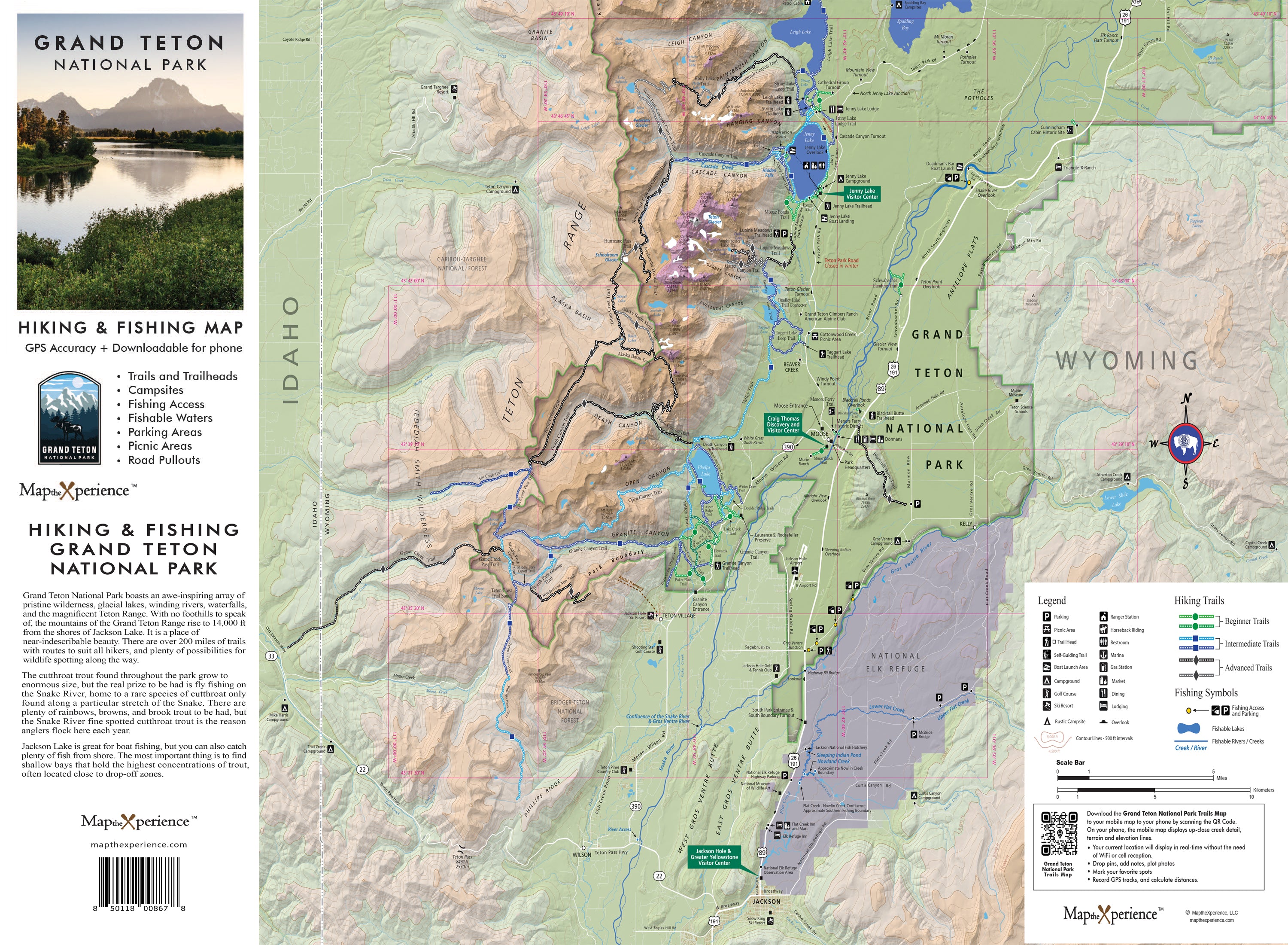
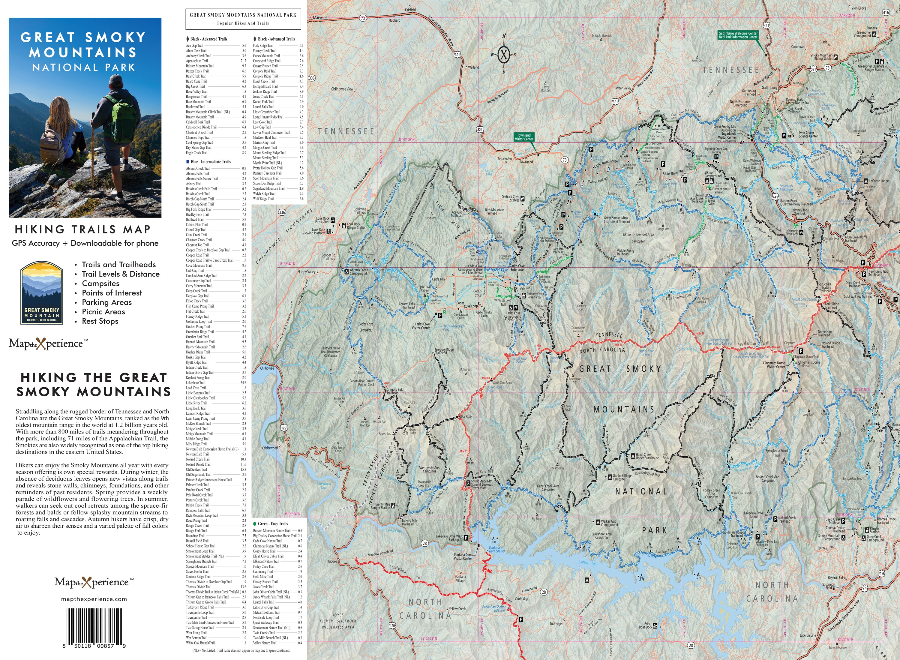
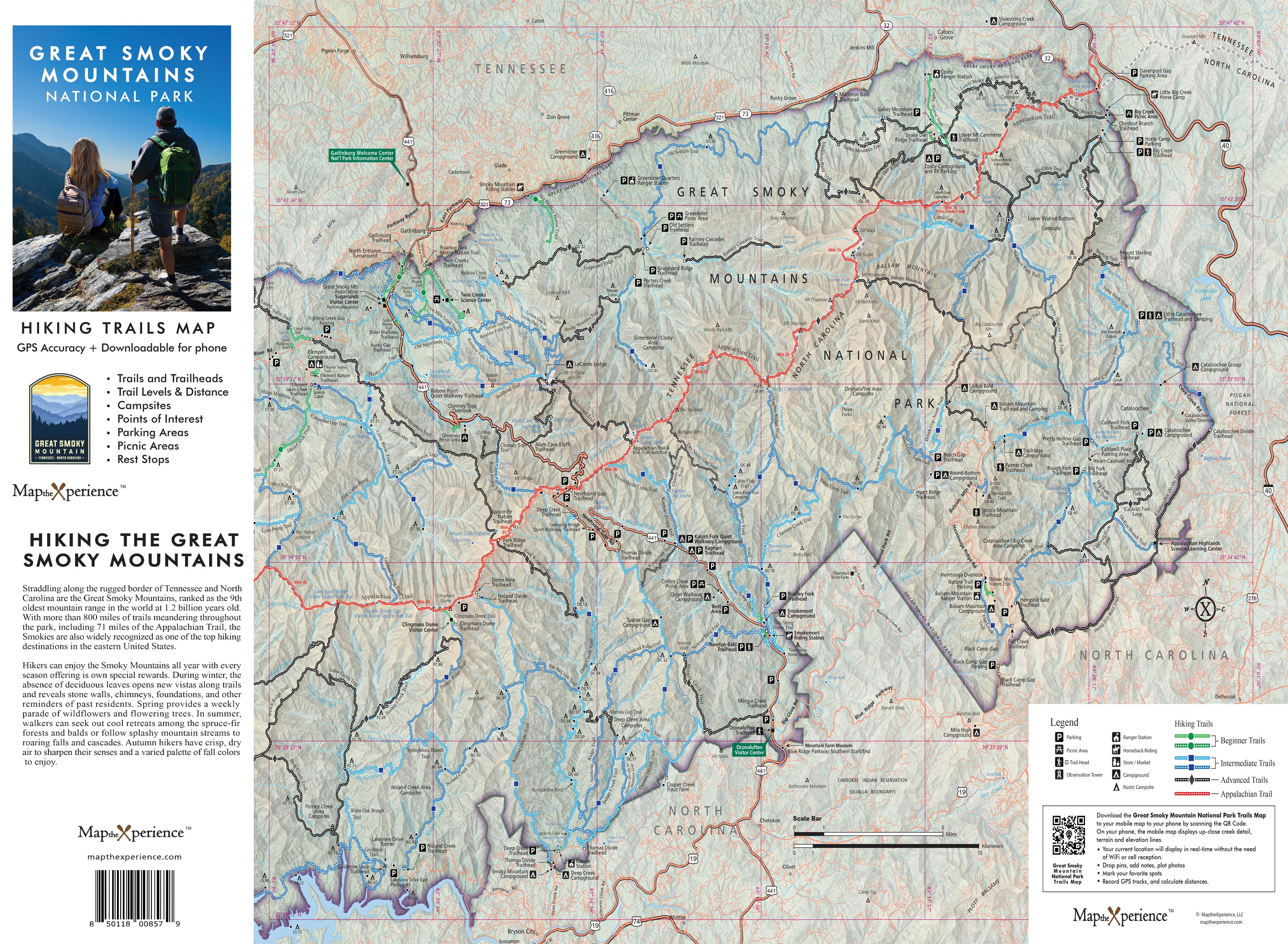
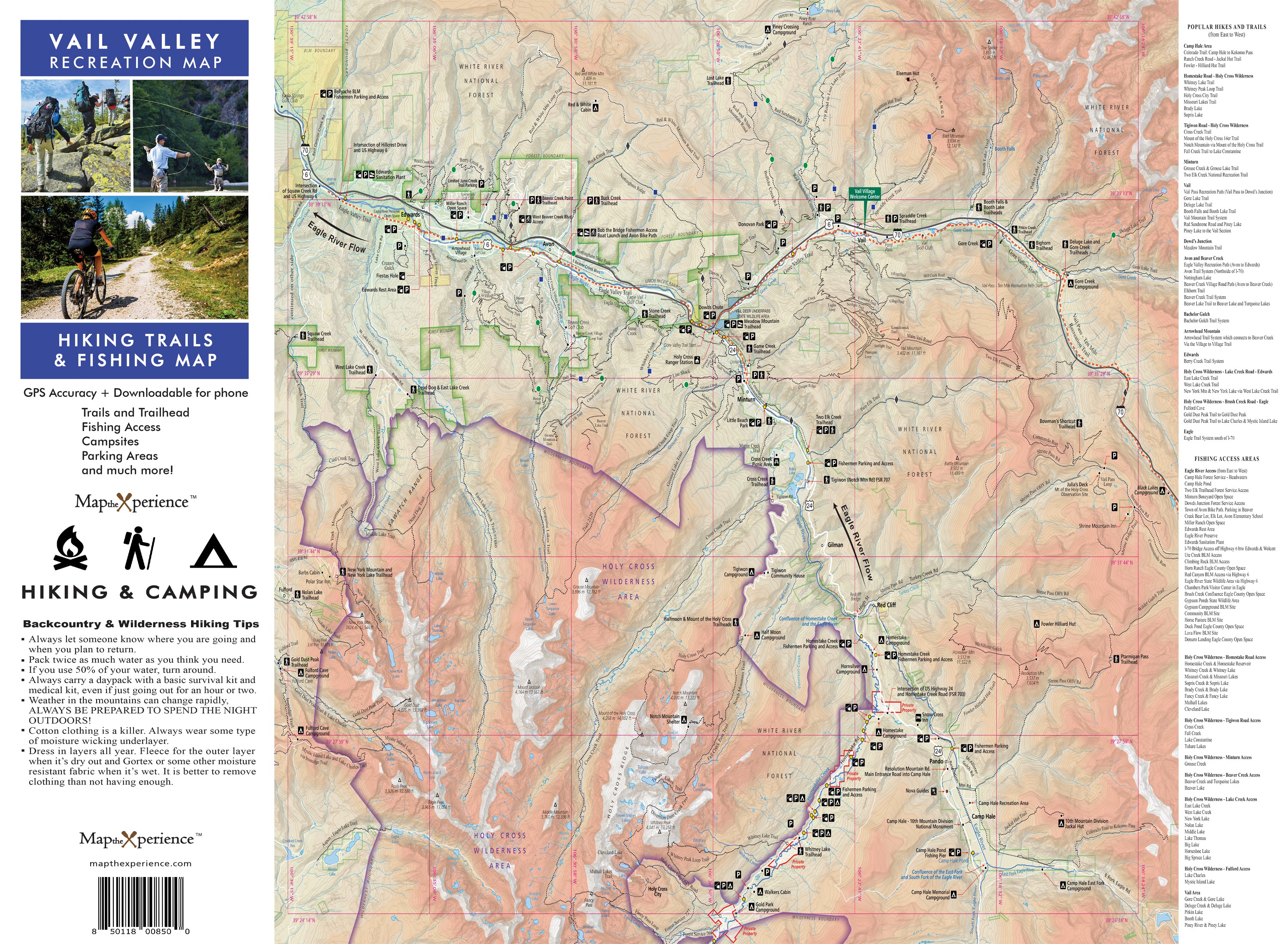
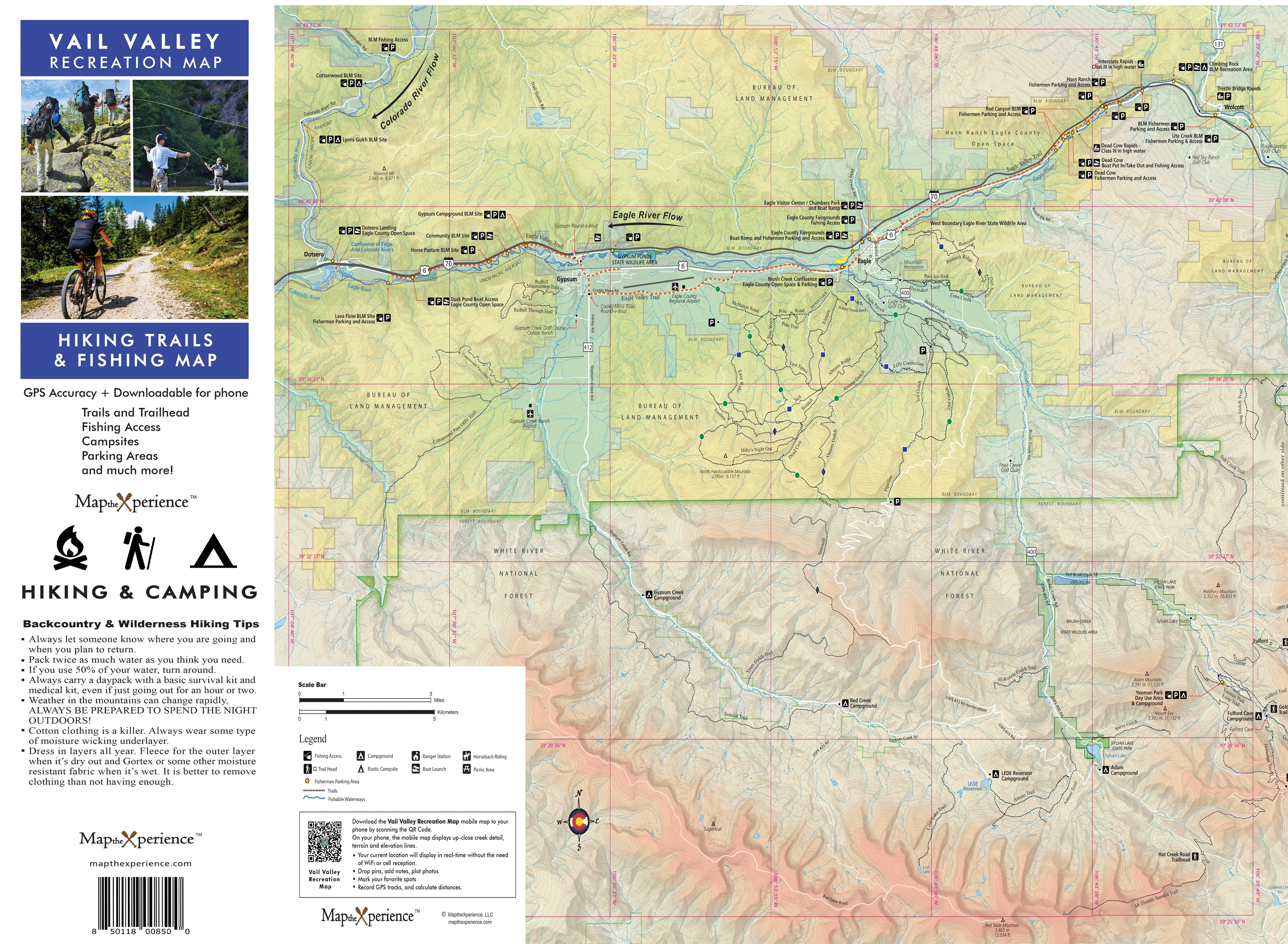
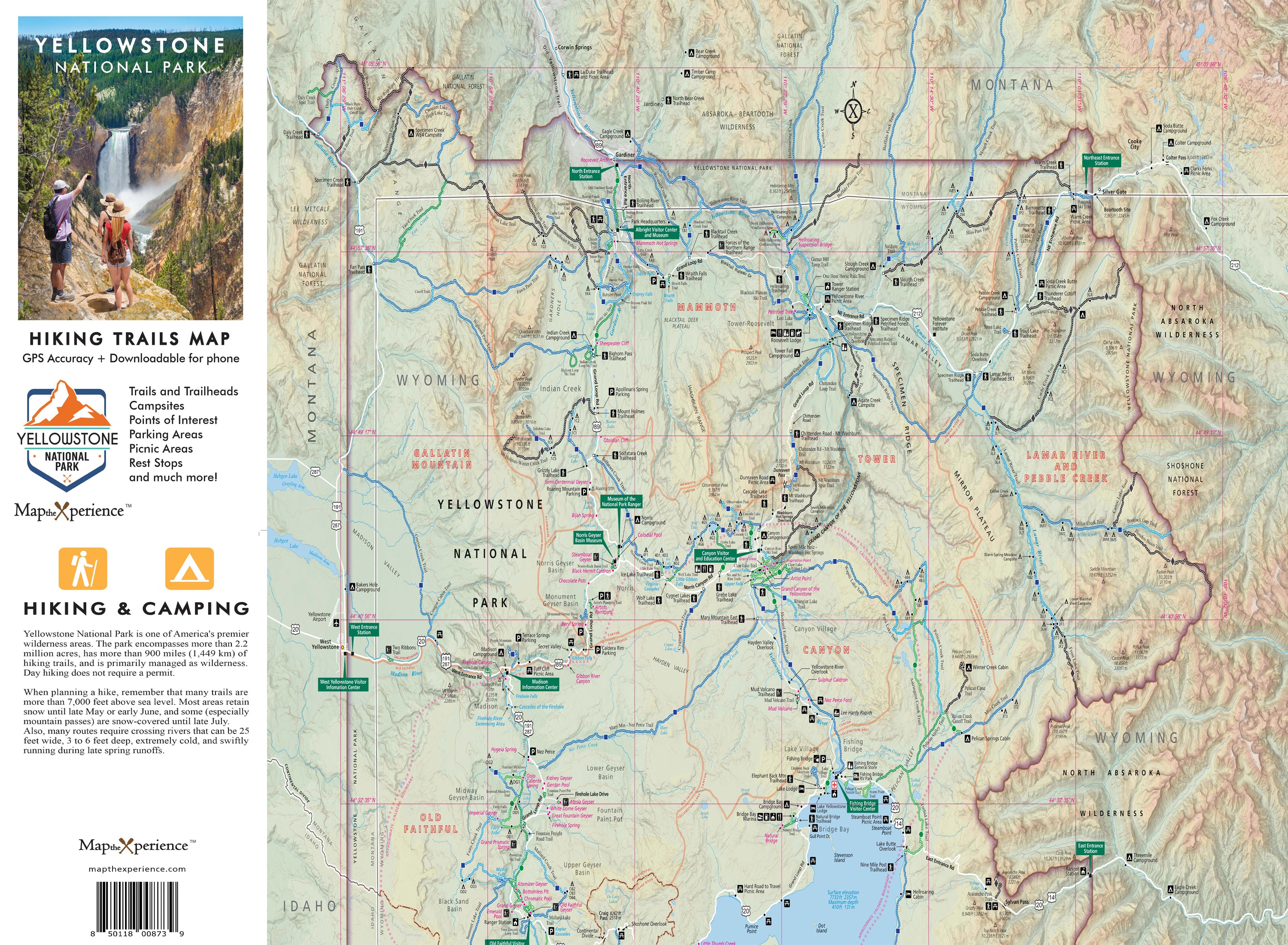
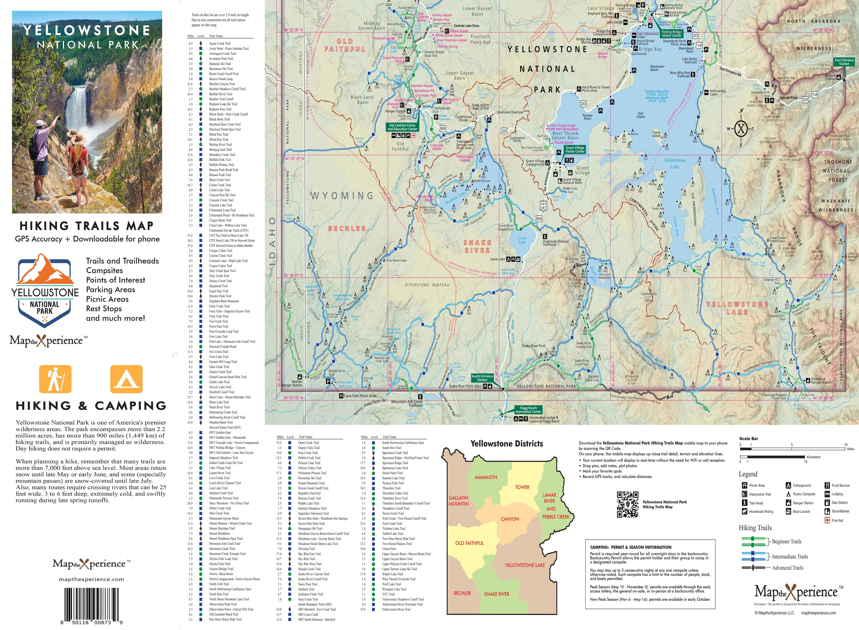
Since 2017, Map the Xperience has been crafting the finest GPS-accurate trail maps for National Parks and public lands across the U.S. Our team of expert cartographers and outdoor professionals builds every map with precision and passion, ensuring you're equipped for the journey ahead — whether you're hiking to a quiet alpine lake, climbing a mountain ridge, or planning a multi-day backcountry trek.
Each trail map is field-tested and adventure-approved, featuring:
Detailed Trail Networks – Including trailheads, distances, elevation changes, junctions, and points of interest
Difficulty Ratings
🟢 Easy (Green): Great for families and casual hikers
🔵 Moderate (Blue): Ideal for intermediate hikers with elevation gain
⚫ Difficult (Black): Serious trails for seasoned adventurers
Backcountry Features – Campsites, water sources, landmarks, and scenic viewpoints
Printed + Digital Combo – Every map includes a digital download for mobile use
Product Specs:
-
Size: 4x8" folded / 36x24" unfolded
-
Material: Durable, tear-resistant