River Maps by Map the Xperience
Precision Mapping for Fly Fishers, Rafters, and River Explorers
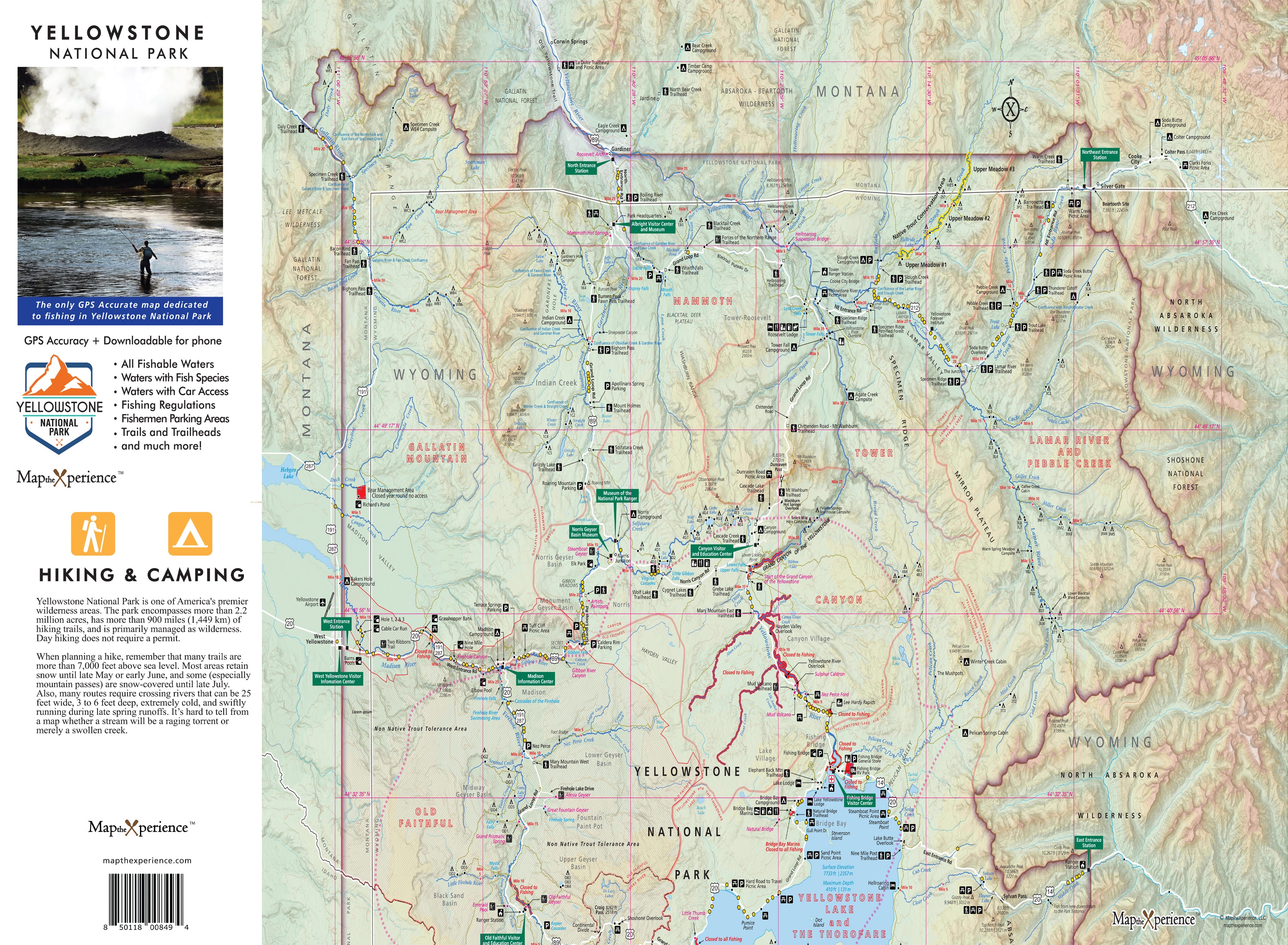
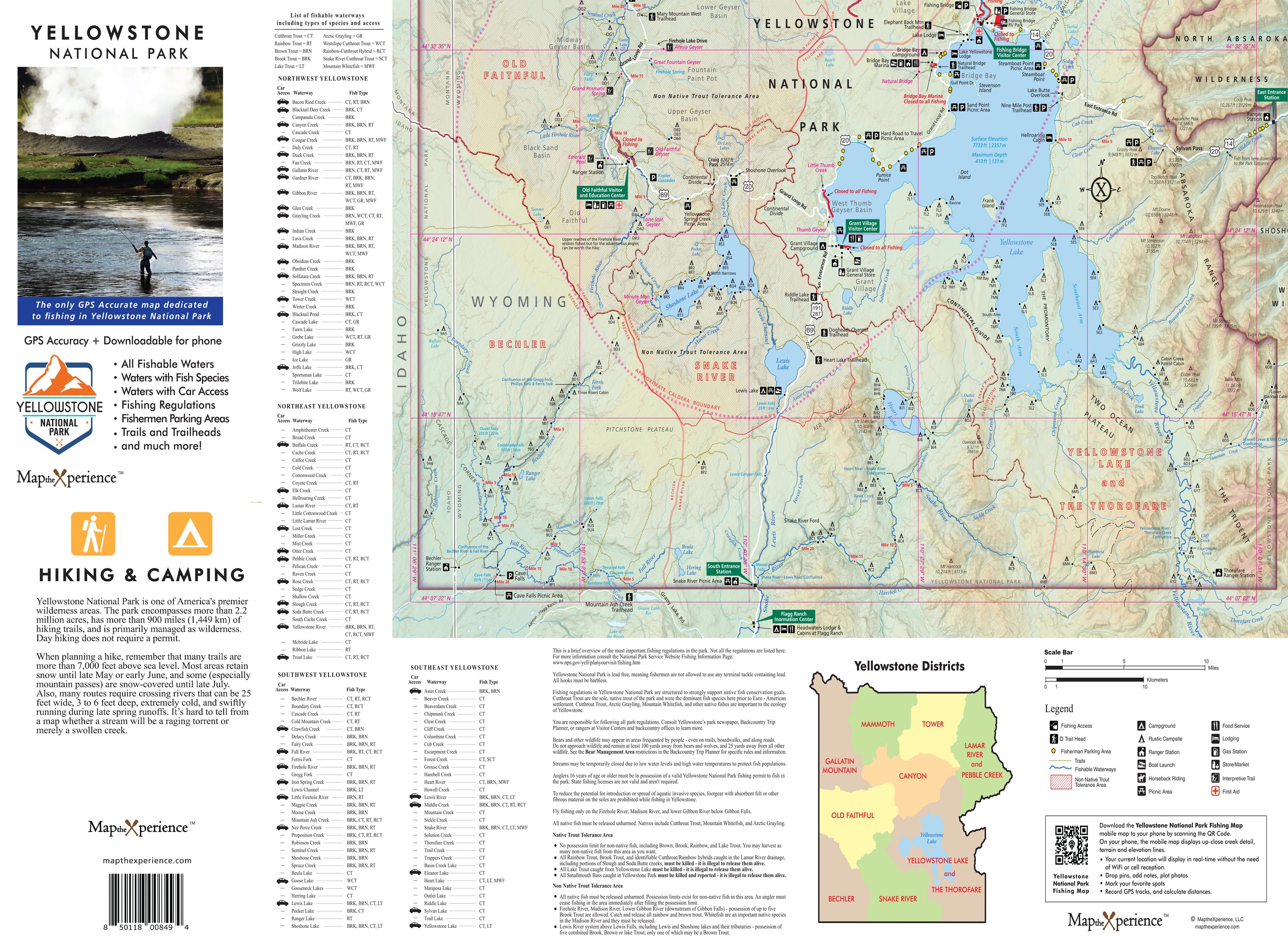
Since 2017, Map the Xperience has been creating the most accurate and detailed river maps in North America. Crafted by our expert cartographers and professional guides, these maps are built specifically for those who live to follow the current — whether you're casting flies, rowing rapids, or navigating remote float stretches.
Each river map is designed with GPS accuracy and real-world field data, making it an essential tool for safety, navigation, and strategic planning on the water.
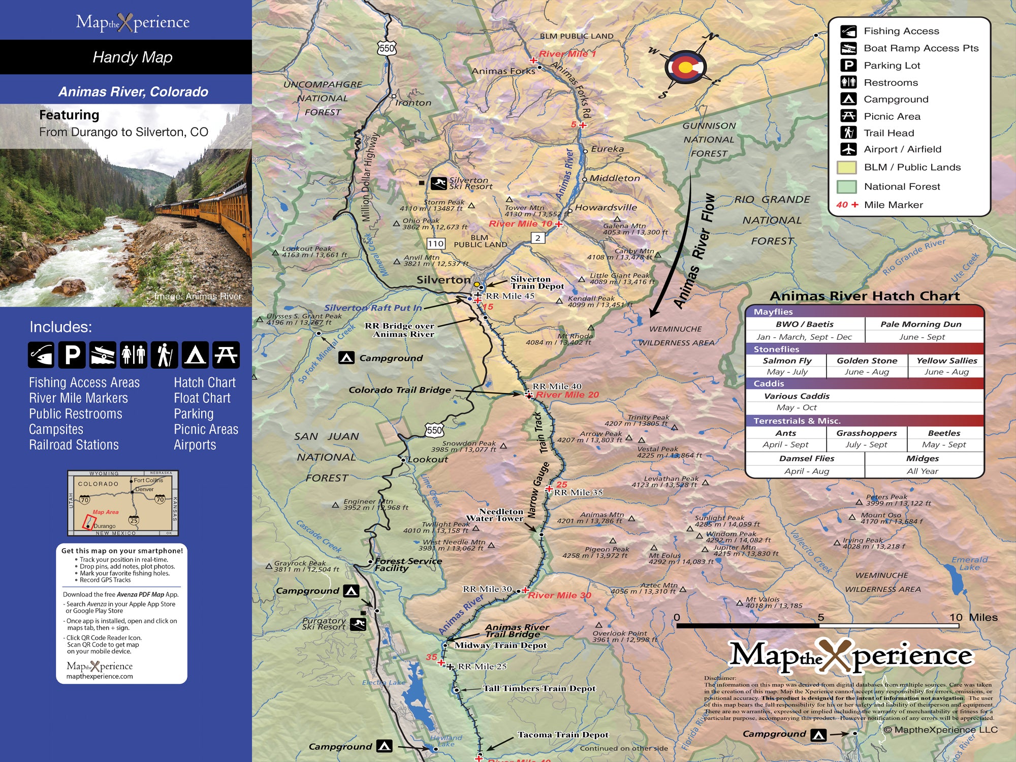
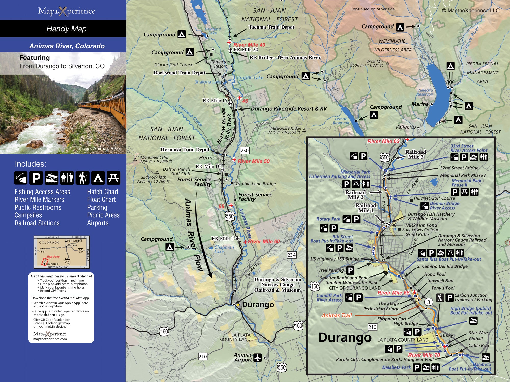
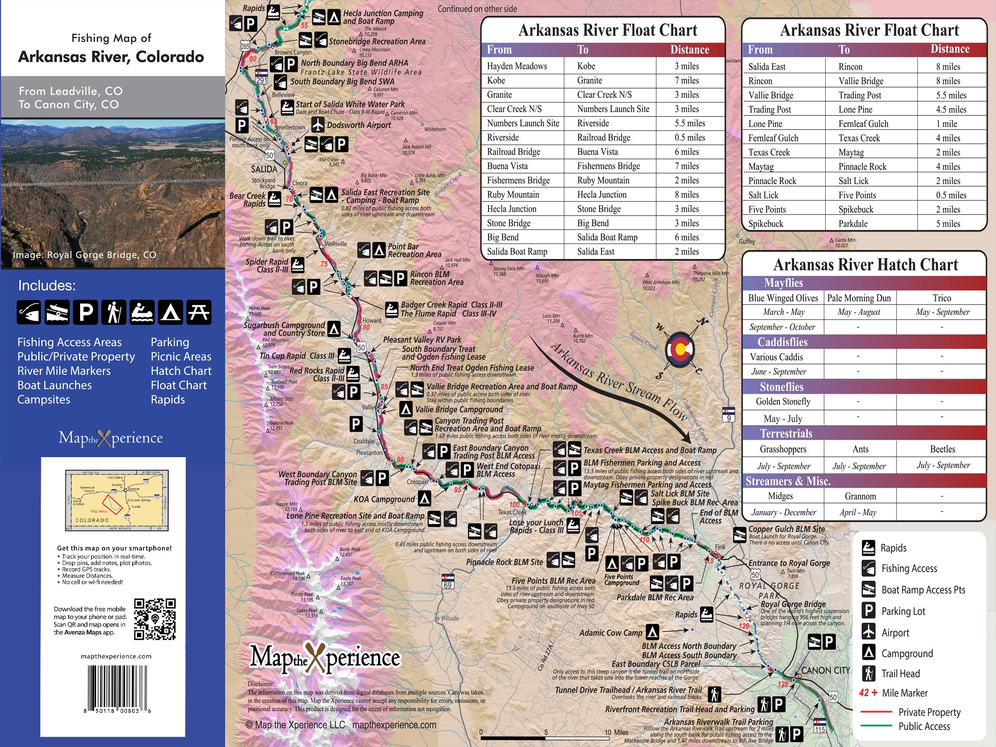
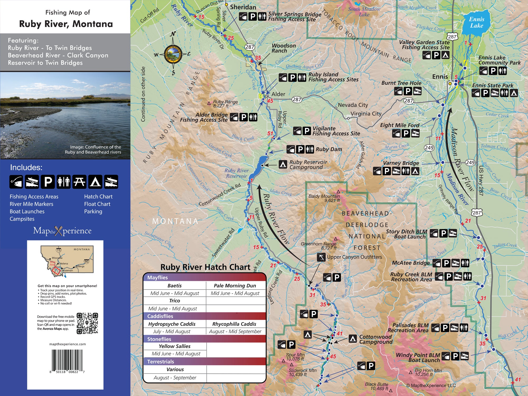
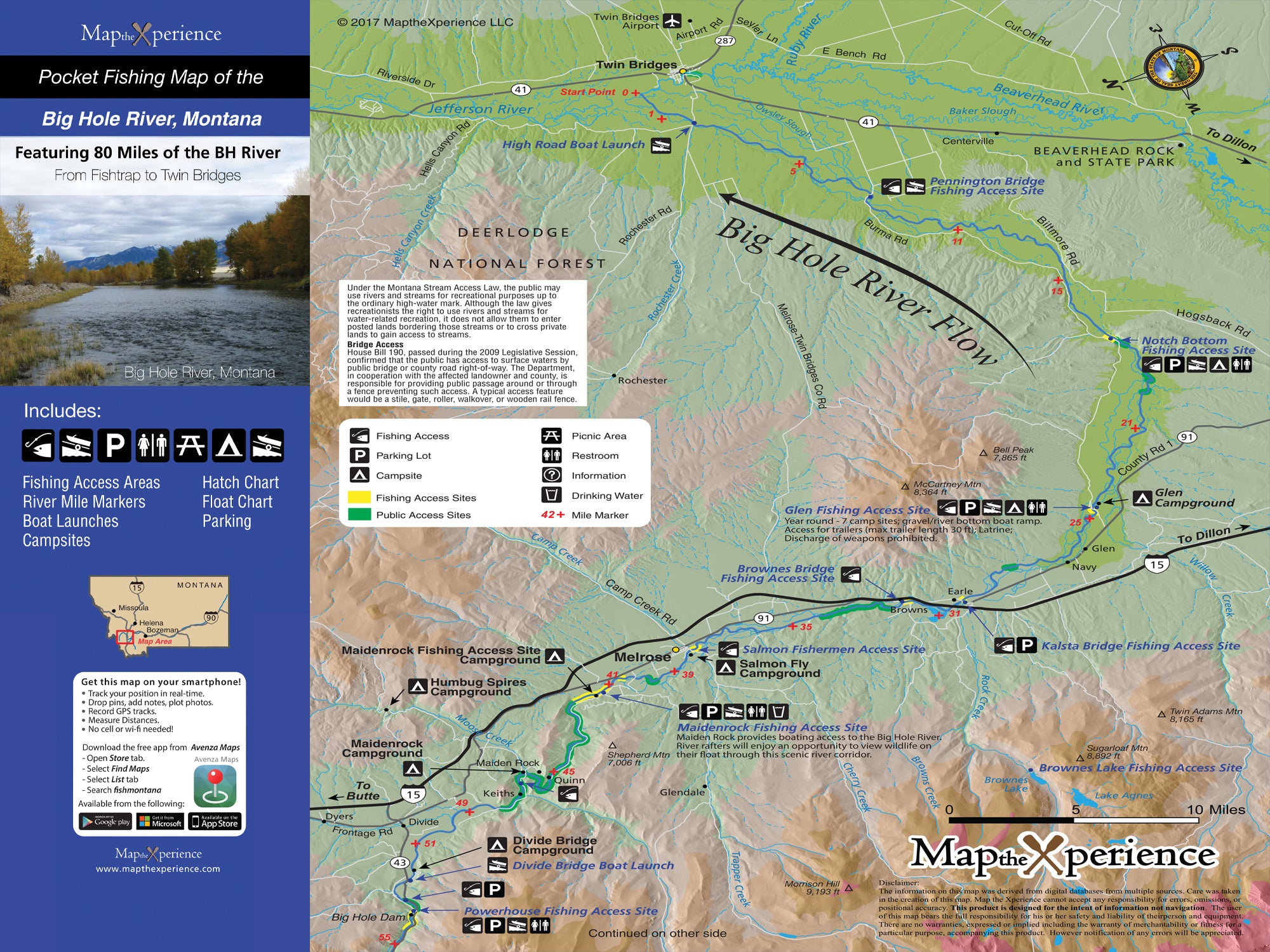
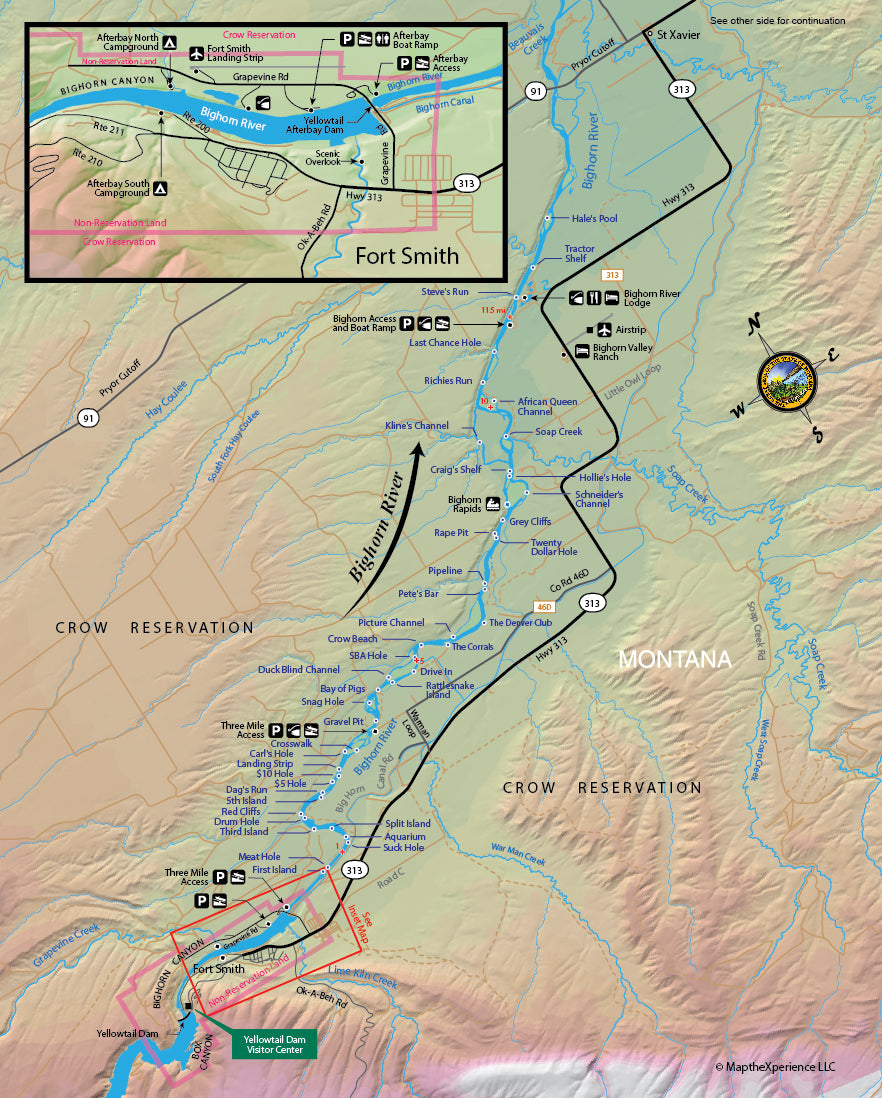
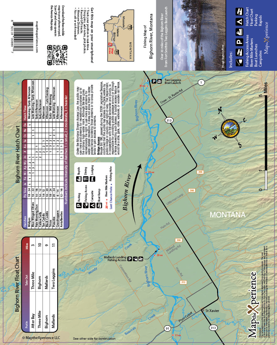
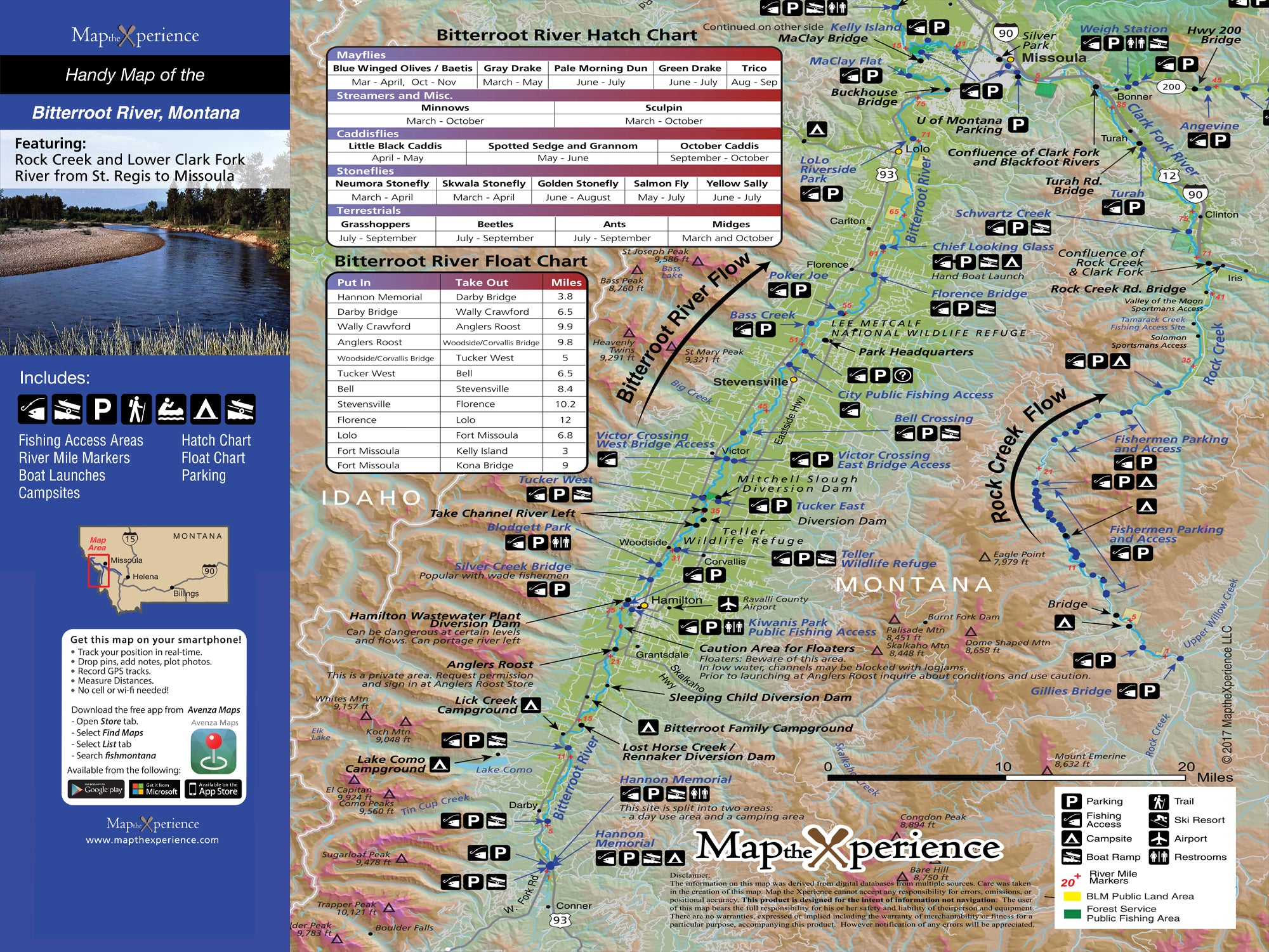
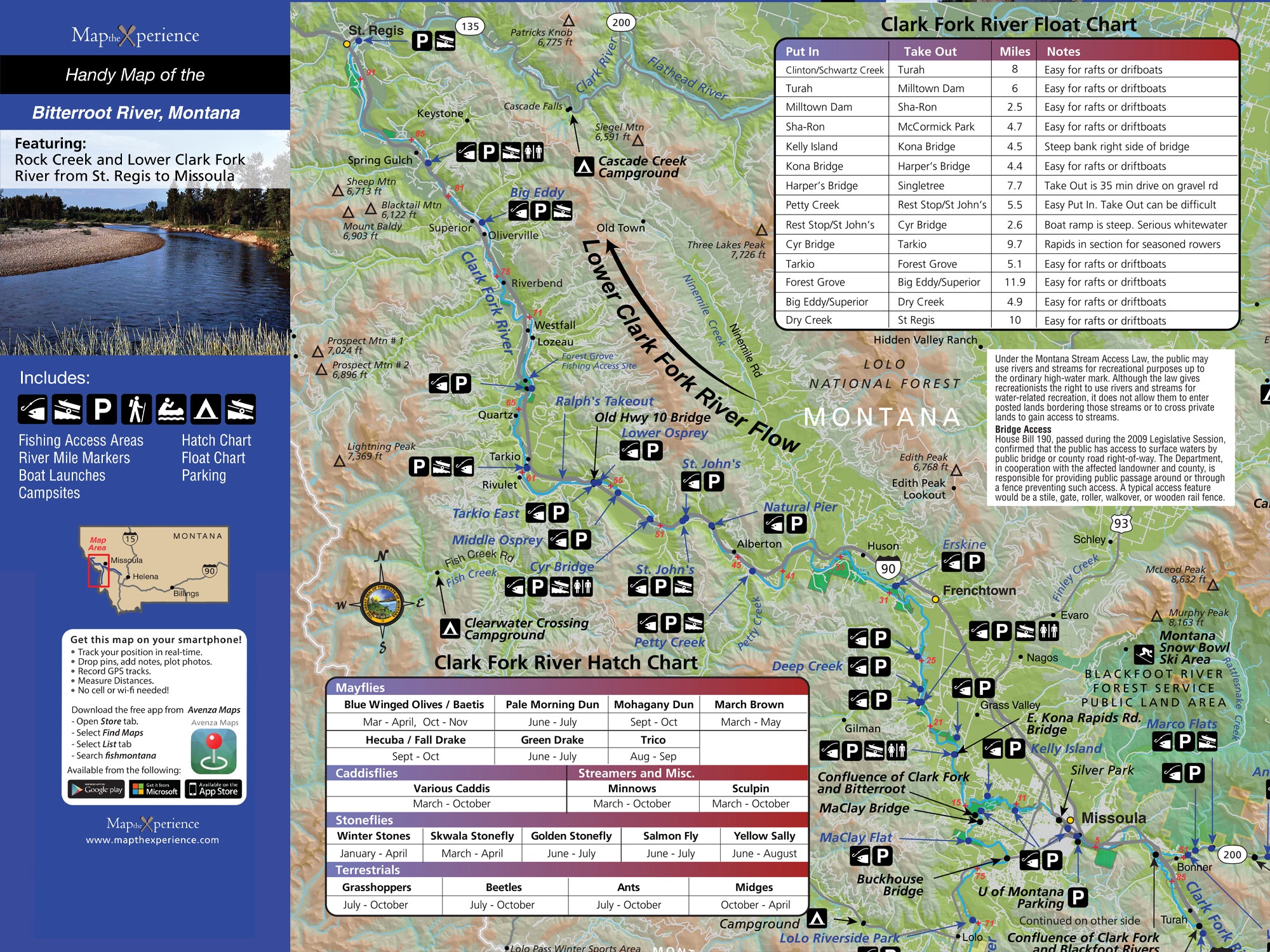
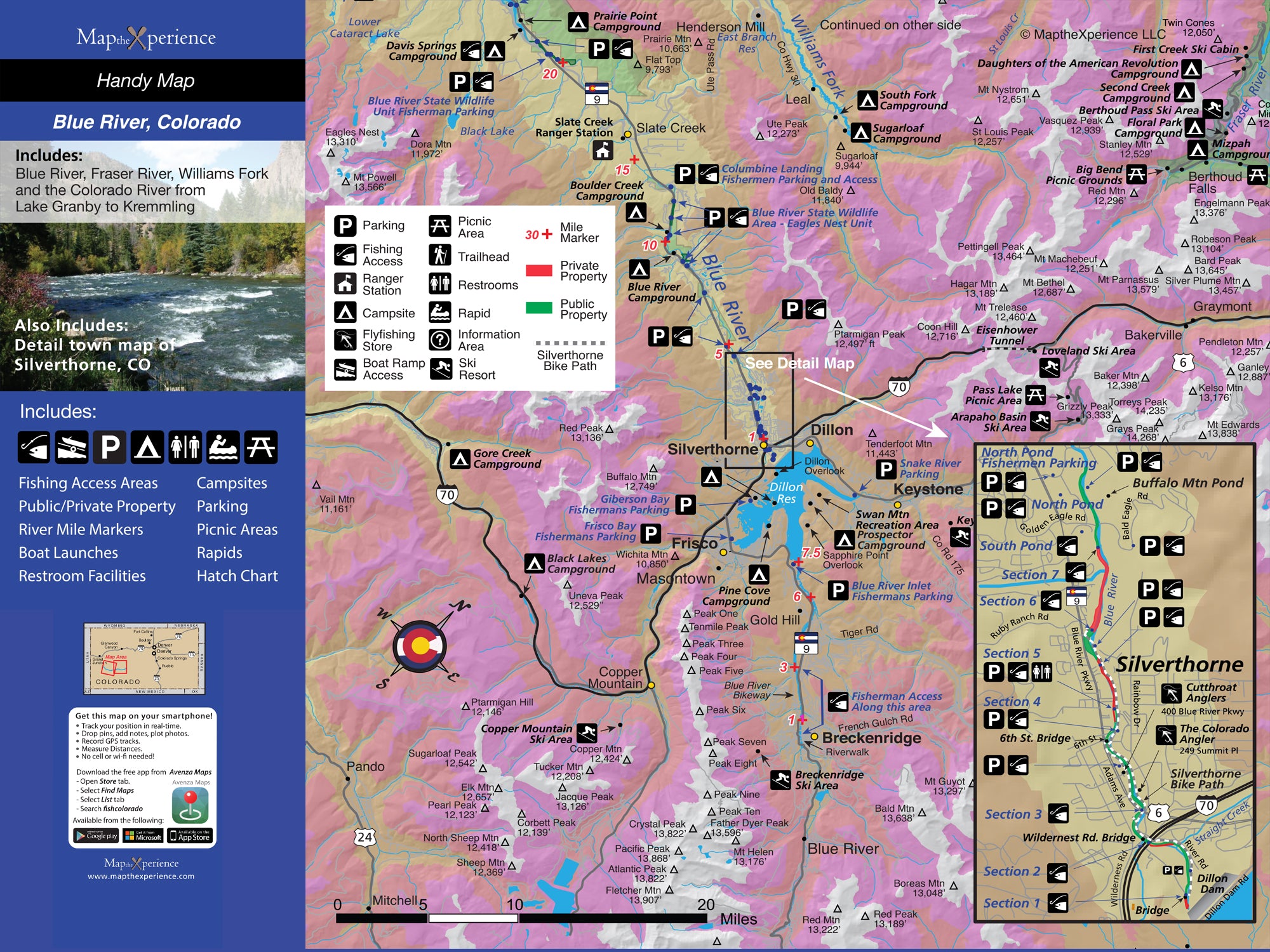
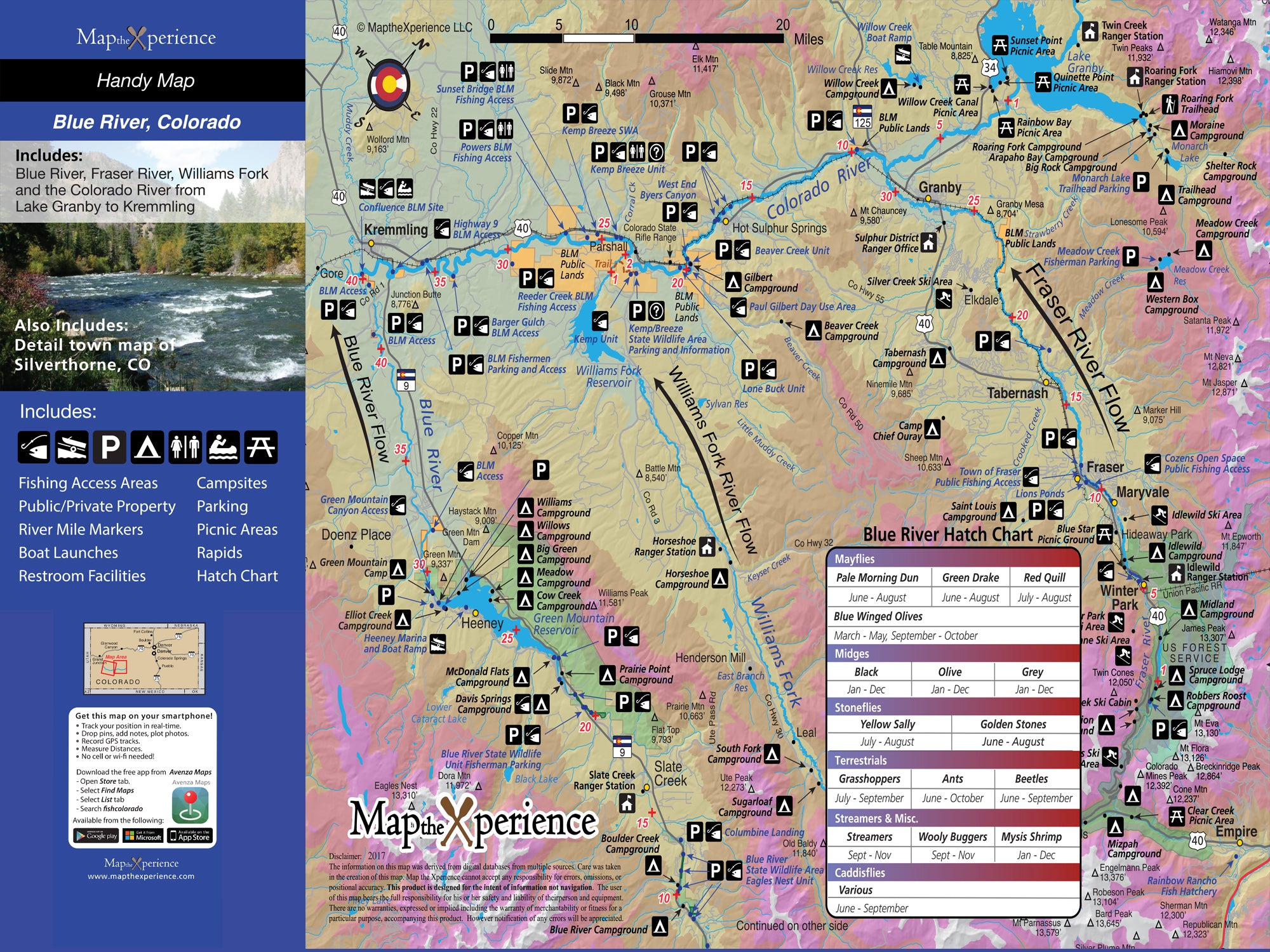
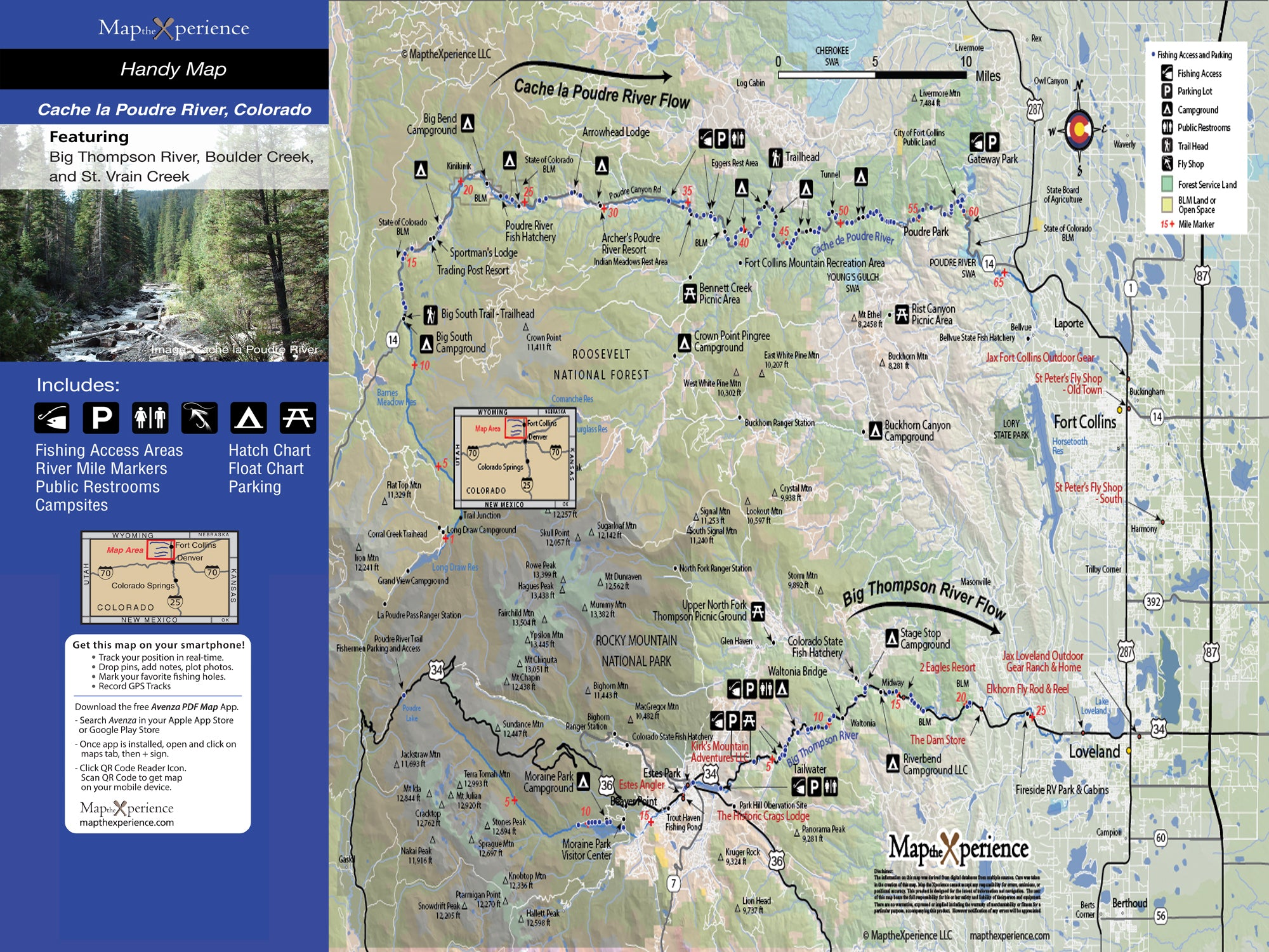
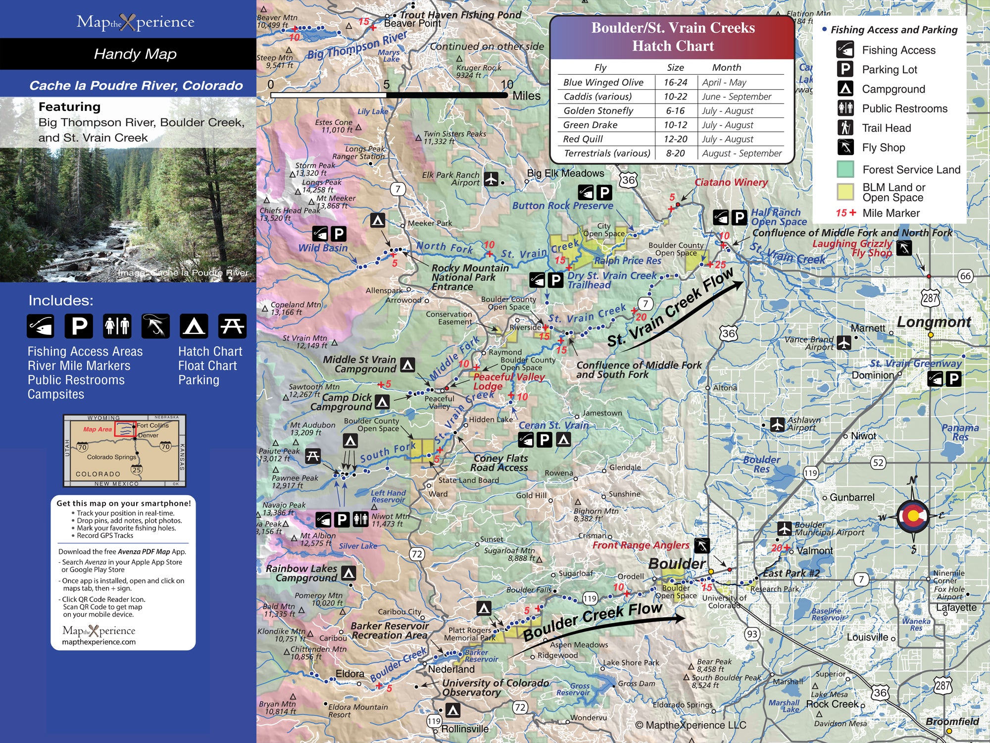
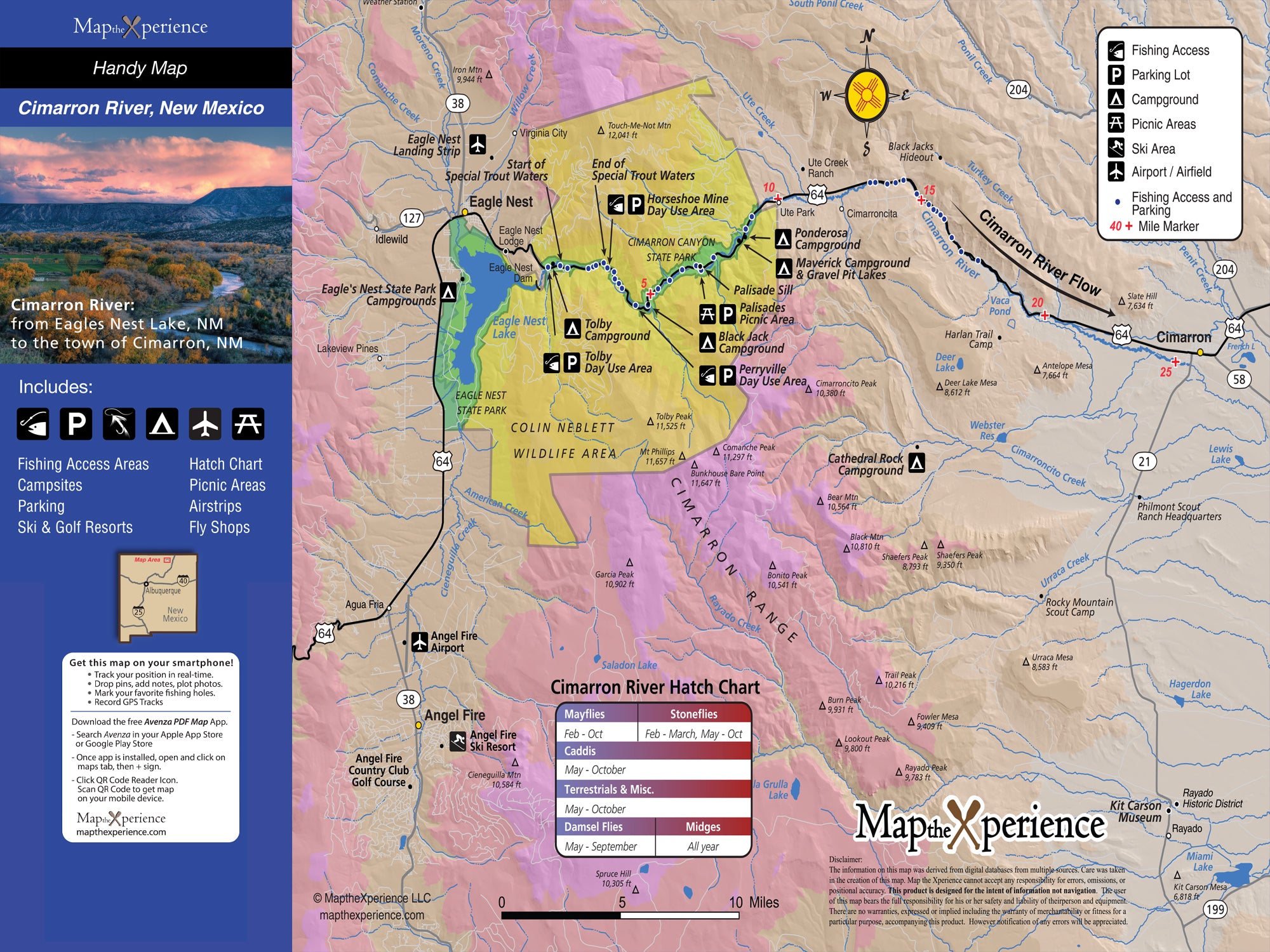
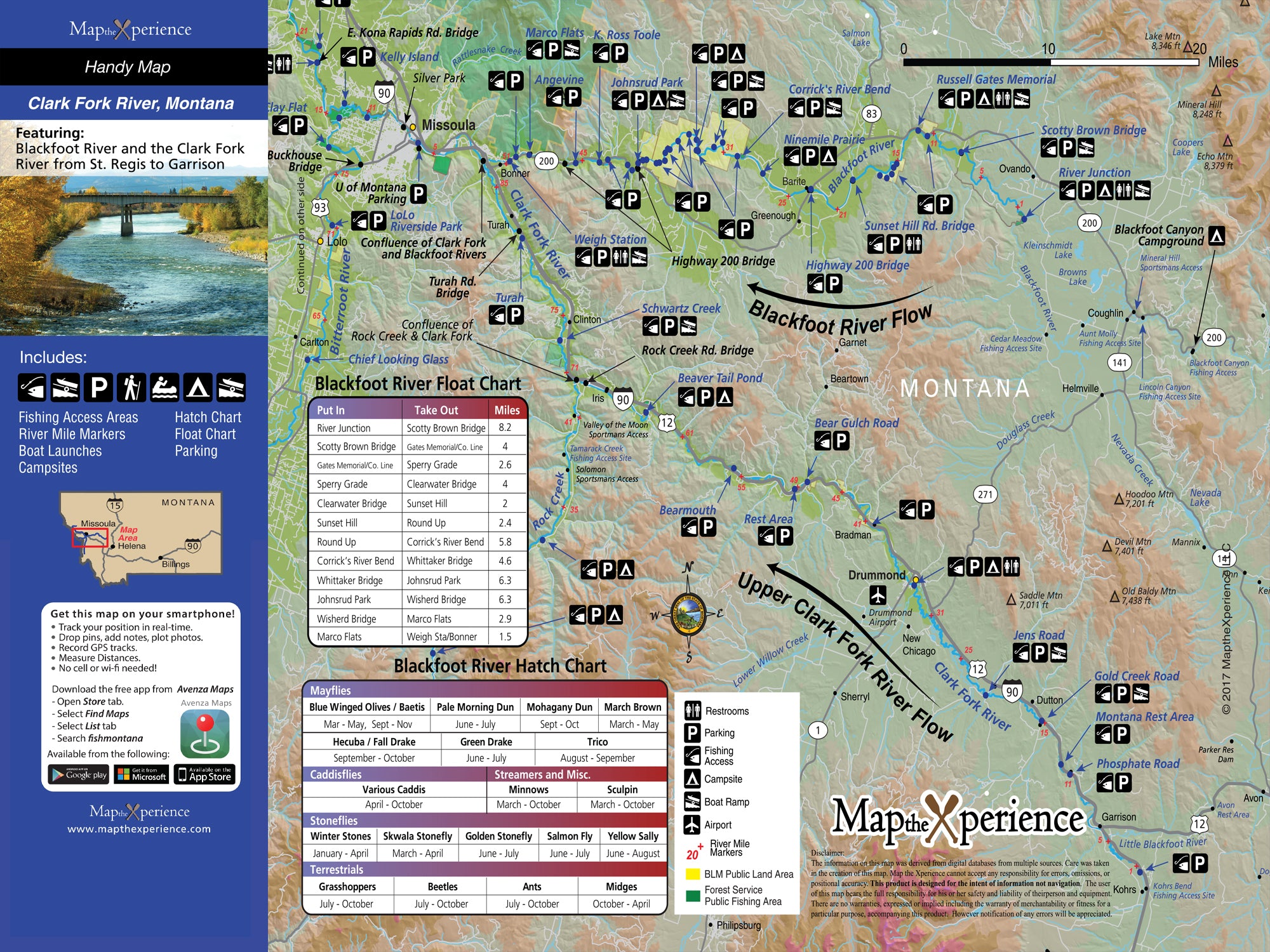
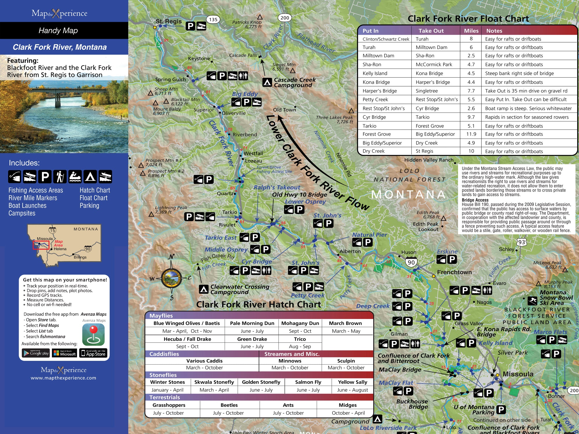
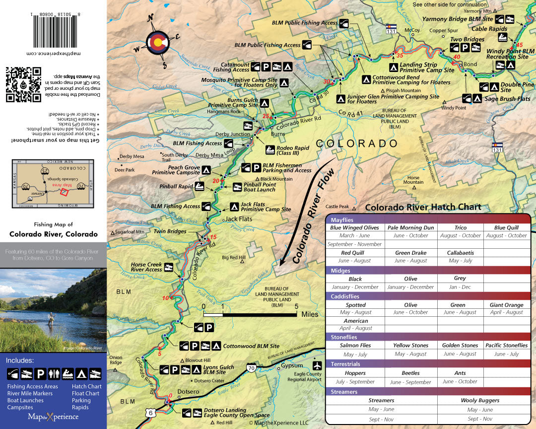
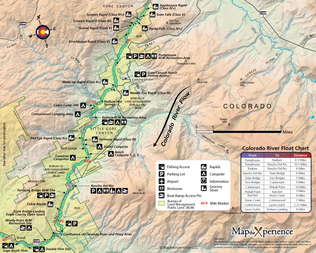
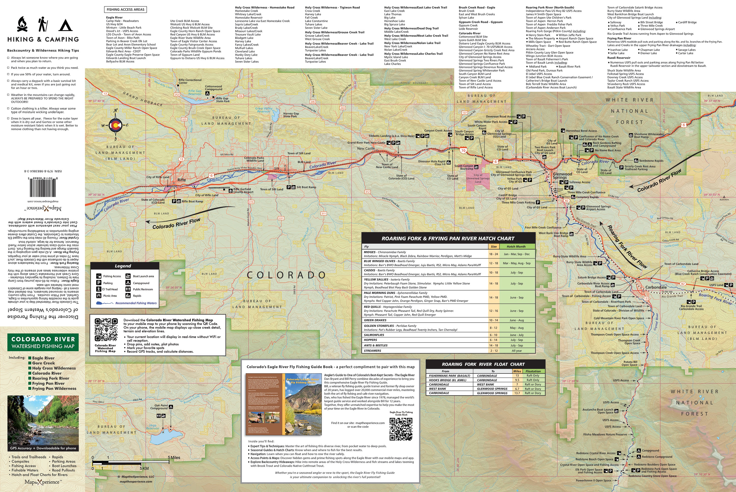
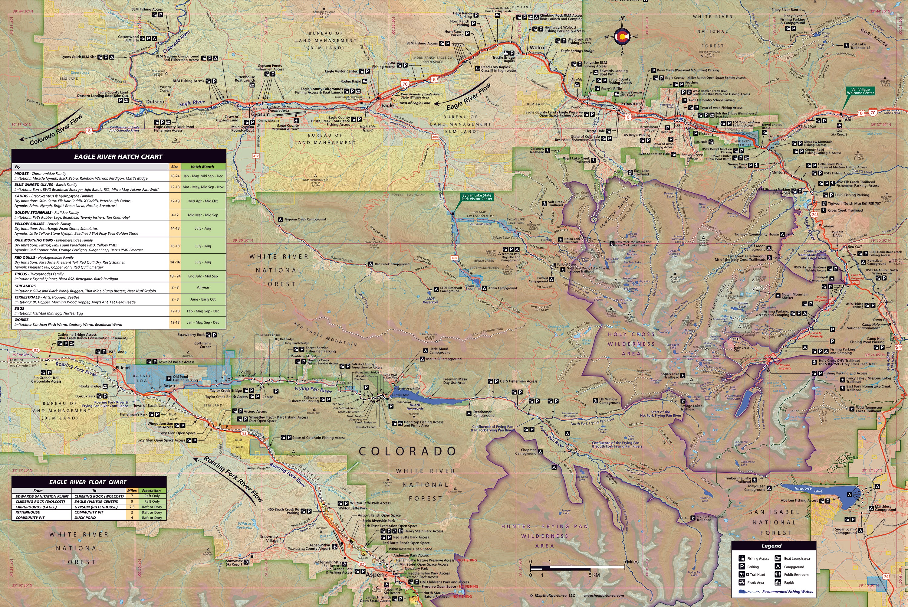
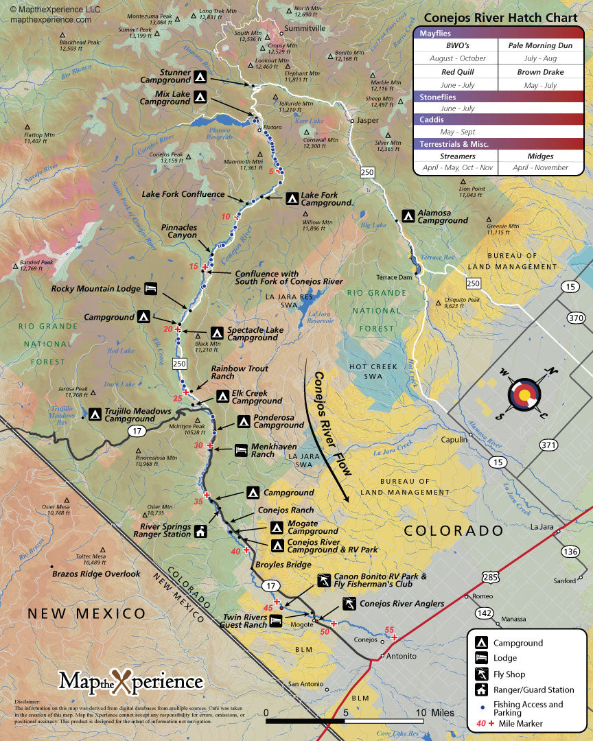
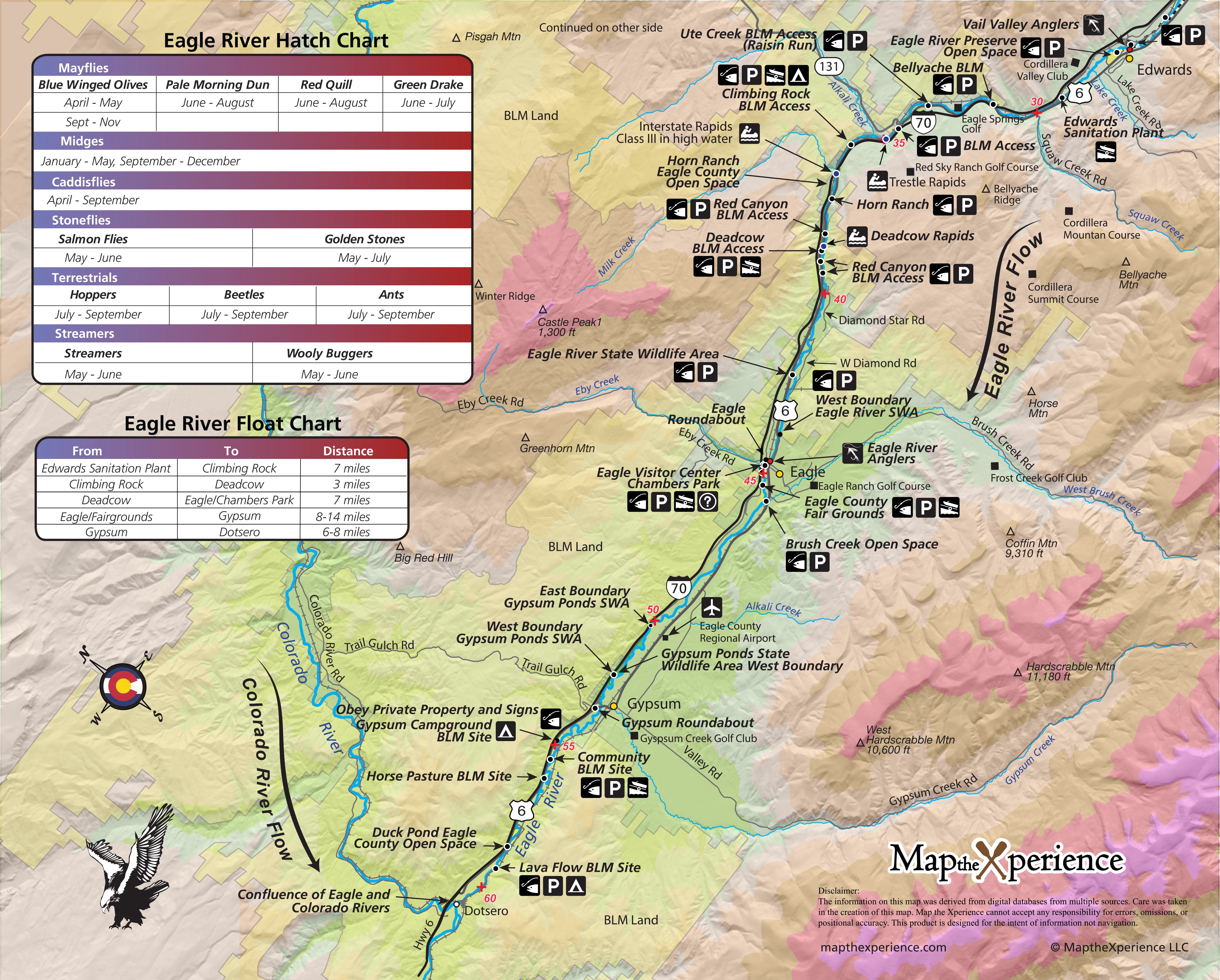
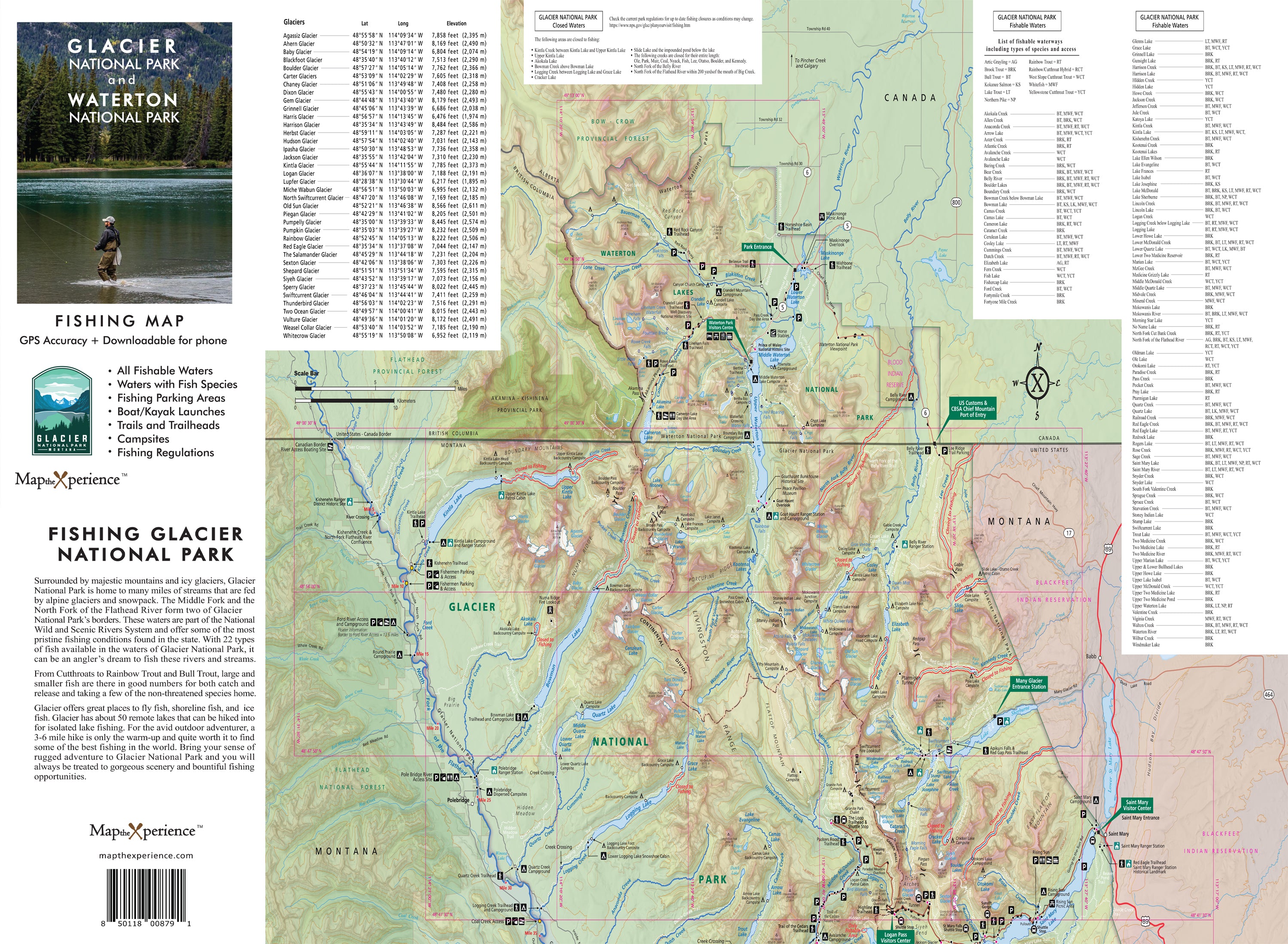
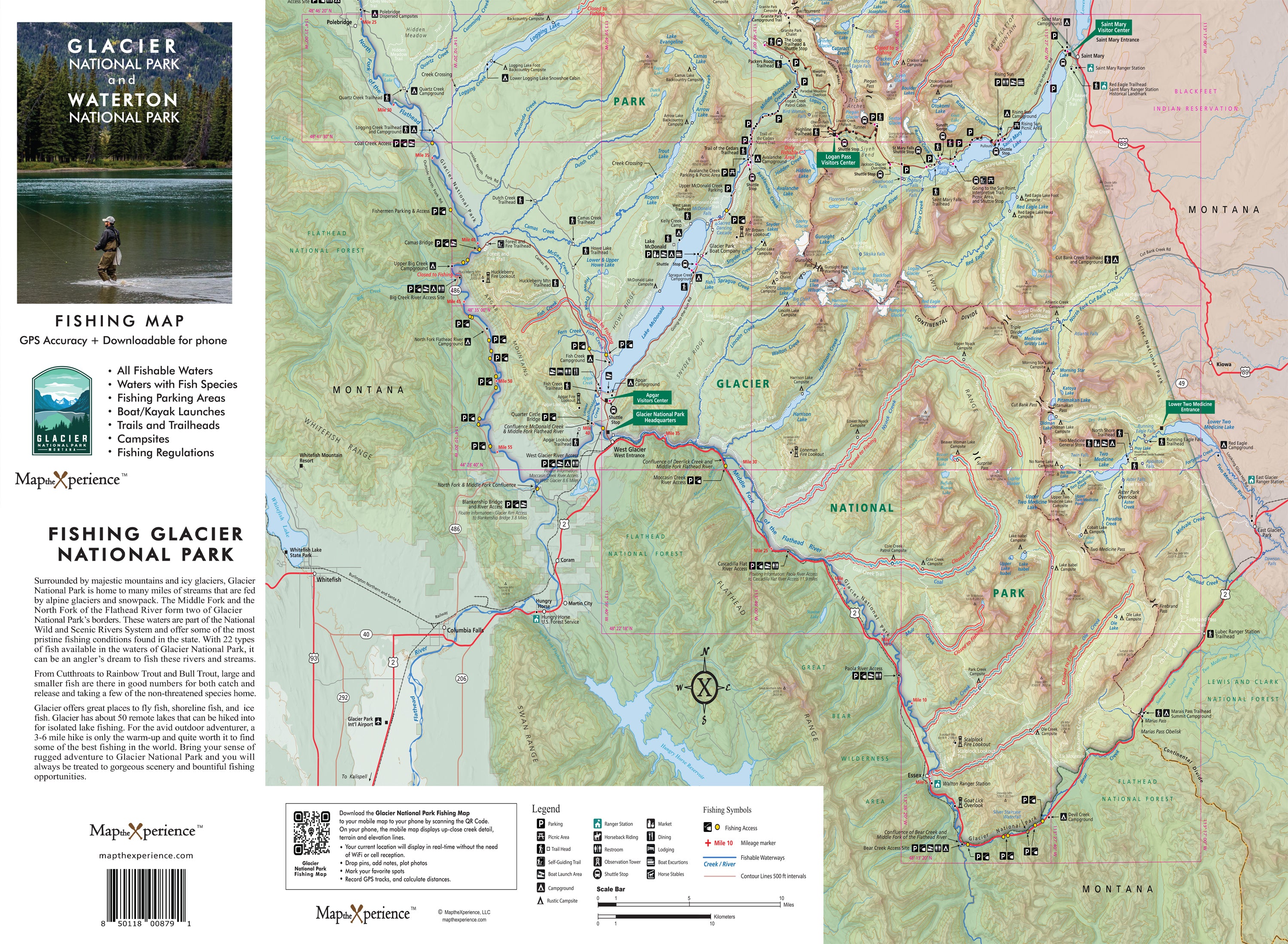
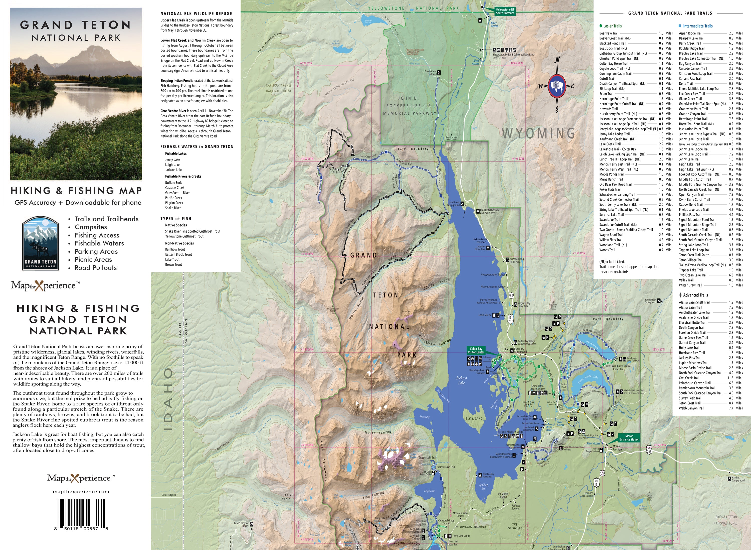
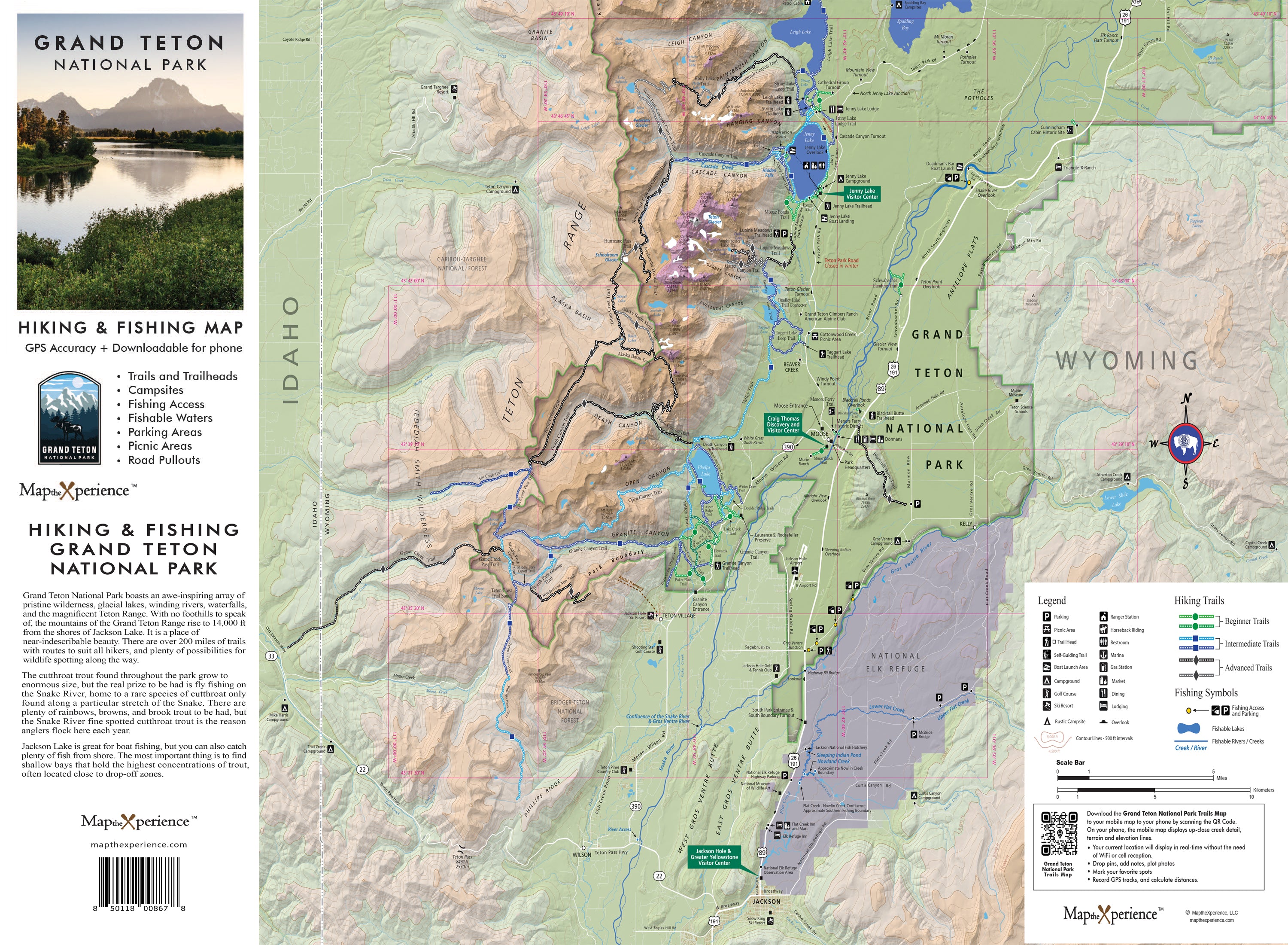
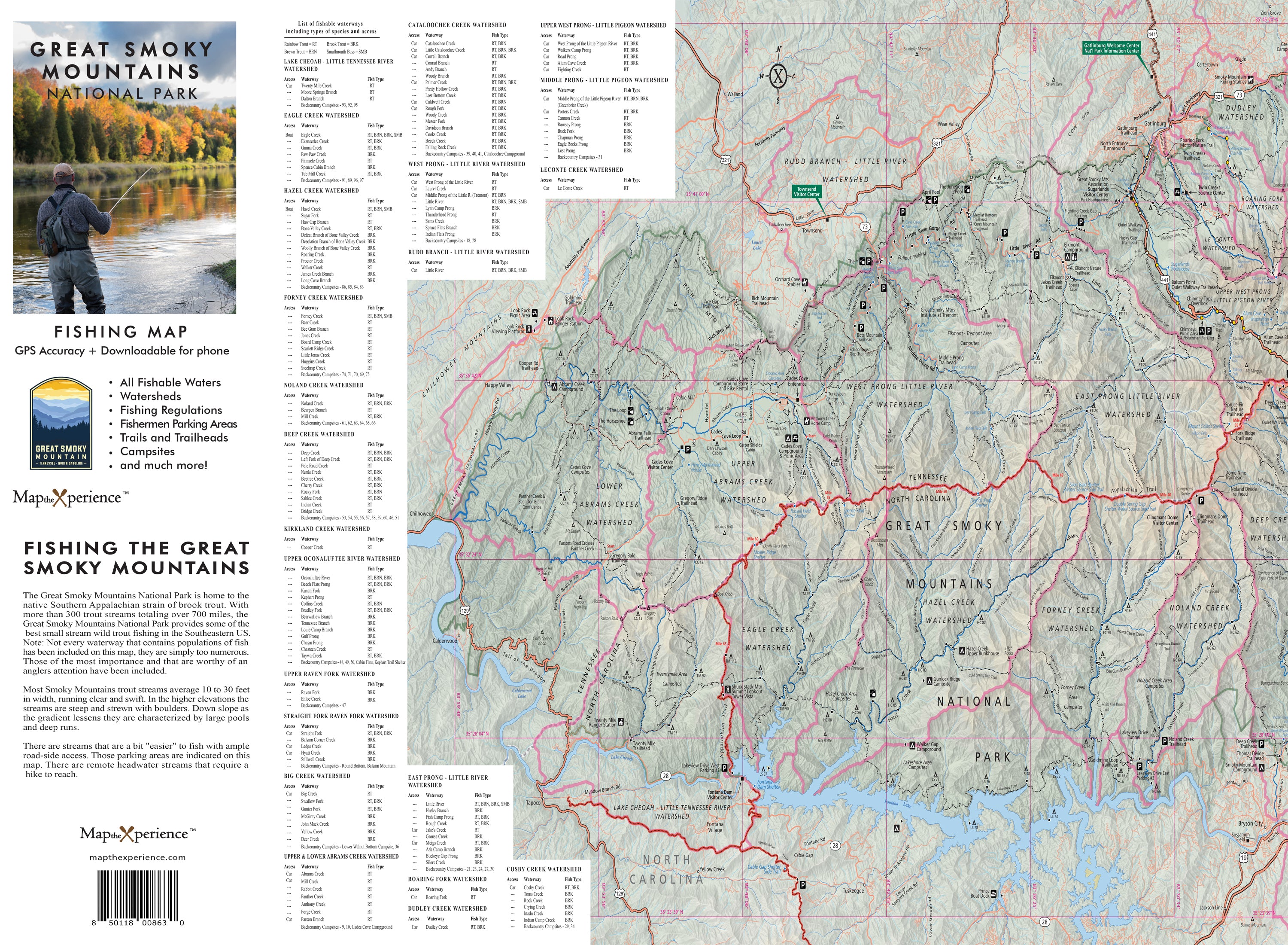
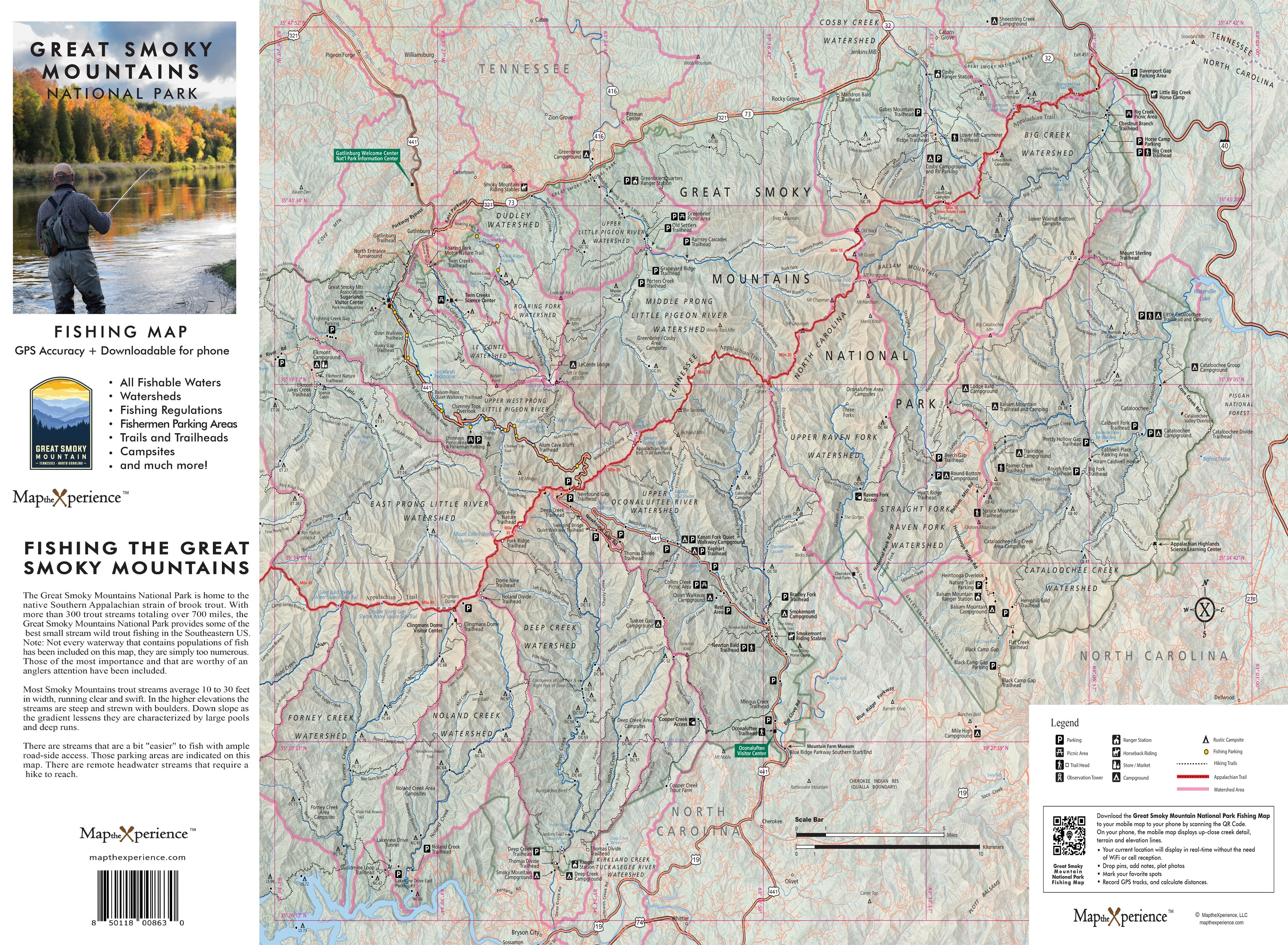
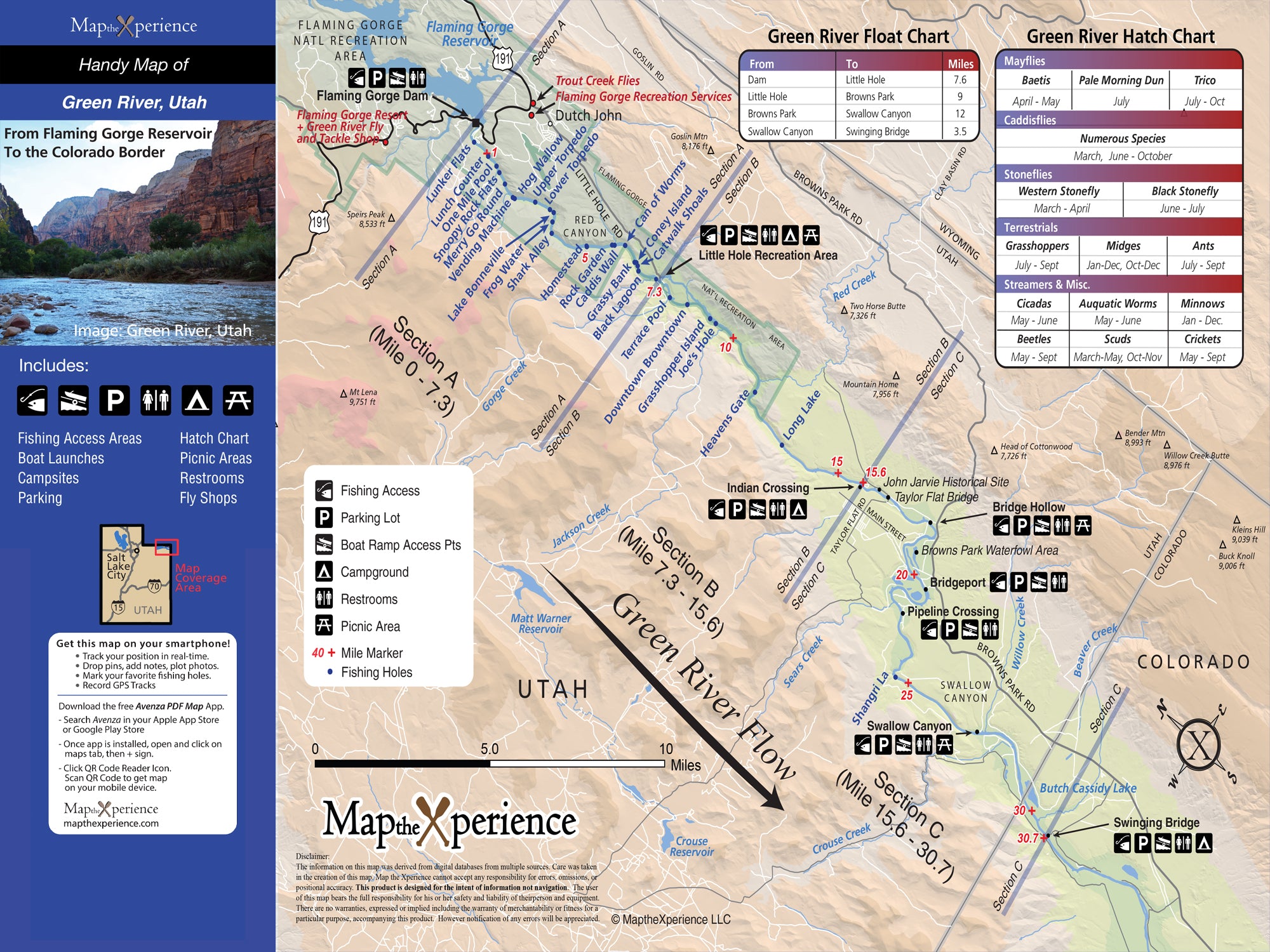
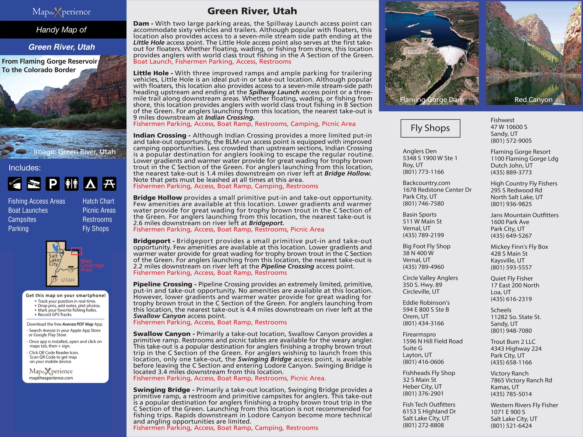
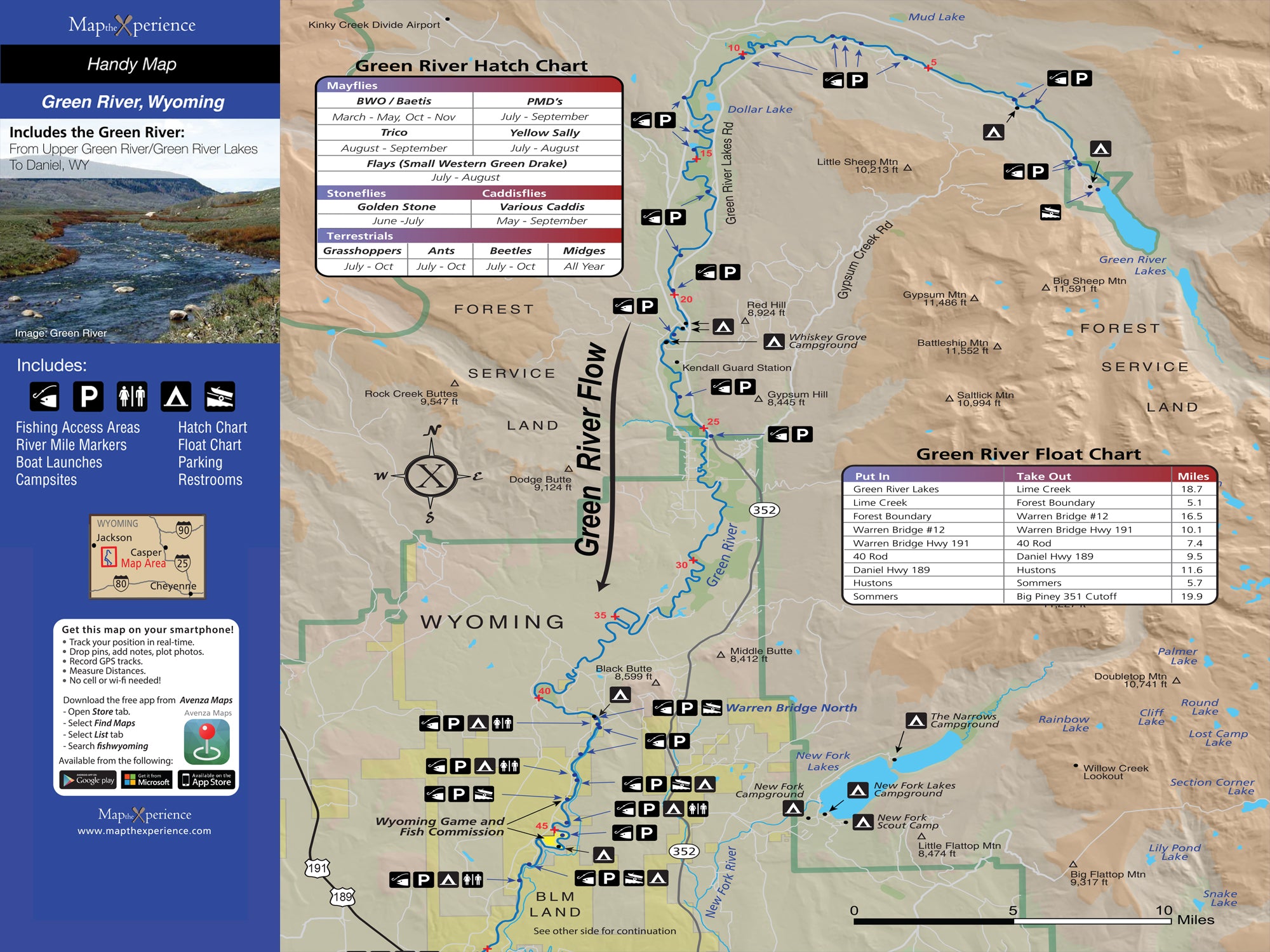
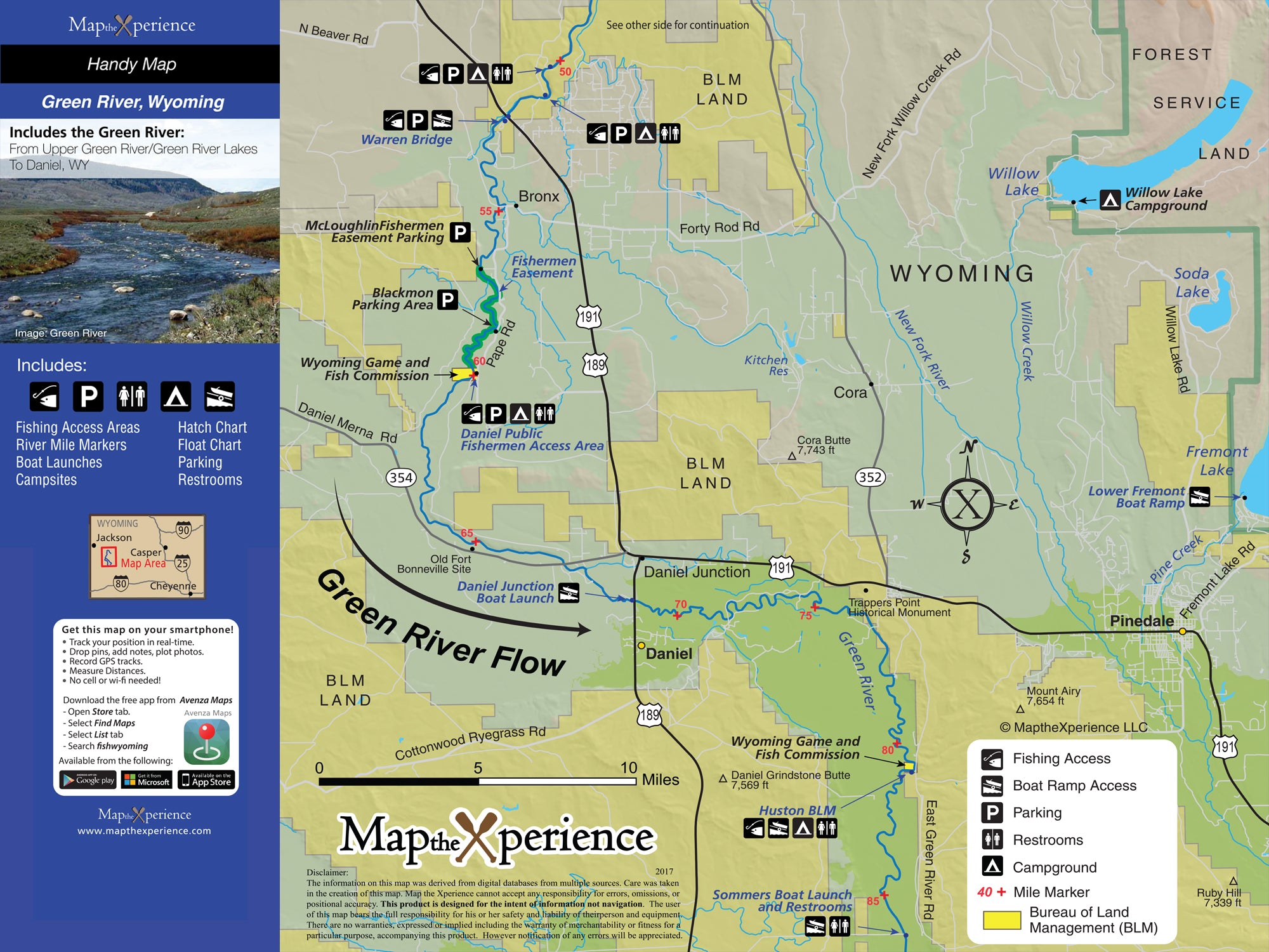
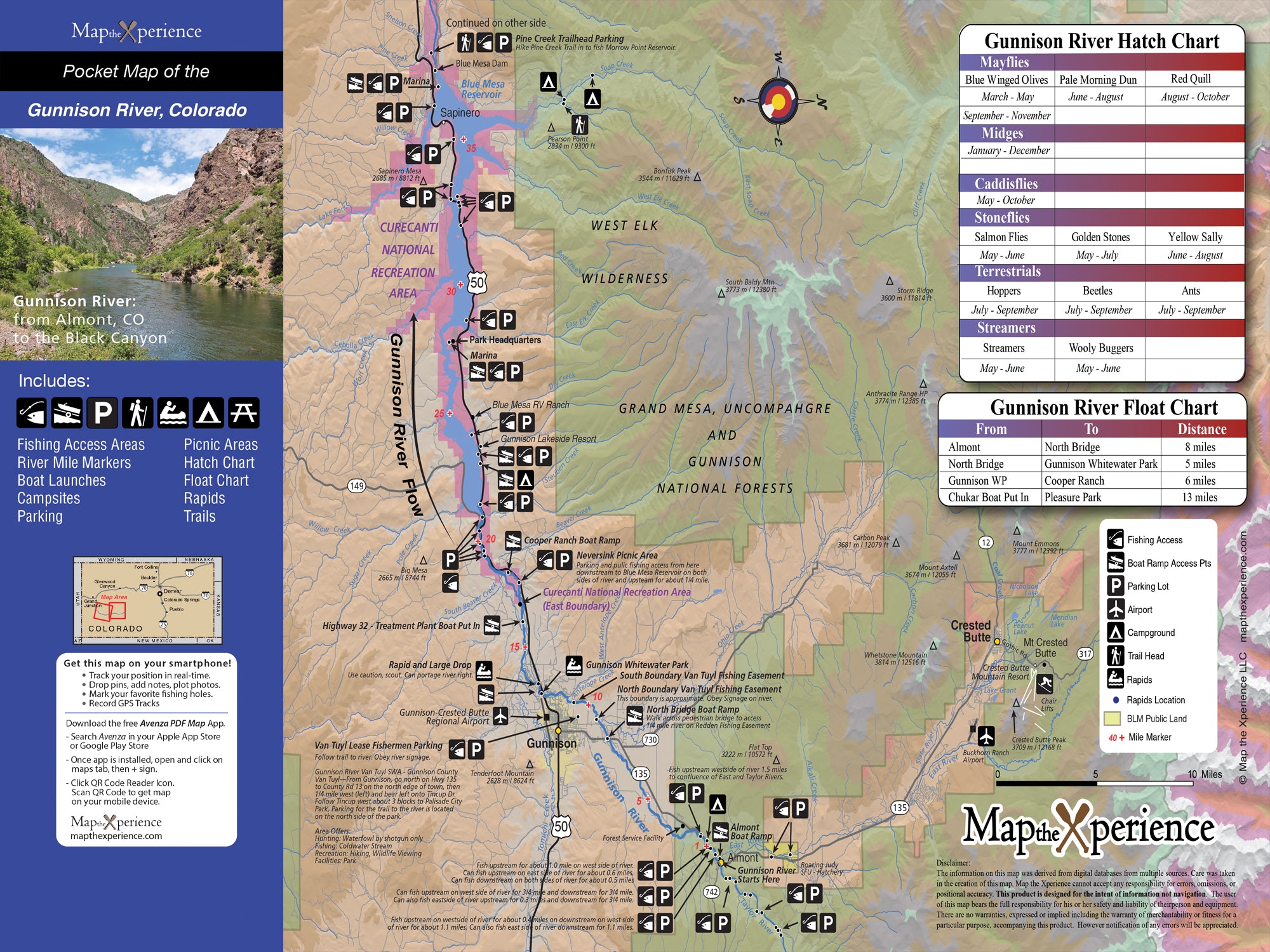
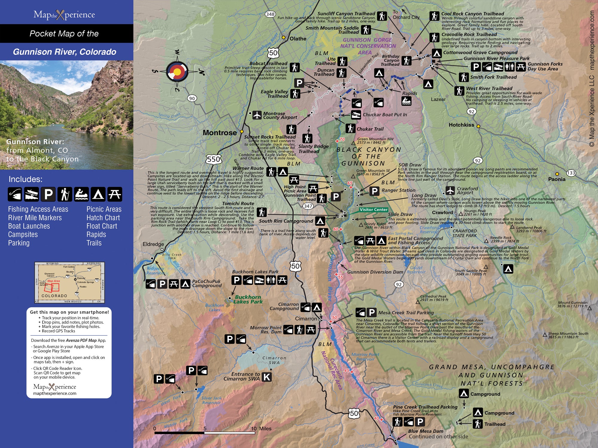
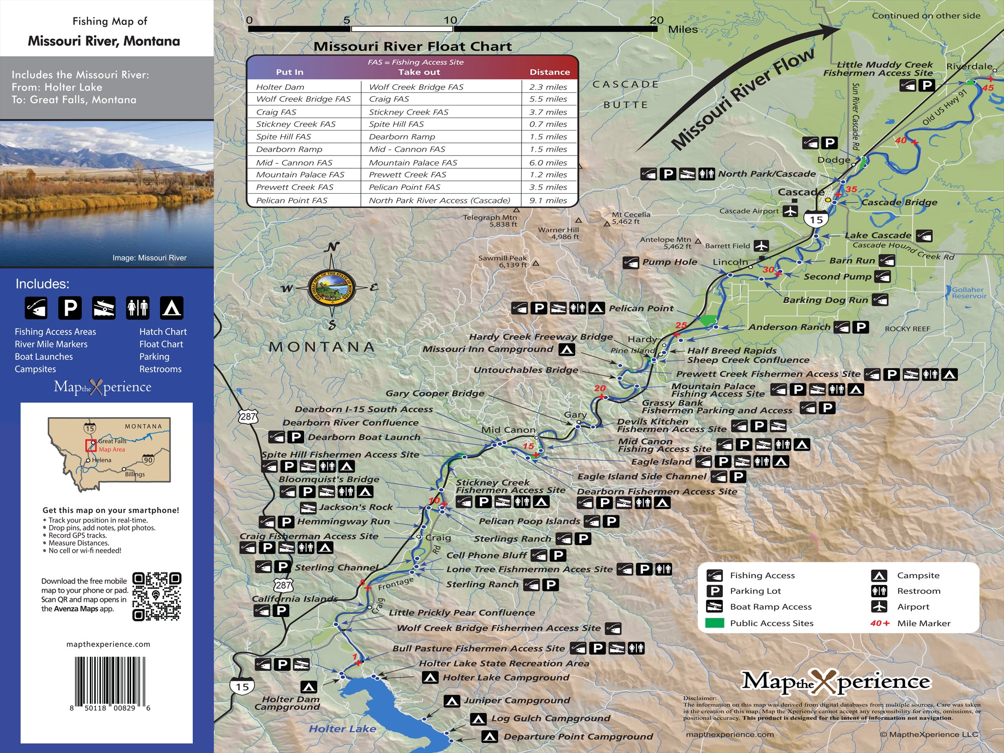
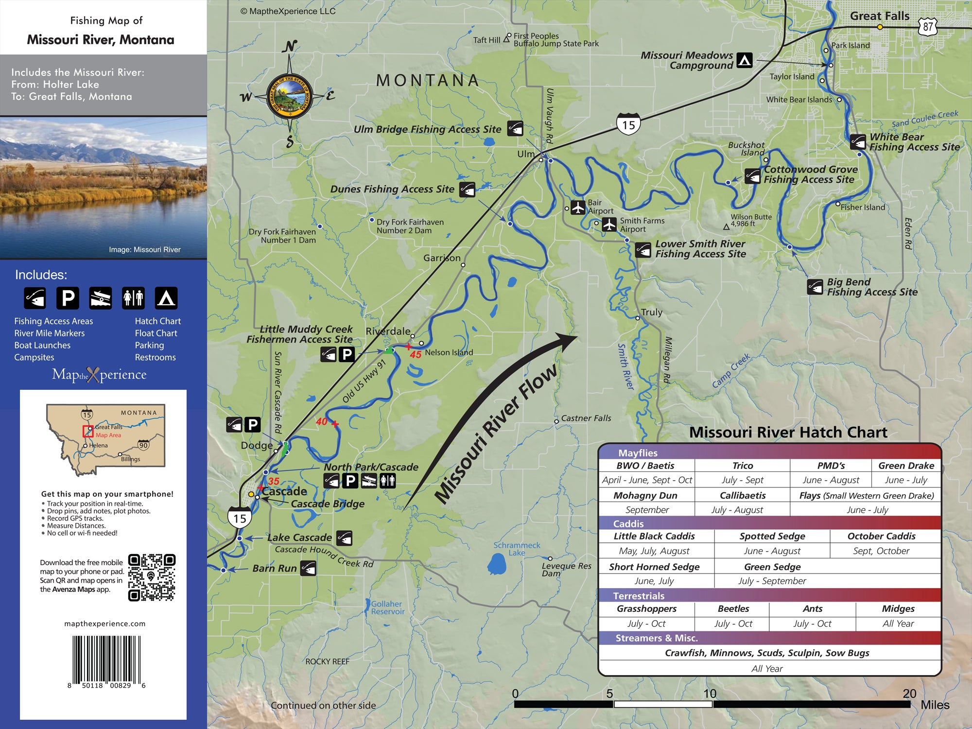
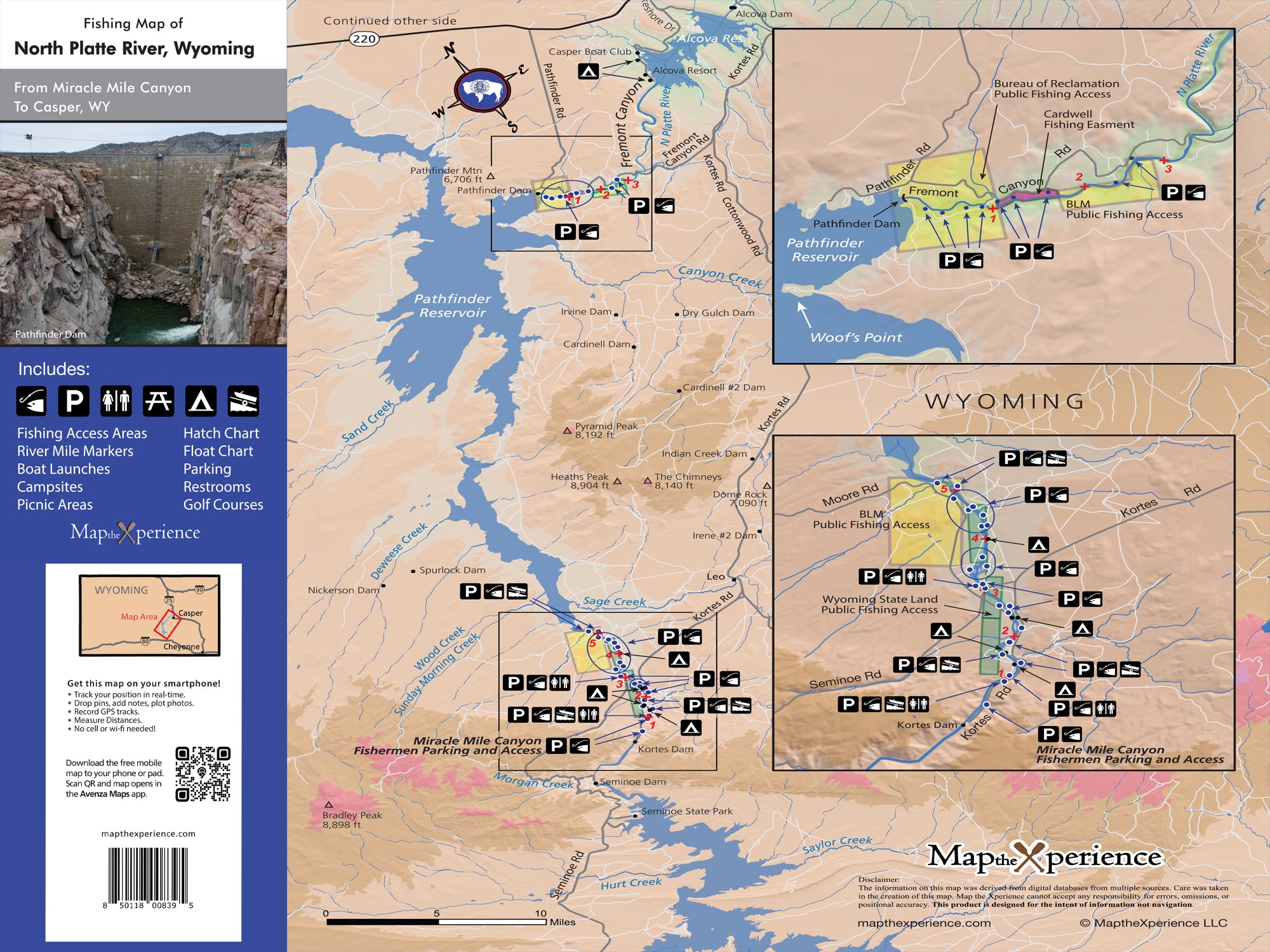
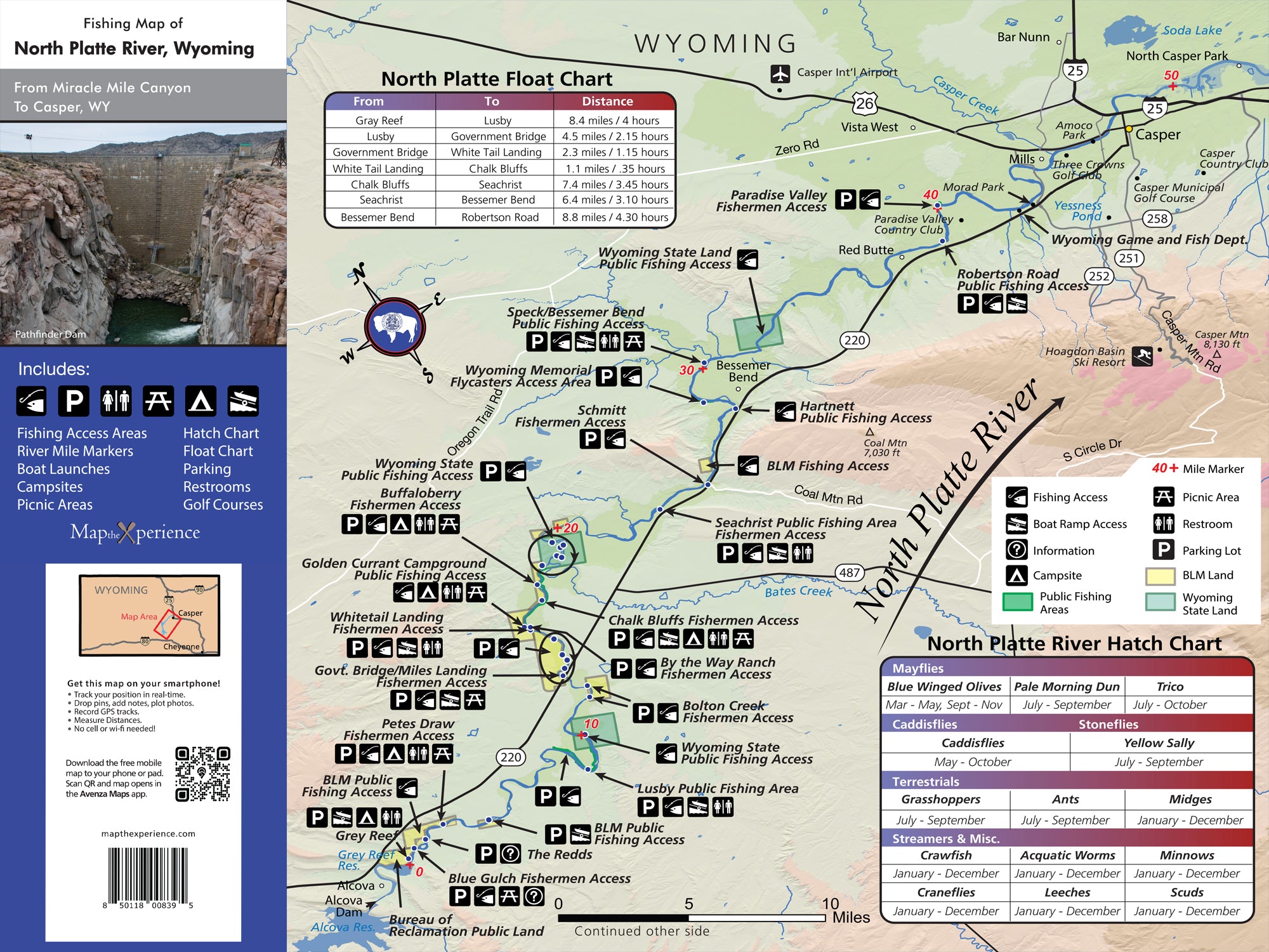
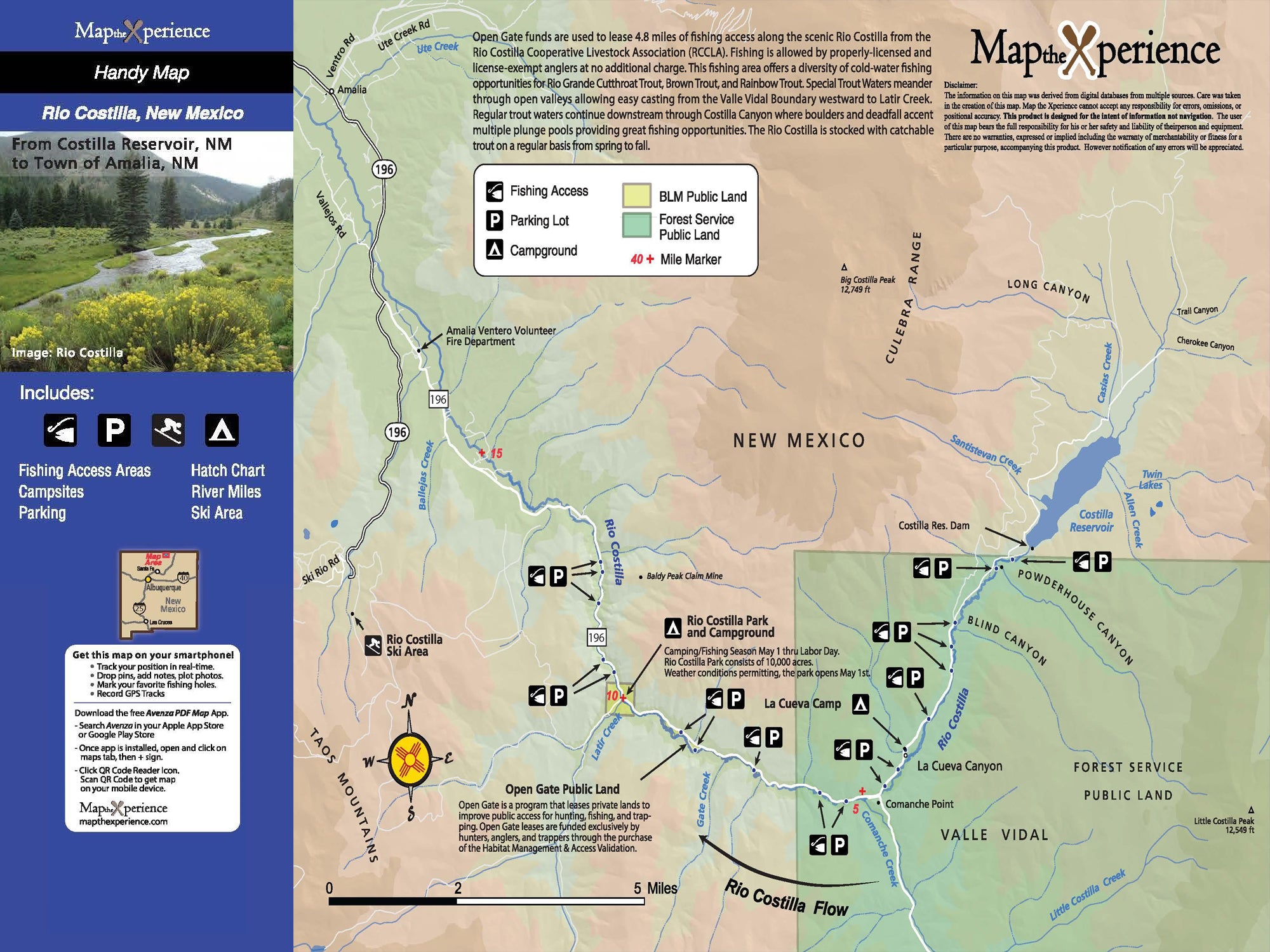
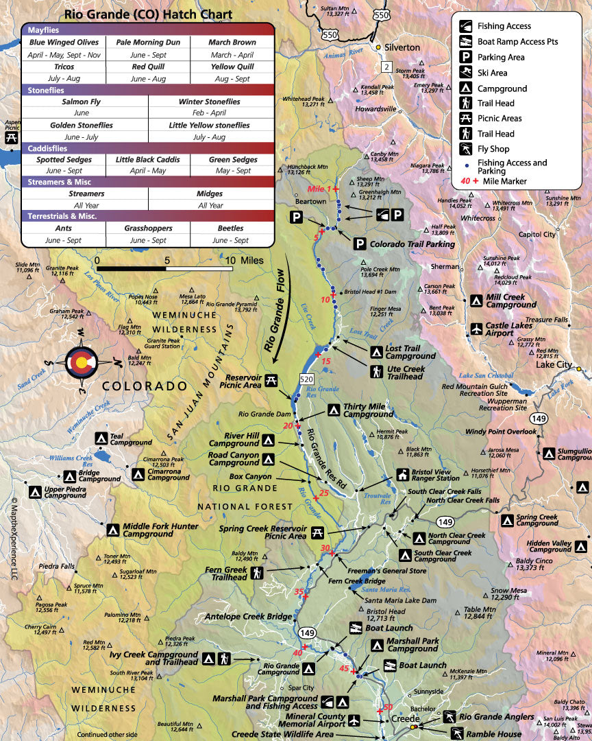
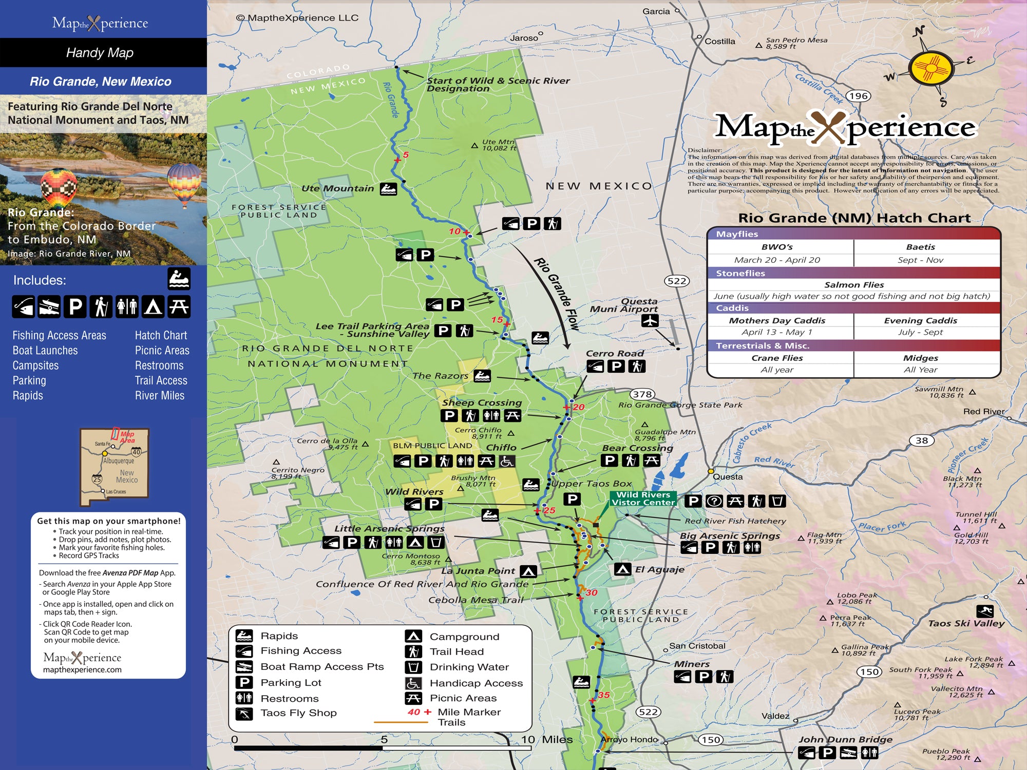
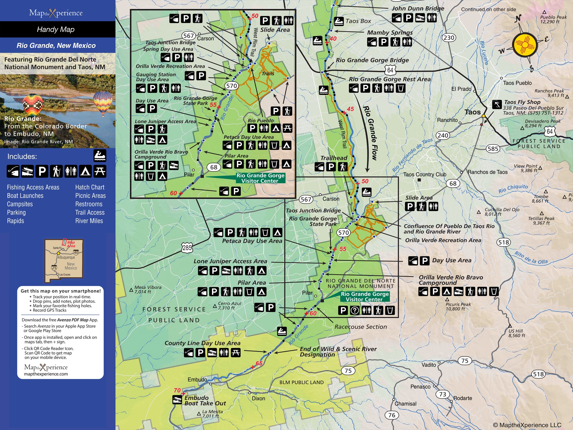
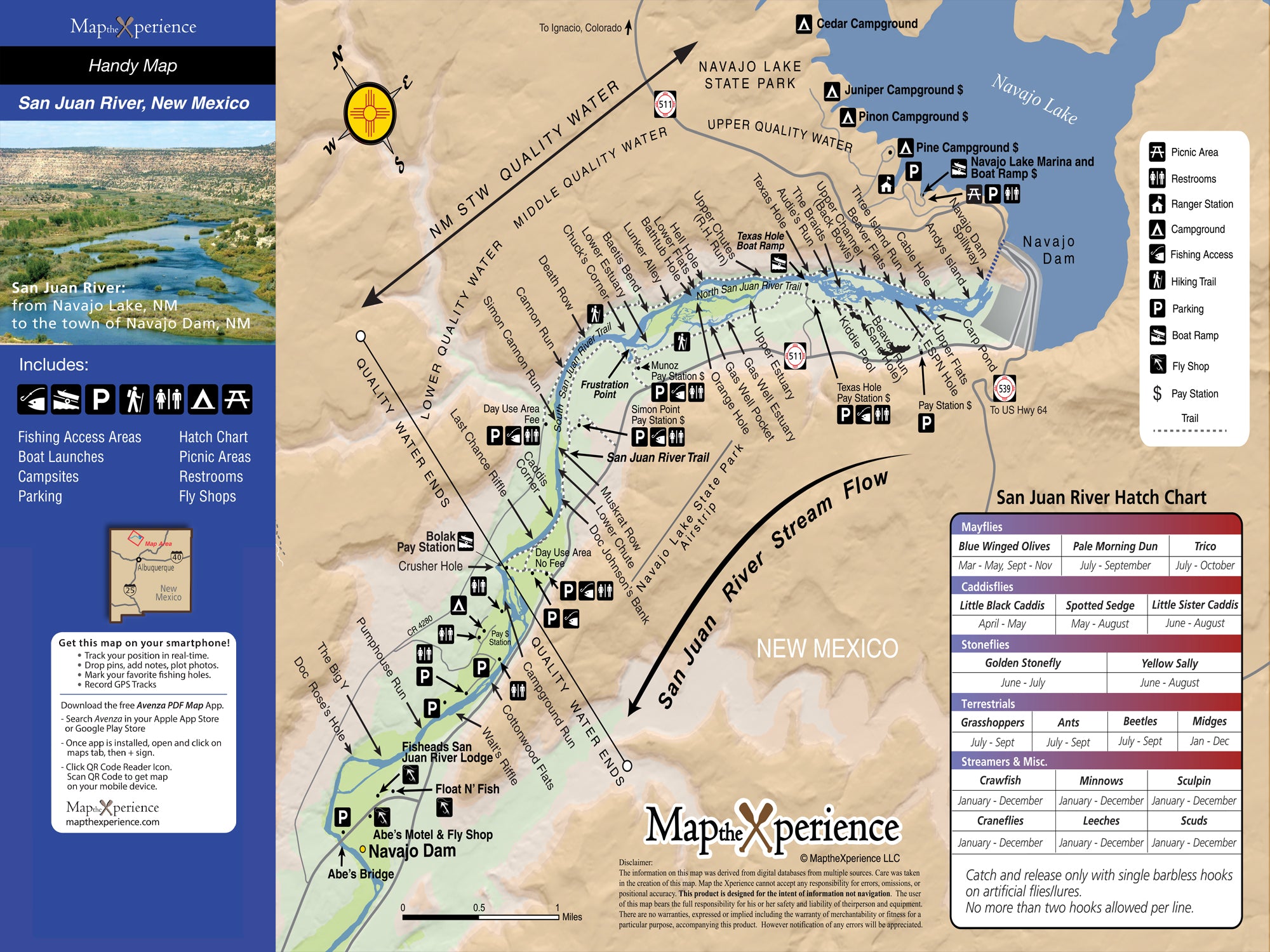
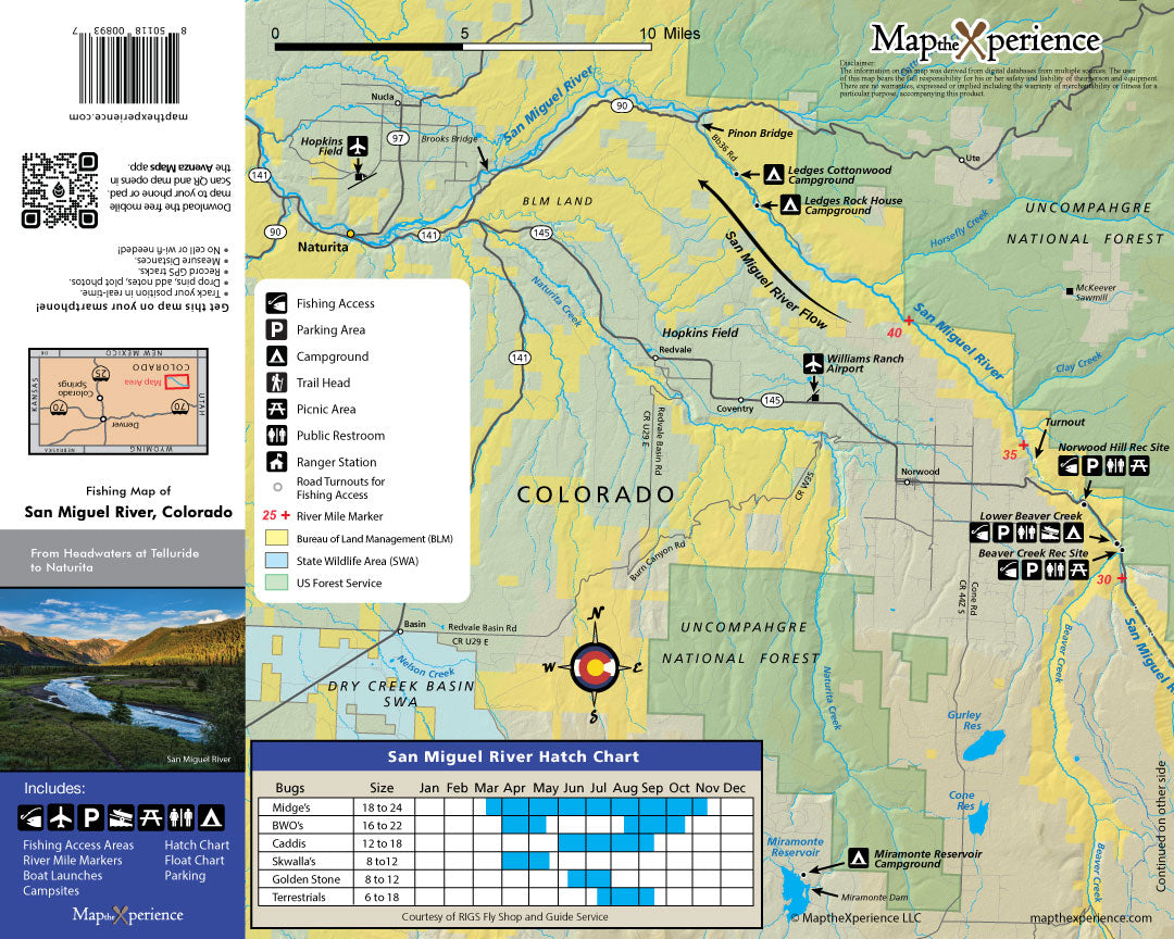
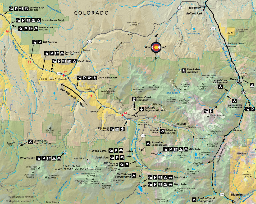
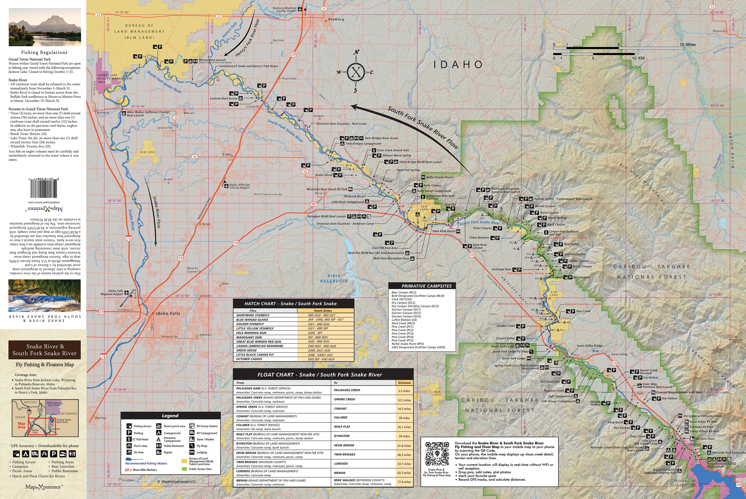
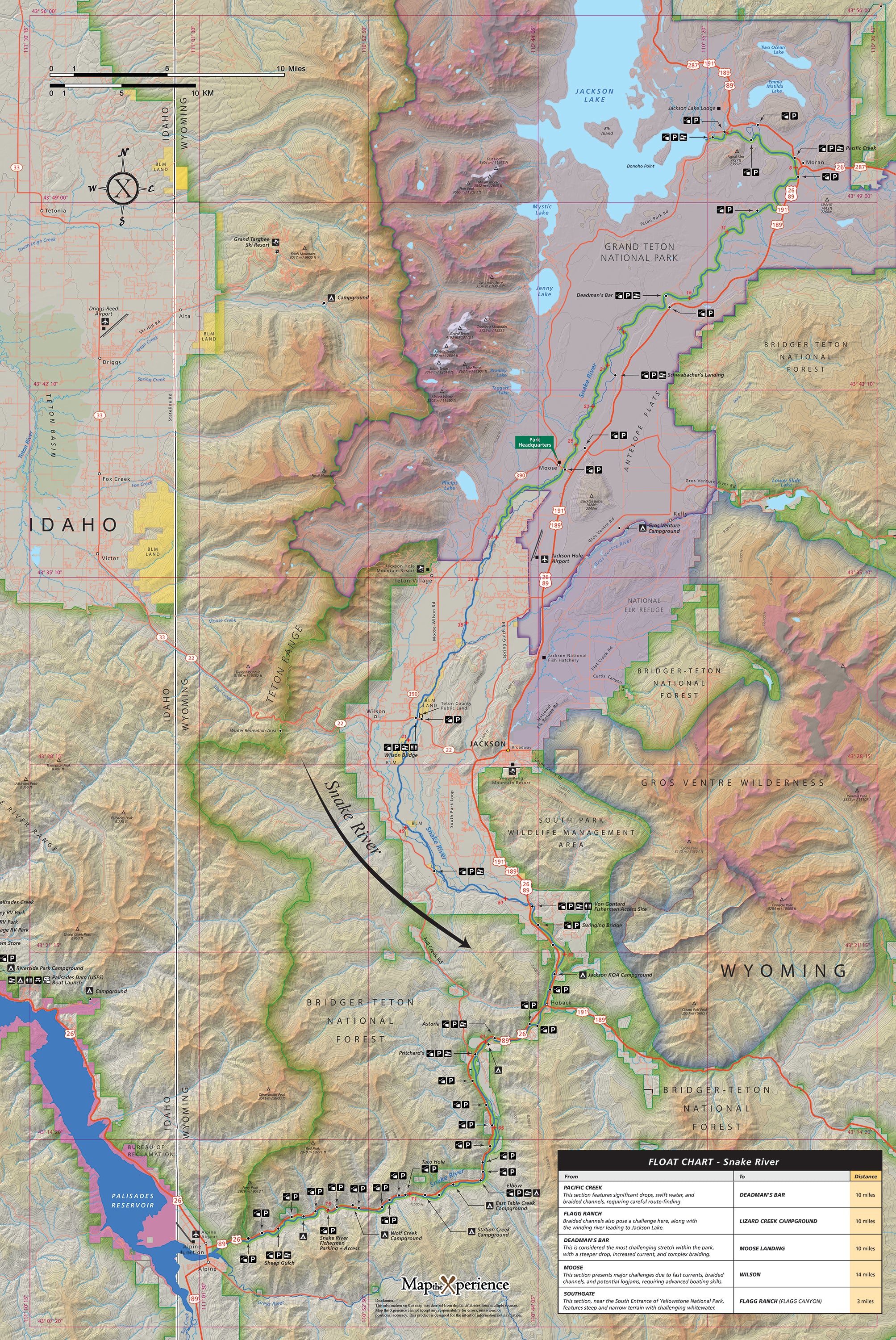
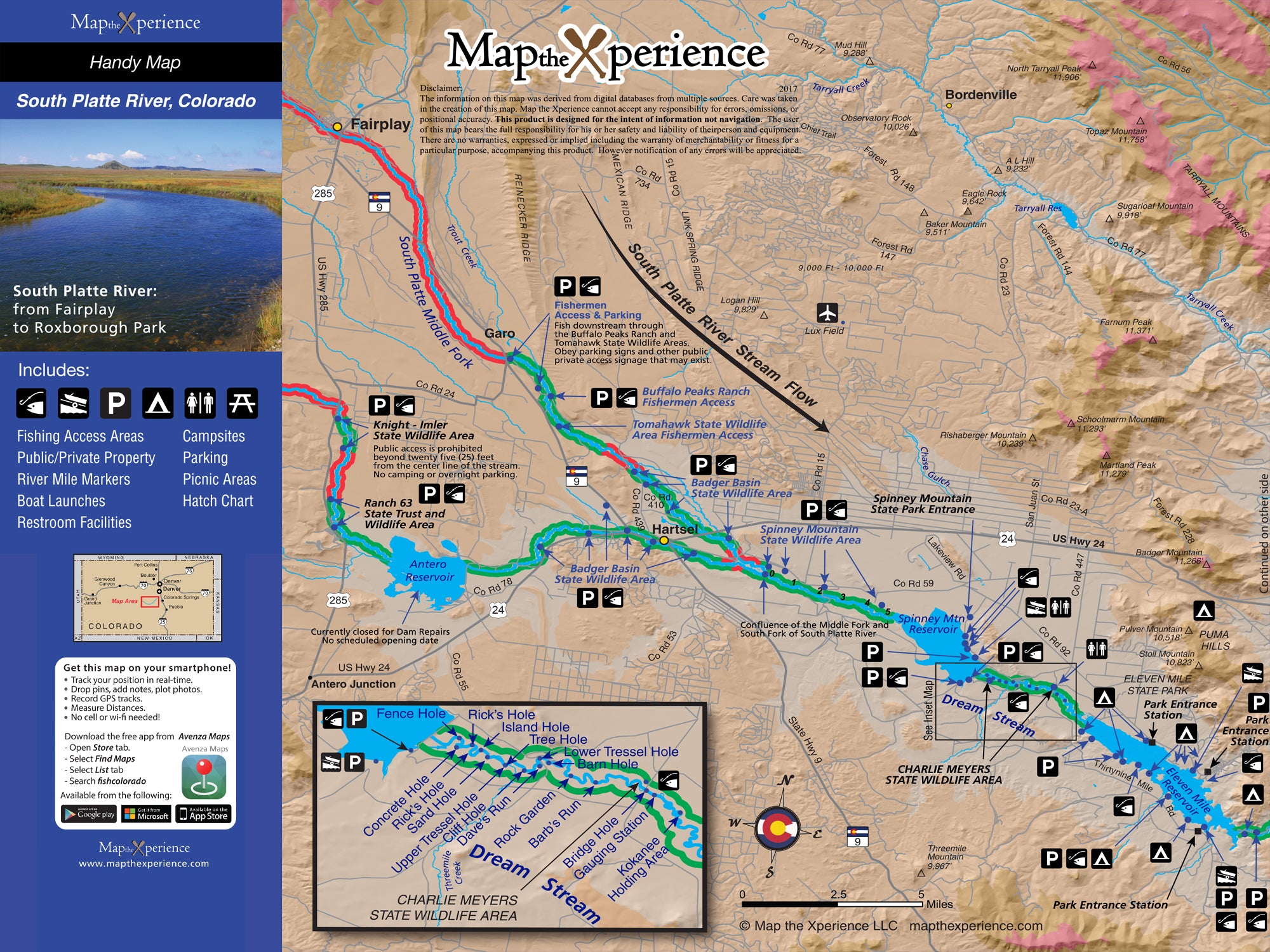
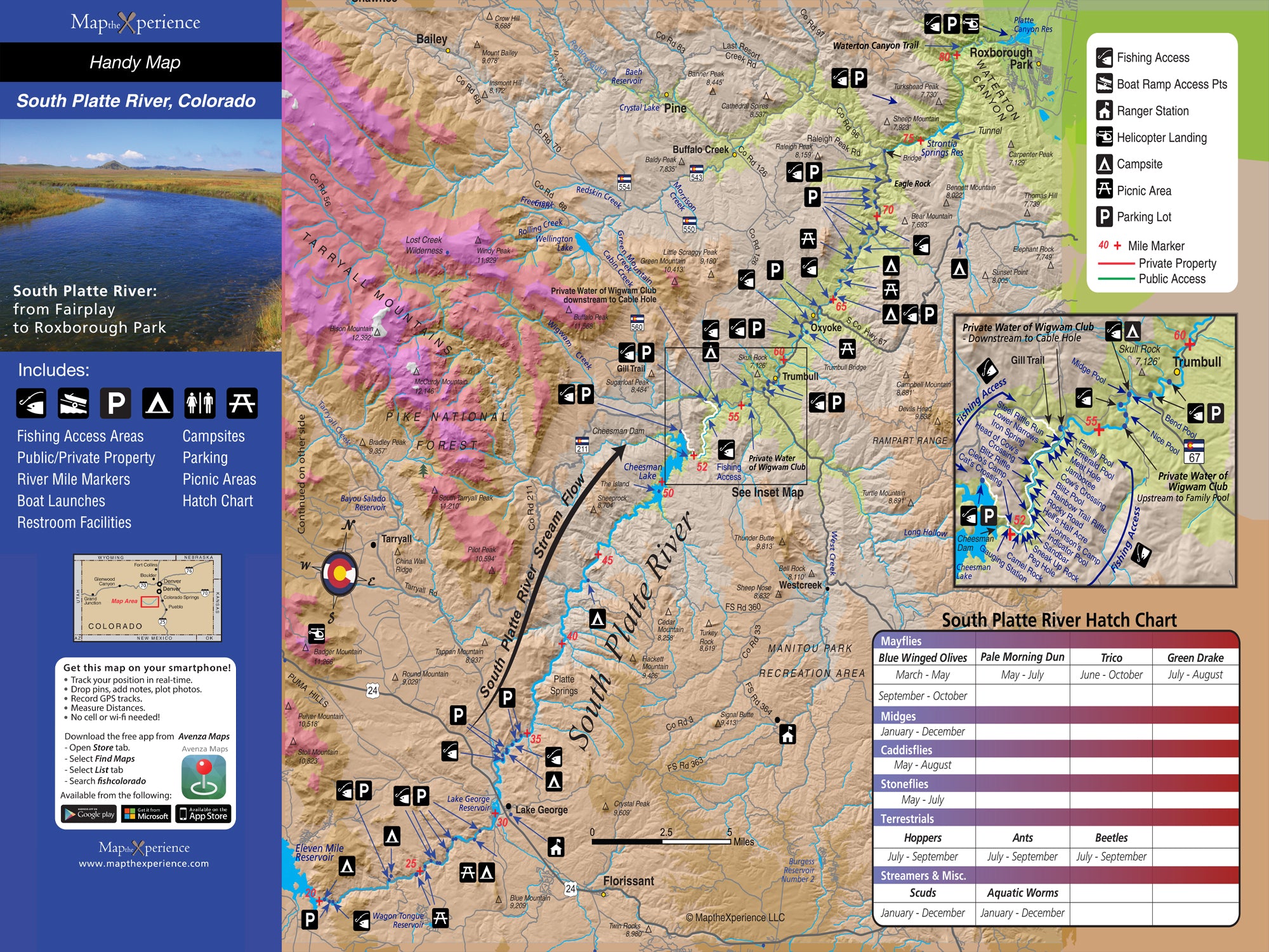
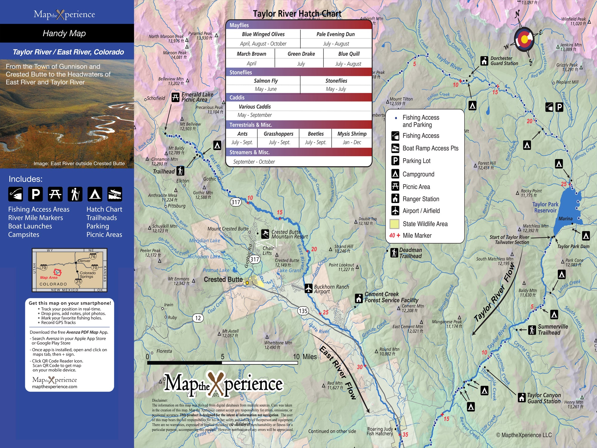
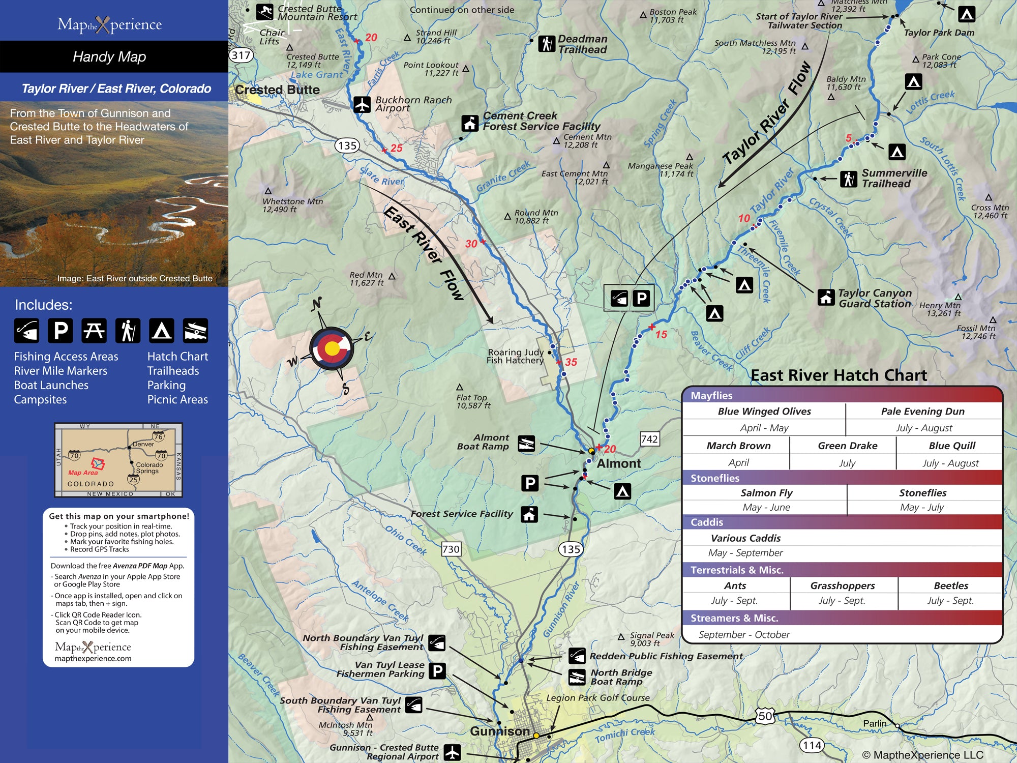
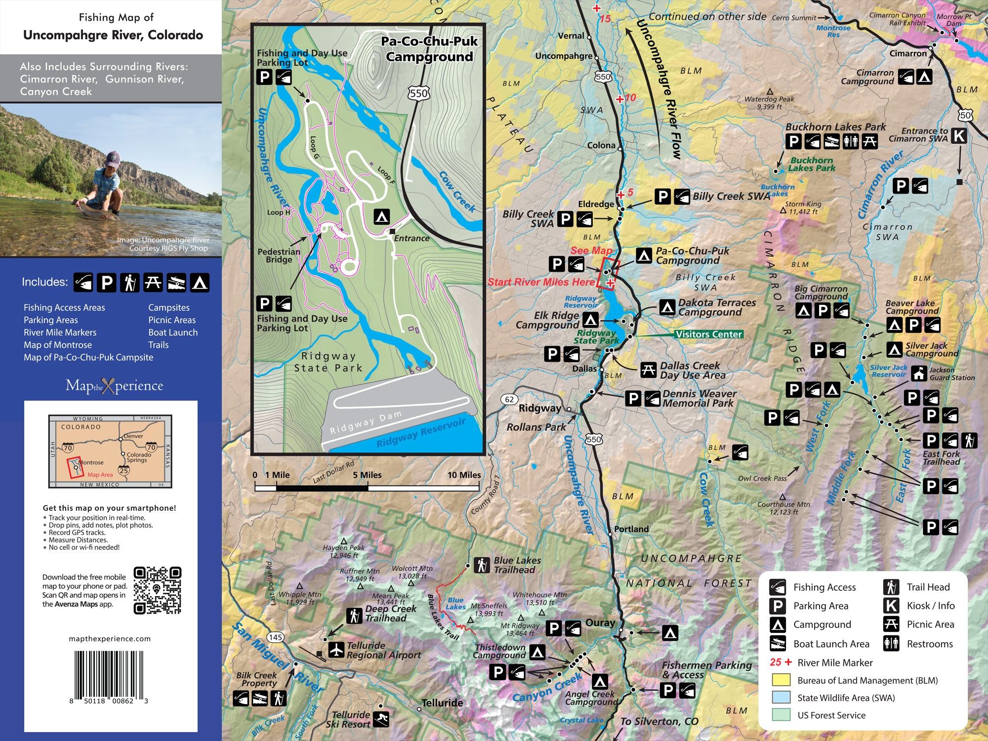
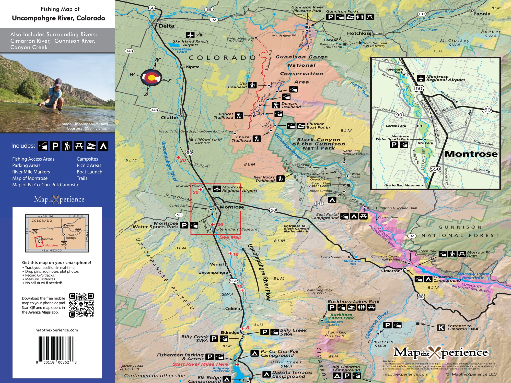
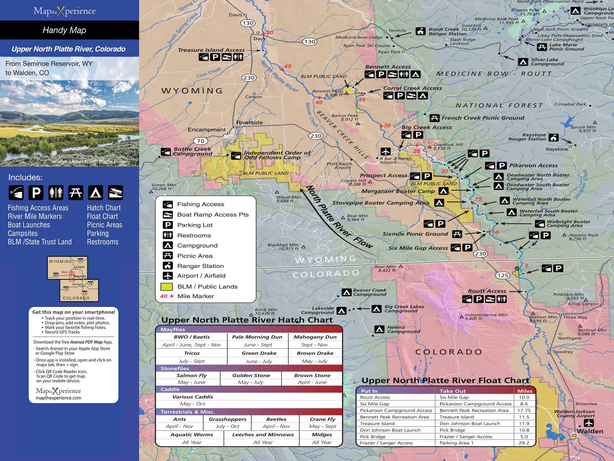
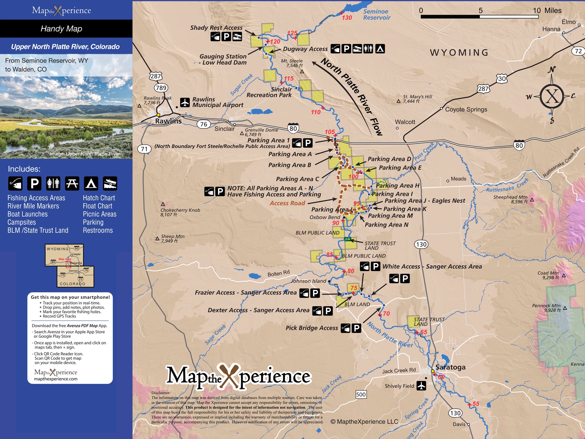
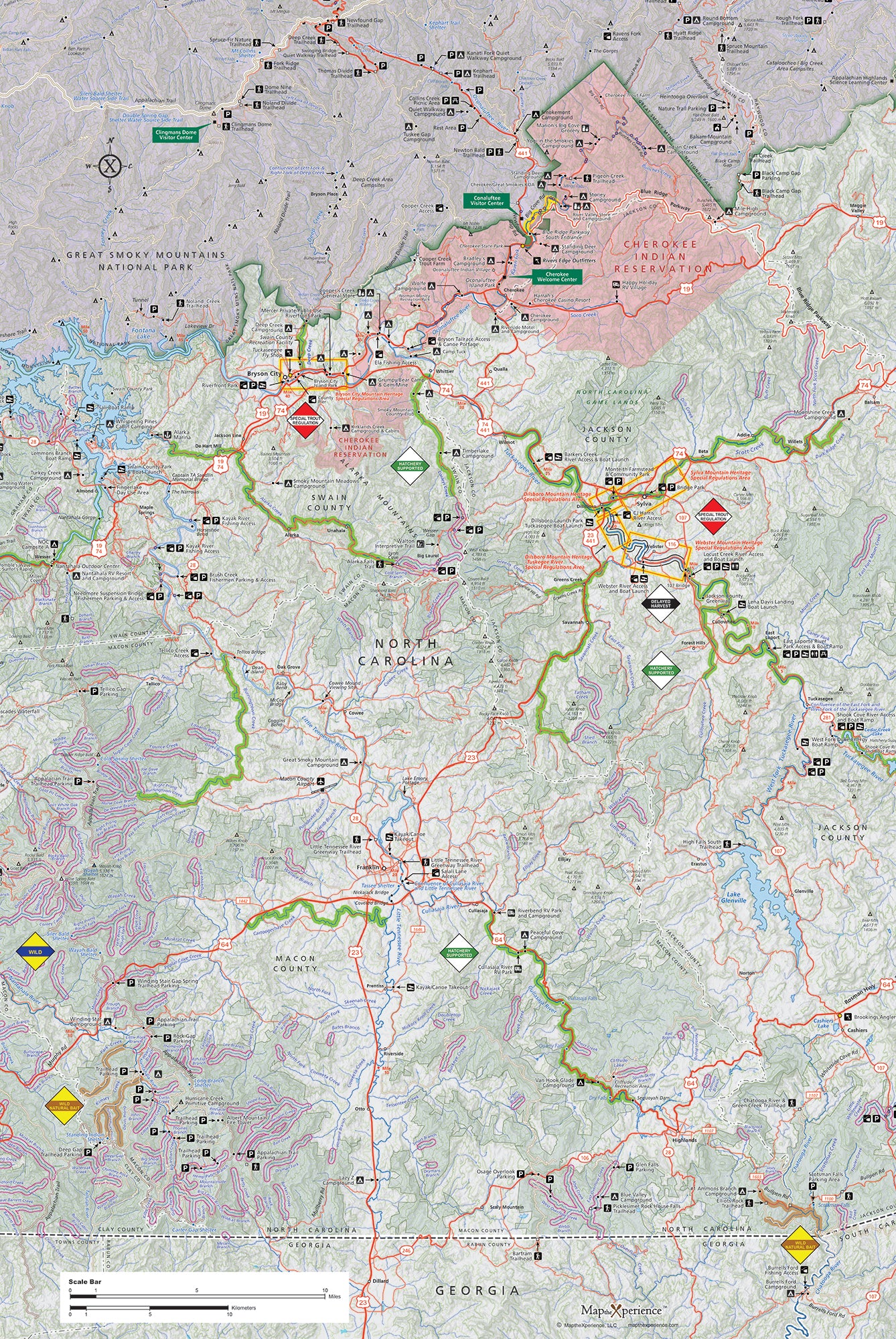
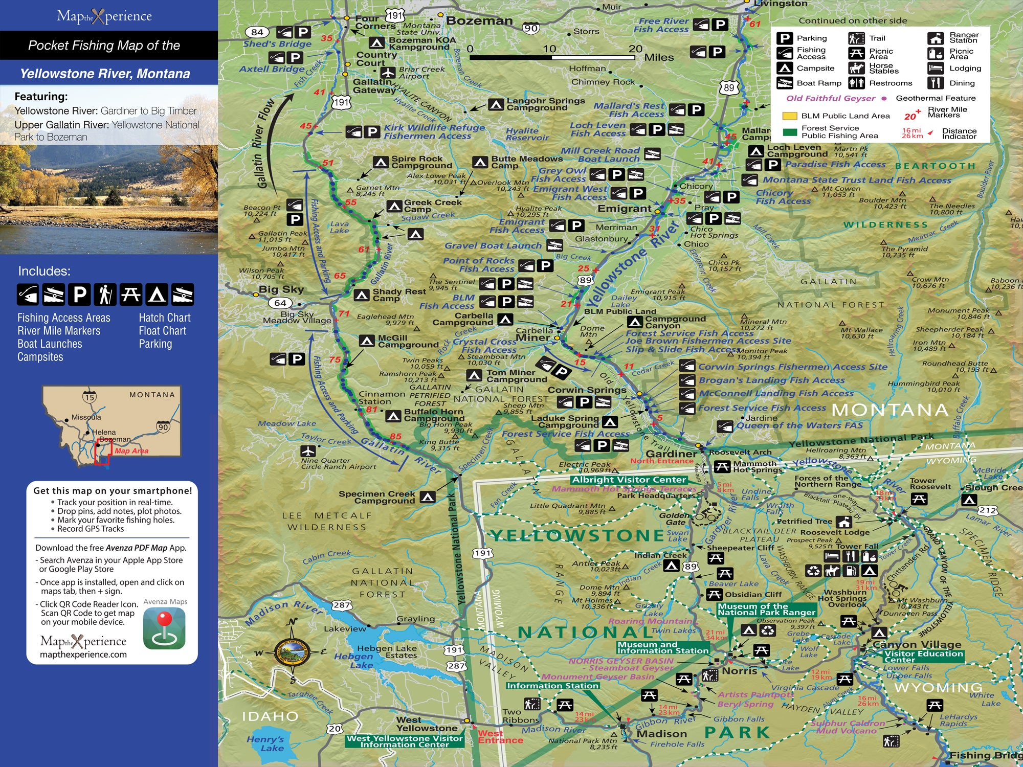
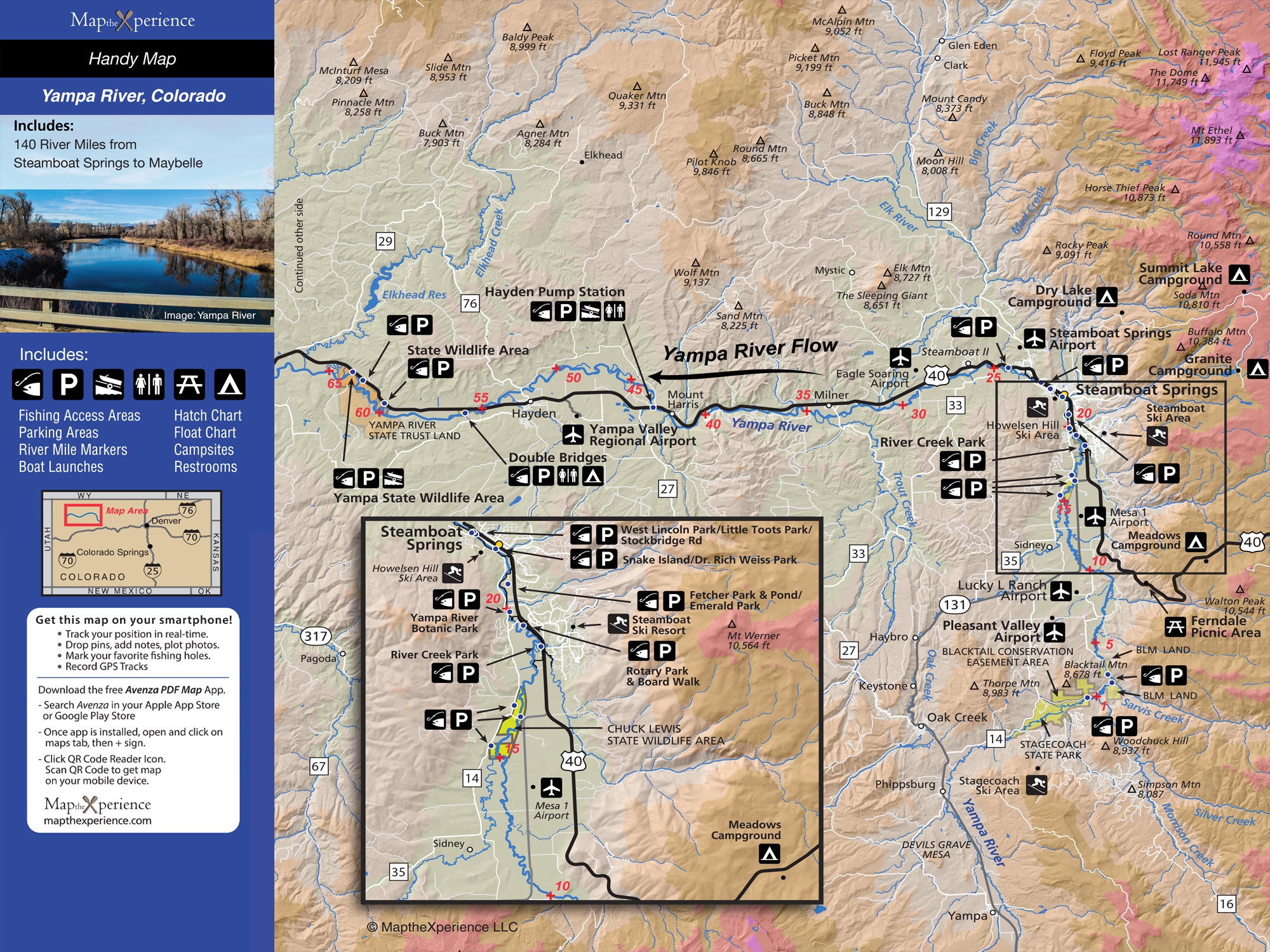
Complete River Coverage – Includes key stretches of fishable and floatable water
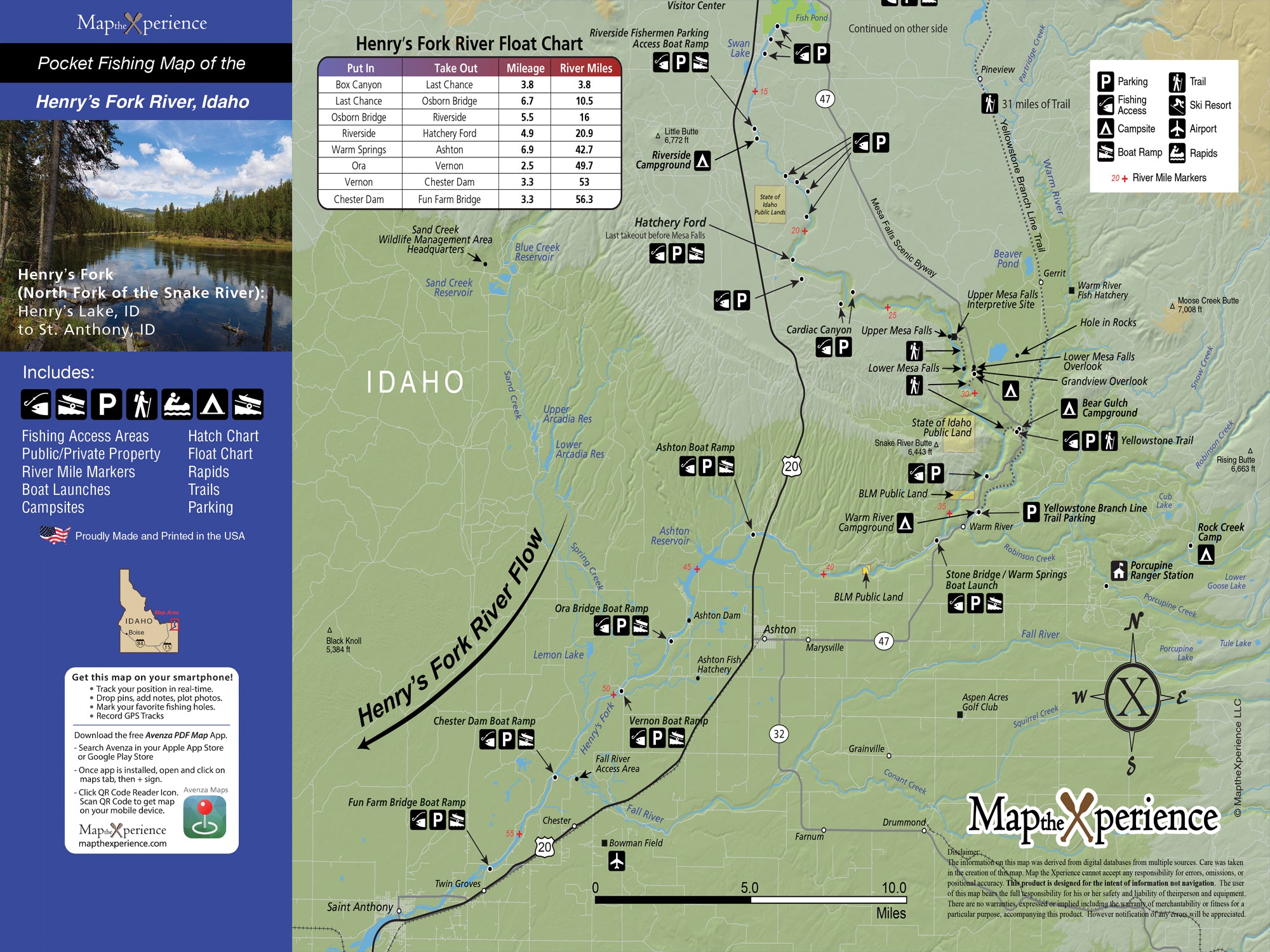
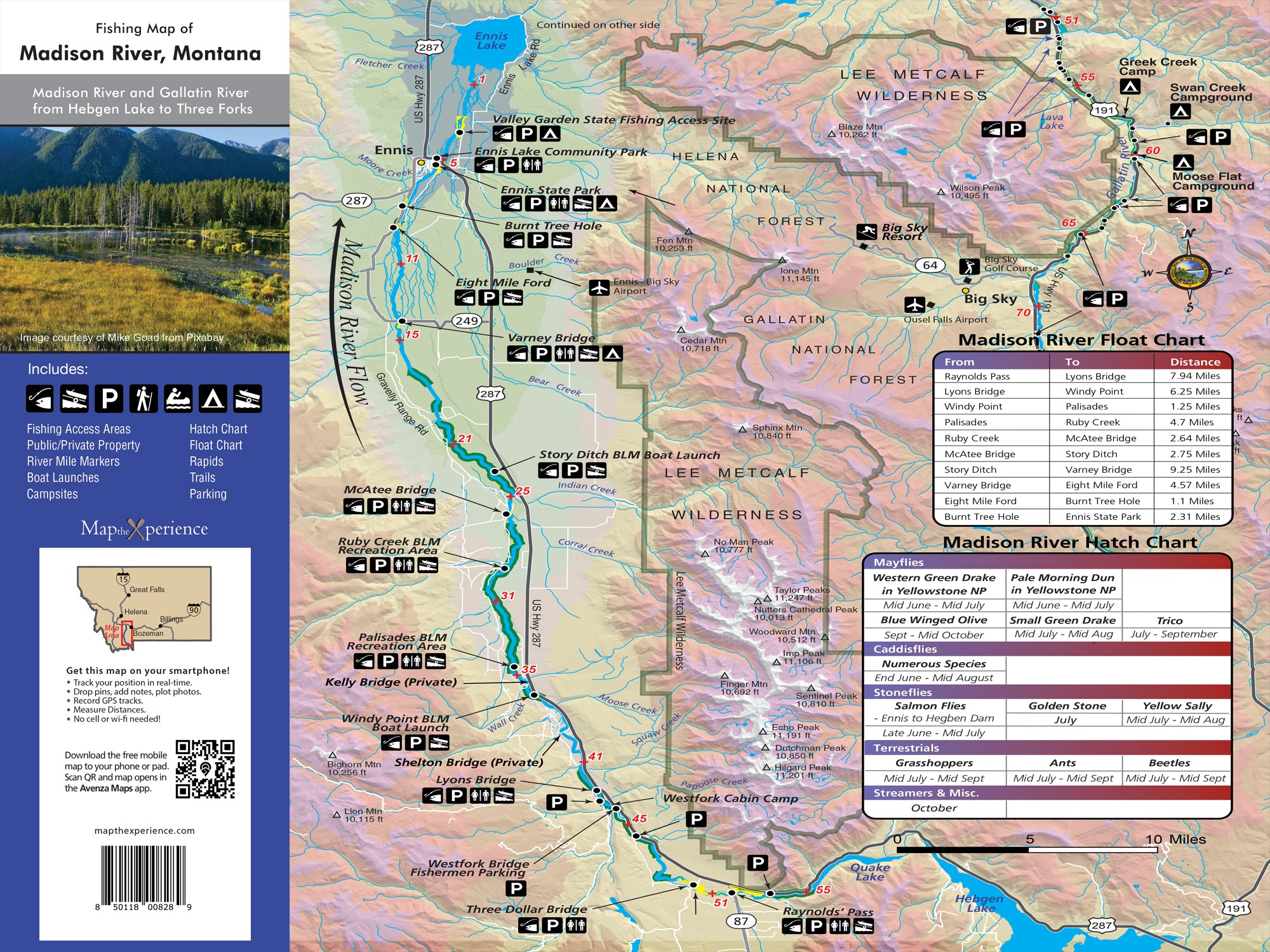
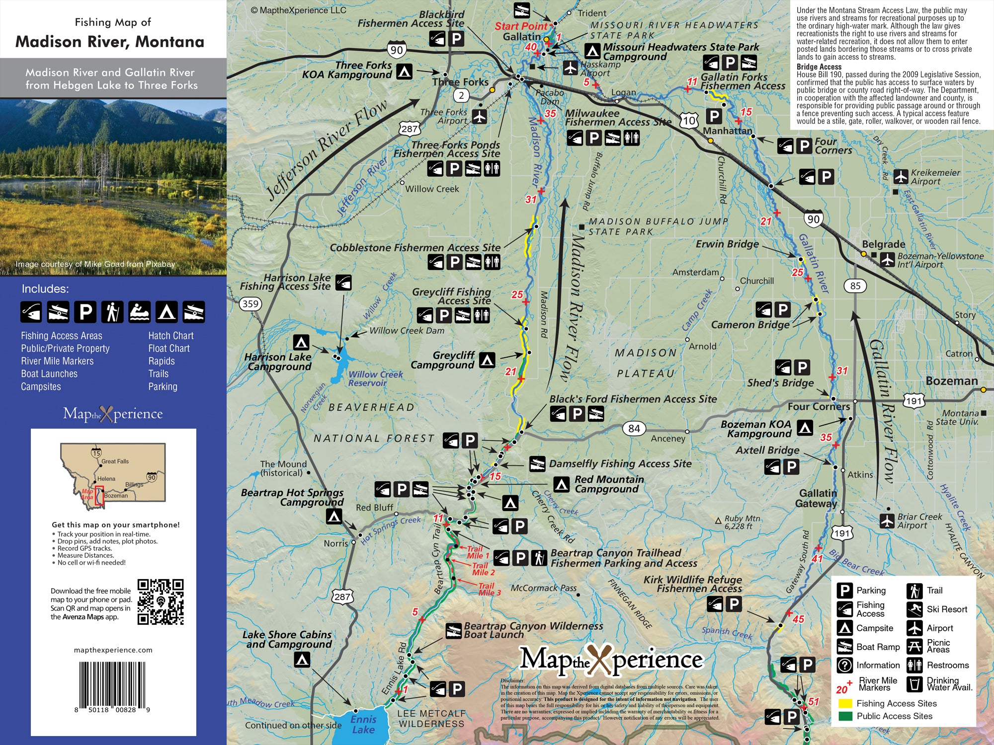
Access Points & Boat Launches – Every put-in and take-out, with nearby parking
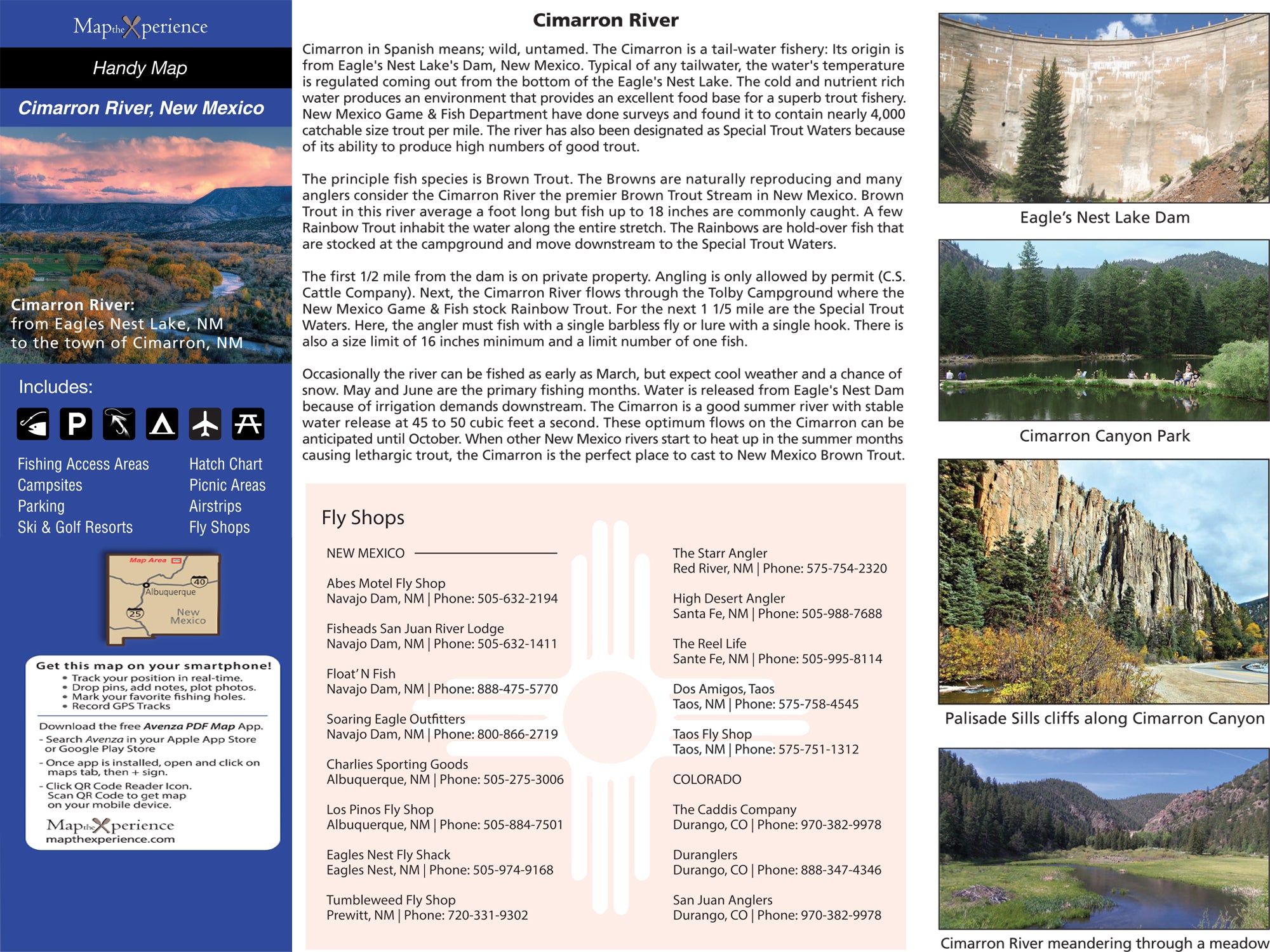
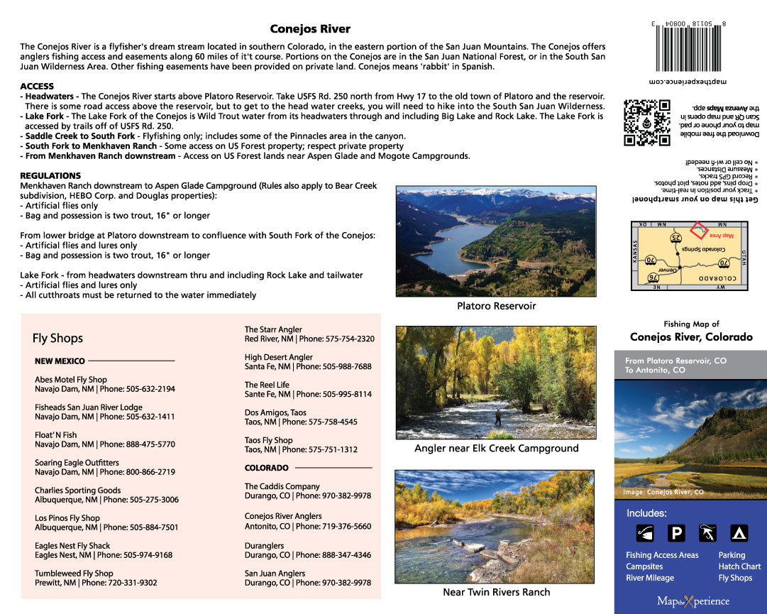
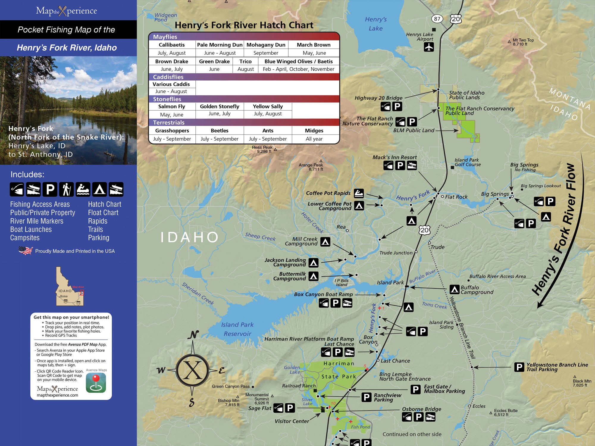
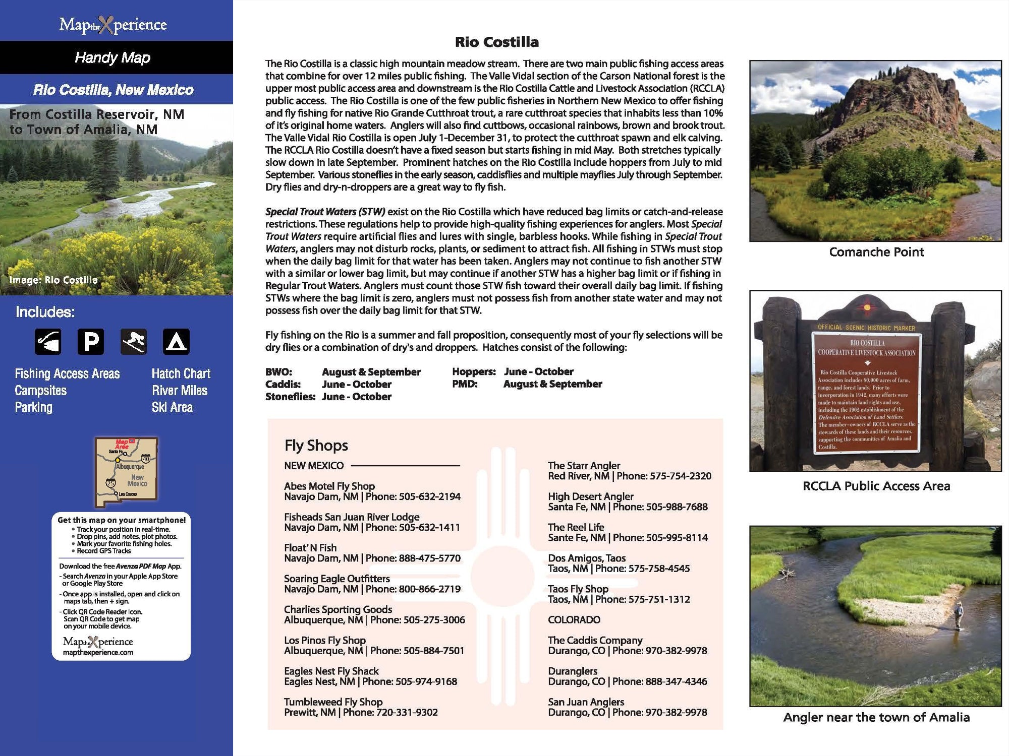
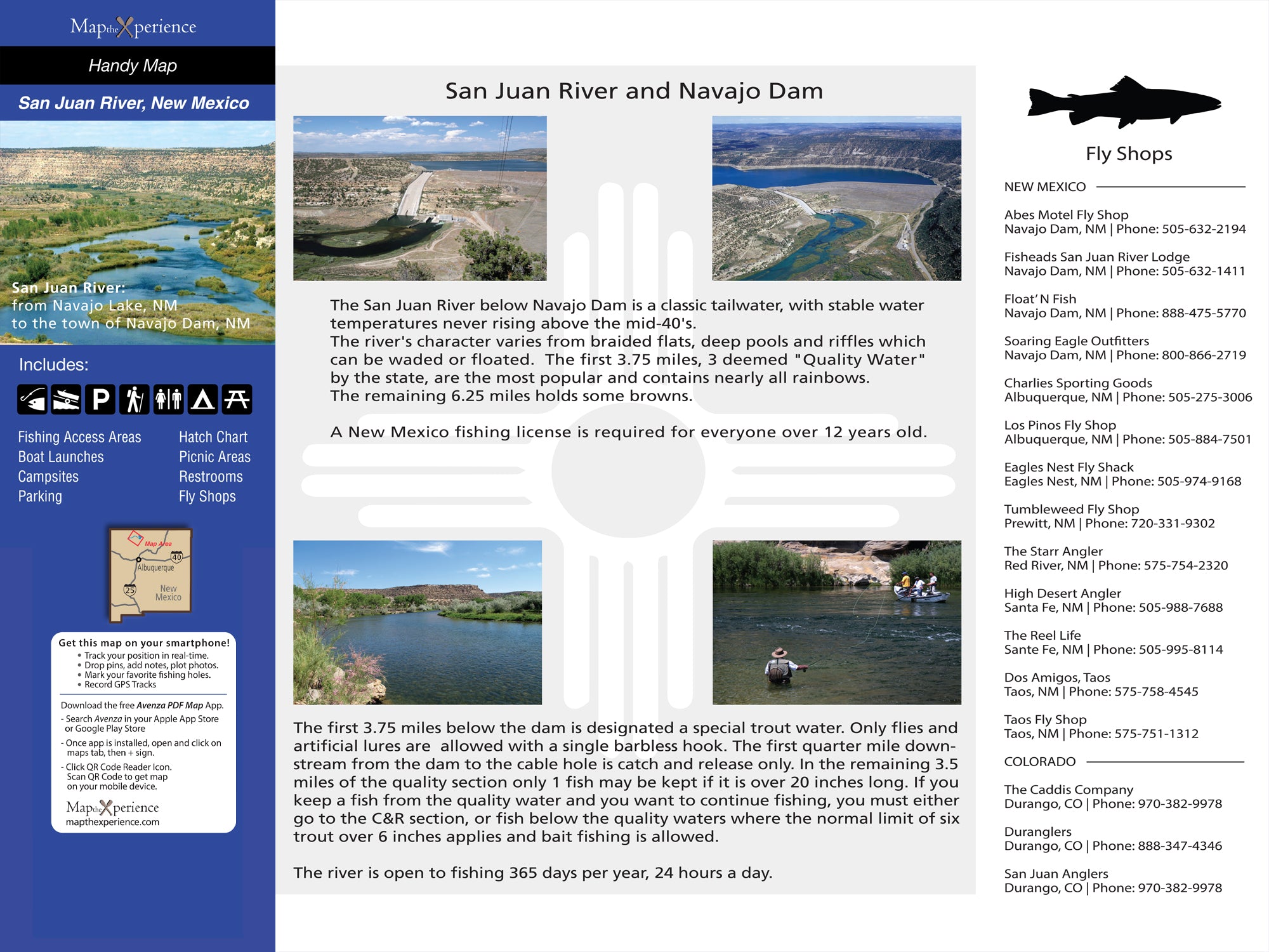
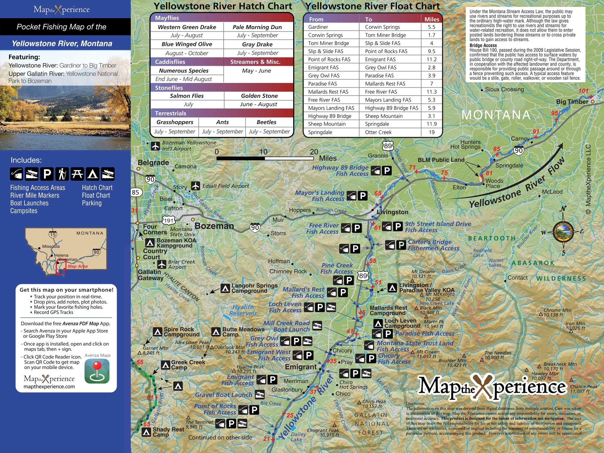
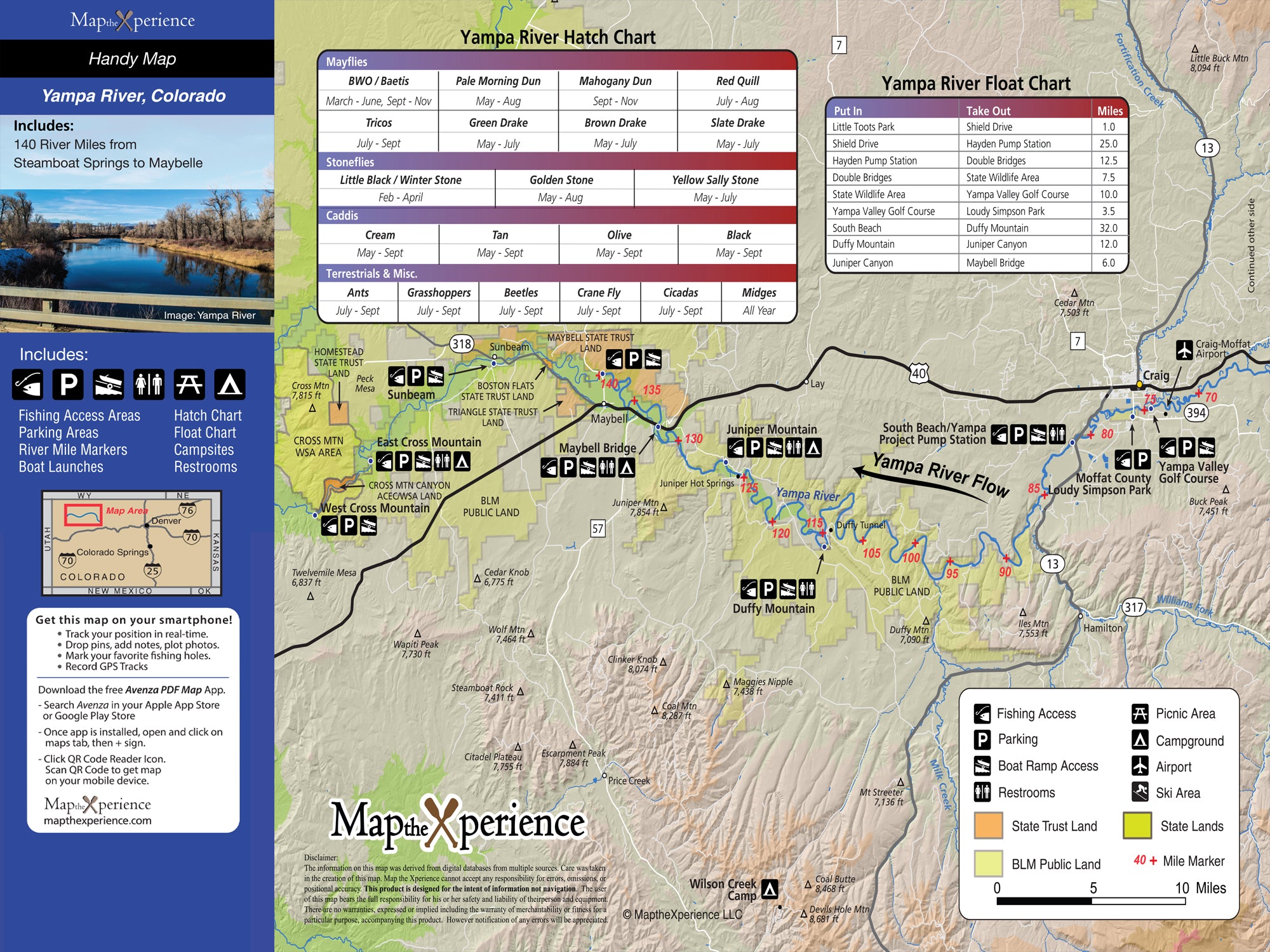
Fishing Info – Fish species by section, hatch charts, public/private boundaries
Public Land Boundaries – Federal, state, county, and city lands clearly marked
Campsites & Closures – Primitive and developed campsites, BLM info, closure zones
River Miles – Float mileage charts with distance markers between access points
Regulations – Local fishing and boating rules summarized
Product Specs:
- Full Size Maps: 4x8" folded / 36x24" unfolded
- Pocket Guides: 3x6" folded / 15x12" unfolded
- Material: Tear-resistant
- Bonus: Includes access to a Mobile Map
GPS-Enabled Mobile Map
- Works offline – perfect for remote river canyons
- Pinpoint your location as you float or fish
- More detail than the printed version
Whether you're drifting the Snake, wading the Colorado, or exploring secret creeks, Map the Xperience river maps give you the knowledge and confidence to make the most of every mile.
Field-proven. Angler-tested. River-ready.