Great Smoky Mountains National Park Fly Fishing Map | Paper + Free Mobile GPS Guide
Great Smoky Mountains National Park Fishing Map
Wild trout. Remote streams. Your essential guide to fishing deep in the Smokies.
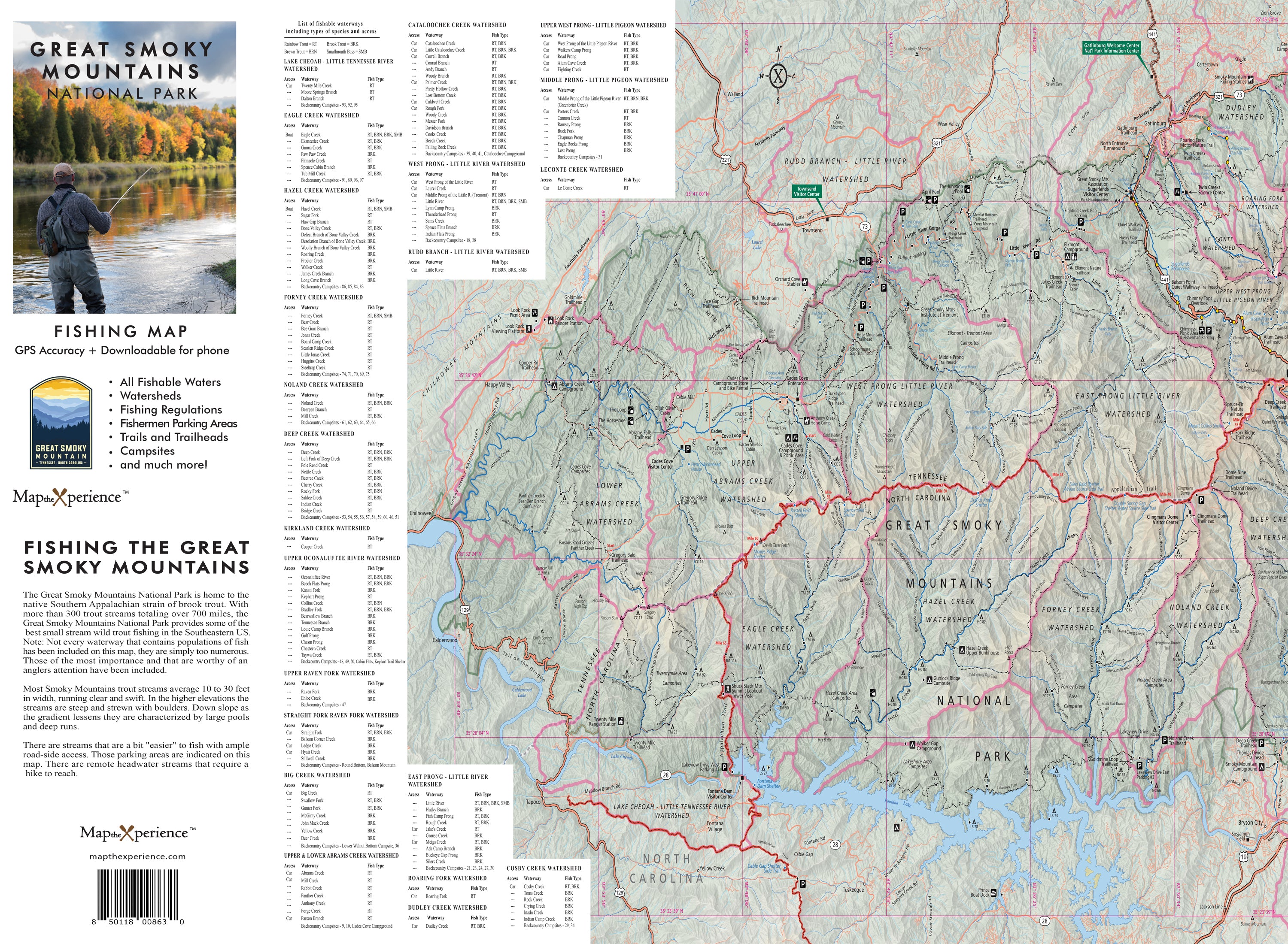
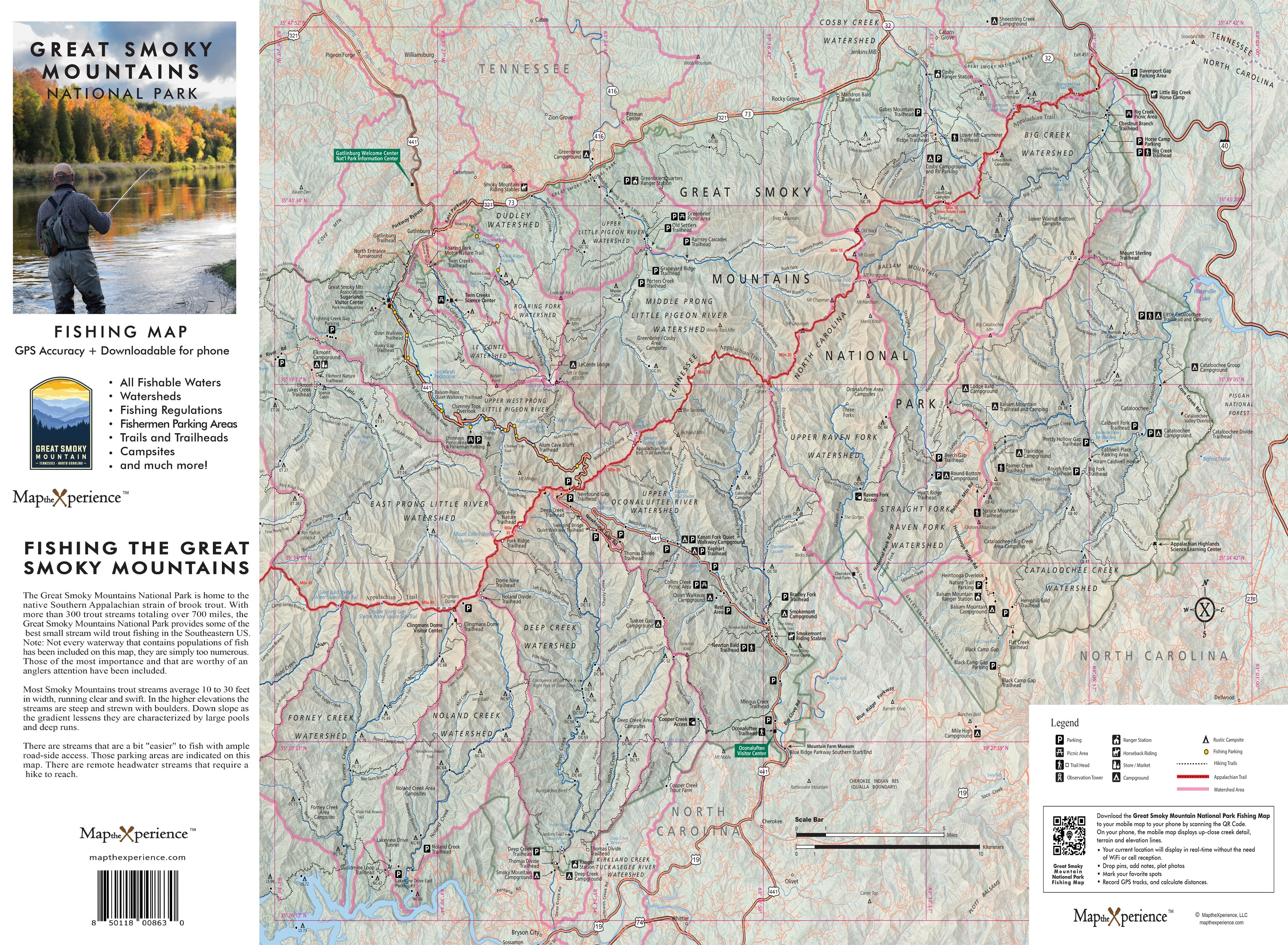
The Great Smoky Mountains National Park Fishing Map is built for anglers who want to go beyond the roadside and into the heart of Appalachia’s premier trout water. Covering legendary streams like Little River, Abrams Creek, Deep Creek, and Hazel Creek, this detailed, large-format map helps you plan smarter trips and discover wild, fishable waters across the park.
Designed for serious fly anglers chasing native brook trout, wild rainbows, and browns, this guide highlights public fishing access points, trailheads, stream mileage, backcountry campsites, and prime trout zones—giving you everything you need to explore confidently and fish with purpose in the Smokies.
What This Map Includes
-
Full coverage of the park’s top fishable rivers and streams
-
Public access, hiking trails, and backcountry entry points
-
River and stream mileage clearly marked for route planning
-
Backcountry campsite locations near key fishing waters
-
Fishing regulations and fish species identification guide
Large Format for Total Clarity
-
Sized at 36” x 24”, folds easily for use on the go or at the trailhead
-
High-resolution printing for clean, readable trail and stream data
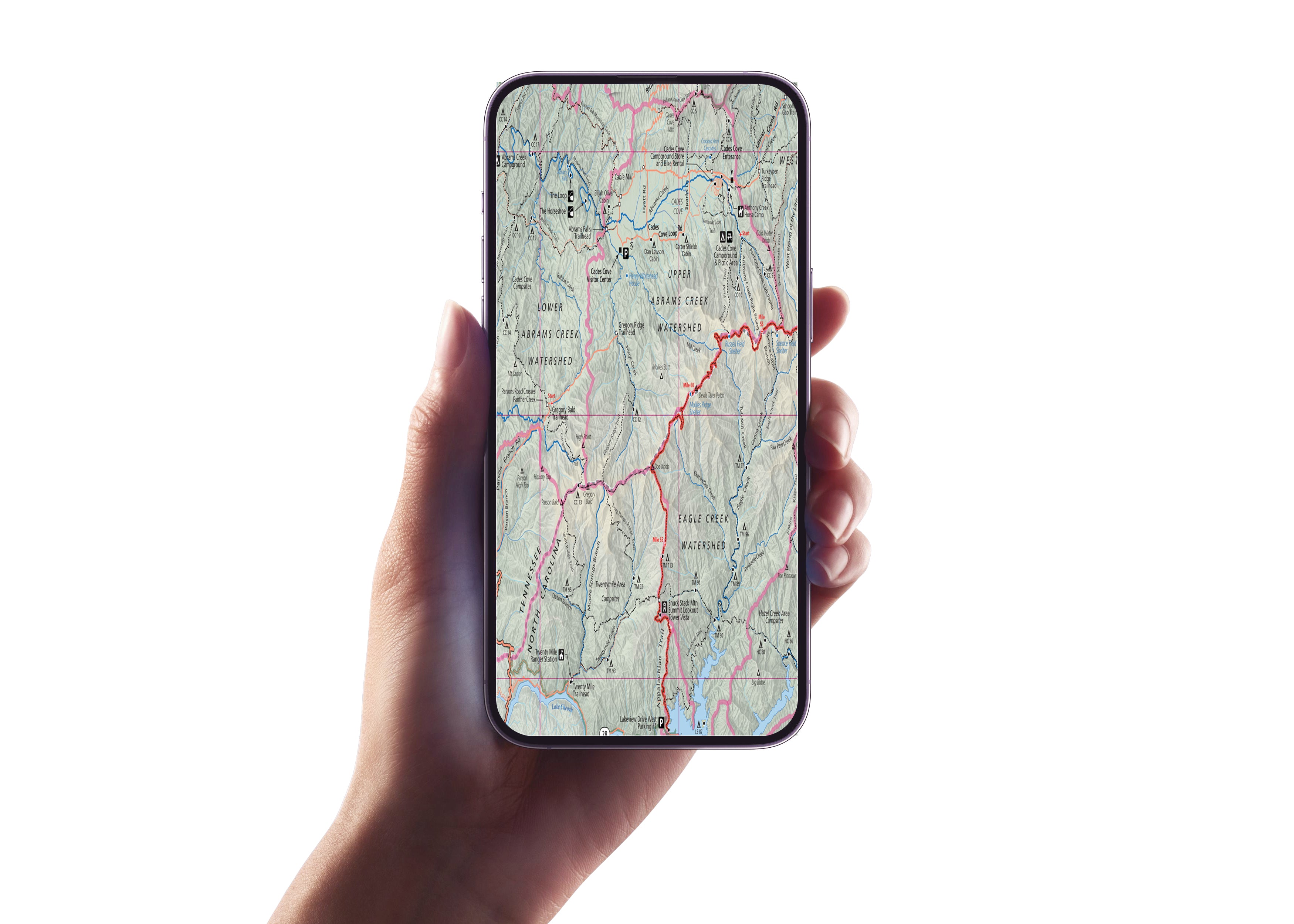
Includes a GPS-Enabled Mobile Map (via Avenza Maps)
-
Works offline — no cell service needed in remote backcountry areas
-
GPS-enabled so you can track your location in real time
-
Zoom in for more detail than the printed map
-
Matches the print version for seamless cross-reference
Whether you're swinging a dry fly on Abrams Creek, exploring the solitude of Hazel Creek, or bushwhacking into lesser-known brookie water, this map is your trusted tool for getting it right.
Fish deeper. Plan smarter. Explore the Smokies like never before.
Order your Great Smoky Mountains Fishing Map today and discover the wild side of GSMNP.