Henry’s Fork Idaho Fly Fishing Map | Public Access Guide
Henry’s Fork River, Idaho Pocket Guide + Mobile GPS Map
Unlock the Magic of Idaho’s Most Iconic Trout Water.
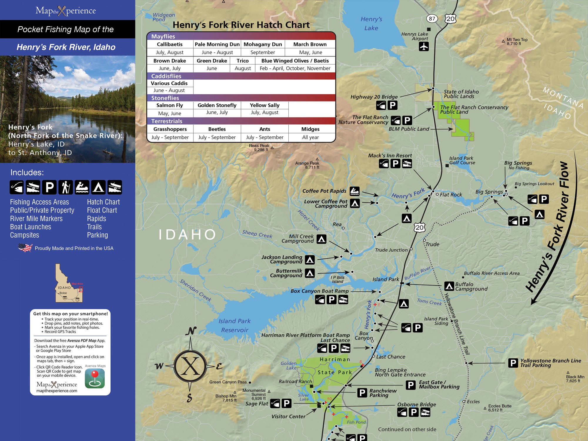
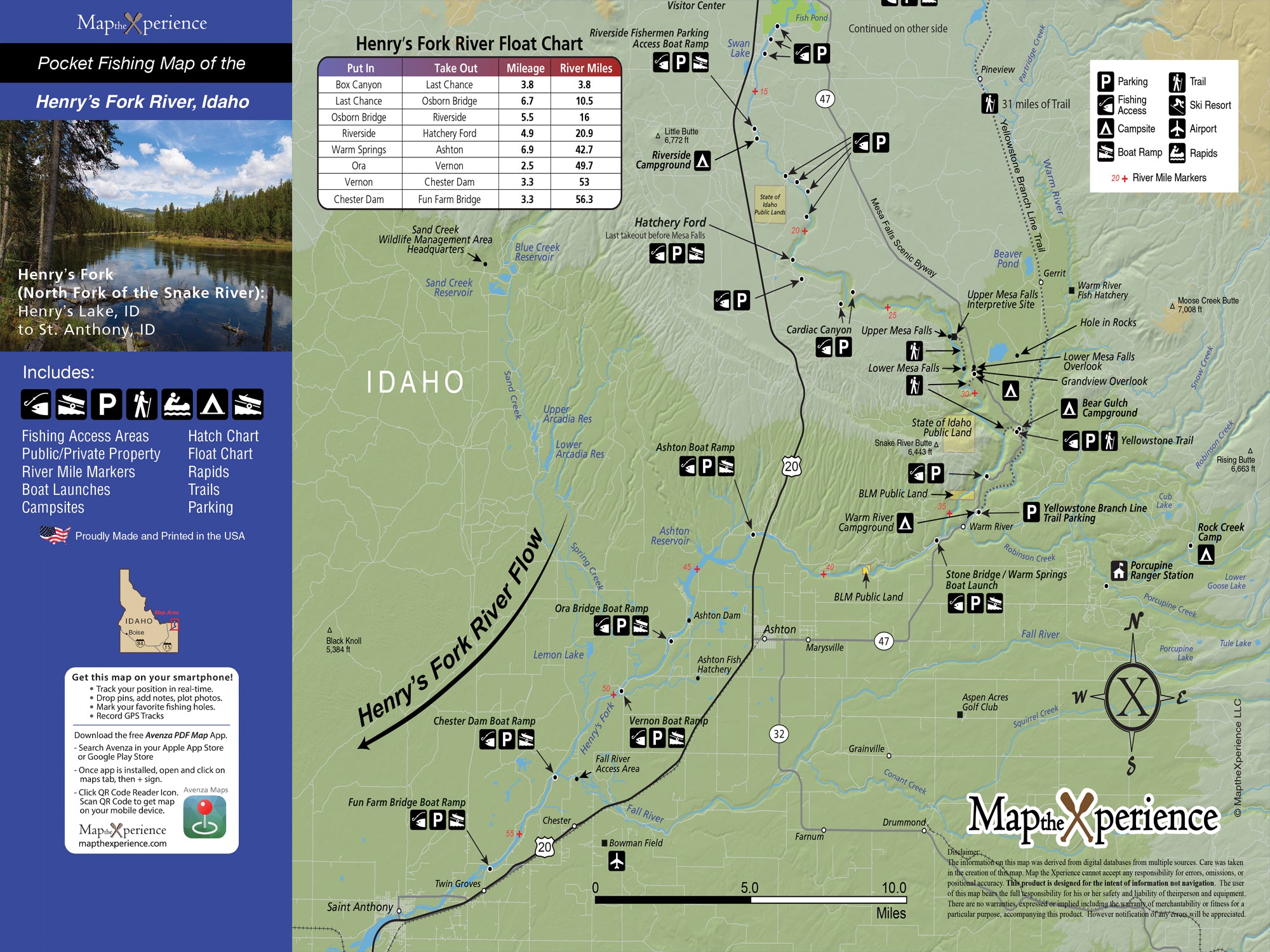
Fish one of the most storied rivers in the West with our Henry’s Fork River Pocket Guide—designed for serious fly anglers. From the technical dry fly drifts of Harriman Ranch to the deep, nymph-holding runs of Box Canyon, this map covers every stretch you need to know, including Riverside, Ashton, and St. Anthony.
Built with precision and passion by local experts, this detailed guide shows public fishing access, river miles, boat ramps, campsites, and the river’s most productive trout water. Whether you’re stalking risers or rowing the canyon, this map is your key to fishing smarter and going farther.
What You’ll Find Inside
-
Covers Box Canyon, Harriman Ranch, Riverside, Ashton, and more
-
Pinpoints public access, float launch points, river mileage, and campgrounds
-
Designed for both wade and float anglers
-
Target legendary rainbow and brown trout with confidence
Pocket-Sized & Field-Ready
-
Unfolded: 15” x 12” | Folded: 3” x 6”
-
Lightweight, rugged, and adventure-tested—made to travel with you
Includes a Mobile Map (via Avenza Maps)
-
Works offline—no signal needed
-
Real-time GPS tracking shows your position on the water
-
Zoom in for hyper-detailed river data
-
Identical layout to the printed version for seamless use
Whether you’re new to the Fork or know every bend by heart, this map is your ultimate companion to Idaho’s most technical and rewarding trout river.
Fish smart. Go farther. Conquer the Henry’s Fork.