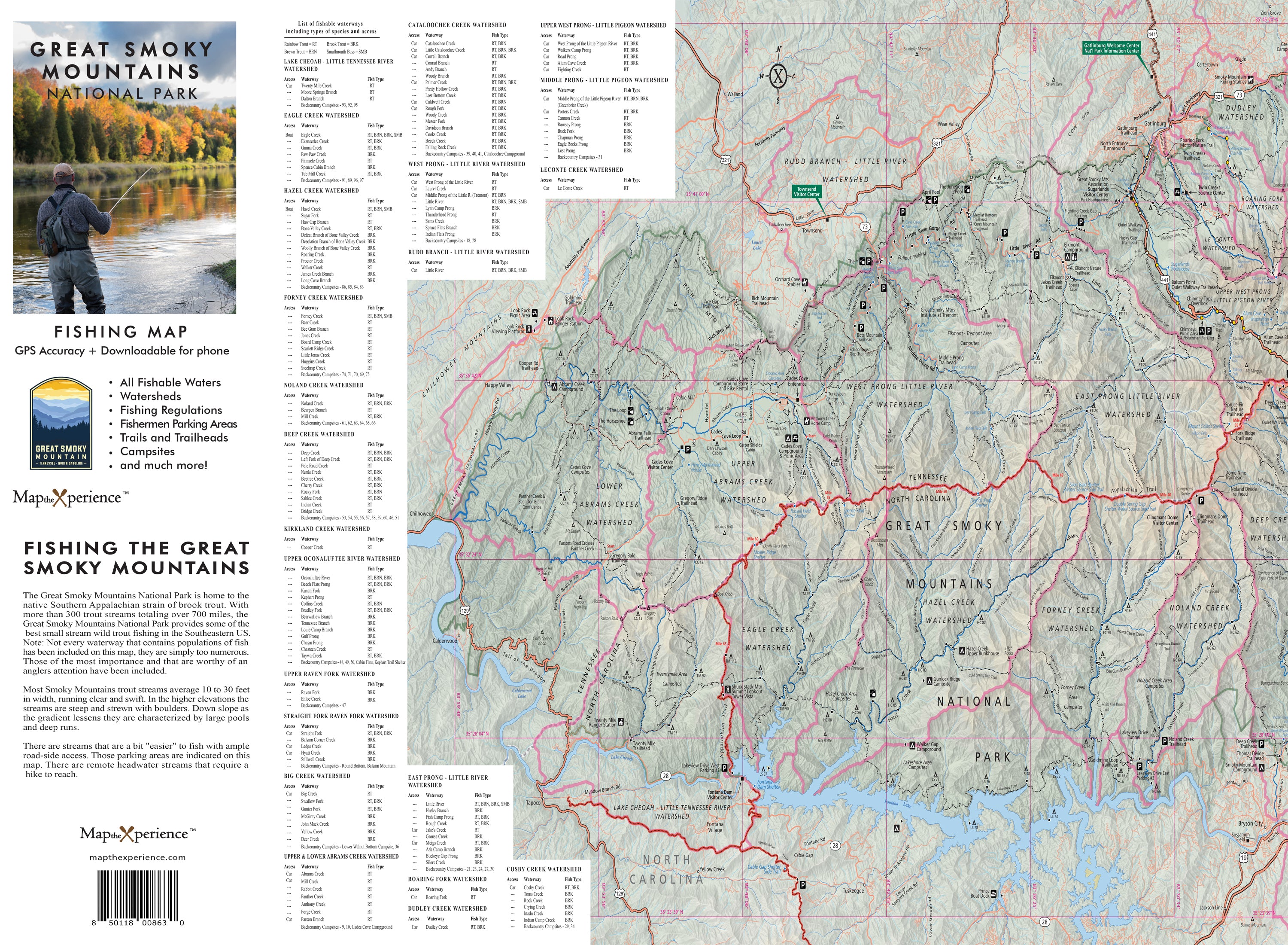
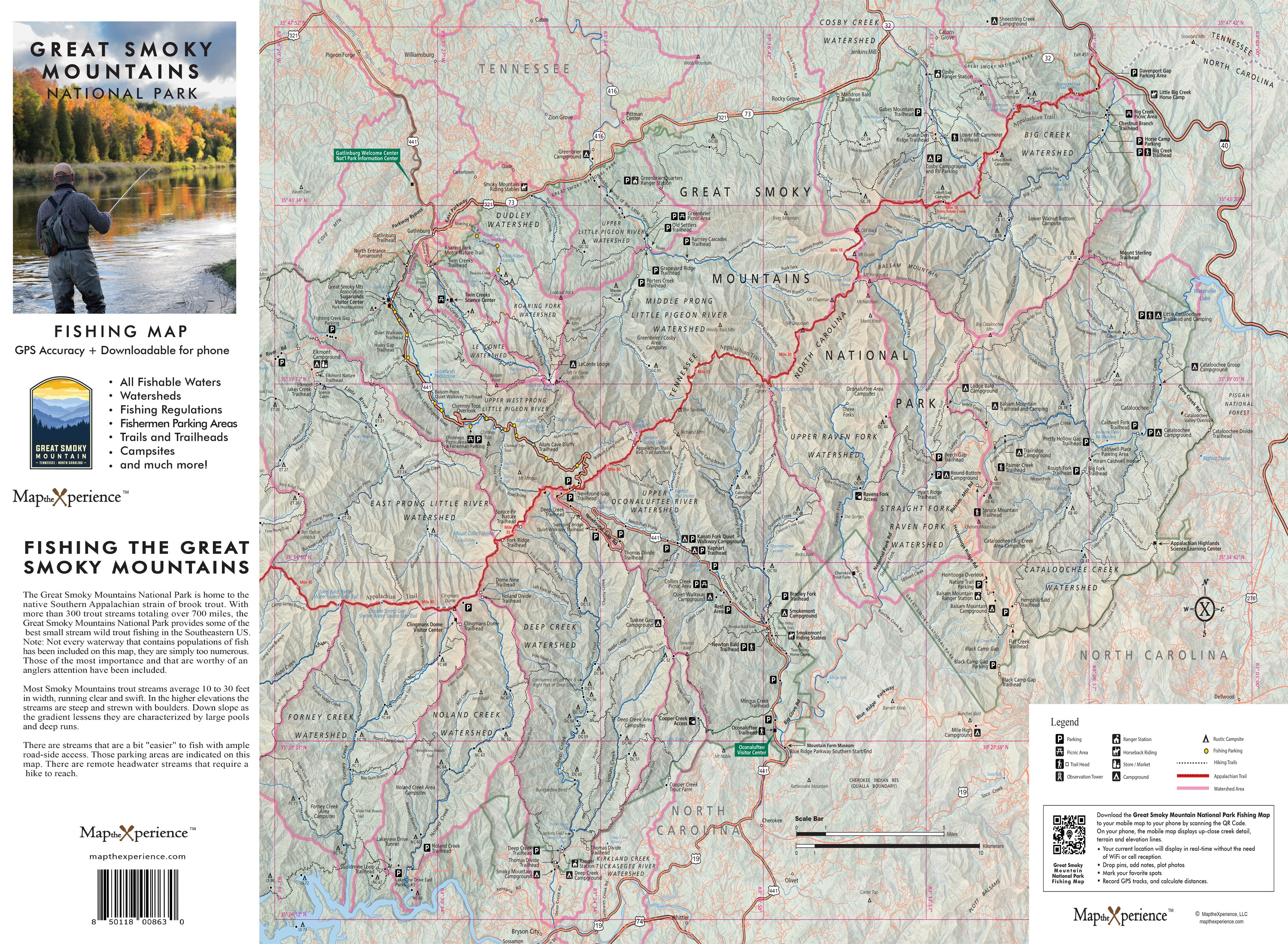
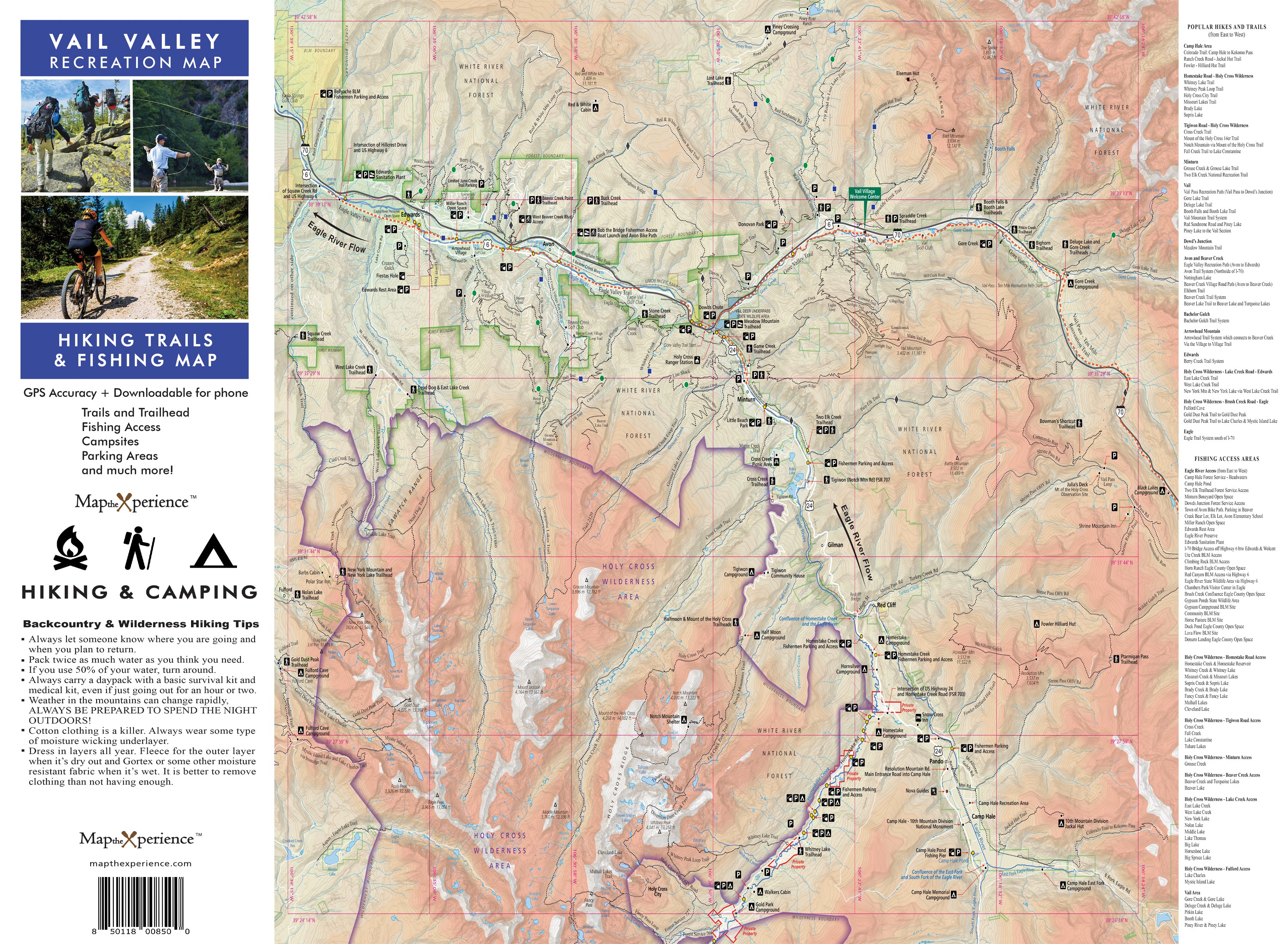
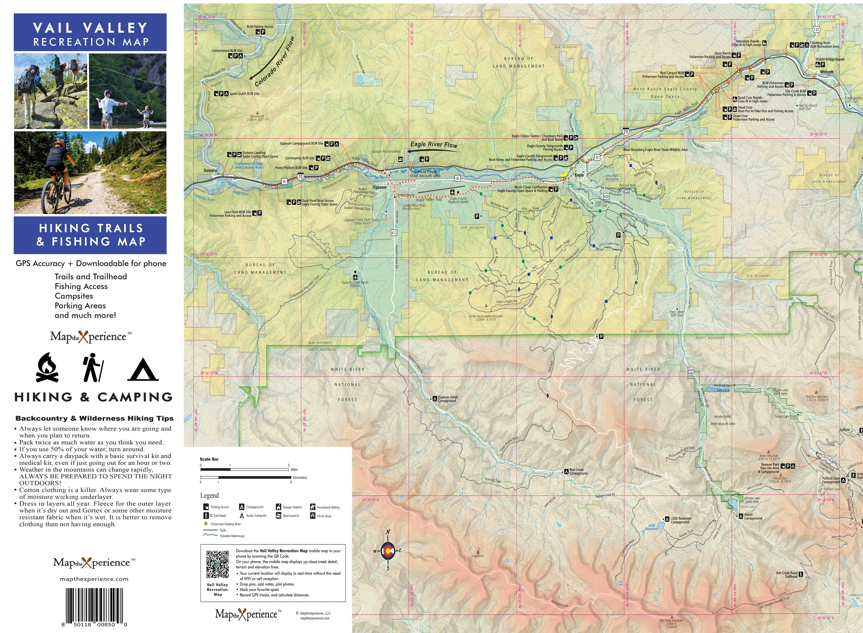
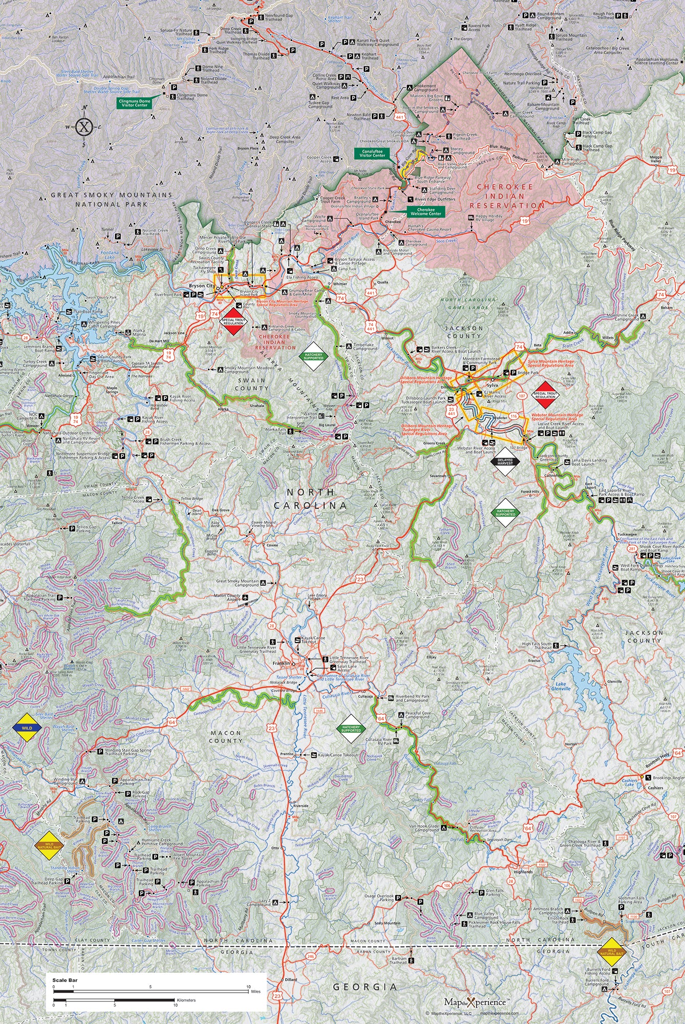
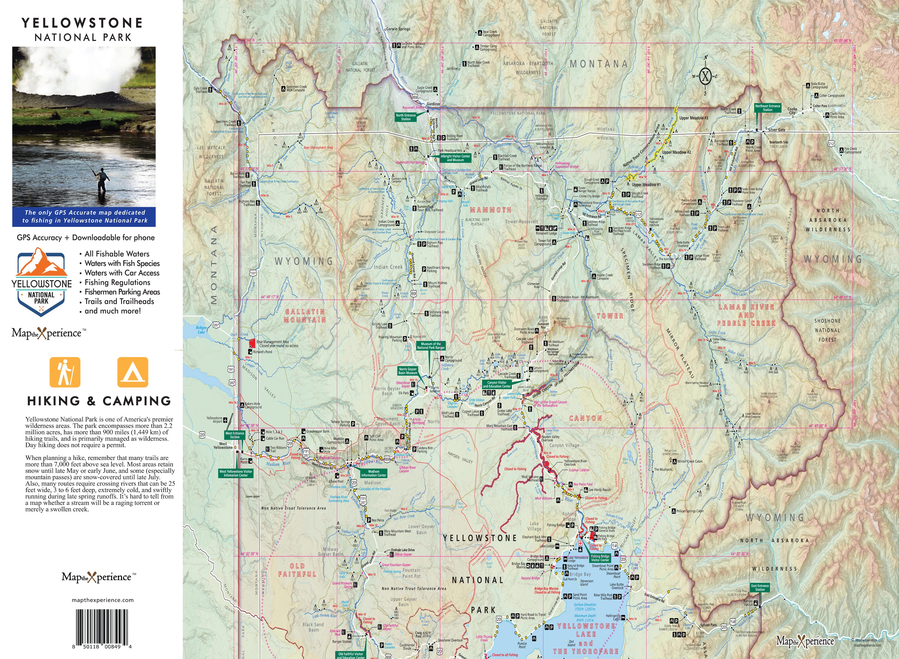
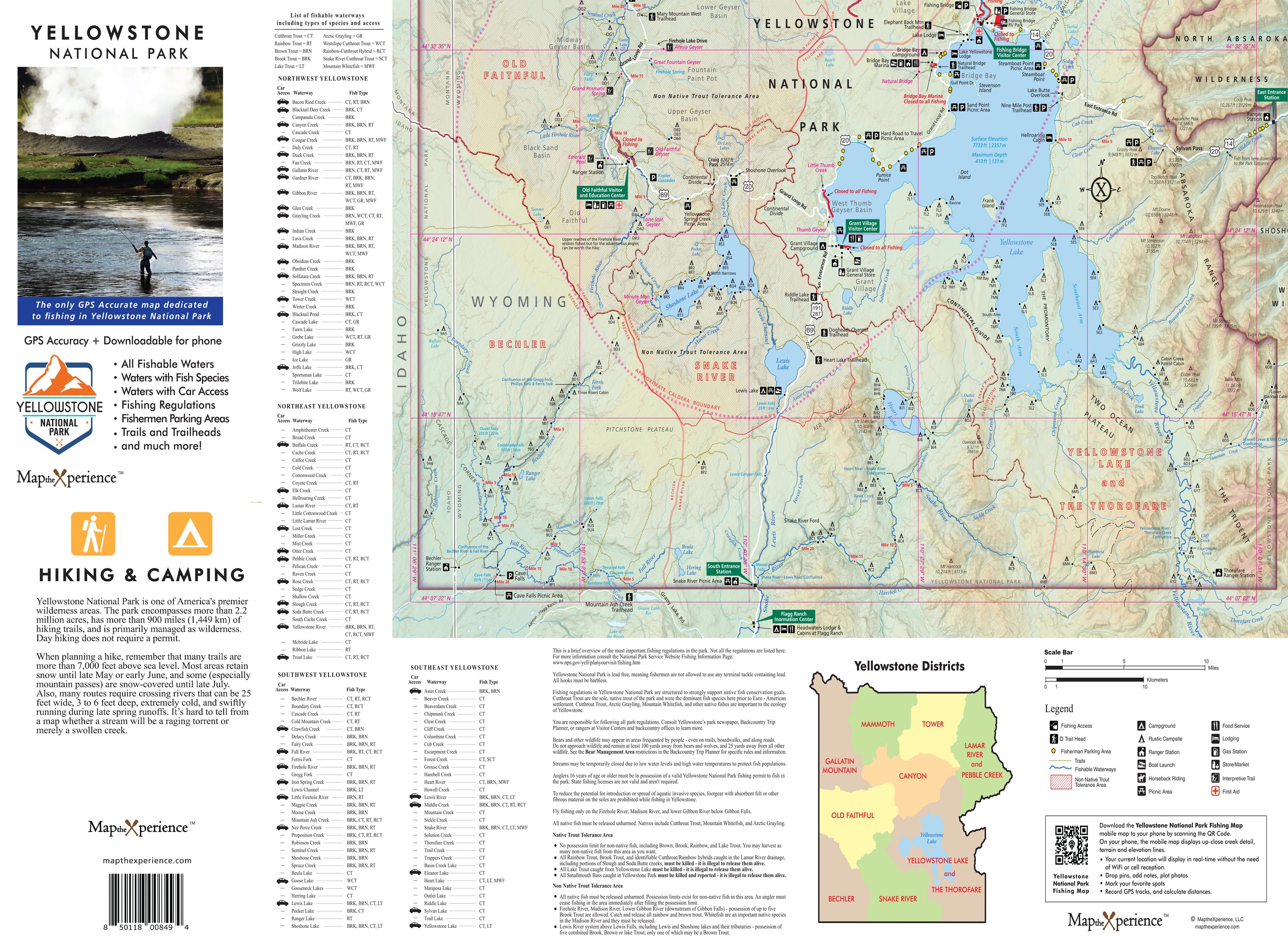
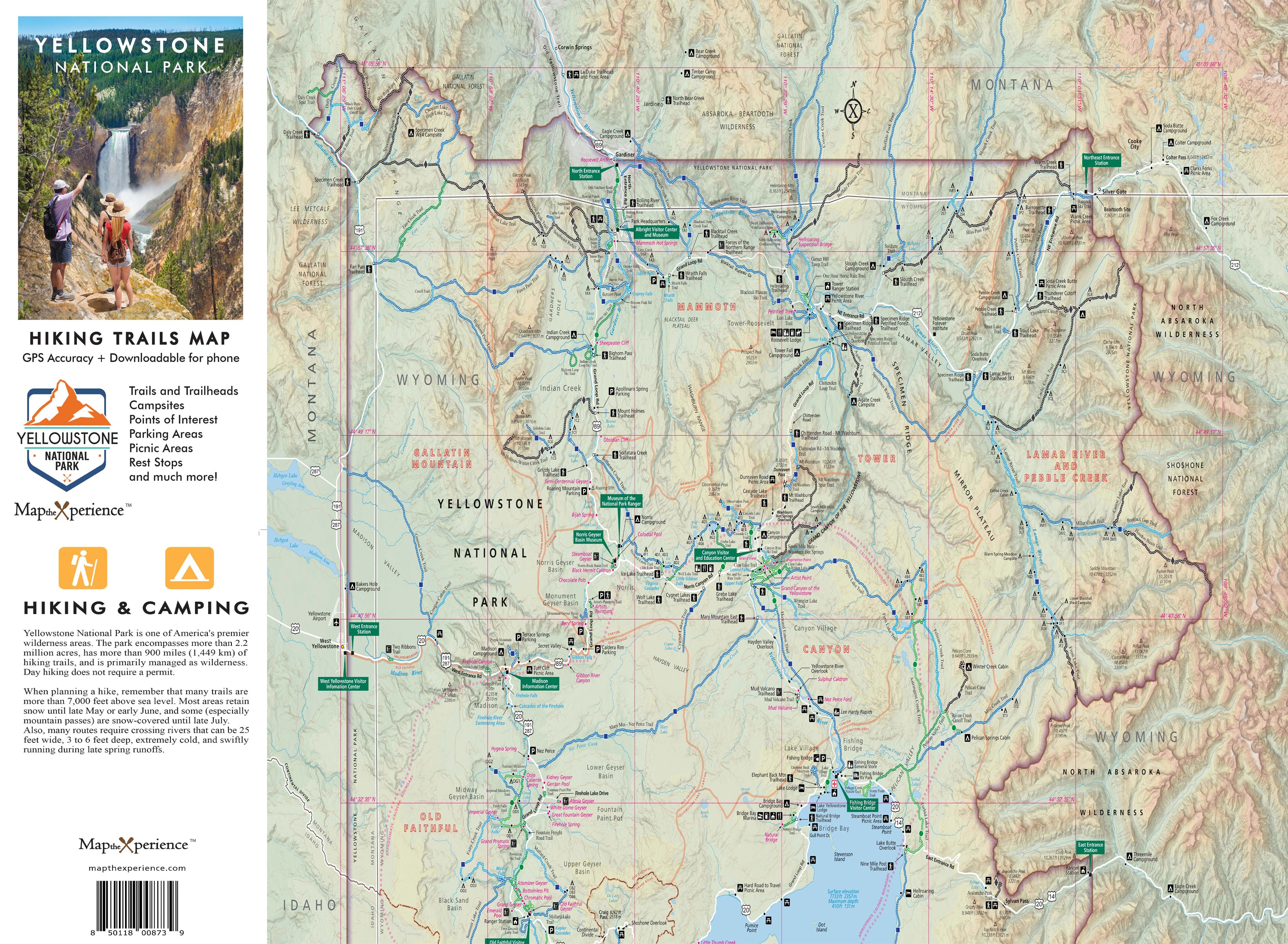
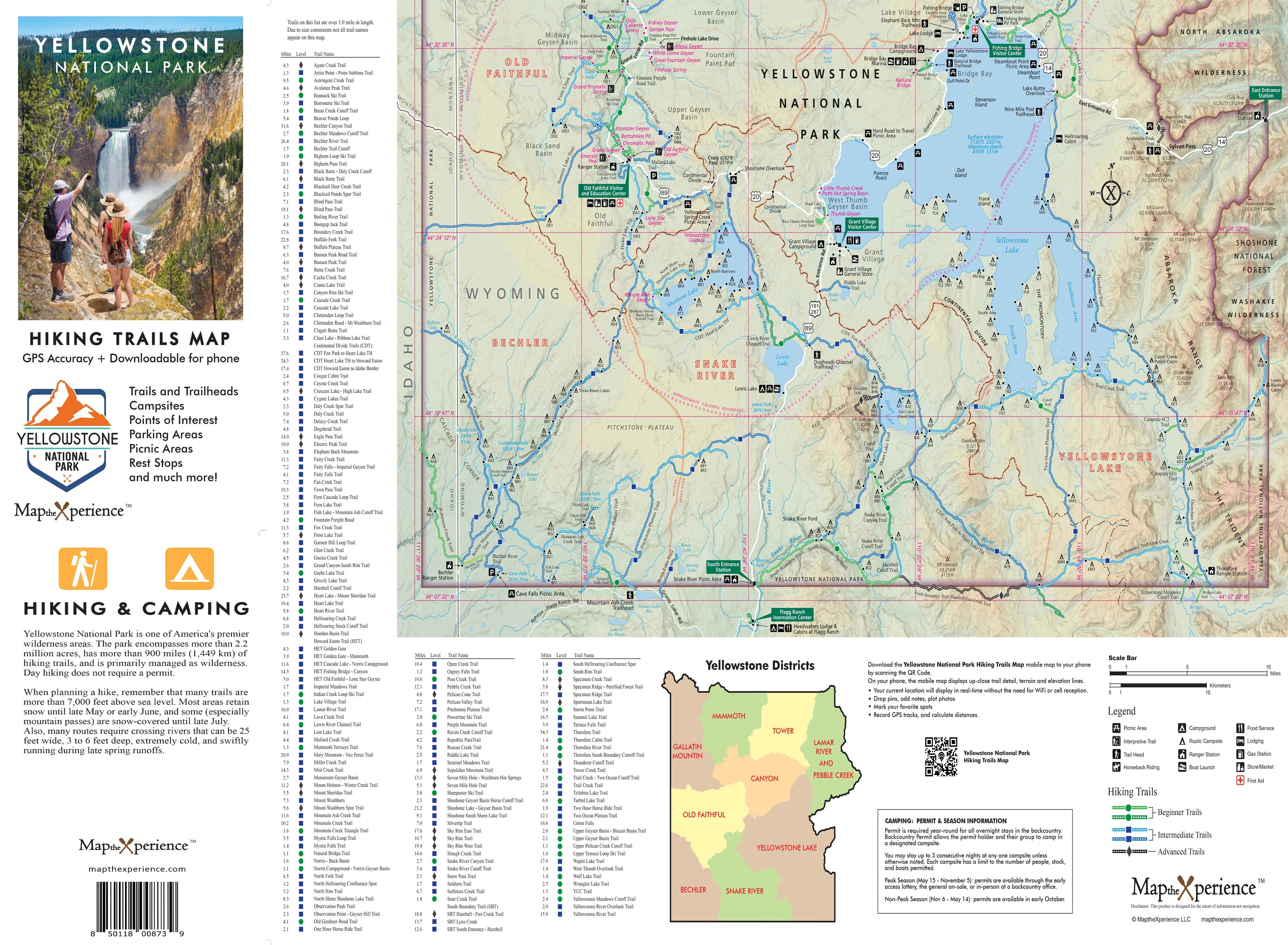
National Park Maps: Your Ultimate Guide to Exploring Nature's Wonders

National Park Maps: Your Ultimate Guide to Exploring Nature's Wonders

Introduction

National Parks are nature's playgrounds, offering breathtaking landscapes, diverse wildlife, and endless opportunities for adventure. Whether you're planning a family vacation, a solo backpacking trip, or a weekend getaway, having a reliable national park map is essential to make the most of your outdoor experience. In this article, we'll dive into why our national park maps will enhance your exploration.

We create our GPS accurate National Park Maps with you, the end user in mind. 

We keep it simple.  We include the information you need to enjoy your time in our National Parks.  Includes all hiking trails, points of interest, prime fishing waters, campgrounds, backcountry campsites, visitor centers, restrooms, fuel locations, trailheads and more.   Two maps in one.  Paper map with a free mobile map that works without cell service or internet.  NEVER GET LOST.

Why National Park Maps Matter

National park maps are more than just folded pieces of paper; they are gateways to discovering hidden gems within these vast natural wonders. Here's why they matter:

  • Navigation: National park maps provide accurate trail descriptions, marked viewpoints, and points of interest, ensuring you stay on track and don't miss out on any must-see spots.
  • Safety: Maps outline potential hazards, such as steep terrains or areas prone to wildlife encounters, allowing you to plan and prepare accordingly.
  • Wildlife Spotting: National park maps often highlight prime wildlife viewing locations, giving you a better chance to spot elusive animals like bears, wolves, or eagles.
  • Planning: With a map, you can plan your itinerary, estimate hiking distances, and decide on the best camping spots or picnic areas.

Types of National Park Maps

There are several types of national park maps available, catering to different needs and preferences:

  1. Topographic Maps: These maps provide detailed information about the terrain, including elevation contours, water features, and vegetation. They are ideal for hikers, backpackers, and those seeking a more immersive outdoor experience.
  2. Visitor Center Maps: Usually available at the park's visitor center, these maps offer a general overview of the park, highlighting main attractions, visitor facilities, and easy-to-access trails. They are perfect for first-time visitors or those looking for a quick day trip.
  3. Online and Mobile Maps: Many national parks have interactive maps available online or as mobile apps. These digital maps often include real-time updates, GPS tracking, and additional multimedia features, making them convenient and user-friendly.

Tips for Using National Park Maps

To make the most of your national park map, keep these tips in mind:

  • Get a Current Map: National park landscapes can change over time due to weather conditions or trail modifications. Ensure you have the most up-to-date version of the map to avoid any surprises.
  • Study the Legend: Familiarize yourself with the symbols and colors used on the map legend to understand the different features and trails indicated.
  • Bring a Compass: While GPS devices and smartphone apps are useful navigation tools, having a compass as a backup can be invaluable, especially in remote areas with limited connectivity.
  • Mark Your Route: Use a highlighter or pen to mark your intended route on the map. This simple step can prevent wrong turns and help you stay oriented during your outdoor adventure.

Conclusion

Exploring national parks is a remarkable experience that allows us to connect with nature's beauty and serenity. By utilizing national park maps, you can navigate these stunning landscapes, discover hidden treasures, and create unforgettable memories. So, before you embark on your next national park adventure, be sure to grab a map and let the exploration begin!

Back to blog

Leave a comment

Please note, comments need to be approved before they are published.